
MAINE, USA — Any prayers for a White Christmas are being answered. At least, across southern Maine.
Southwestern Maine especially is primed for some of the heavier snow bands to move early Thursday morning.
Given the cold air, this storm favors all snow. There will not be any melting once the snow starts to fall, either...which favors accumulation happening fairly quickly.
This cold air will also keep the snow light and fluffy. Unlike the last storm, power outages aren't a factor in this forecast.
That also means it'll be much easier to shovel your driveways and clear out the snow!
LATEST DIGITAL UPDATE
Timeline and Impacts

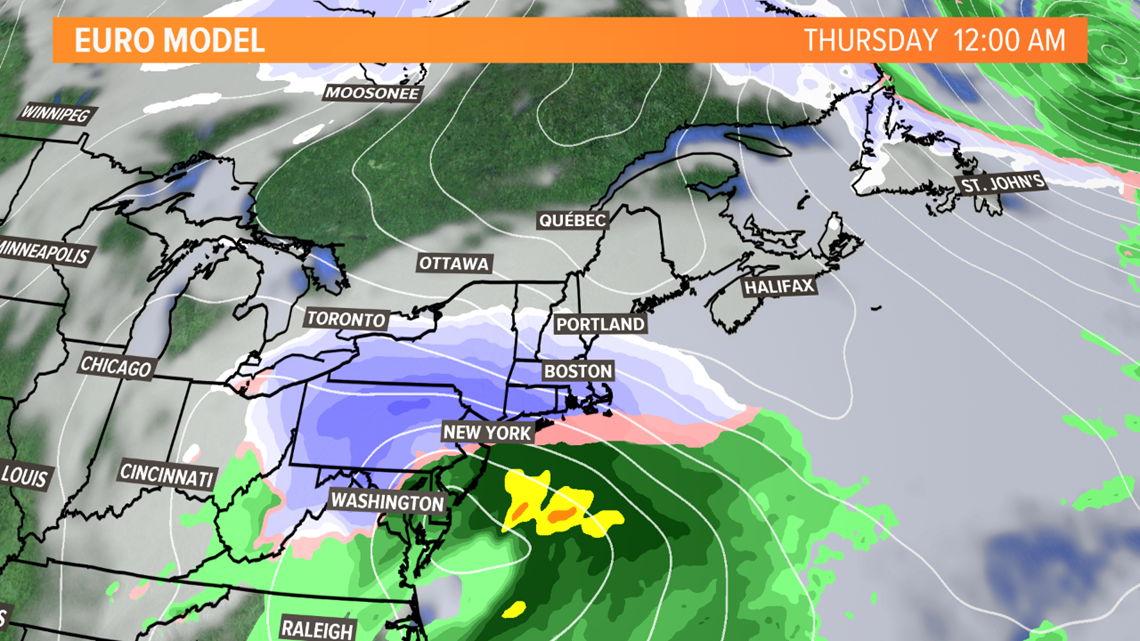
The storm will be moving along the east coast and heading toward New England late Wednesday evening.
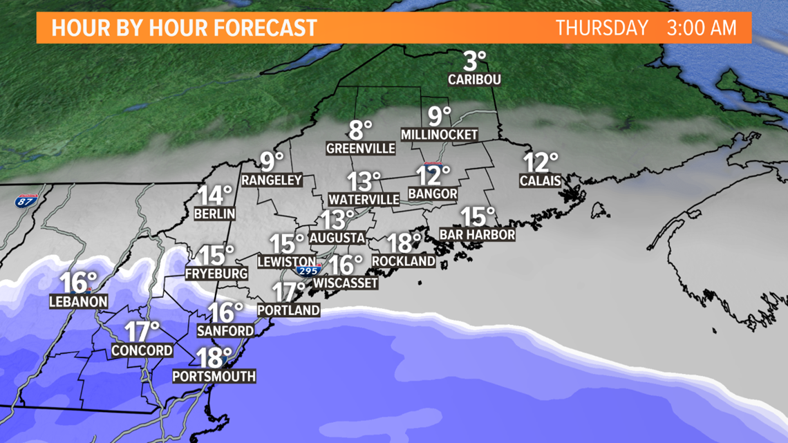
Locally, it will be a quiet but cloudy weather night.

Given this storm track, the heaviest snow tracks through western New England and Upstate New York late Wednesday night and into Thursday morning.
Locally, these snow bands start to clip southwestern Maine early Thursday morning. Kittery to York and the Berwicks will be the first spots to see flakes fly.

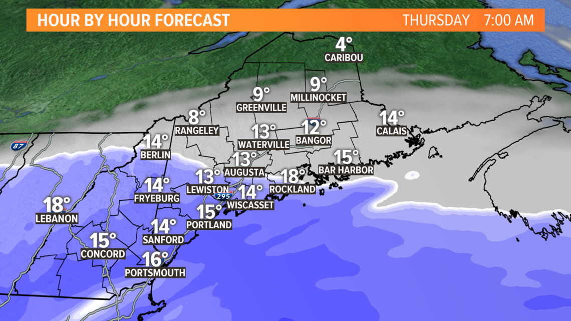
As the storm tracks east, more snow will fall. The morning commute for Portland to Fryeburg and south will be slick. Expect reduced visibility on the roadways, too.

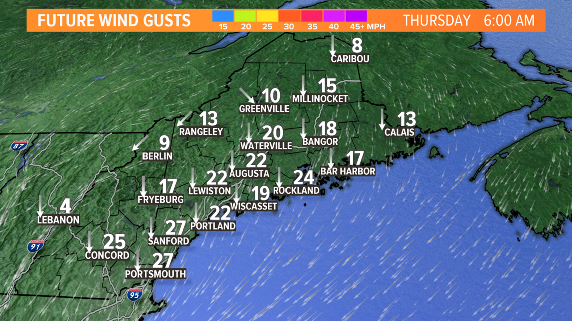
Wind gusts are not going to be damaging. I don't think this is really an event that carries an outage risk.
However, gusts still could be in the 20 mile per hour range...plenty strong enough to blow around that light, fluffy snow. Watch out for snowdrifts and reduced visibility.

Snow keeps moving inland through the morning. Snow showers begin near Bangor around noon. Overall, though, the heaviest snow still looks like it will remain near the coastline.
I think the I-95 corridor could deal with some fairly heavy snow bands in the morning. Nothing record-breaking, but enough to allow that snow to stack up quickly and efficiently.

The storm wraps up pretty quickly Thursday evening. Some lingering light snow showers are still expected through the evening, but drier air takes over pretty quickly.
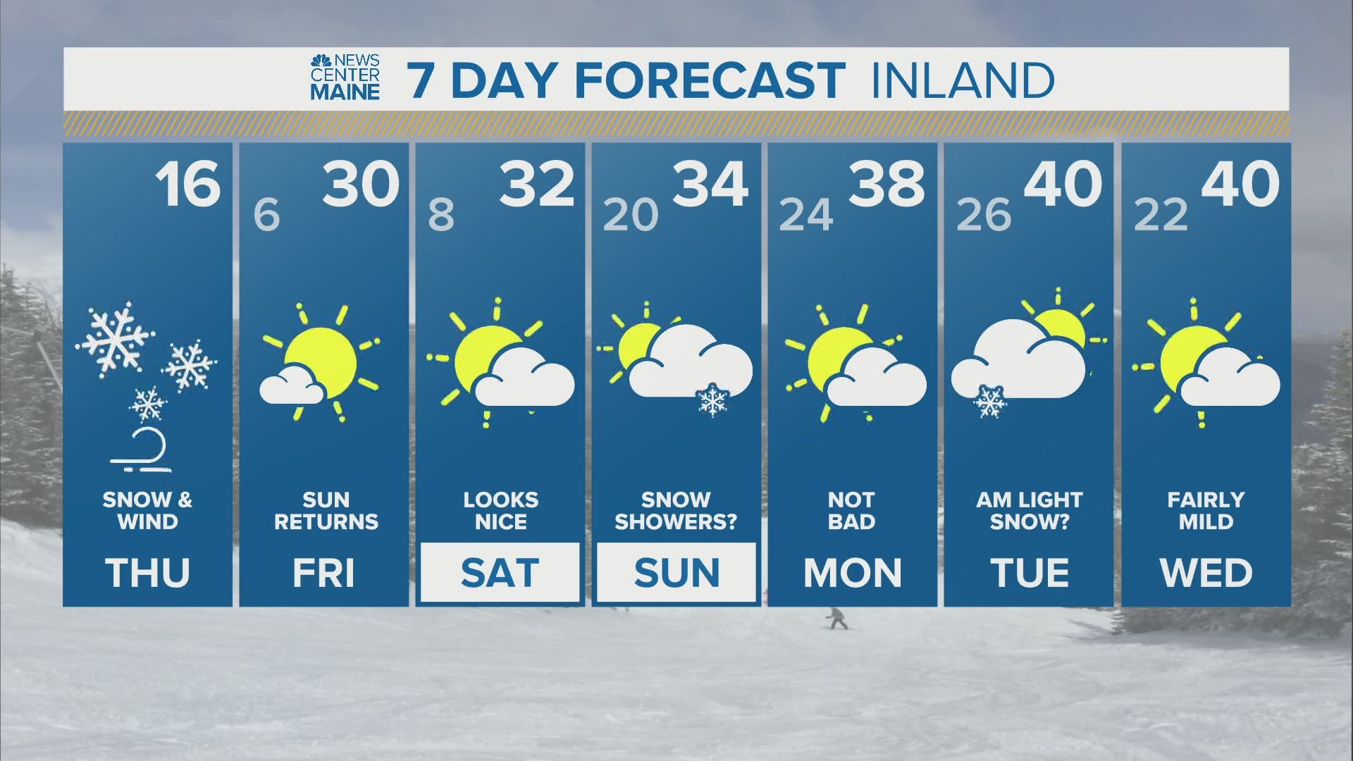
It'll be pretty cold Thursday night, with quiet but cold days to end off the week.

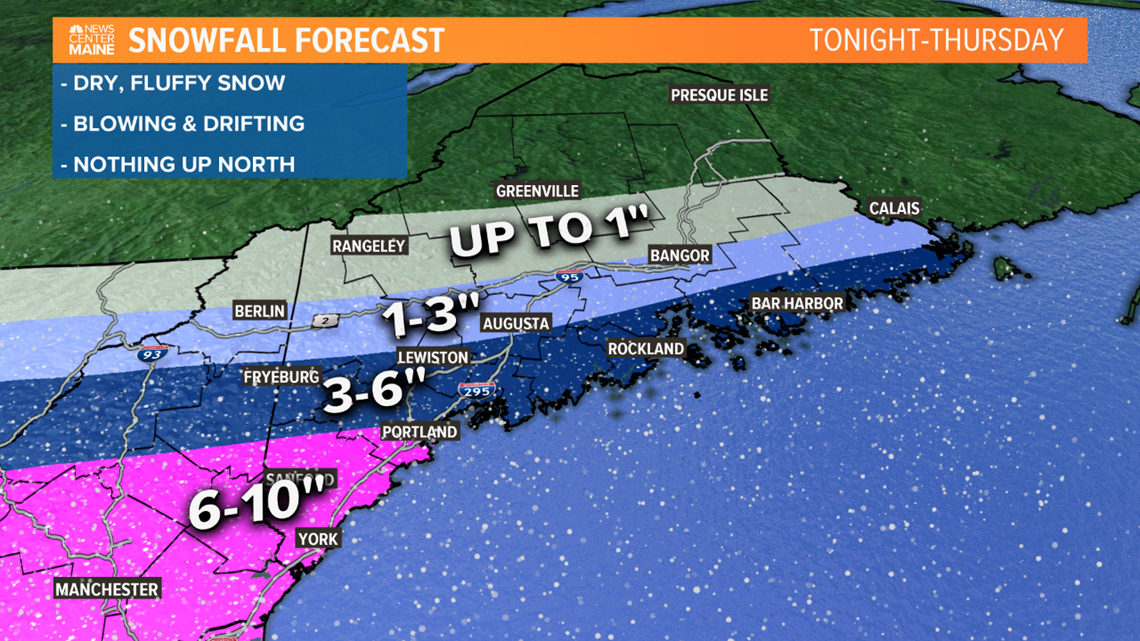
Here's the moment you've all been waiting for...the new snow map.
No big changes here. Bullseye for highest totals will remain in southwestern Maine and especially through York county. You'll notice the snow gradient across western and central Maine has been tightened a little, though.
The big question with this is just how far north that moisture can get. Any changes to the forecast from here on out will likely revolve around the northern extent of precipitation.
There will be a lot of dry air to get through, which will eat up a lot of the flakes that fall north in the 1-3" zone and up. Sorry Aroostook county, this is not your storm.
Either way, the ski resorts will have great snowmaking weather for the next week.
For more forecast info, follow me on Twitter, @MikeSliferWX.