MAINE, USA — I don't just predict the weather ... I predict Facebook comments too.
Below this article, in no particular order, shall be:
"These guys hype storms up for weeks, and they never happen!"
"I'll believe it when I see it."
"I wish I could be paid to be wrong and keep my job."
Let's just get this out of the way: This is an early look at a storm. No doubt about that. But when a storm looks impactful, is well-modeled, and consistent for a few days, I believe there is real value in talking about it.
The first shot at a storm 5-6 days away isn't going to be dead on, but we aren't the gatekeepers of weather information anymore. If I don't weigh in with my meteorological degree/credentials, someone is still gonna post a seven-day out model snowfall map from the EURO model. So, if you don't want to know about a potential storm because things might change, click out of this article, and check back in on Thursday.
Still there?
I thought so.
Ok, let's get to it.
The storm in question is going to be what we (weenies) call a "Miller Type A" storm. That basically means the low forms down across the southeast and then rides ride up the coast. "Miller Type B" is a storm that takes two pieces of energy and "phases" (combines) them together closer to us.

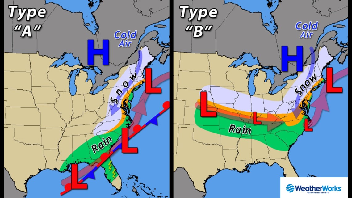
In some ways it makes the storm easier to model because it's one less variable to track through the atmosphere. When, exactly, a storm will phase can change the intensity of a storm in a hurry.
This is what the storm will look like by Friday night.

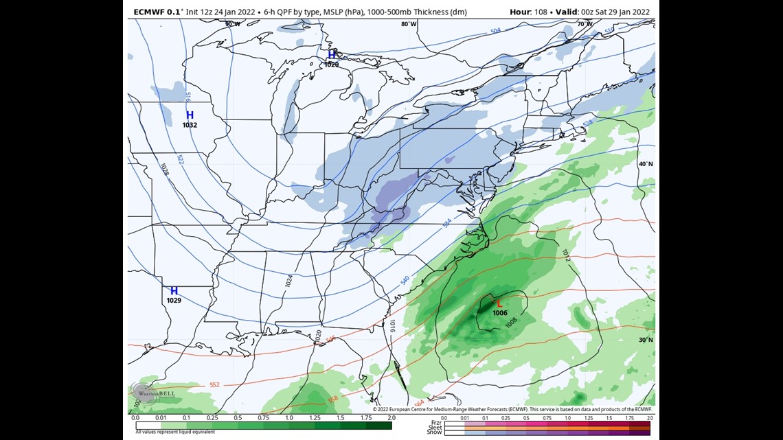
From there there is reasonably high confidence it will move north-northeast and be offshore of the mid-Atlantic on Saturday morning.

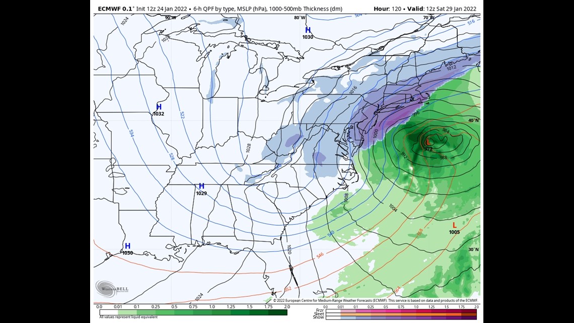
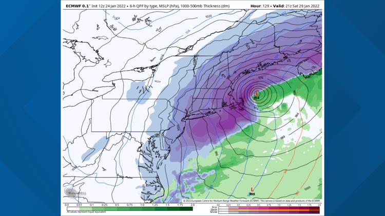
And then, it bombs out to a monster storm for us on Saturday.

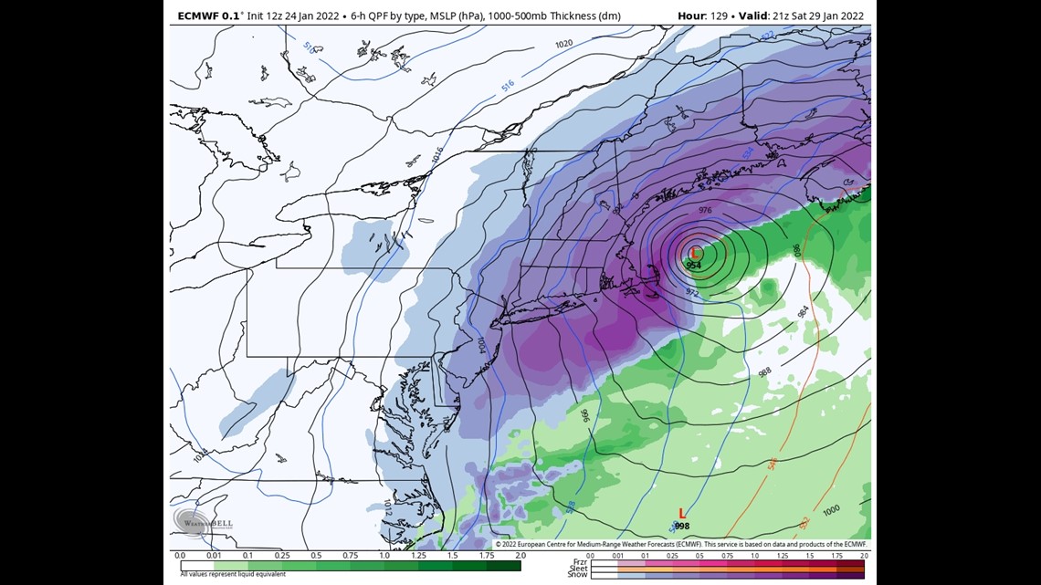
Now, if you are any version of a weather nerd, you can look at that image and realize what it would mean. It's a blizzard. It's a crush job. It's easily a foot plus.
But is it ... right?
In short — I think the broad strokes of this are locked in. There will be a big, deep low-pressure system offshore on Saturday.
But wobbles west and east will have a big impact. For example, the GFS model wobbles the storm west relative to the EURO.

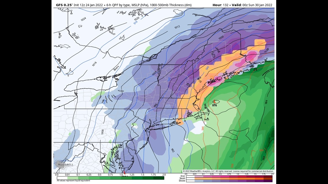
That solution introduces some mixed precipitation into the picture. Although storms that strong often "manufacture their own cold air," but we don't have time for that.
So the wobbles will matter, and there's no great way to know what those will be this far in advance.
But I'm bullish on this storm; so take that for what it's worth.


Carson out.
Follow Keith on Instagram here.


