MAINE, USA — As we head into the second half of April, it's only fitting to start talking about the potential for accumulating snow.
I really thought Maine would have a chance at not getting one of these storms before spring really took hold.
The last time Portland saw measurable snow was on March 9, 2022, when only 0.9" of snow fell.
In Bangor, it happened on March 16, 2022. A measly 0.6" fell that day.
Usually, both cities average much more March snowfall than that.
We were close to writing this off as the year we ended winter early, as snow becomes even more unlikely past the halfway point of April. Still, that was not good enough for 2022.

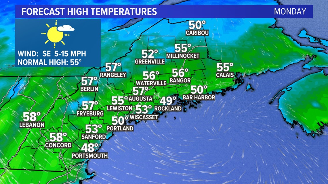
Monday will be an absolutely beautiful day before Tuesday's storm gets going.
High temperatures will reach the low 50s before an afternoon sea breeze cools off the coast.
Inland areas will avoid the afternoon cooldown and might be able to hit 55°.

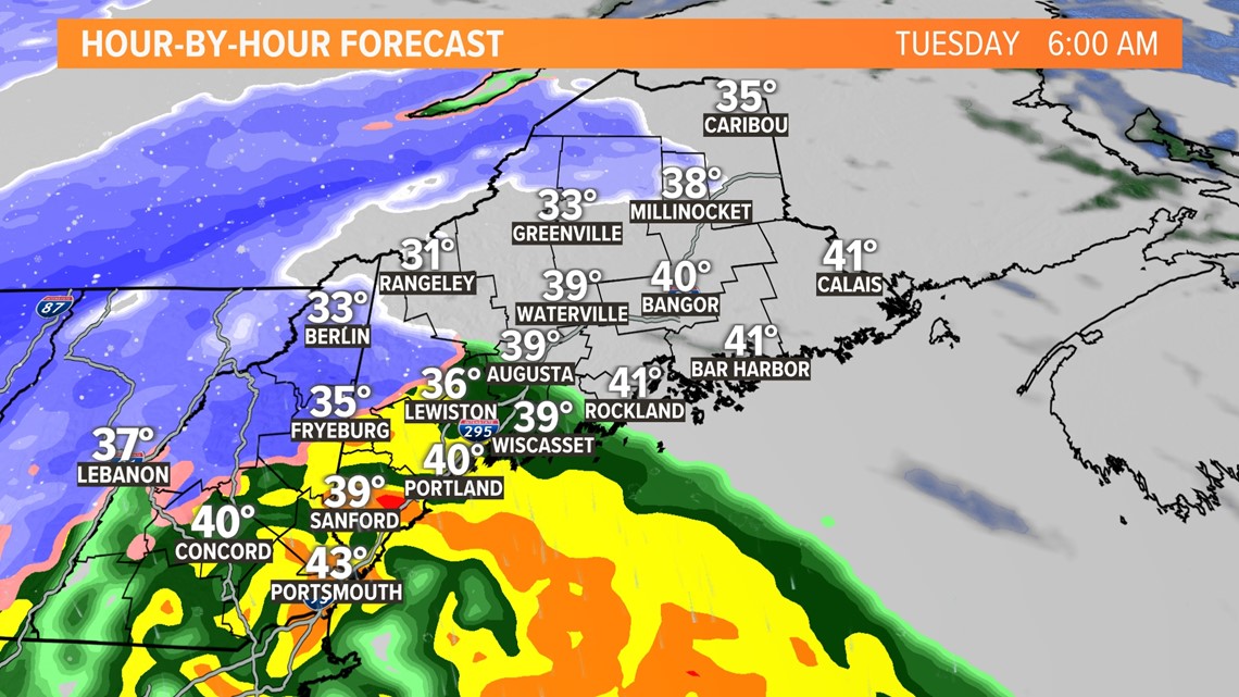
Overnight Monday into Tuesday, a storm starts to move into Maine.
While the wind off the ocean keeps the precip all rain in southern Maine, the mountains will likely get some snow from this one.

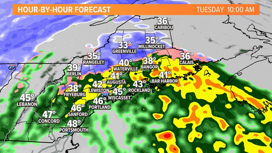
It's a pretty fast storm as drier air infiltrates.
Rain and snow will wind down through the morning and into the afternoon.
All in all, the day will still be gloomy, but the heavier precip is what wraps up early.

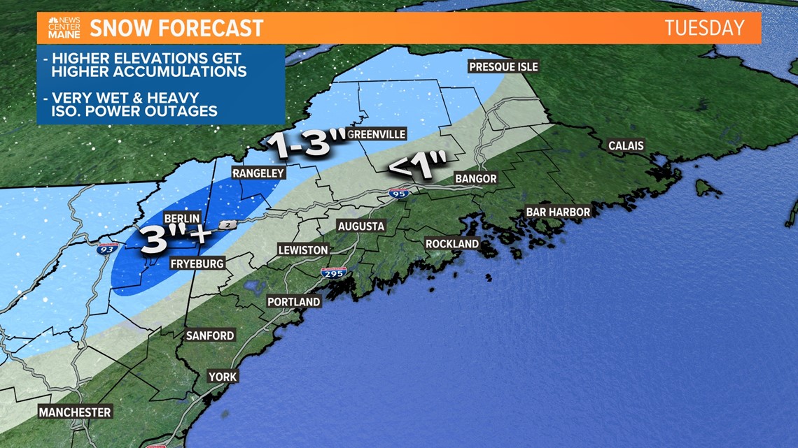
Generally speaking, I think coastal Maine will just see rain. If flakes are mixed in, they will be short-lived and not bring any impacts.
Inland areas will see more snow, though, and the higher peaks in Maine will cash in on the colder air.
A late-season snow is expected to bring a few inches of heavy, wet snow. Some isolated power outages are possible if any higher amounts get mixed in.

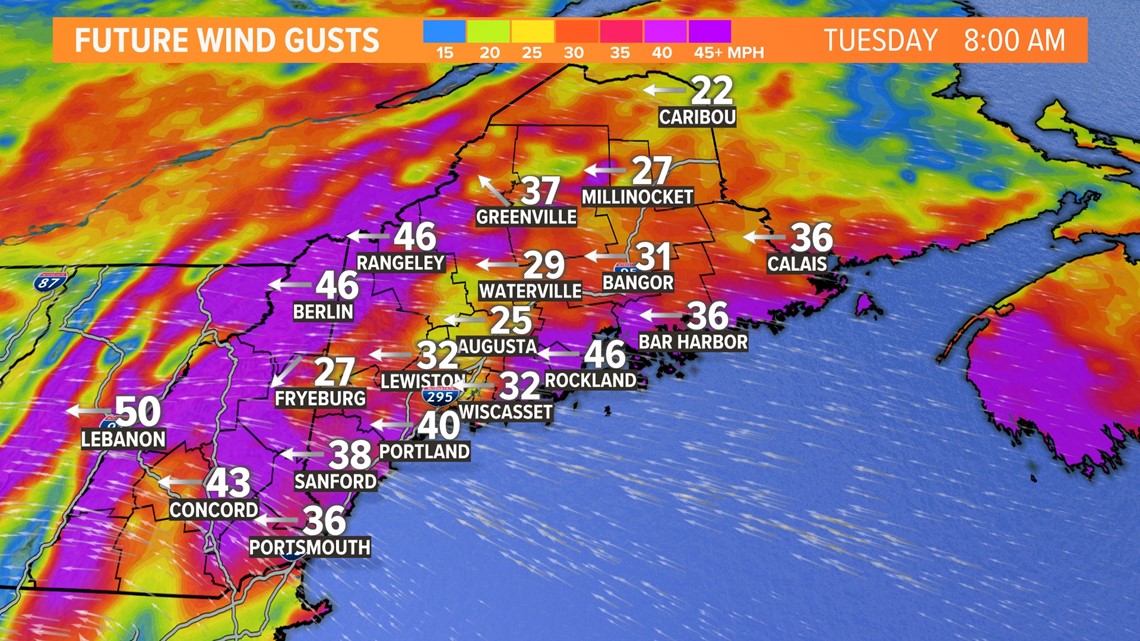
The other piece to this storm is the wind.
Wind gusts will pick up at the coastline on Tuesday morning, gusting to between 30 and 40 miles per hour.
The strongest gusts continue into the middle of the afternoon.
A few outages will be possible again, but overall I think the threat of wind-related power issues is still relatively low.

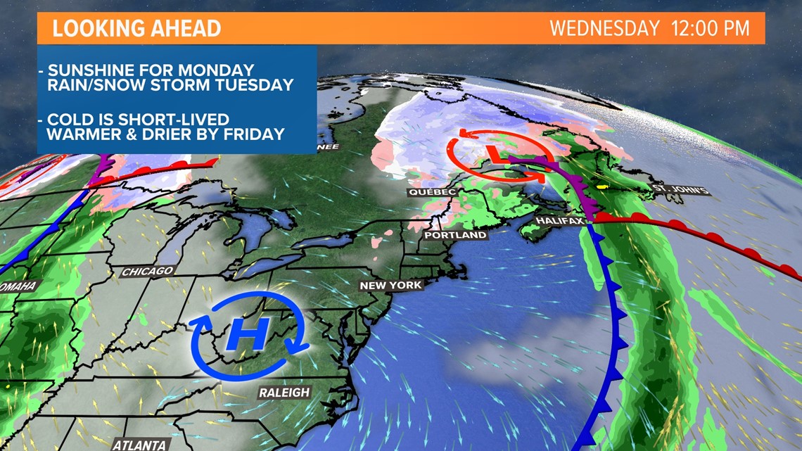
Cooler air settles in on Wednesday with high temperatures generally in the lower half of the 50s.
As drier air moves in, expect the breeze to pick up through the late morning and into the afternoon.

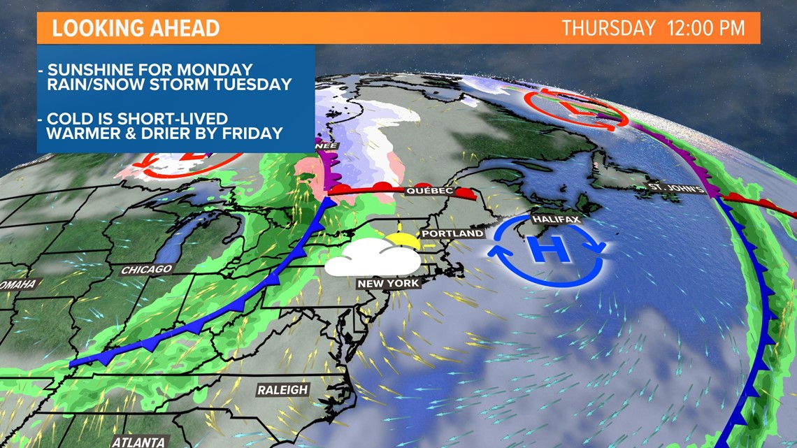
Thursday looks a bit milder but still pretty cloudy.
The storm system in the Great Lakes will fizzle out as it approaches New England at the end of the week, but a few showers are still possible either late Thursday or on Friday.
With a bit of luck, temperatures will end up near 60° on Friday and Saturday.
Follow me on Twitter, @MikeSliferWX, for more forecast info. Barring anything too big, I think this could be our last need for snow shovels this season.


