MAINE, USA — While many are still licking their wounds from the last storm that dropped a foot of snow over much of Southern Maine.
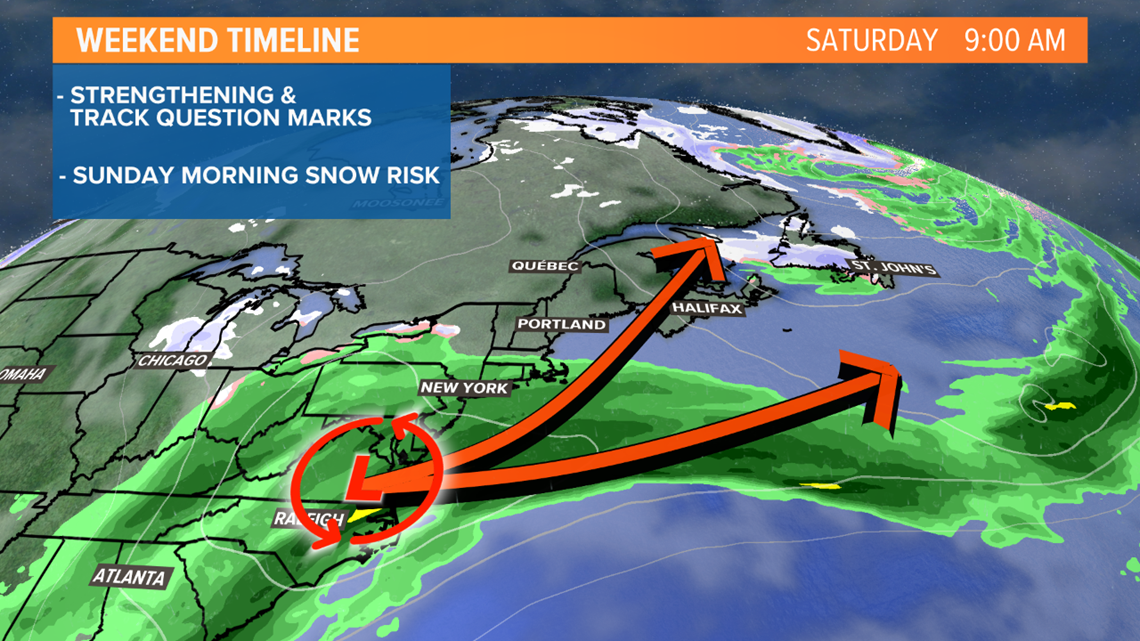
The next storm system is taking shape in the Deep South. Low pressure is gathering moisture from the Gulf of Mexico, getting ready to eject north up the Appalachians and threaten the Northeast with snow over the weekend.
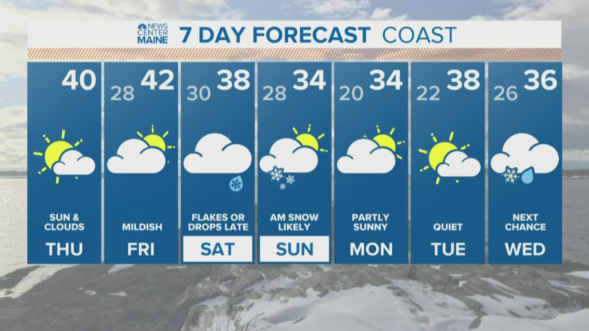
It's early in the game, so the forecast is still in flux and needs a lot of fine-tuning. There are a lot of strength and track question marks. But it's becoming more and more apparent an accumulating snow threat exists early Sunday morning.


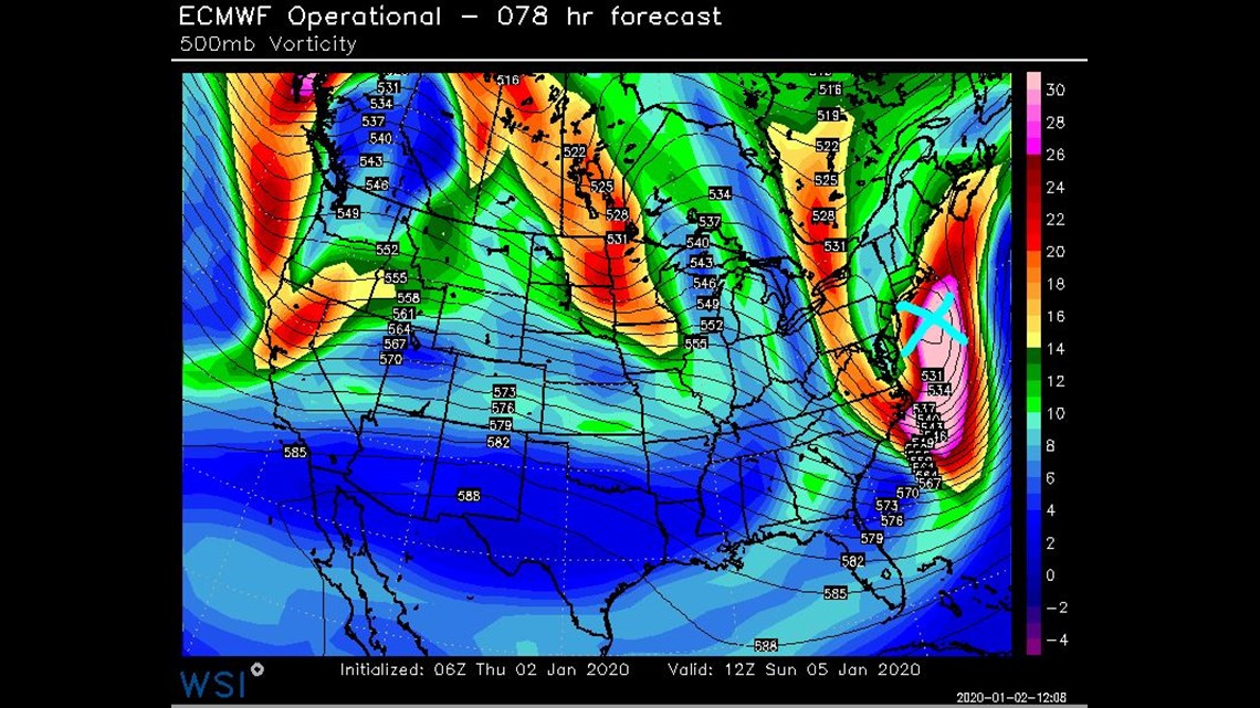
I'm actually leaning toward a flatter track with this storm. Not a complete miss, but one that suggests highest snow amounts would fall to our south or closest to the Maine coast. The mid-levels support this outcome and I'd like to see the 500mb low farther north before entertaining a direct hit to the entire State.


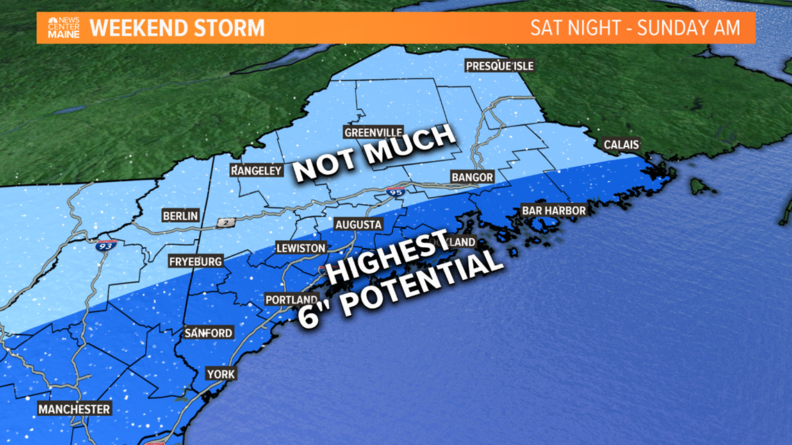
I'm not ready to put solid numbers on a map yet as confidence isn't quite there. But I'm thinking there's a darn good chance of accumulating, plowable snow for the coastal plain with limited snow across Northern Maine and the mountains. The next 24 hours should bring us clarity.


