

MAINE, USA — A rain and wind storm on a Monday? Hm... This feels familiar. The start of the Dec. 18 work week is going to look very similar to last Monday.
We're about to see more rain and winds across the state, starting later Sunday evening.
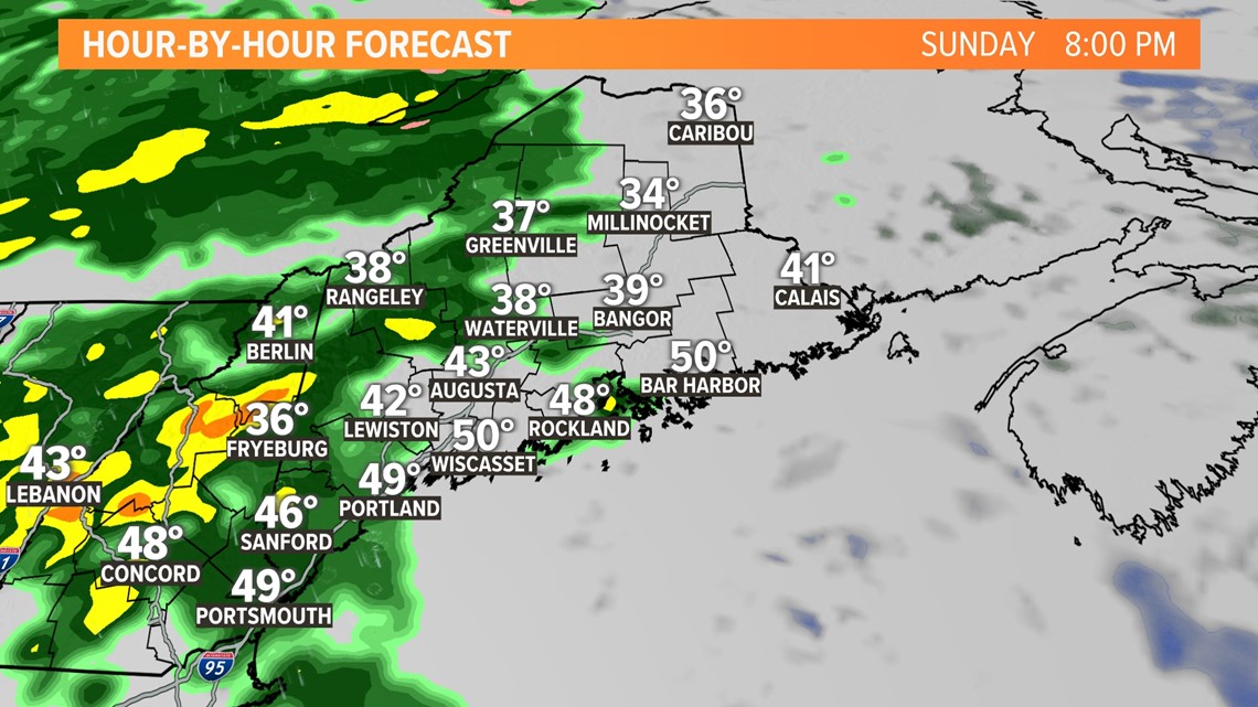
The rain will begin to move into western Maine after you wrap up Sunday. It won't be the heaviest of the storm but just the beginning of the rain that will then begin to pick up overnight. This is the time to get outside and pick up any holiday decorations that can't be blown around or anything else that is not secure.

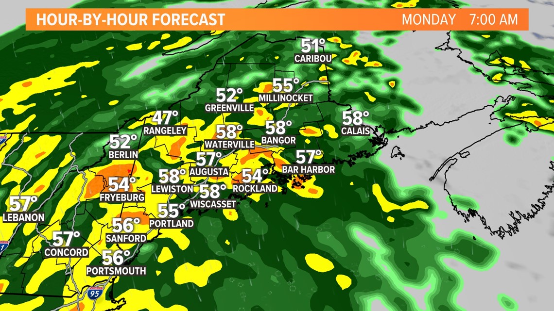
During the commute Monday morning, we're going to be dealing with much more widespread rain. Some of this will be heavier at times, and we could hear a few rumbles of thunder, as well.

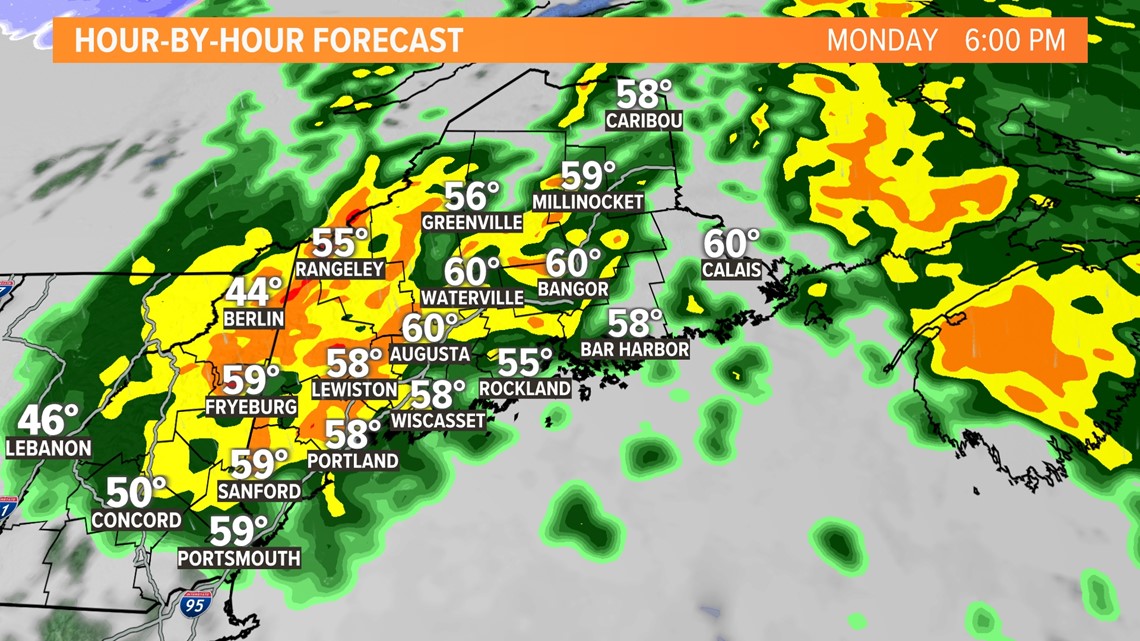
This continues all day long. It will be raining through lunch, during your drive home from work, and as you're sitting down for dinner. Luckily, it begins to move out of the way and should end for all of us by midnight on Tuesday.

We're concerned about a few things with this system.
First off, the rain is concerning. We're expecting a good amount of rain with this one. About two to three inches should fall for the majority of us, with four to five inches in some areas. You can see where the highest rain totals will be on the map.

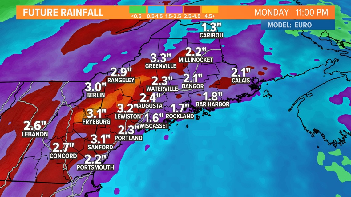
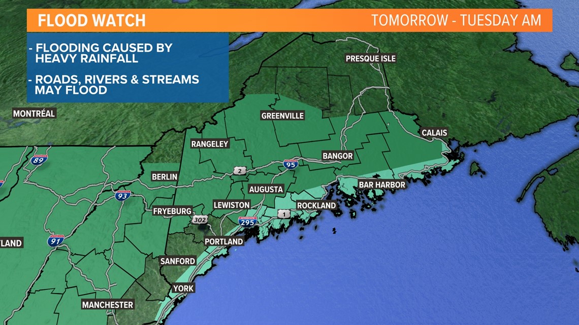
This has prompted the National Weather Service to issue a Flood Watch for much of Maine. All of that water is falling on an already-saturated ground, so a lot of it will run off into creeks, rivers, and streams. We'll talk about that concern a little later Sunday. Just be aware that all of the places that normally flood will likely flood.

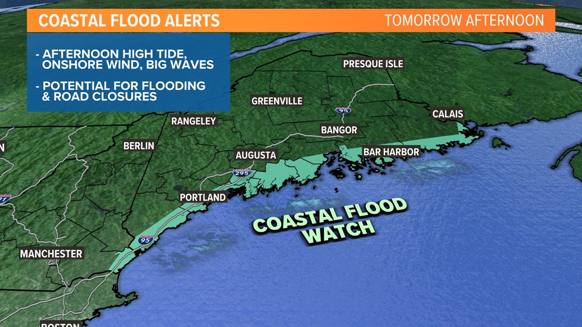
The coastline isn't out of this one, either. High tides in the afternoon may potentially align with the timing of high onshore winds and could lead to coastal flooding. The NWS has also issued a coastal flood alert.

Winds are our next concern.
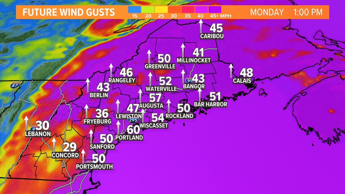
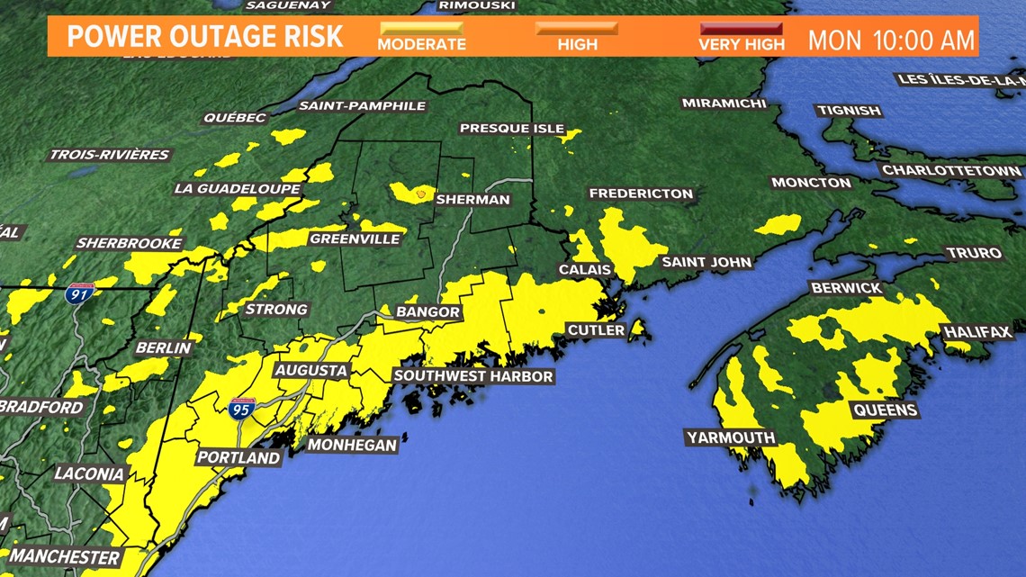
Winds will really pick up as we get later into Monday morning and into the afternoon. Wind gusts will be highest along the coastline, up to 65 mph out of the South and Southeast.

That's why the NWS has also issued a High Wind Watch for Monday. The highest will be along the coastline and some inland areas, including Bangor.

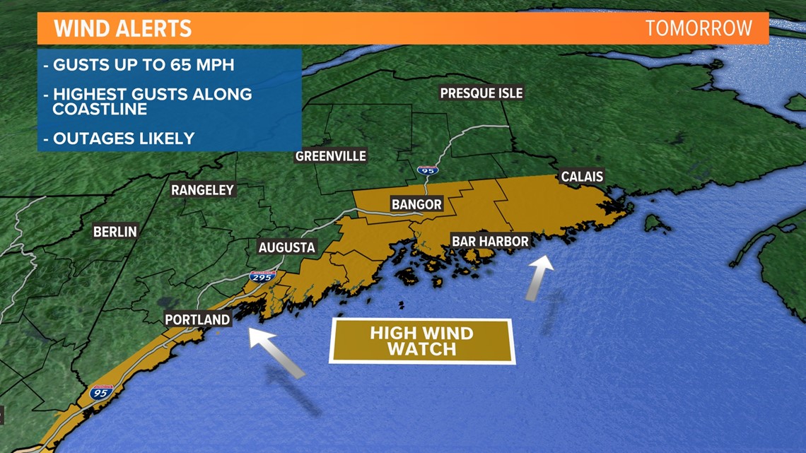
That means we have to talk about power outages. We will likely see outages along the coastline as this low moves through. The most will likely occur during the highest gusts in the late morning and afternoon.

Last but not least: All of that water has to go somewhere. Rivers, creeks, and streams will continue to rise after the rain has ended. The Kennebec River in Hallowell will continue to rise into Tuesday morning. It is set to reach moderate flood stage as of now, but these river forecasts notoriously change quite a bit by the time we get there.

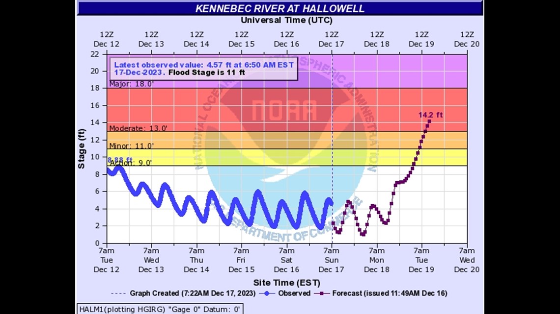
I know that Hallowell floods quite often, but if you want to check out the other river gauges in our state, click here.
It's going to be another windy and rainy day, but then the sun comes back out midweek. Yay!
