PORTLAND, Maine — Storm season is upon us, with our weekly dose of wind, rain, and snow on the way soon. It’s a good time to prep your property for impacts starting Sunday and lasting into Monday from south to north through Maine.
A strong cold front and associated low pressure will undergo strong cyclogenesis as the storm gets stronger. This will allow high wind to be transported down to ground level from the atmosphere, resulting in high wind for part of the Pine Tree State.
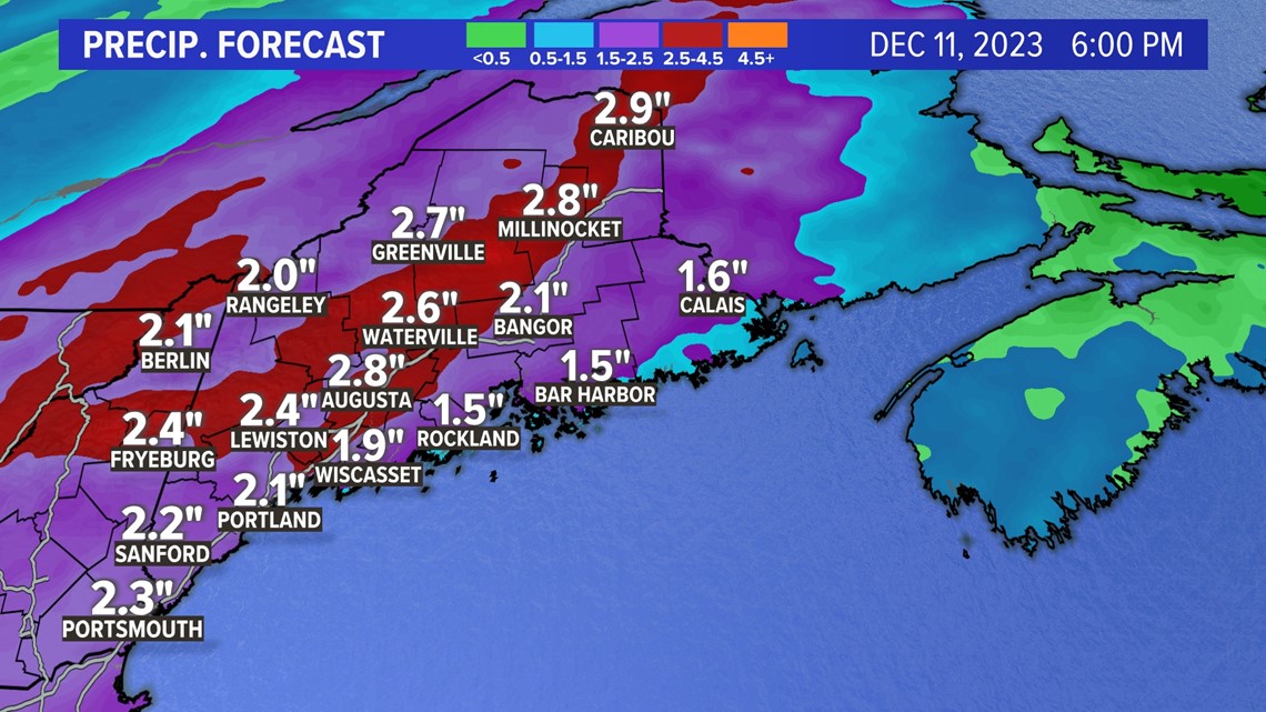
Rainfall amounts will exceed the 1-inch mark by more than 2 inches locally. Snowfall will generally be light and confined to the higher elevations of the western mountains. Here is the breakdown:

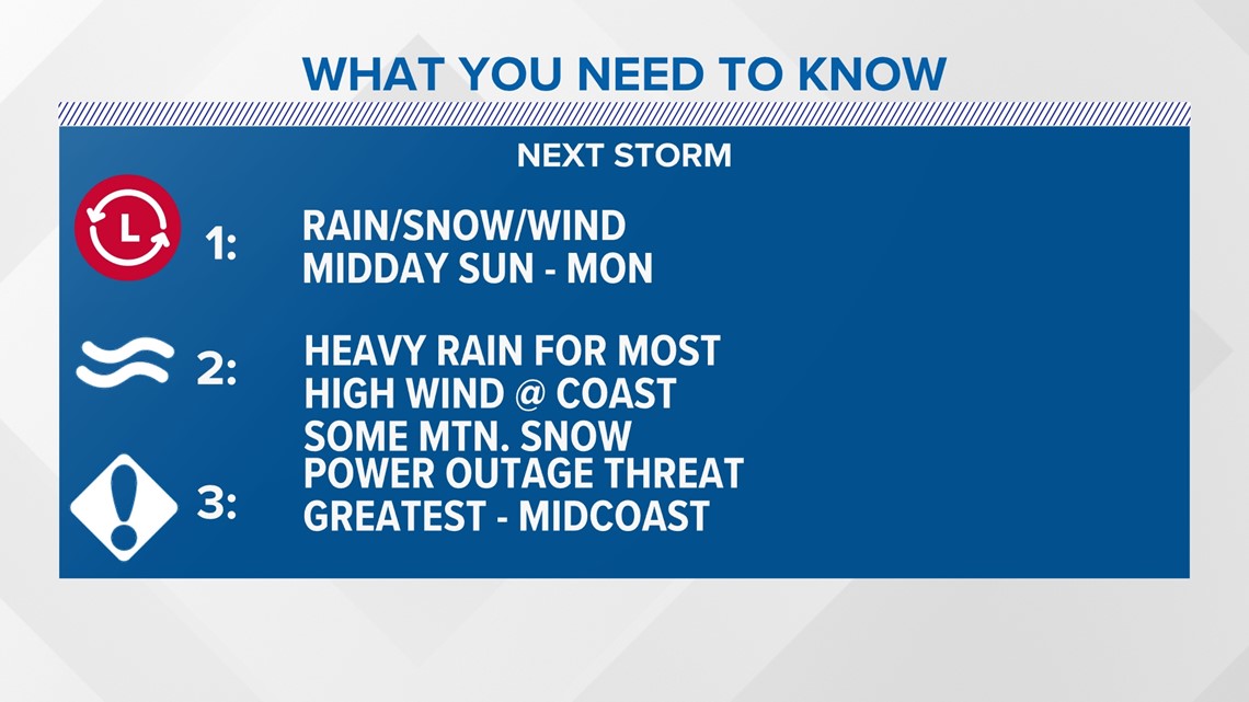
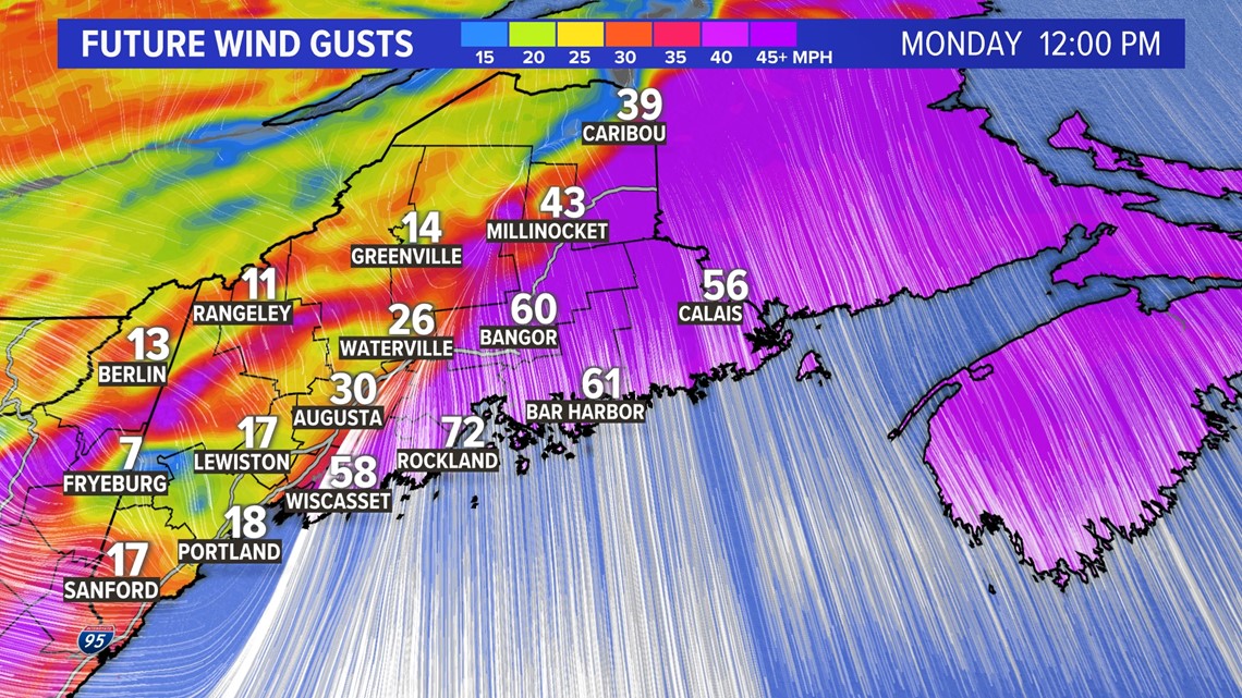
Look for the rain and wind to begin mid to late afternoon on Sunday in western Maine and then move east. There won’t be much snow to start. The highest wind gusts will be along the midcoast and capitol region Monday morning.

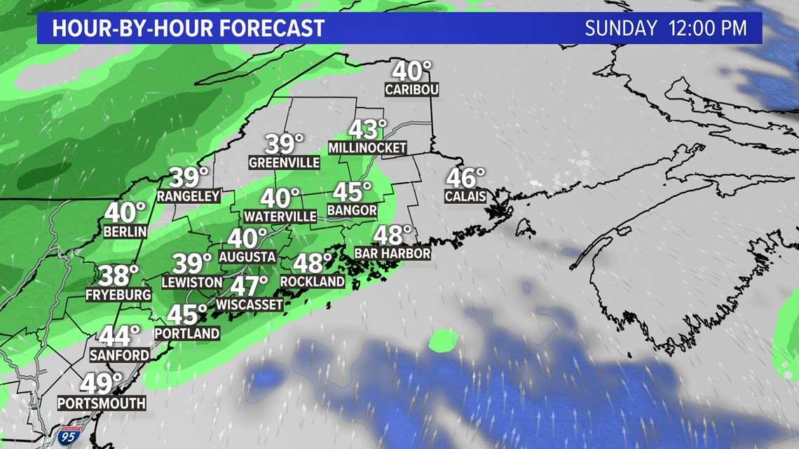
The rain starts out fairly lightly until after about 8 p.m. on Sunday.

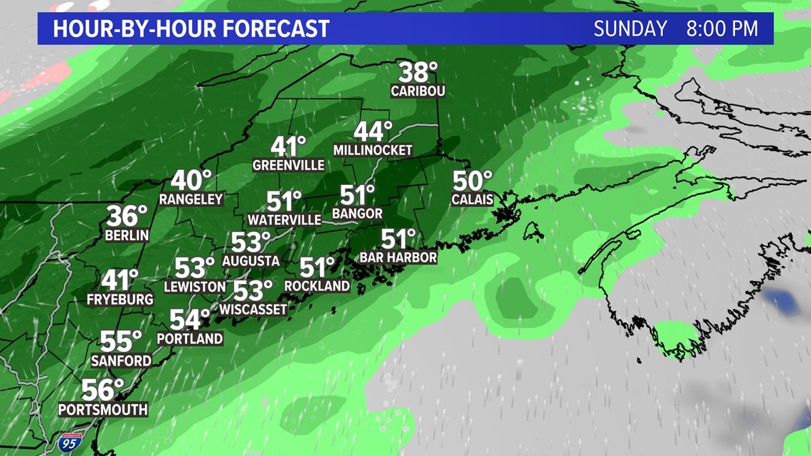
Heavy rain moves in from Sunday night into Monday for a good chunk of Maine.

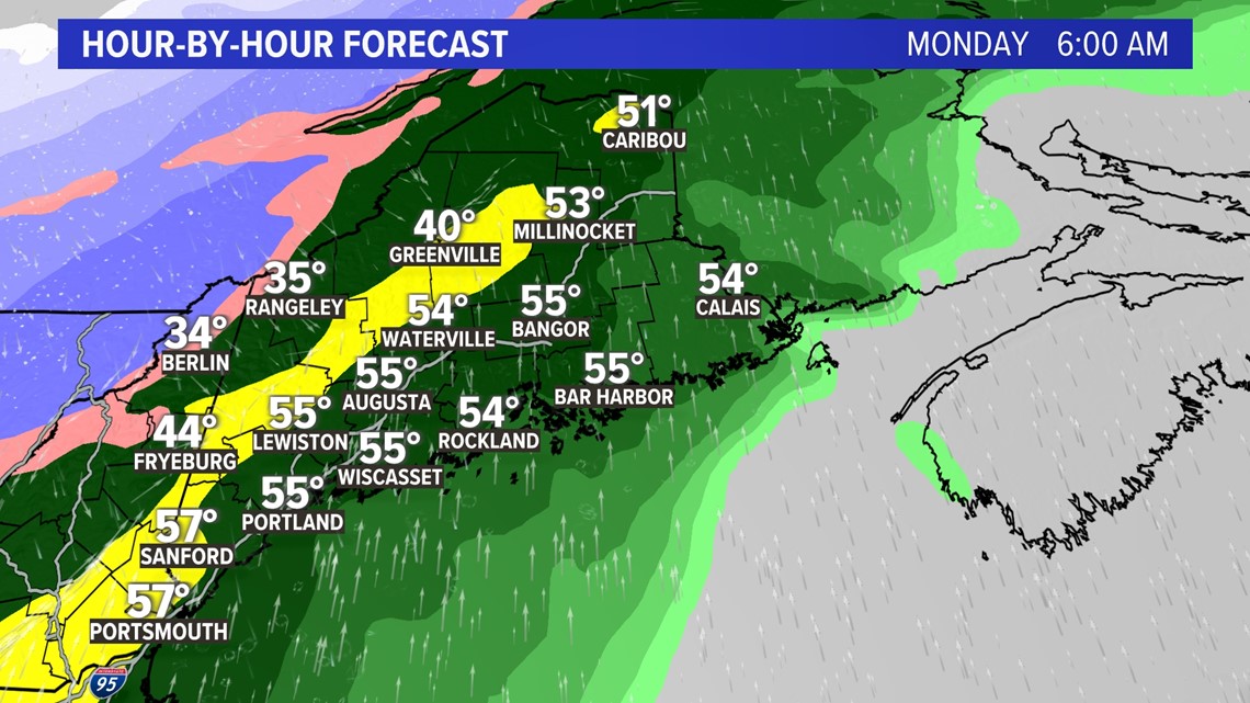
I expect the Monday morning commute and most of the lunch time hour to be messy.

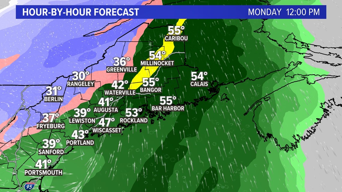
Things begin to taper off with snow in the mountains and less wind by Monday evening.

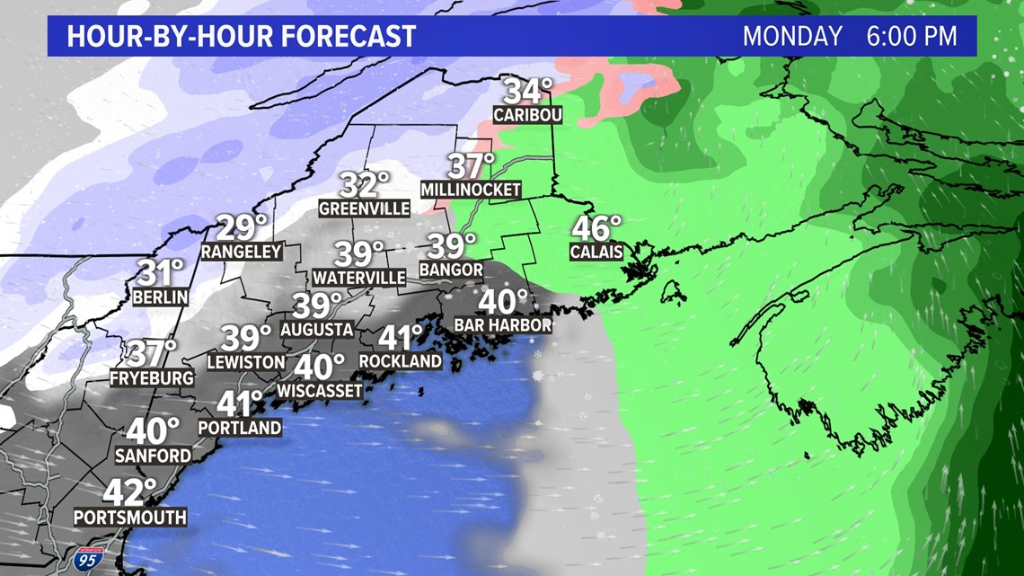
Only a couple inches of snow are expected in the western mountains from this storm, but more than 2 inches of rain is coming in a relatively short period of time.

It’s a good time to secure loose objects as the wind begins to howl early Monday through midday.

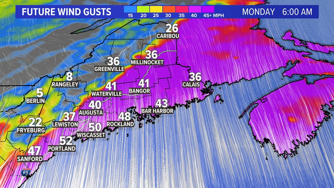
Look for wind gusts to exceed 50 miles per hour for much of the coastline. There could even be near hurricane force gusts along the midcoast, where high wind warnings are likely to be issued.

I’ll have more updates throughout the weekend as I track the storm.


Follow along for more weather blogs and pizza discussion.


