MAINE, USA — This summer has been rainy, but luckily most of it has not come from storms. Our severe weather season in Maine runs from June through August. We've had tropical downpours and many flood watches, warnings, and advisories, but we haven't seen much severe weather.
That's not the story elsewhere. Most of the country has already seen tornado warnings this year. These are tornado warnings, not confirmed tornadoes. Most of these tend to stay in the Midwest and Southeast, but we've still see some tornado warnings pop up in the Northeast.


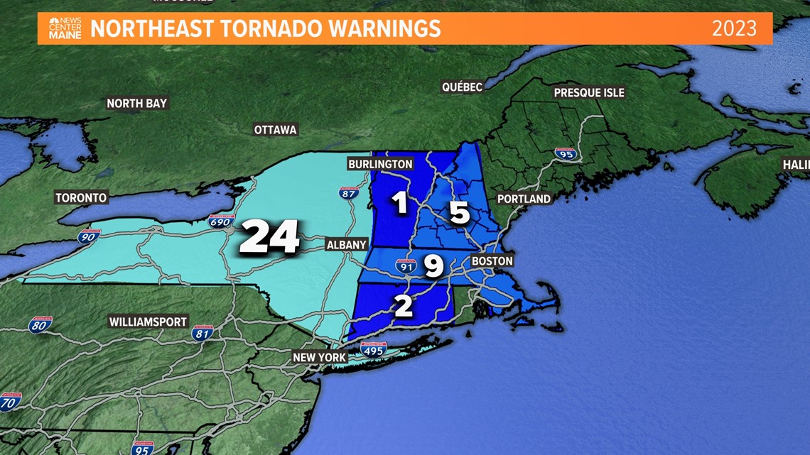
We've seen more than a few warnings a bit closer to home. New York saw the most in our region with 24 tornado warnings. Massachusetts has the most in New England with 9 tornado warnings so far this year.


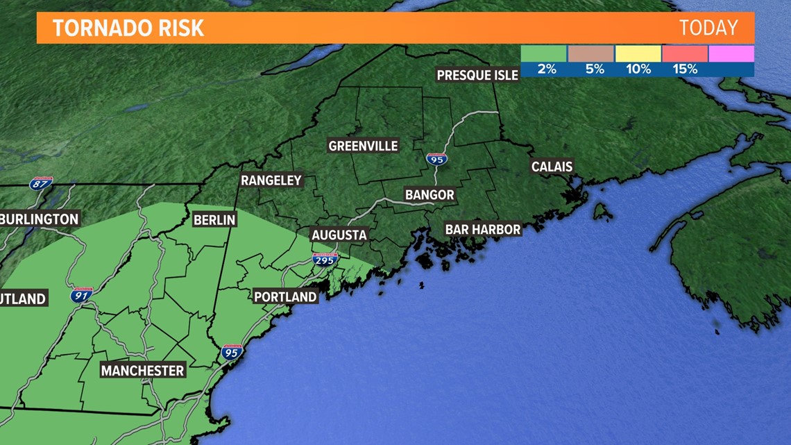
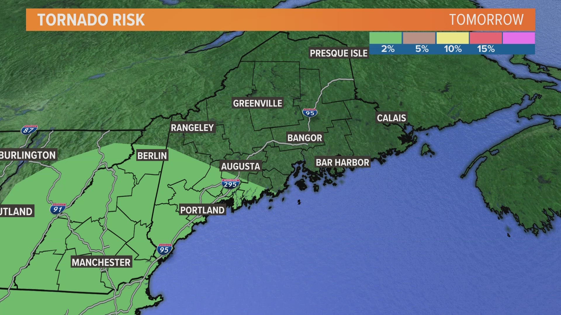
As far as Friday's storms are concerned, we have a non-zero risk for a tornado in western and southern portions of the state. A non-zero risk means there is a very very low risk, almost zero. On Friday, we have a 2% chance of a tornado spinning up. I would pay attention to our coverage for any potential issues, but I would not assume a tornado will touch down. Again, there is a chance, but a very small chance.


As far as tornadoes in Maine are concerned, they're not all that common.
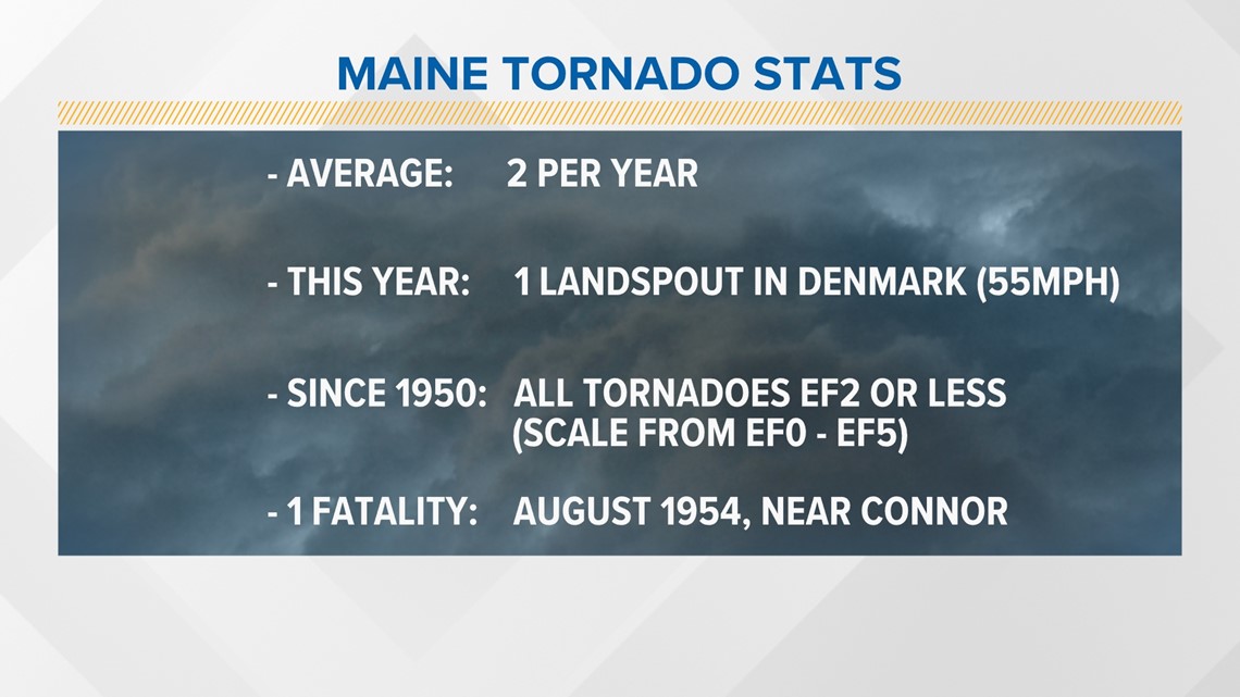
We usually receive about 2 tornadoes per year. We already had one landspout (a weak type of tornado) in Denmark earlier this year with winds around 55 miles per hour. A tornado warning was not issued for this because they are so weak that they cannot usually be spotted on the radar, and usually only cause minor damage.


Any tornadoes we've had since 1950 (when we began keeping records) have been an EF2 or less. That means we've avoided the strongest categories of an EF3, EF4, or EF5 tornado. Those are the ones see on social media causing massive damage. Usually we do not see much damage anyway, as the state is not densely populated.
If something does touch down, get away from windows and outer walls, and get to the lowest possible point in your house.
Stay up to date with the latest by paying attention to our forecasts here.

