

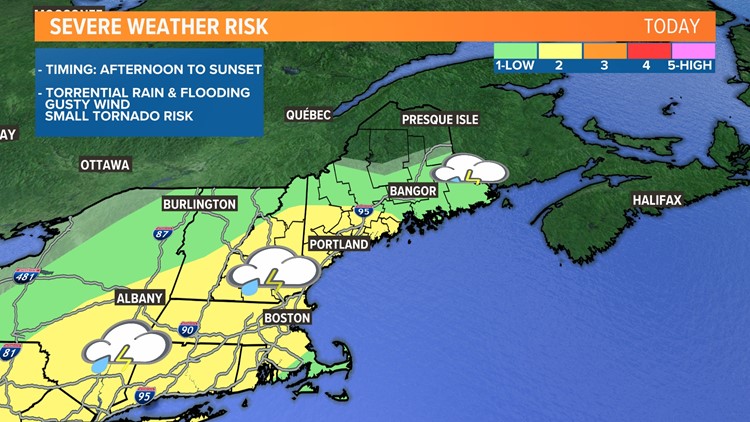
PORTLAND, Maine — Our atmosphere this afternoon is primed for severe thunderstorms. There is a good amount of what we call "wind shear" available as well as moisture to produce heavy downpours. The trick will be popping enough storms to our west in order to have them run into this favorable environment.
So far we have a few cells back into New Hampshire that are trying to get going.
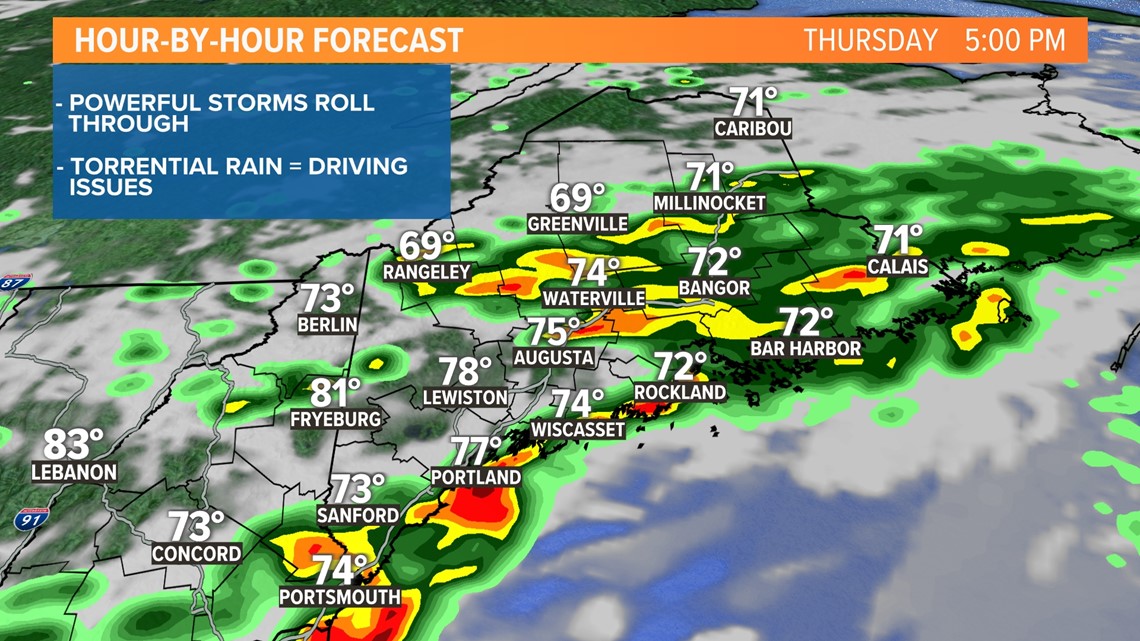
Our ground is super-saturated already, and these storms will contain torrential rain. Once again, flash flooding may occur. Streets and parking lots could get submerged, and culverts and other infrastructure may wash out. Please be cautious if you encounter any flooded areas.
Along with flooding, wind is a concern. Some of these storms may bulge or bow out with strong winds capable of pockets of tree damage.
Lastly, while unlikely, there is a small risk of a tornado. Wind will be changing direction with height. Coming in from the south near the surface and from the southwest higher in the atmosphere. This may turn or spin a few of the storms, which are needed for tornado formation.
THURSDAY AFTERNOON:

We'll continue to pass along updates throughout the day. If you are watching us on TV, we'll let you know of any severe weather with a crawl at the bottom of your screen or a live update.
- Todd & Keith
