

PORTLAND, Maine — After a record-setting warm winter, it's ironic that at the start of spring, we start talking about snow again!
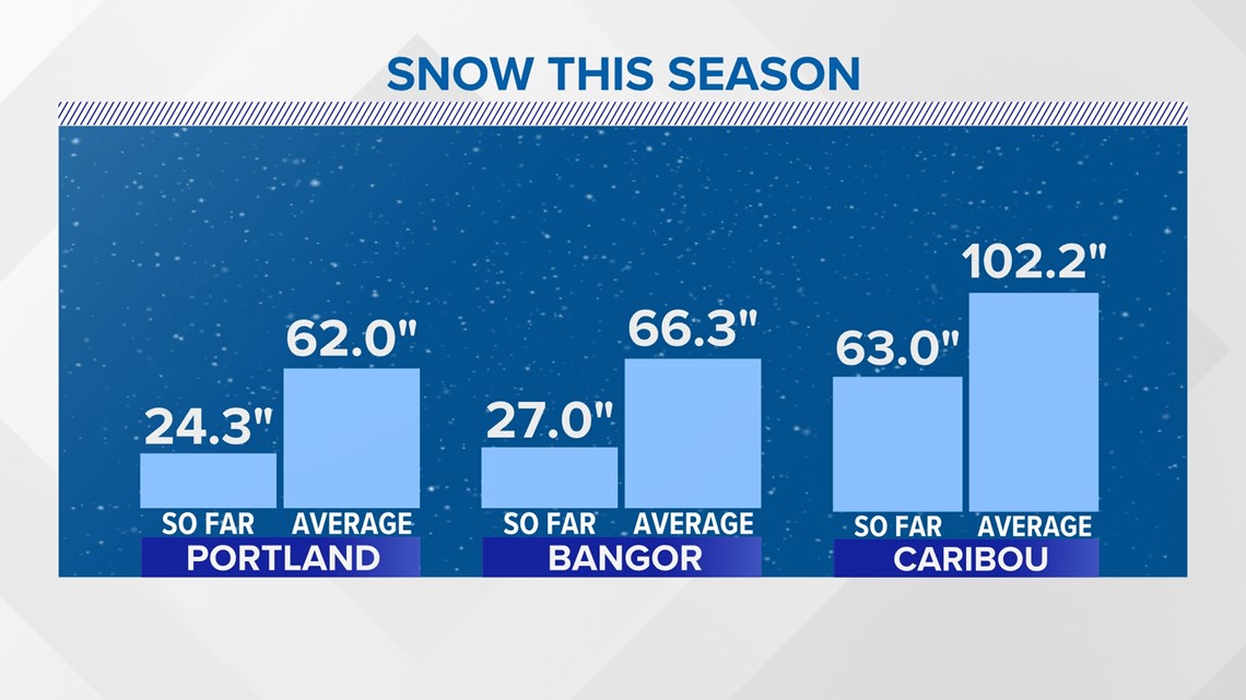
This has been a tough winter for people who rely on snow for their businesses and fans of winter in general. We are running well below average in all of our climate sites across the state.

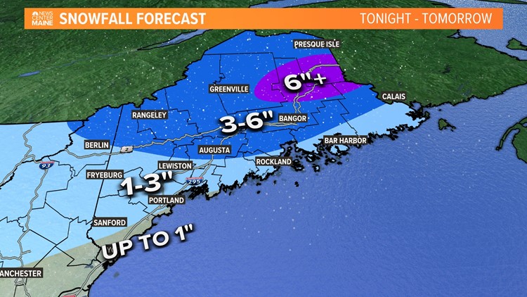
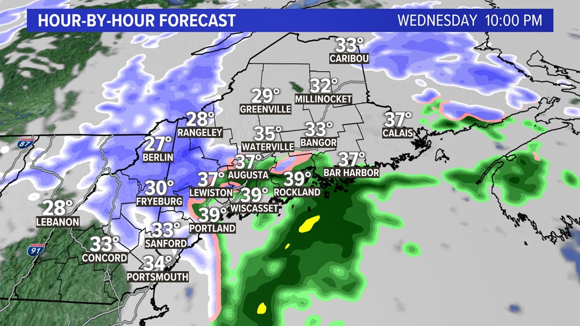
But if you have been missing the snow, I have some good news for you. Overnight tonight, a small but mighty area of low pressure will move in and bring accumulating snow to areas that have been lacking in the past few weeks.
Inland will start with snow, and the coast will gradually change over from snow to rain as the low traverses eastward.

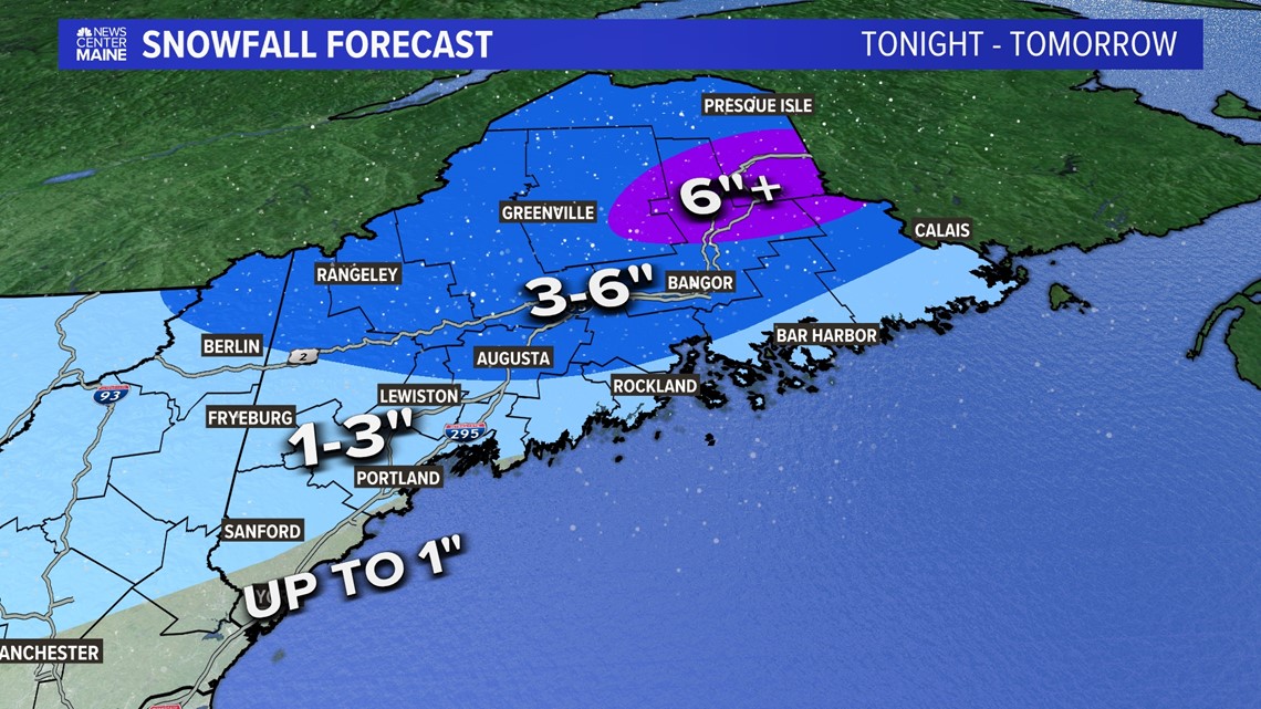
The heaviest bands of snow will be to the north and west of where the area of low-pressure forms.

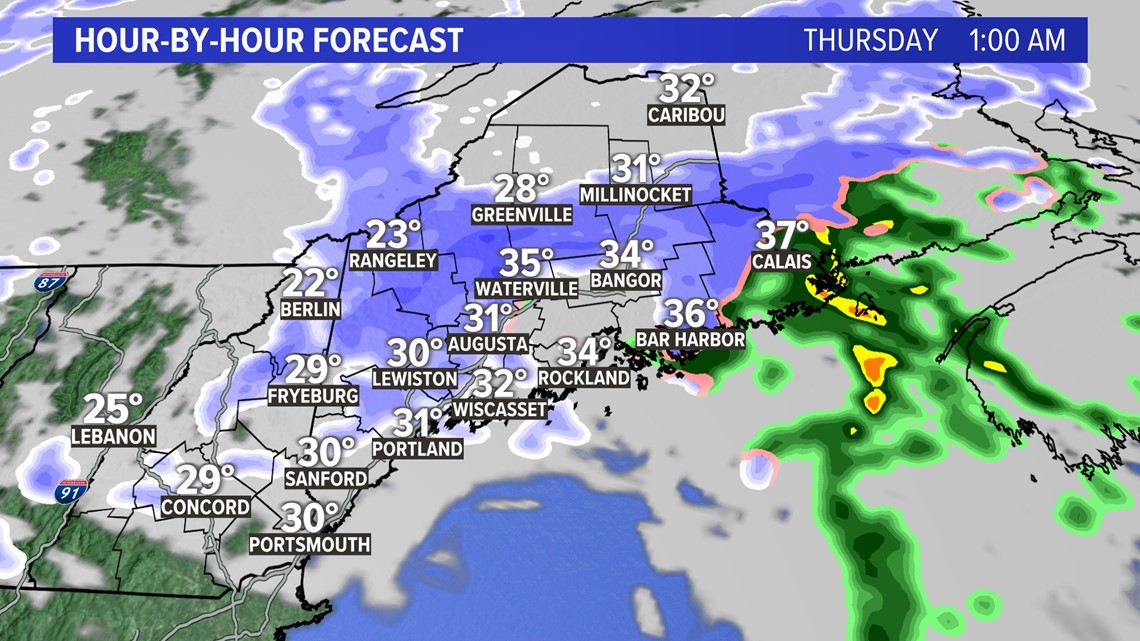
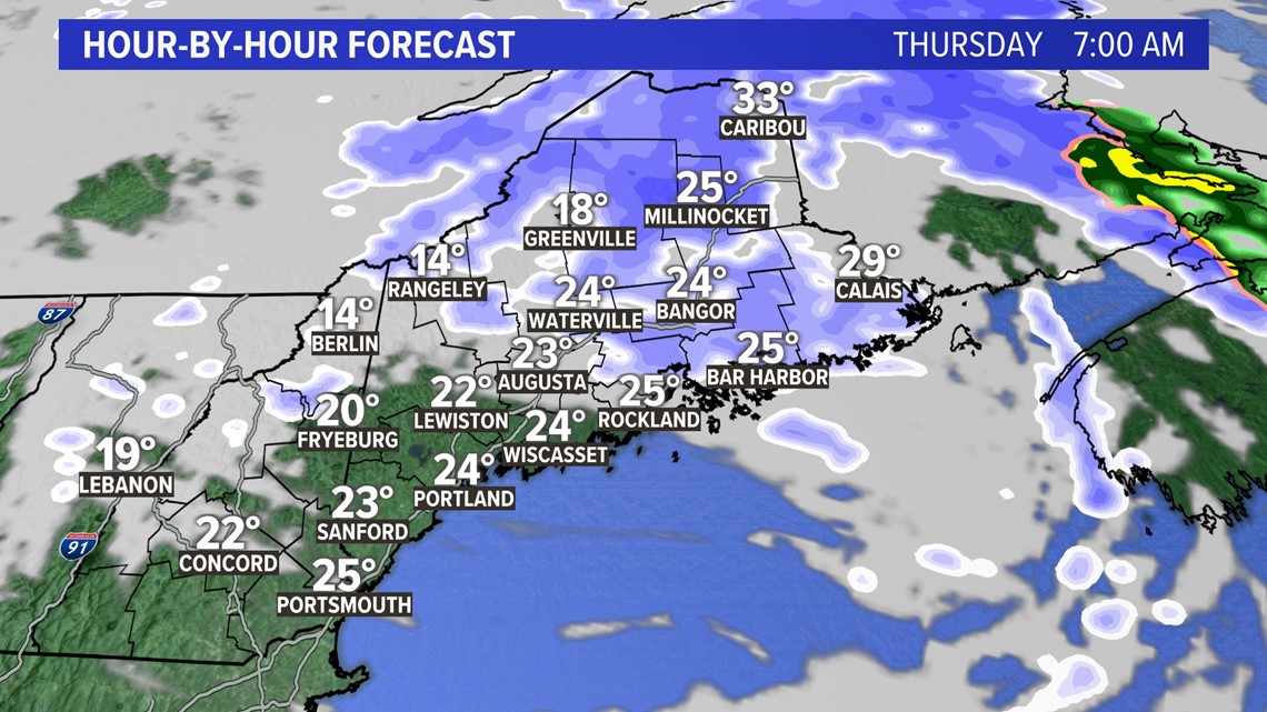
The morning commute will be clearing in western Maine, but northern and eastern Maine will still have snow lingering. It will be pretty windy after this system passes through, so keep an eye out for blowing snow.

Snow accumulations will be highest in the mountains and the North Woods, which will see the heaviest bands of snow, as well as in northeastern Maine, where the snow will be falling for the longest duration.

Behind this system is quiet, but much colder and breezy. It'll feel like winter again! Another system moves in for Saturday, and this one looks like a state-wide event. Stay with us on-air and online this week and we'll have more updates for you.
Hope you kept that shovel handy!
Dana
For the latest breaking news, weather, and traffic alerts, download the NEWS CENTER Maine mobile app.
