PORTLAND, Maine — That was a sucker punch.
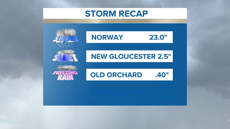
The storm has moved out and into Canada but it has left behind a mess. The coastline is glazed over and dealing with branches and wires down all over the place. The interior is buried under countless inches of powder and sleet.
It's going to take time to get back to normal, but the weather will cooperate over the next couple of days to aid the clean-up and restoration effort.


It was all about precipitation type. We all started off with snow but then warmer air worked in. Warm air is lighter than the dense, cold air and rides in aloft melting flakes into rain drops as they descend. If that drop falls through a thick enough cold layer, it will refreeze into a sleet pellet. But, if that cold layer is shallow and thin, that drop gets all the way to the surface and then freezes on contact creating dangerous glazes. The weight of that glaze was responsible for cracking limbs and branches which then brought down power lines creating widespread outages.


Here are links to snow amounts from the storm:
The next couple of days will feature sunny skies and daytime temps above freezing. Expect conditions to improve and the lights to come back on soon.
Todd - Here's my Instagram feed.
For the latest breaking news, weather, and traffic alerts, download the NEWS CENTER Maine mobile app.


