MAINE, USA — All good things come to an end. That’s the saying, right?
A strong cold front will move through Maine from north to south to kick off the weekend. This will put an end to the hot and dry conditions we’ve been experiencing lately. A run for record highs will no longer be in the forecast once the “backdoor” cold front gets here just in time for the weekend.

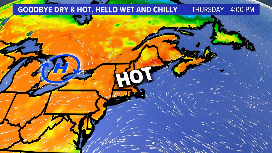
But we aren’t there just yet...
Thursday will see widespread 80s and a run for the low and mid 90s before the sea breeze kicks in.

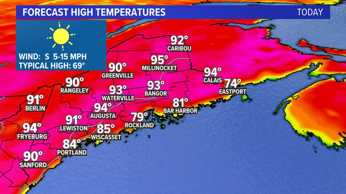
As a matter of fact, this will be one of the hottest days of the year for all New England, except the immediate coastline.

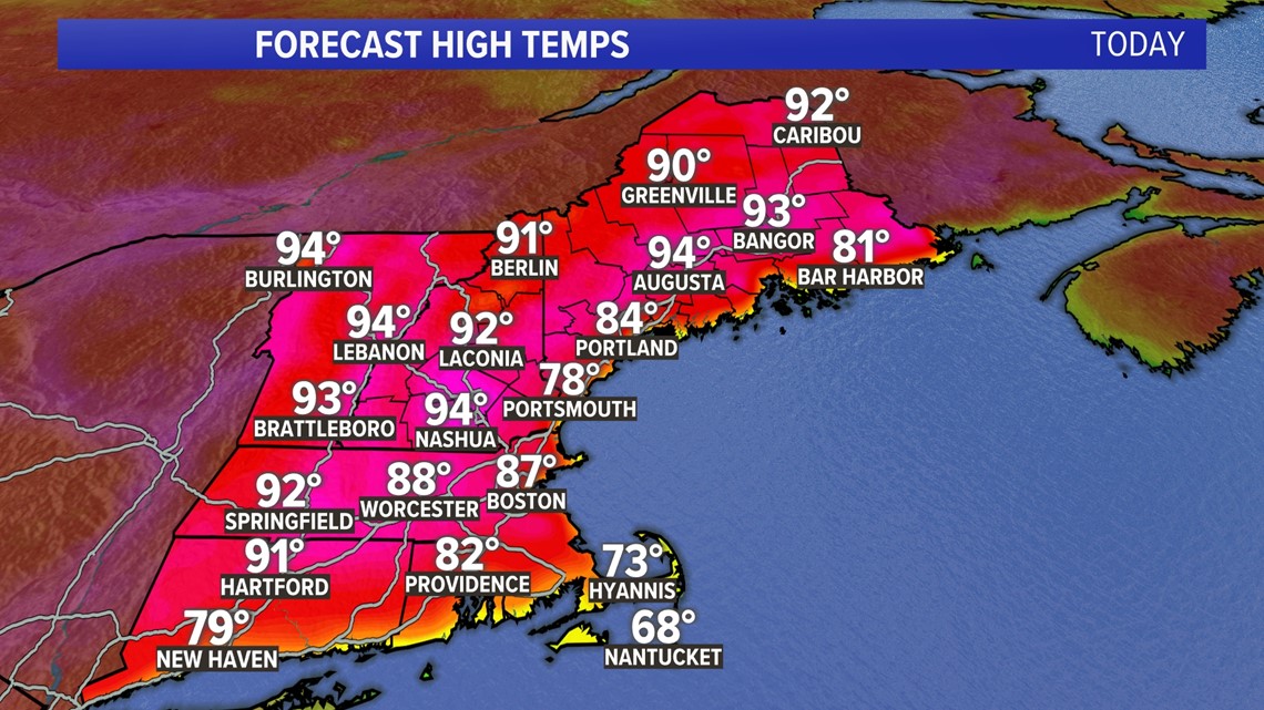
Typically, we only see highs around 70 degrees this time of year, and it will also be a bit humid into Friday.

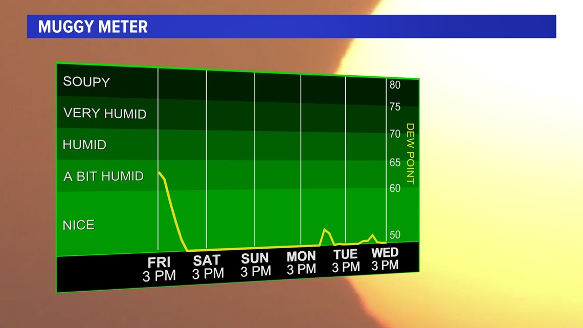
But it all comes crashing down Friday as a cold front advances from the north. It’s called a “backdoor” front because it moves in from the north instead of the west.
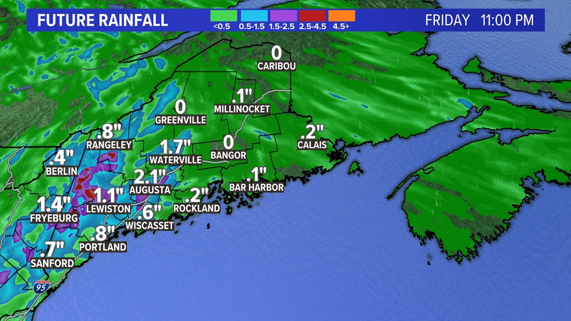
The front will spark showers and thunderstorms from Friday afternoon into the evening. There will be downpours with a localized flash flood threat.

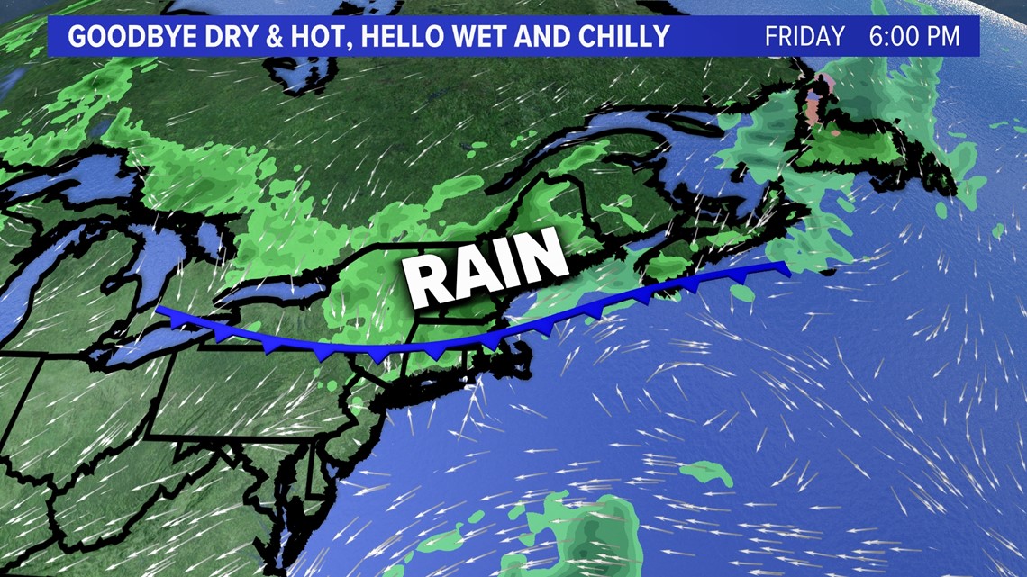
Local rainfall amounts will be more than one inch if you get caught in a thunderstorm. Great news for the lawn and garden, not so good for Friday afternoon and evening plans.

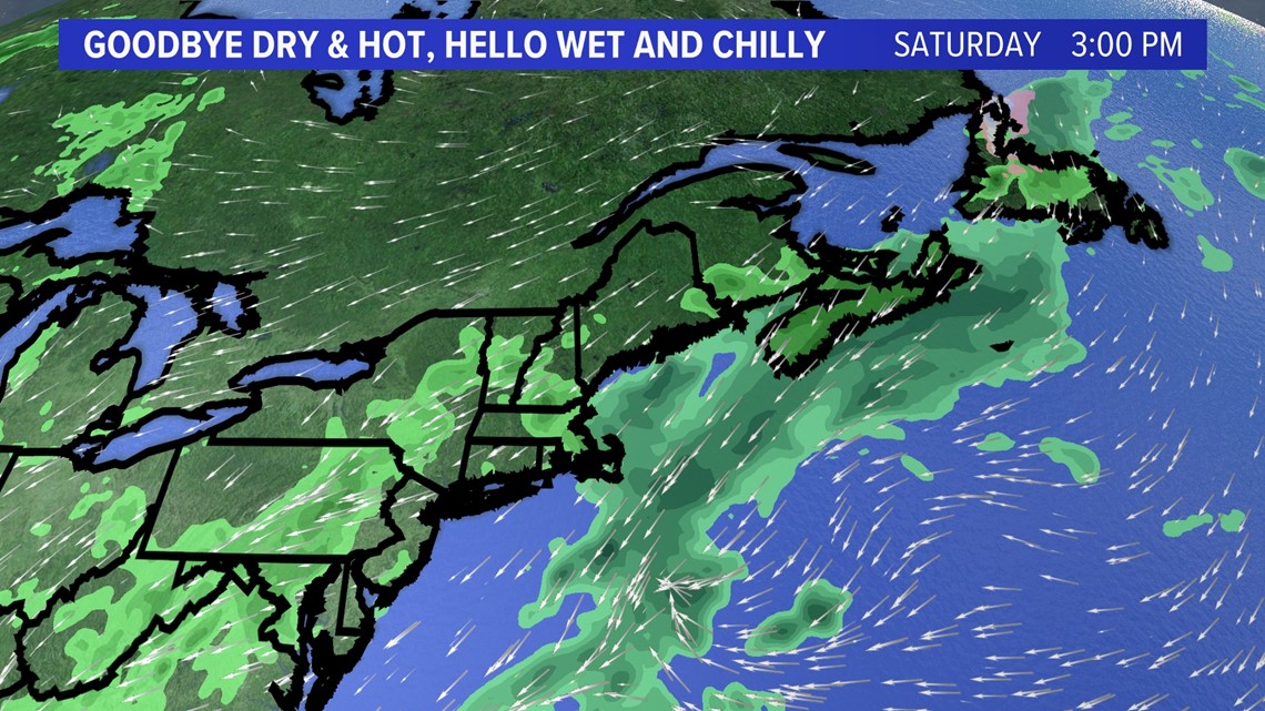
We get a brief break from the rain on Saturday with a cloudy sky in the forecast.

But an upper level low will emerge off the coast of Cape Cod on Sunday and bring rain back to Maine.

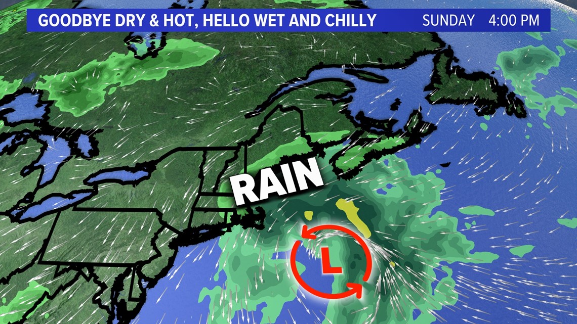
The rare, upper level low will swing back to Maine Monday and Tuesday giving us days of an onshore breeze and rain. Temps will struggle to reach the 60 degree mark with plenty of showers.

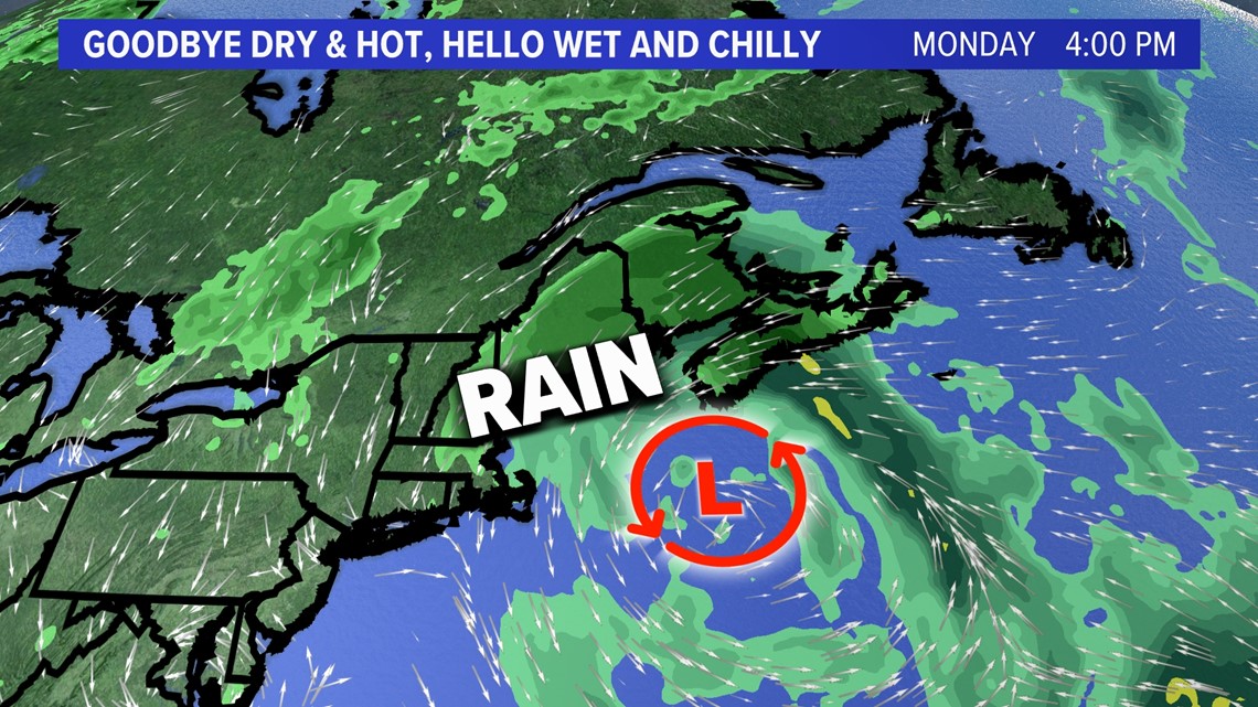
There are signs the system will move away by the middle of next week.
You can get the latest updates by following me on social media:


