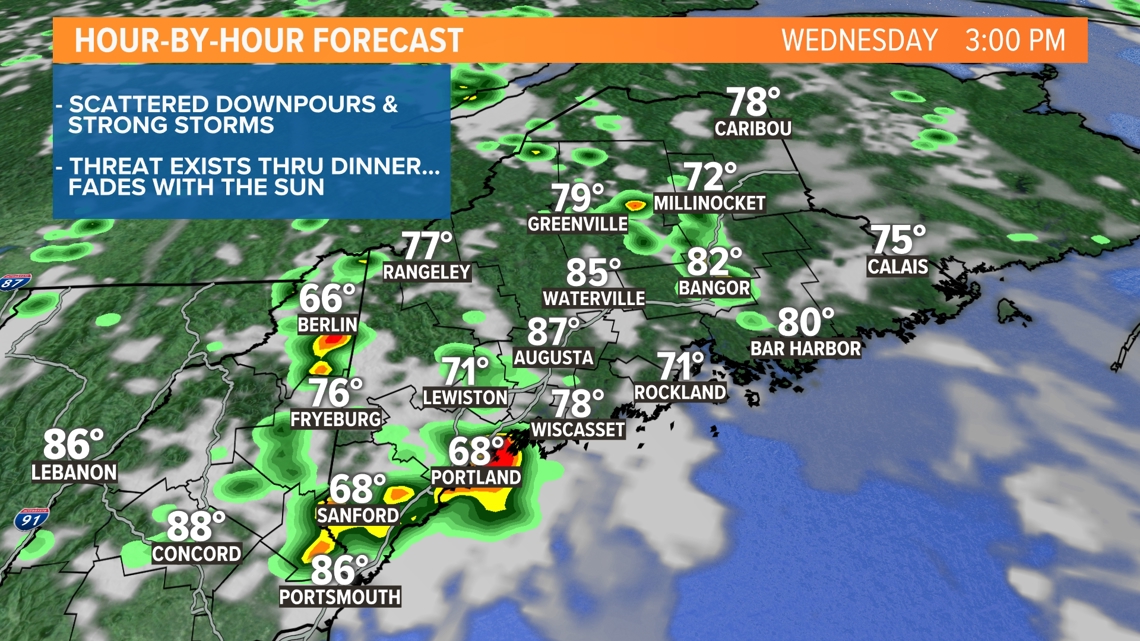
PORTLAND, Maine — We've got a warm Wednesday on tap and, for the first time in a while, a humid one too. Both will lead to instability Wednesday afternoon and, with some upper level energy passing over the state, we have a trigger for thunderstorms.
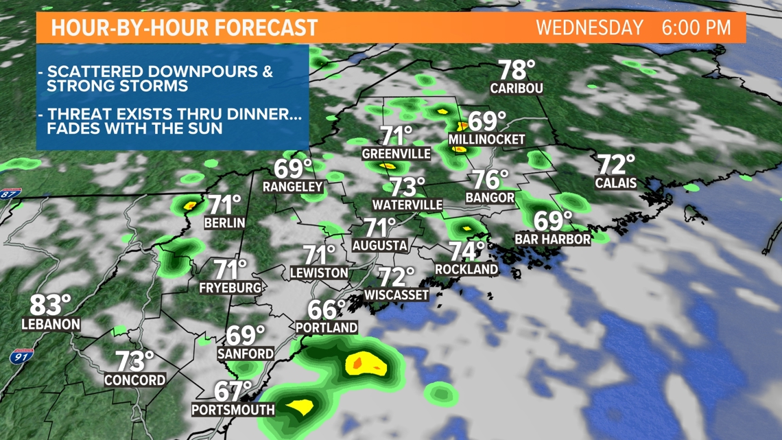
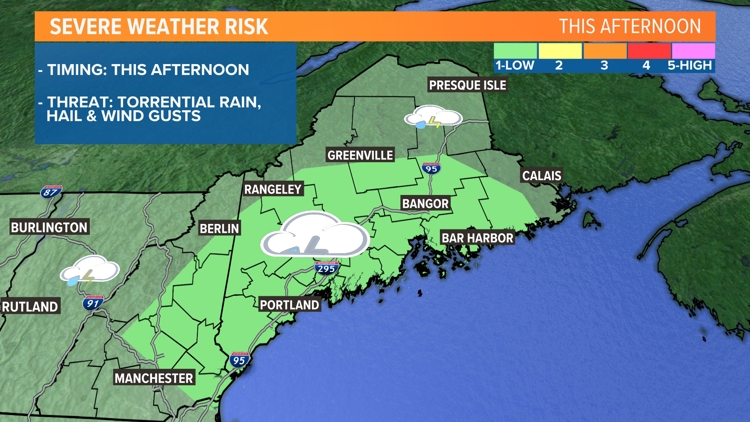
Towering cumulus clouds will begin growing into thunderheads during the middle of the day, after temps climb into the lower 80s. They'll first form over the hills and mountains, then slowly work south and east toward the coastline by the middle of the afternoon. The threat will continue into the early evening before fading with the setting sun.


These storms will be slow movers, capable of dropping large amounts of rain and could lead to drainage issues. Be careful driving while in any downpours. Along with torrential rain, gusty wind and hail will be possible within these cells too.
We'll provide crawls and cut-ins on-air if any storms get feisty.
Todd - Click here to check out my Instagram page.


