
MAINE, USA — On the one hand, this isn't going to be a huge ice storm. On the other hand, it's April.
The time of year is playing a pretty big role in our forecasting of this event. It's not that you CAN'T get ice in April; you certainly can. It's just that it's hard to accumulate larger amounts of ice when the sun angle is so much stronger than it is mid-winter.
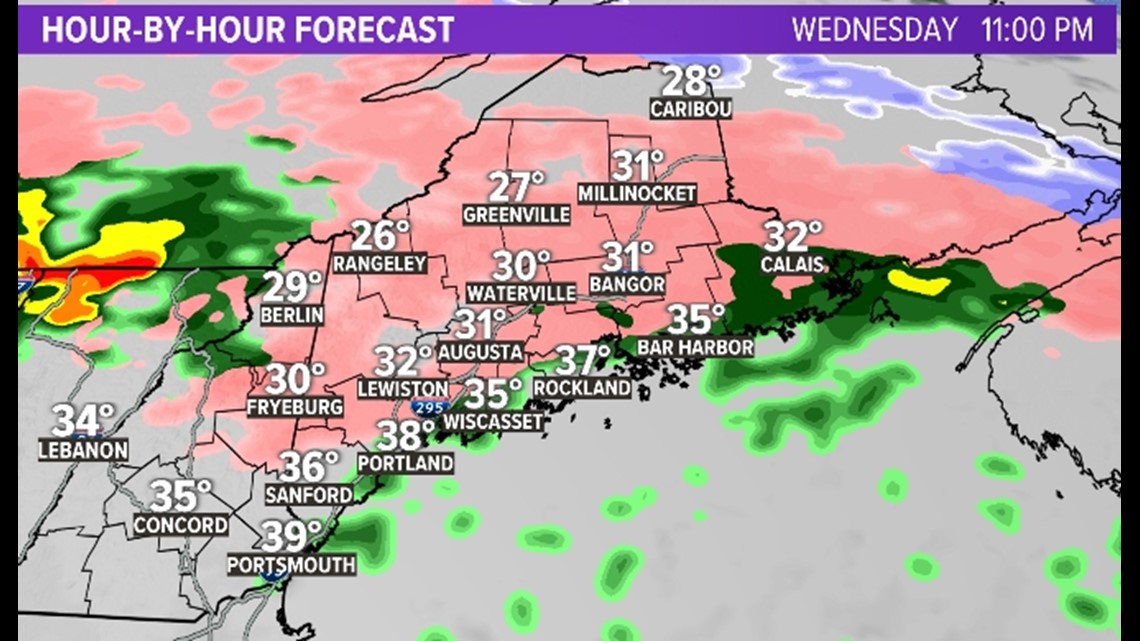
On radar right now, we can see the leading edge of the precipitation, which is associated with a warm front.

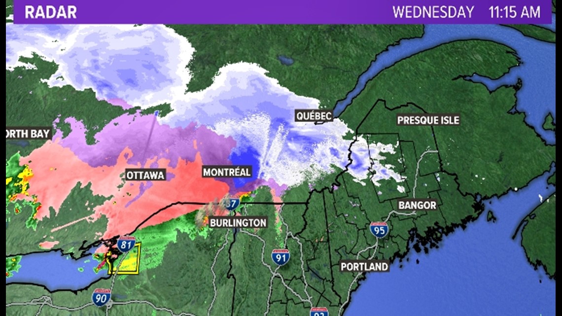
This moisture is sliding into an airmass that is certainly on the cool side due to cold air damming (more or less when cold air is pushed in from the north and gets stuck against terrain).

During the daylight hours, we will see some freezing drizzle and rain, especially in the mountains and foothills, but I think true ice accretion will be hard to come by due to the aforementioned (do I sound like an attorney yet?) sun angle.

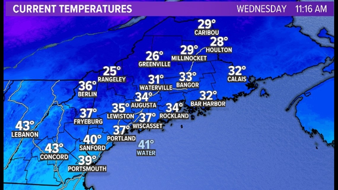
Notice during this time period there are areas depicted as freezing rain, but temperatures are at or above freezing. That isn't going to lead to an ice accumulation, and it might even be sleet instead of freezing rain in those spots.
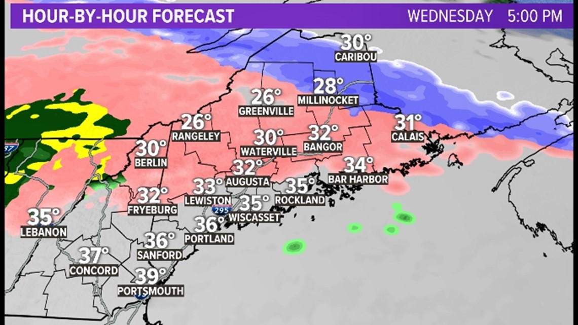
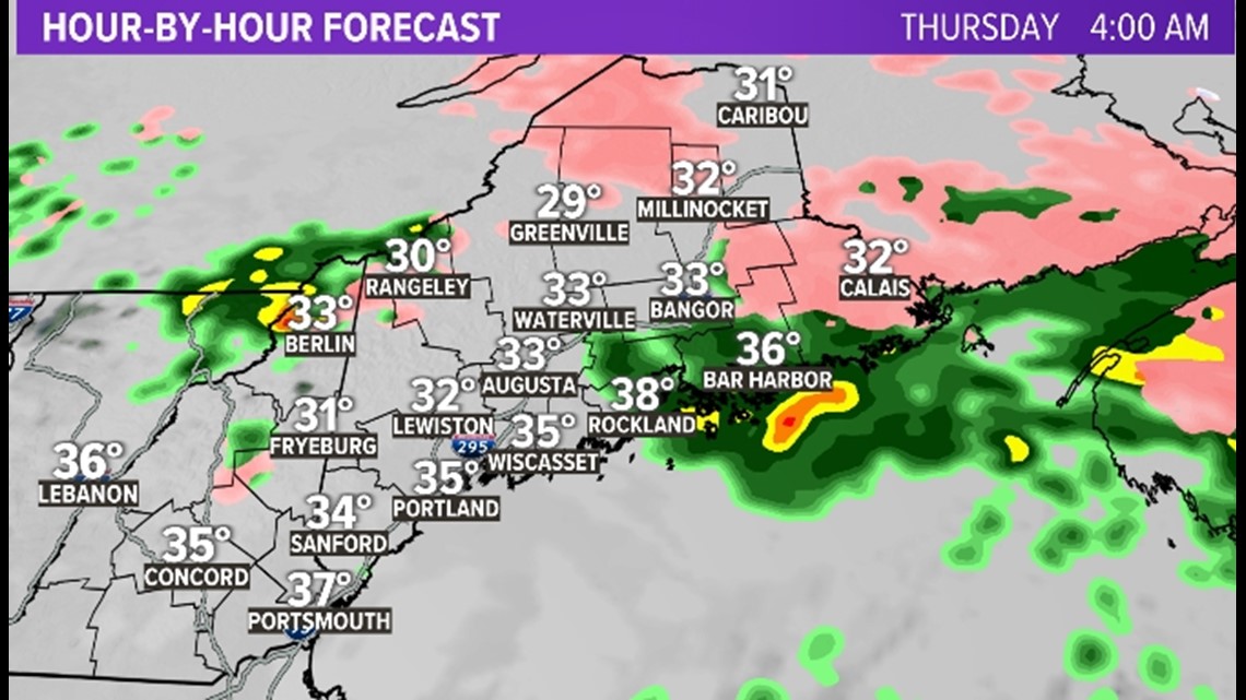
Overnight, we are able to be a little more efficient at accumulating ice, especially in central Maine and the foothills and mountains.

By Thursday morning, slow warming occurs and most everyone changes over to rain showers.

So what are we looking at here? Well, it's important to note that computer model ice forecasts are notoriously WAYYYYY too high. Several times a winter I see computer model outputs of 0.6"-0.8" of ice which, if you know ice, is fairly catastrophic. But it doesn't happen.
The reason behind this varies, but one of the biggest issues is that computer models assume that if the temperature profile fits freezing rain, every drop of freezing rain will then accumulate on the surface. That just doesn't happen, even in the middle of the winter. Often freezing rain accretion is very inefficient, and that's especially true in the spring.
All that to say, I think we are looking at 1/4" of ice in the worst spots here and just a glazing in most others. Along the coast I don't see much of anything.

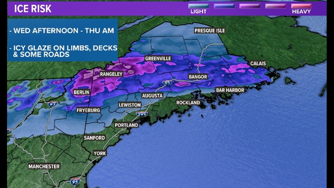
Most roads will be fine as well because, at this point in the season, there's quite a bit of "treatment" still left over from the winter. That makes it hard for the roads to freeze over unless there is snow down first.
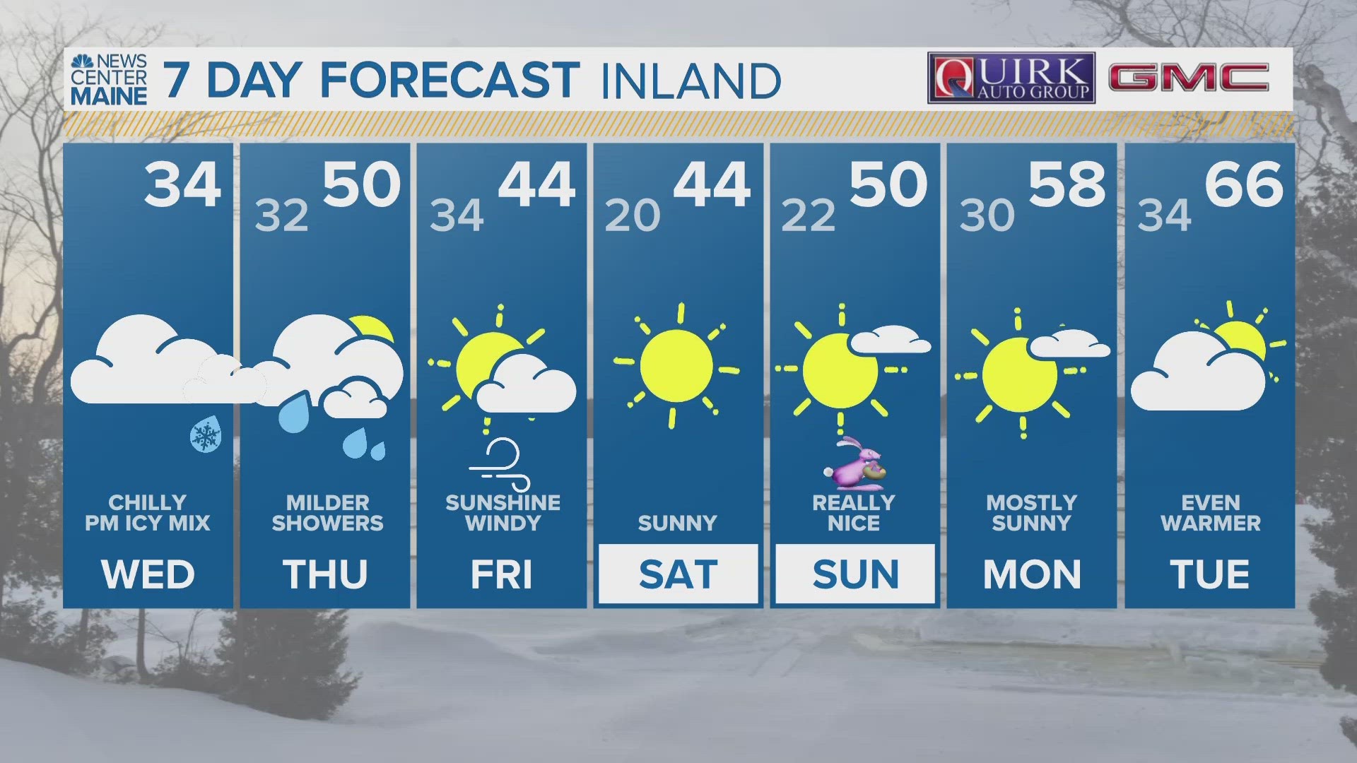
Hey, on the positive side, next week looks pretty warm. So we've got that going for us, which is nice.
I'm out.
Carson
For the latest breaking news, weather, and traffic alerts, download the NEWS CENTER Maine mobile app.