PORTLAND, Maine — No, winter isn’t officially over in Maine yet, but you might as well stick a fork in it. Or in our case, stick a fork in the mud because there’s no snow to be found except at higher elevations.
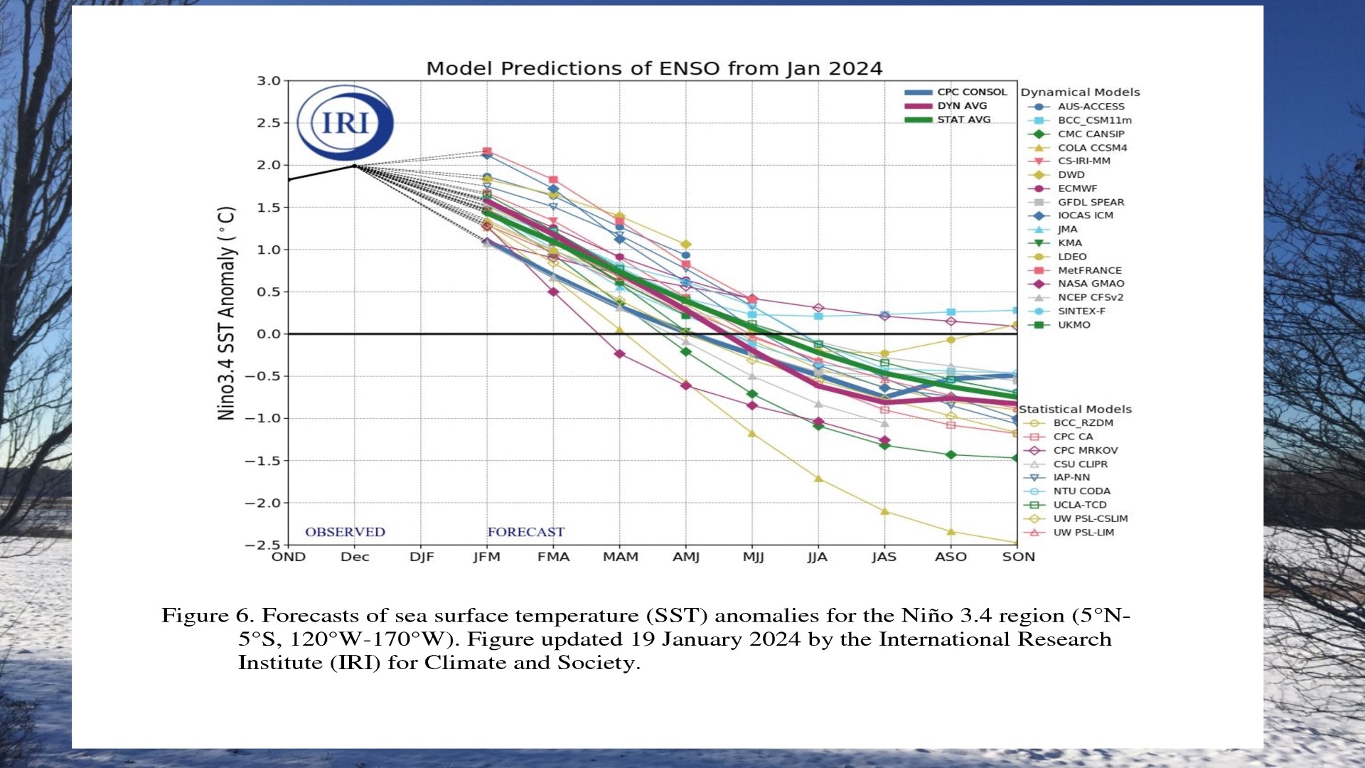
Typically, we see more than 60 inches of snowfall in southern and Down East Maine, and more than 100 inches in northern Maine. The chance we make up that much ground in the next several weeks would border on a miracle. Yes. It’s that slim. A lot of this can be attributed to the strong El Nino that dominated the winter season and will continue into the start of meteorological spring.

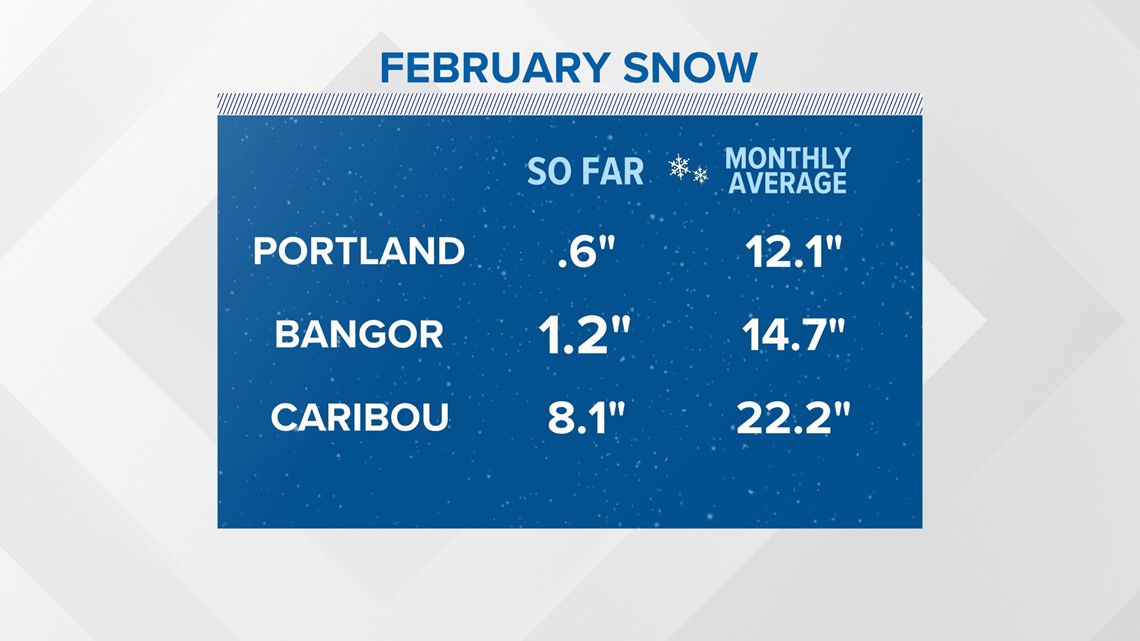
Let’s start off by looking at what is typically one of the coldest and snowiest months: February. The numbers came in about as low as they could be for snowfall. February 2024 will go down in history as the second least snowy month on record in Portland and Bangor.

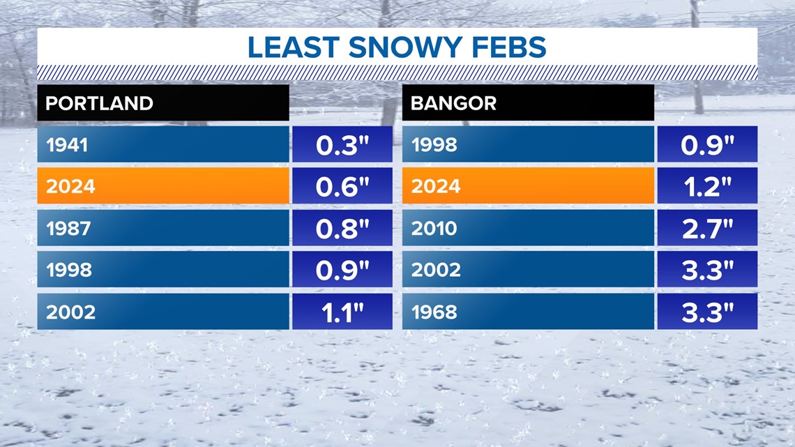
Both locations typically see more than a foot of snow in February. Neither came close. Portland didn’t even get to an inch.

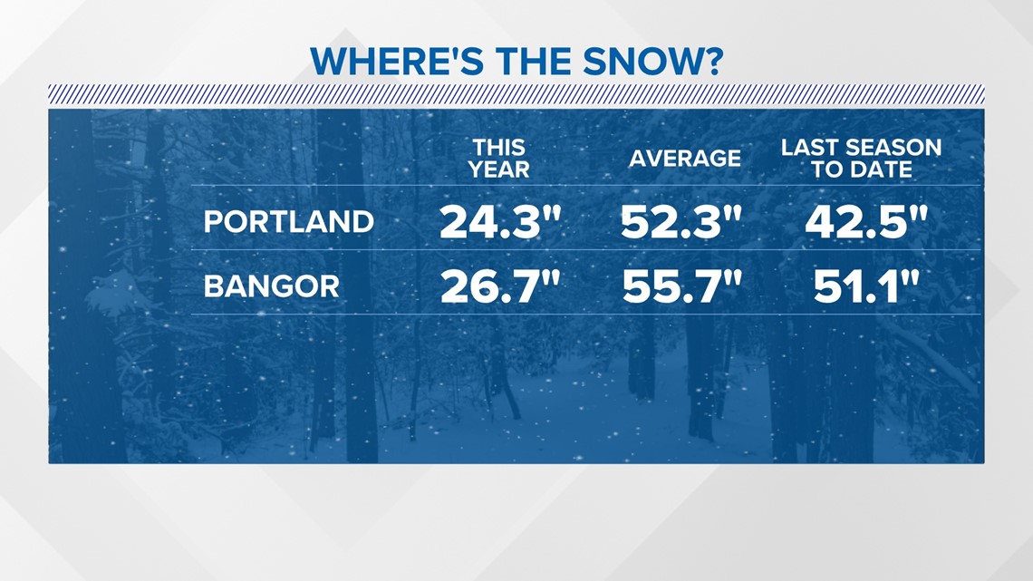
The snow picture, or lack thereof, gets uglier when you look at last year, when we had nearly double the amount of snow by this time. Even in Portland, where we didn’t have the average of 52.3” by now, we still made it up in March.

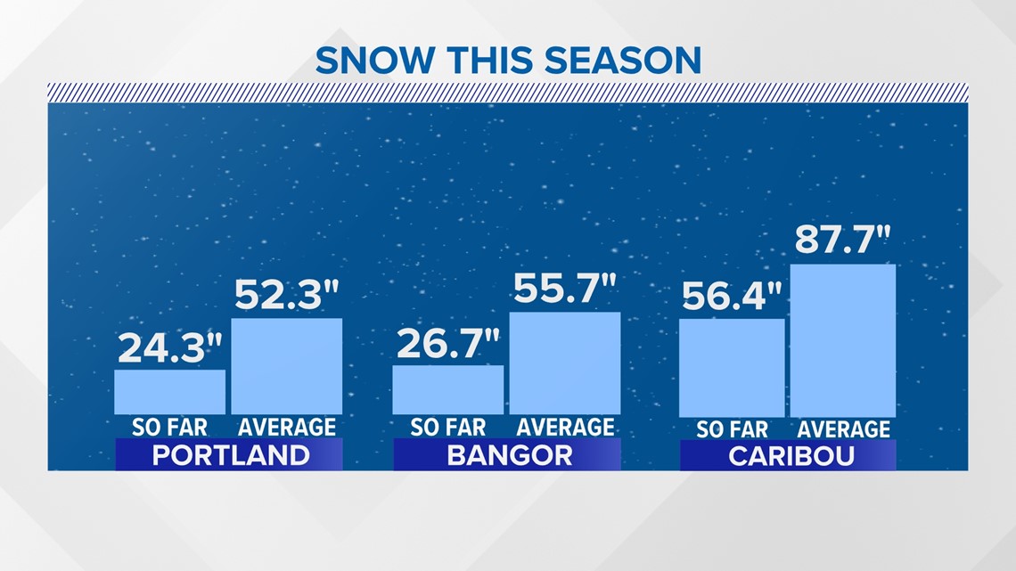
Add Caribou into the mix and it’s clear to see this is not just a southern or Down East Maine problem. Even northern Maine is in a snow drought this year, and that’s after an above-average season last year.

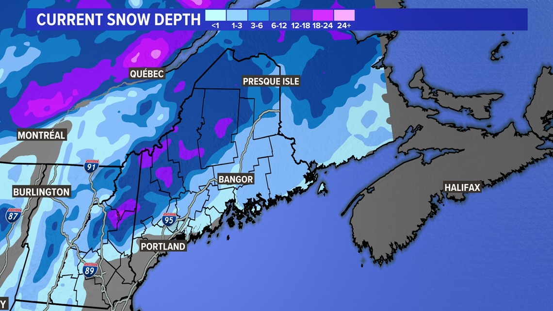
The snow depth or amount on the ground is as bleak as it could look. The cold front dropped some fresh powder in northern and Down East Maine this morning, but that will be gone by the weekend and isn’t enough for snowmobiling.

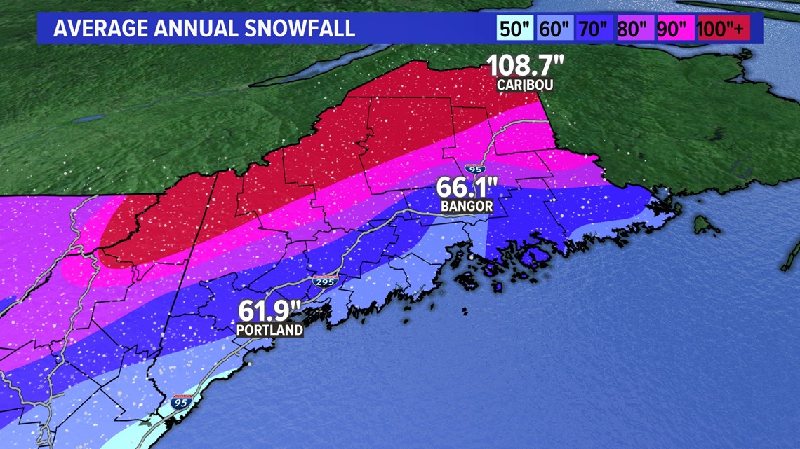
Getting to the annual snowfall numbers means we have heavy lifting to do in March.


A lot of this snow drought is attributed to the strong El Nino that’s been observed and the forecast for El Nino to remain into spring. The polar jet stream has retreated north, and it will take a big snowstorm to create its own cold air in March for us to make up the snow drought.

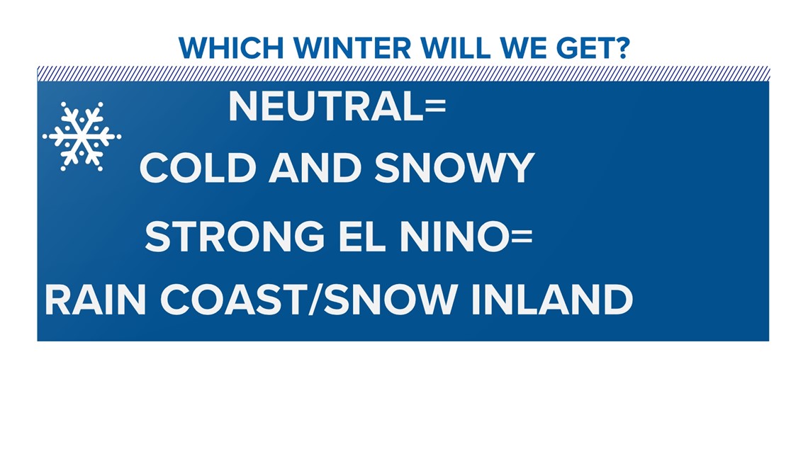
My forecast for a backloaded second half of winter busted because El Nino hung on longer than anticipated. Without cold air blocking from a negative North Atlantic Oscillation, a ridge across the Pacific Northwest, and phasing from the polar and sub-tropical jet stream, we didn’t get the nor’easters to head into the Gulf of Maine.

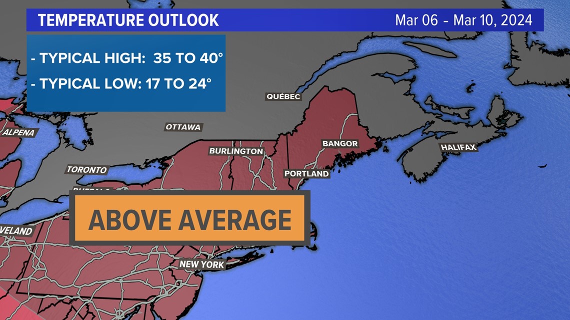
We need to make up a lot of ground to get rid of the snow drought, but the March outlook is showing a 50% chance of above normal temps heading into the first and second weeks of the month.

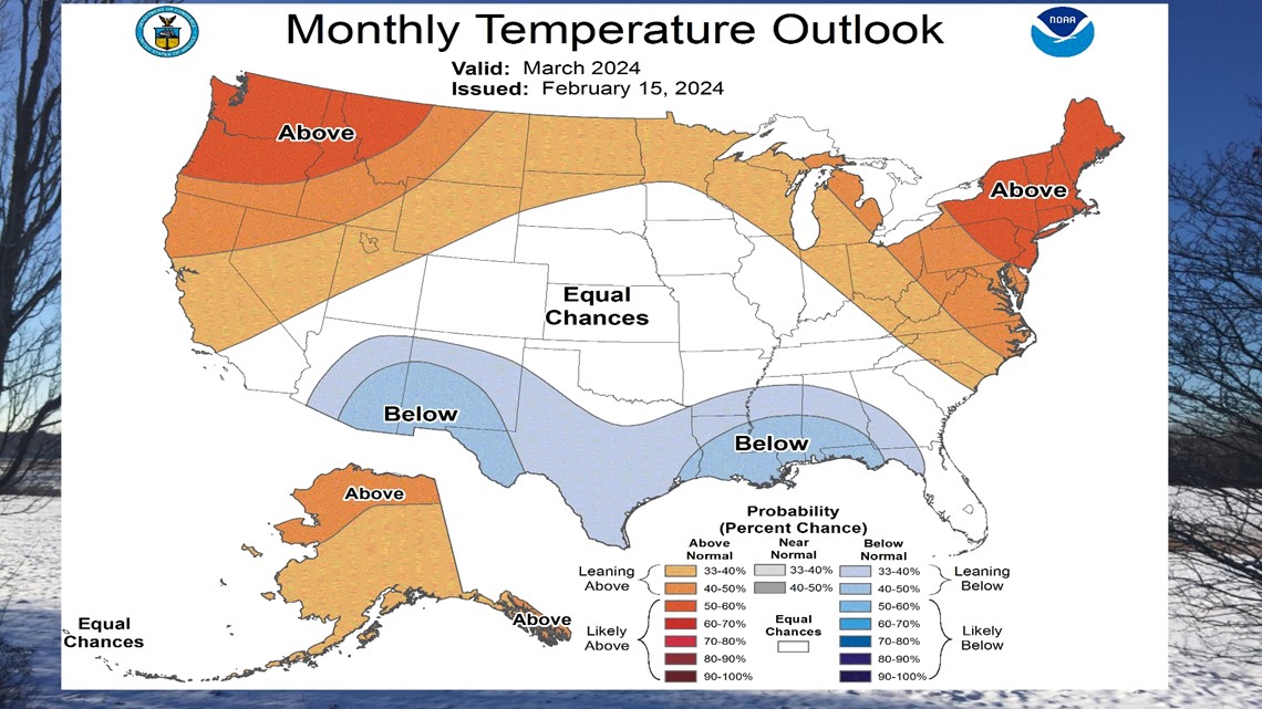
A ridging pattern featuring the entire month will be above average for temperatures.


It’s not what snow lovers or businesses that rely on snowfall want to hear, but those are the cards we’ve been dealt.


Follow along for more weather blogs and pizza discussion.

