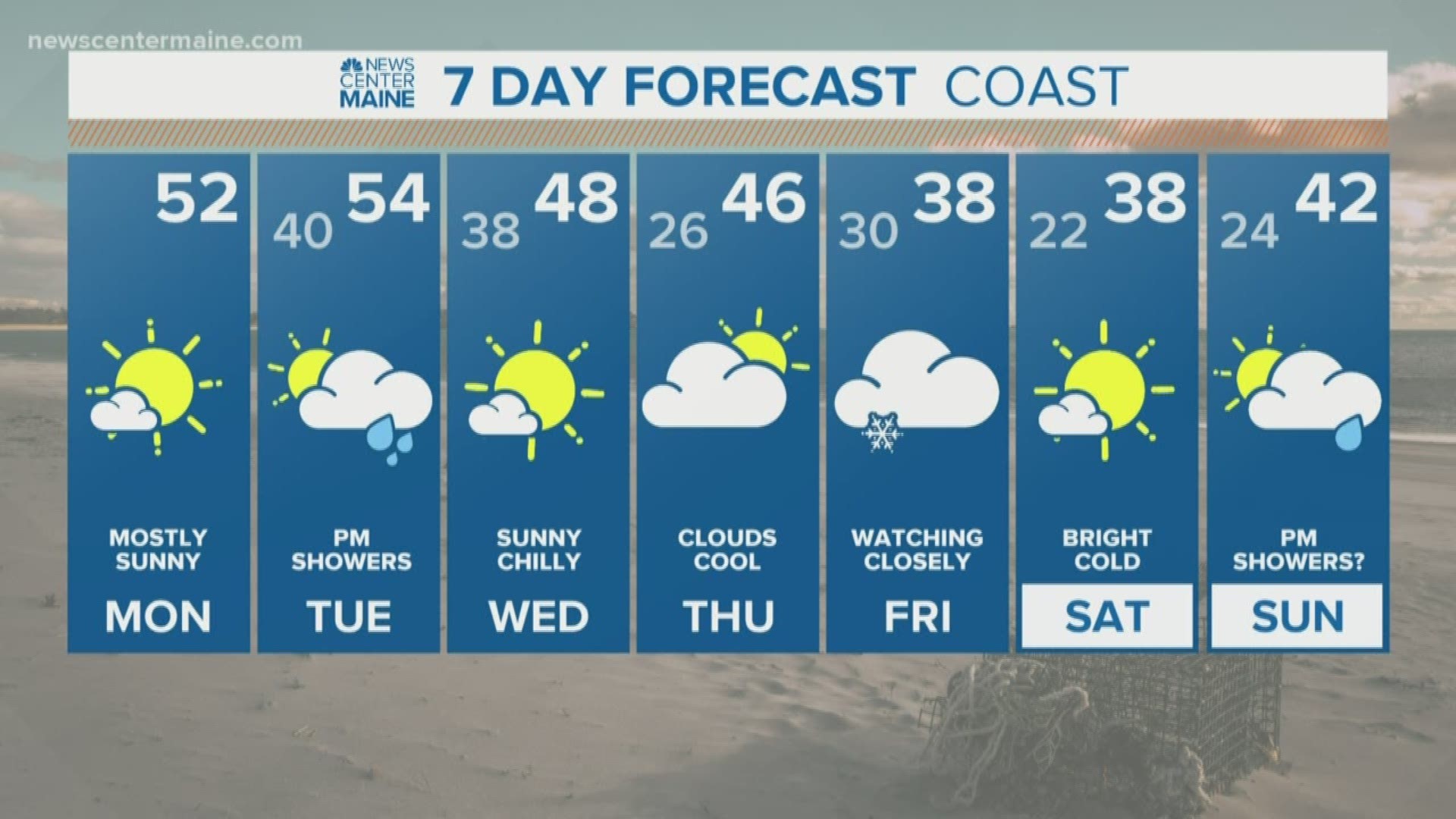
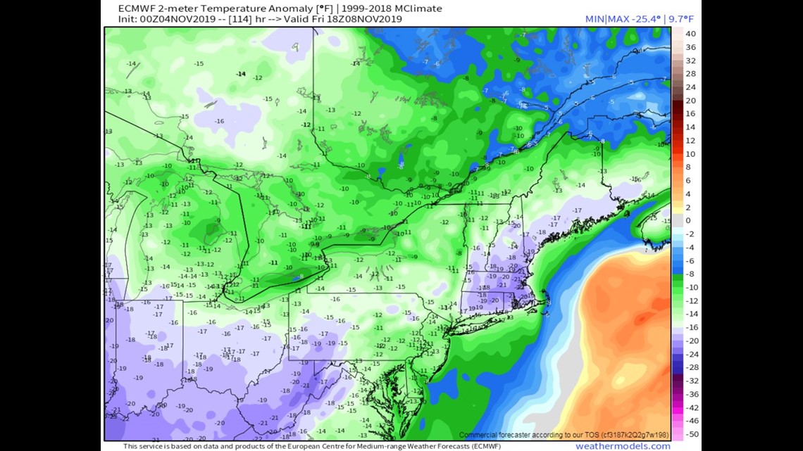
MAINE, USA — Temperatures are continuing to slide as we enter a new month, and later this week abnormally cold air will invade the East. The actual temperatures will be more similar to December numbers, highs in the 30s.

Even more intriguing is our first snow threat of the season. A shortwave will eject out of the Ohio Valley kicking up an area of low pressure along the East Coast Thursday night. The big question is how close to Maine does this storm track? There's conflicting information, it's just a little too early to say. But if it does come close enough, the temps and timing support snow as the predominate precip type.

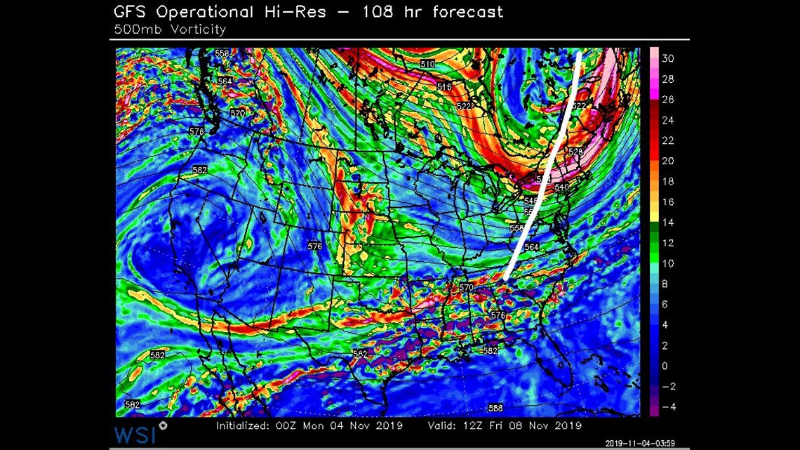
The American model is indicating a more progressive mid-level flow. The storm develops late and stays far offshore.

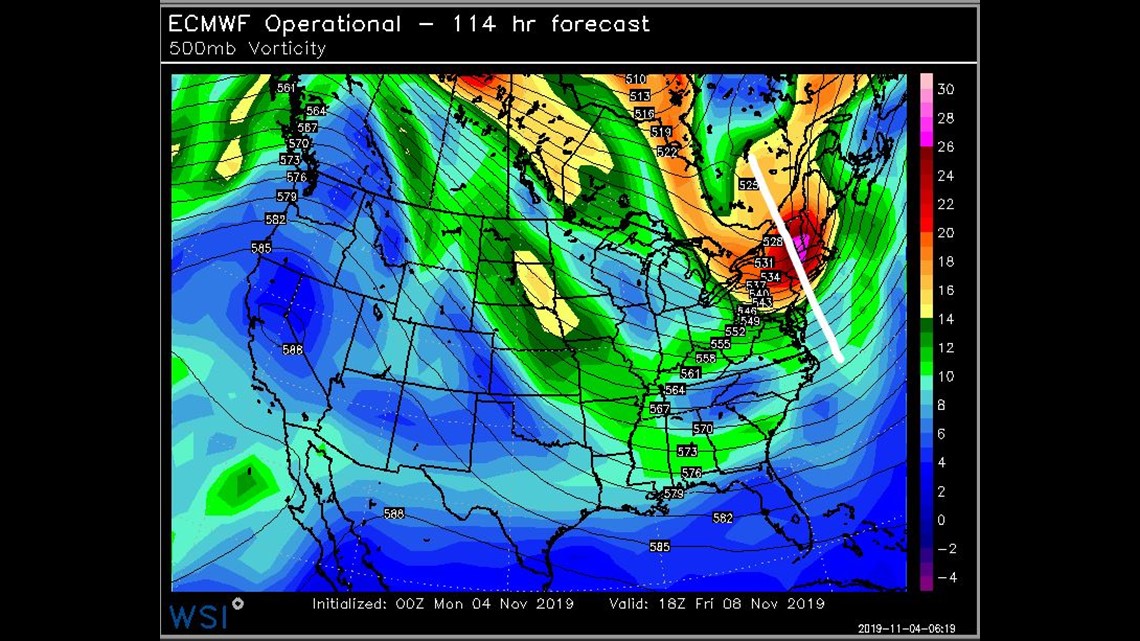
The European model has a sharper and negatively tilted shortwave, the storm tracks closer and strengthens quicker.

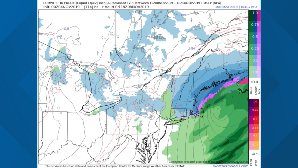
I expect the forecast to become clearer tomorrow as the two start honing in on a solution. Continue to follow the NEWS CENTER Maine weather team for updates.
RELATED: Maine's Climate: Temperature trends

