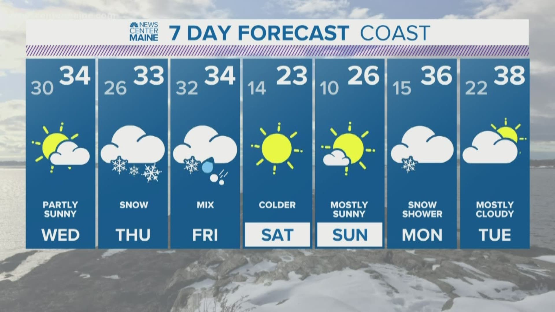
The past few week I've been bored.
Sure, it's been pleasant enough, I regained my driveway and I don't mind a little break from the forecasting action. But it's been too long.
We had a top 5 warmest January and rolled right into the teeth of February with nothing but a yawn, some 40s and a Super Bowl halftime show that Twitter somehow found a way to fight about.
Now we've got something worth talking about, although it's far from a classic Nor'easter.
It's actually a mess.
It begins with a warm front on Thursday:

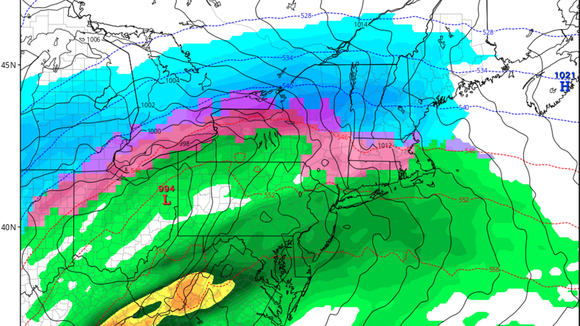
This is a classic "WAA thump" as we call it in the weenie world. That stands for Warm Air Advection. These are pretty reliable when it comes to snow growth and often put down some sexy snowfall rates.
The snow begins on Thursday morning, and because it's pretty chilly Wednesday, it'll be snow statewide at the onset.
That all snow profile will hang on through most of the day with things tapering off by Thursday evening as rain showers. But the moisture is pretty much done by then so it doesn't matter.

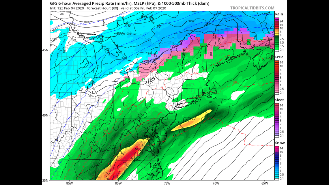
I anticipate most of the state will get 3-5" just from this first round and I feel good about this part of the forecast.
NOW, the second part on Friday is the tougher part.
Another wave of low pressure enters from the south and brings more moisture into Maine.

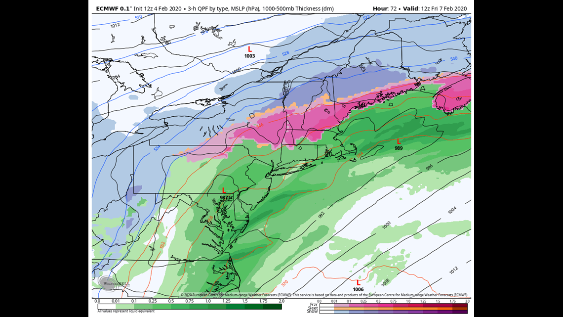
The problem here is the thermal profile. The EURO model, shown above is very cold. It keeps it snow/sleet all the way to the coastline.
However, it's an outlier in this storm. The GFS, NAM and GEM are all warmer with rain mixing in along the immediate coastline.
There could be a number of reasons the EURO is different:
1) Slightly strong low pressure system allowing cold air advection on the backside of the storm.
2) Known cold bias at the low levels when snow-pack is present on the ground.
3) Brexit
Regardless, my instinct is to shade warmer than the EURO but not totally dismiss what it's trying to say.
The result of that is a mixture of rain, sleet and snow along the immediate coastline (in that order on Friday) but mainly snow inland and into the mountains.
The second part of the storm peaks mid day on Friday and wraps up on Friday night.
This isn't a warm and fuzzy forecast to put out given the uncertainty on Friday, and I'm sure I'll be the only professional met with a map tonight, but you know what they say about missing the shots you don't take:

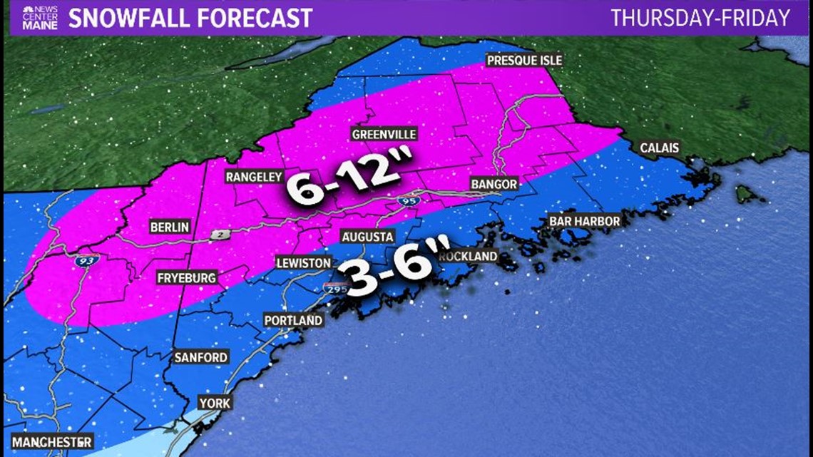
There's still plenty of time to make adjustments but hopefully, you appreciate my early shot at it.
If not...
Carson out.
Pics of my dog, my kid, and my face. Zero weather: https://www.instagram.com/keithcarsonweather/

