Thanksgiving Day looks so-so. Not bad, not amazing. Just "meh".
Luckily it's not exactly an outdoor holiday. Sure you might toss around a football in the afternoon to burn off 7 of the 3,459 calories you just ate....but it's not a must.
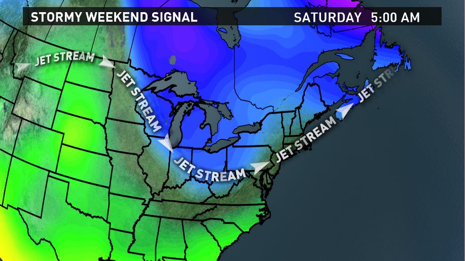
The main forecast interest of the next few days falls on Saturday, where we've been watching a favorable setup for a storm for days now.
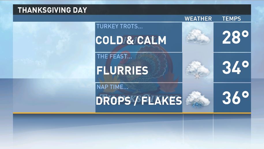
Thanksgiving Day: Most of the state will start off with at least partial sunshine in the morning, but clouds will rapidly encroach from southwest to northeast by noon. Looks to me like the whole state will be mostly cloudy by 2 PM. From 2 PM on a warm front will nose its way into Maine so look for scattered snow showers, particularly across the southern half of the state. Some of the snow showers will melt to rain right along the coast, but most of us are going to be chilly enough.
Black Friday: If you are lining up to buy that LED TV for $6.35, there will be some snow showers across the interior and some rain showers along the coastline. This precipitation could actually become more consistent and uniform through mid morning, so plan to get a little wet
As I mentioned before, Saturday is the most interesting part of the forecast. For 5-6 days now I've noted that the jet stream is in a favorable position for a snow event here in Maine. That's still the case, but the latest models paint an interesting picture of what will go down.
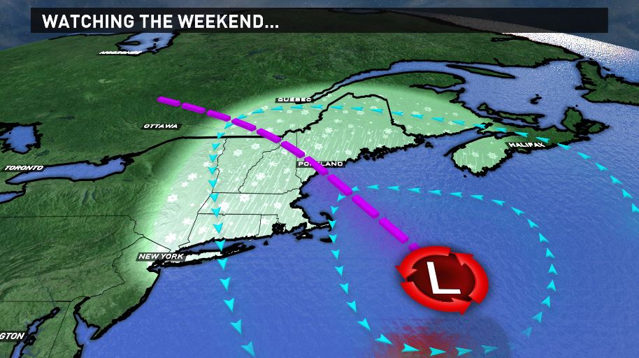
Ah yes, the inverted or "Norlun" trough. Haunter of my dreams, bane of my #Lockitin, Eli to my Tom.
Both the EURO and the GFS have the actual coastal low pretty far out to sea, but reach this "arm" of moisture back into Maine. These scenarios are notoriously hard to forecast, but someone should get a good hit of snow from this.
My meteorologist friends urged me to avoid making a snowfall map 3 days in advance; and I get it...chances of being right are relatively low. But you know what? That's boring. Let's give it the old college try.
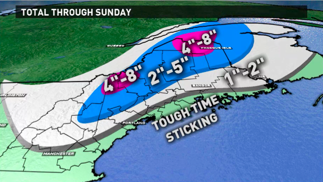
A few things to note about this map:
1. This is TOTAL snowfall through Sunday, so I'm including snow that falls on Thanksgiving night and Friday as well.
2. I'm counting on boundary layer temperatures being a smidge too warm along the coastline to bring real accumulation. That means you will likely see periods of snow, but just grassy accumulation. (Not "grassy surfaces", because that's not an actual thing.)
3. The timing would be snow arriving Saturday afternoon, heaviest Saturday night and tapering Sunday morning.
4. As previously discussed, it's 3 days out and I'm a jerk for trying.
Have a wonderful Thanksgiving.
Carson Out.

