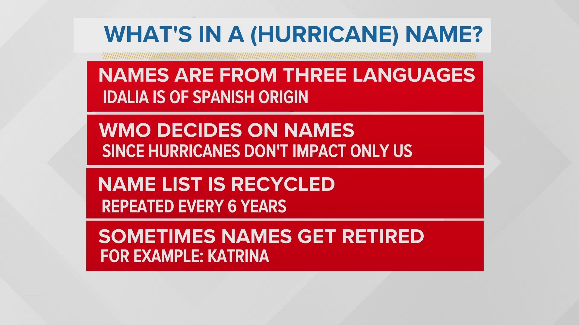
PORTLAND, Maine — Weather is a funny game.
In the select cases we are able to lock in snowstorms/rainstorms seven days in advance, viewers chafe at the advanced warning and call it "hype." Yet, when a storm catches your interest, you start Googling and run into, "Hey, it's 10 days out still. We aren't sure yet!" that annoys y'all even more.
Ok, ok. I see you.
I'm going to do my best to break down what we know about Hurricane Lee and what is unknowable at this time. (Things that are unknowable about me: Does he wear Smedium socks too? Does he have a dachshund as a pet just so he can call it a weenie? Does he lie awake at night envying Gutner's tan?)
Let's start with what and where Hurricane Lee is right now:

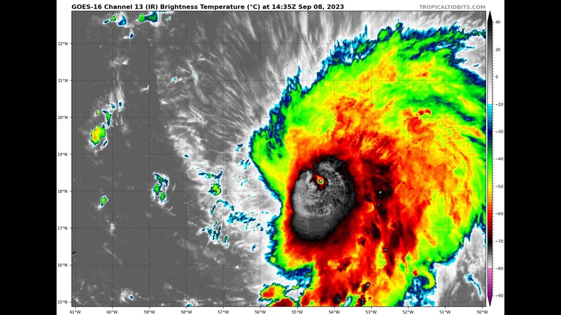
Lee is (as of writing this) a Category 4 hurricane. This thing is an absolute buzz saw. BUT it's worth noting that Lee will not maintain this intensity for the duration. That is especially true when we talk about possible impacts to New England.
Yes, "Lee is a Cat 4 Hurricane" AND "it could threaten New England," but those things will NOT coincide and happen at the same time. It will be a much weaker storm if it even sniffs the salty waters of the Gulf of Maine. (Hurricanes hate our cold water. Think Costanza: "I just got out of the pool.")
If we widen out, you'll see how far away this storm still is from the U.S. mainland.


The storm is just East of the Lesser Antilles. That's so far away that we are talking about NEXT weekend for any possible impacts to New England.
So, where's Lee going?
We have a pretty good idea in the short to medium range.

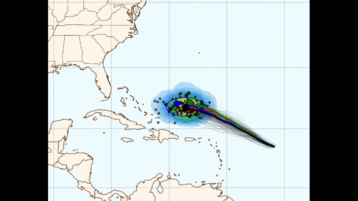
Lee will continue to move Northwest and end up to the South-Southwest of Bermuda. You can tell just by the relatively tight clustering of the individual computer model tracks that this part of the forecast is well handled.
This takes us through this weekend and into about next Tuesday.
But after mid next week, things get significantly more....fuzzy.

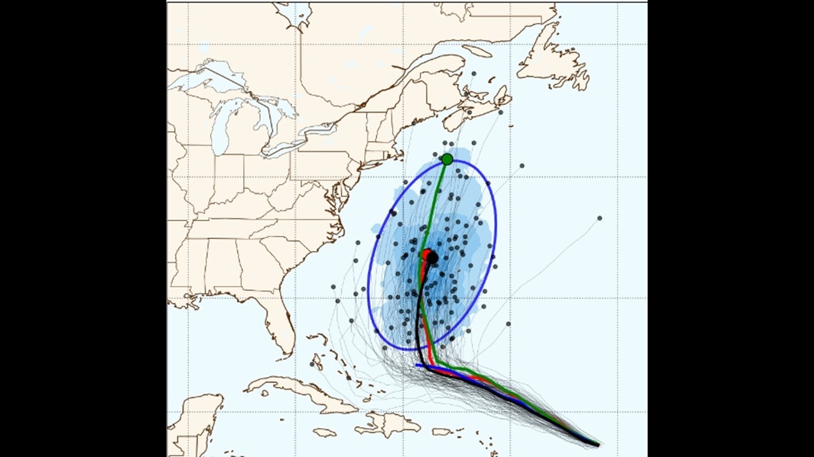
Now, that's just kinda how weather forecasting works: The farther out in time you go the less precise the forecast. But obviously in this case the stakes are relatively high.
There's a lot going on with the steering of Lee but, in my opinion, the key to the forecast is going to be the exact position and strength of two ridges of high pressure. Take a look below.

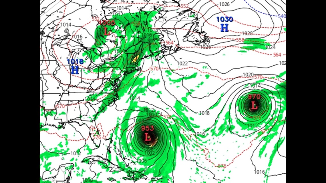
See the two "H" icons? Those are the two highs. See, tropical systems behave a lot like water and teenagers; they take the path of least resistance.
Because of that, Lee doesn't want to plow into either of those Highs, instead it wants to go in between. Therein likes the "alley" that Lee will surely travel along. The key to figure out is if that alley is 500 miles offshore of Maine or over Cape Cod, Massachusetts.
At this time the alley is very close to Maine, but it's a bit east to be a direct hit for us. But, again, this thing wouldn't be at our latitude until NEXT weekend. So there's plenty of time for that to shift.
Bottom Line:
- History and just pure odds are still in our favor for Lee to miss Maine. It's SO hard to get a direct hit from that position in the Atlantic Basin. Most of our hurricanes/tropical storms are "coast scrapers" meaning they ride up the Carolinas and eventually run into Maine.
- Lee will not be a major hurricane if it DOES impact Maine. It will likely be a Category 1 storm. Worst-case scenario would be Category 2, but that seems unlikely.
- Large swells/surf seems a pretty good bet as a minimum impact
- Lee is still 7-10 days from impacting Maine even if the worst-case scenario were to happen
- We will know a LOT more by this coming Monday.
Follow me on Instagram. There's not much weather content, but I take my shirt off a lot:

