

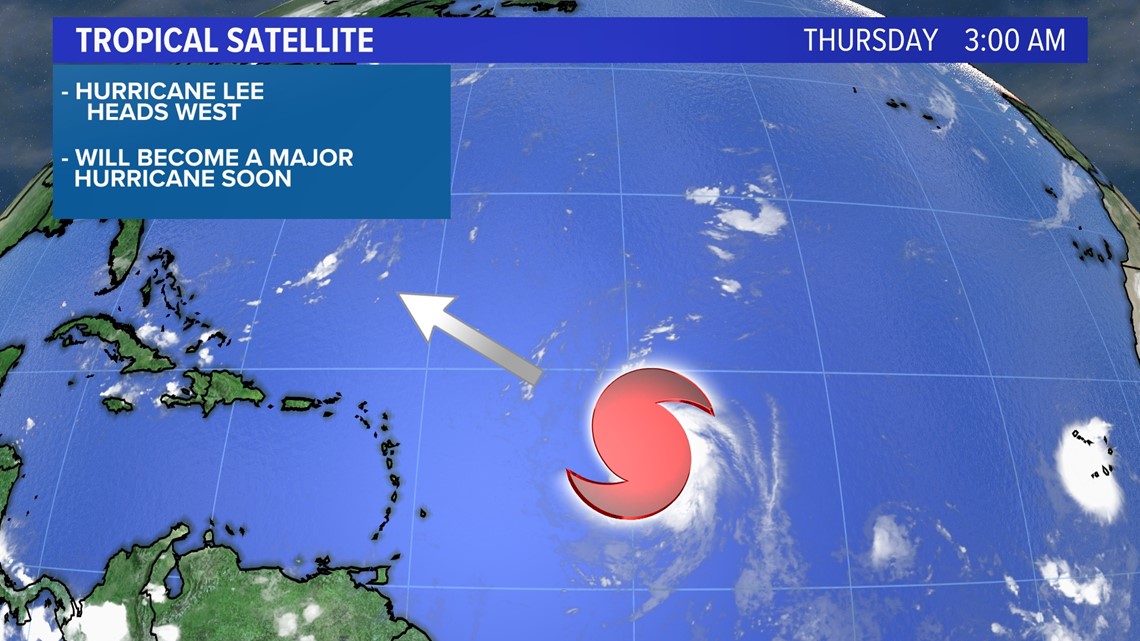
PORTLAND, Maine — Hurricane Lee is churning in the Atlantic Ocean with a forecast to be upgraded to a major hurricane soon as it heads west towards the Leeward Islands.
The latest track from the National Hurricane Center shows the storm south of Bermuda on Tuesday of next week, with at least 155 miles per hour sustained winds and gusts near 200 miles per hour. No part of the East Coast is currently in the cone of uncertainty, which shows where the storm could go, but that could change next week.

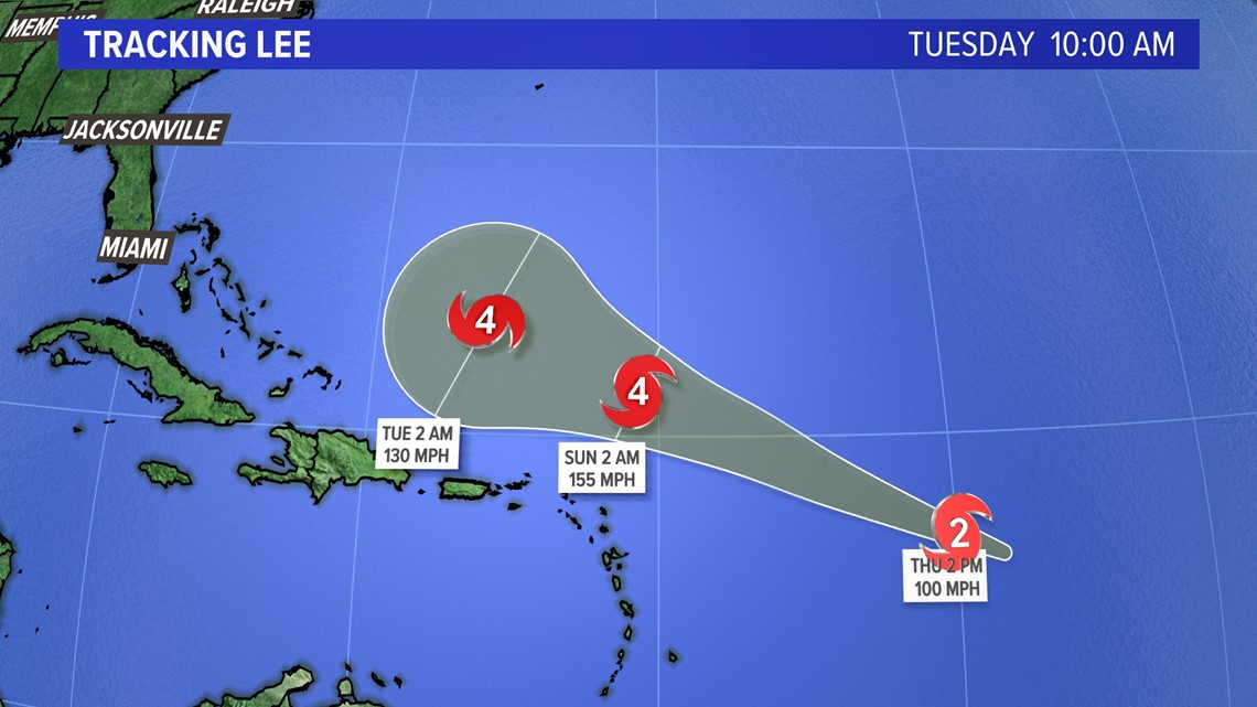
Here’s the latest track from the National Hurricane Center, showing the cone extending south of Bermuda and away from land at this time. The center of the storm could be anywhere in the cone, so impacts will extend far outside the cone.

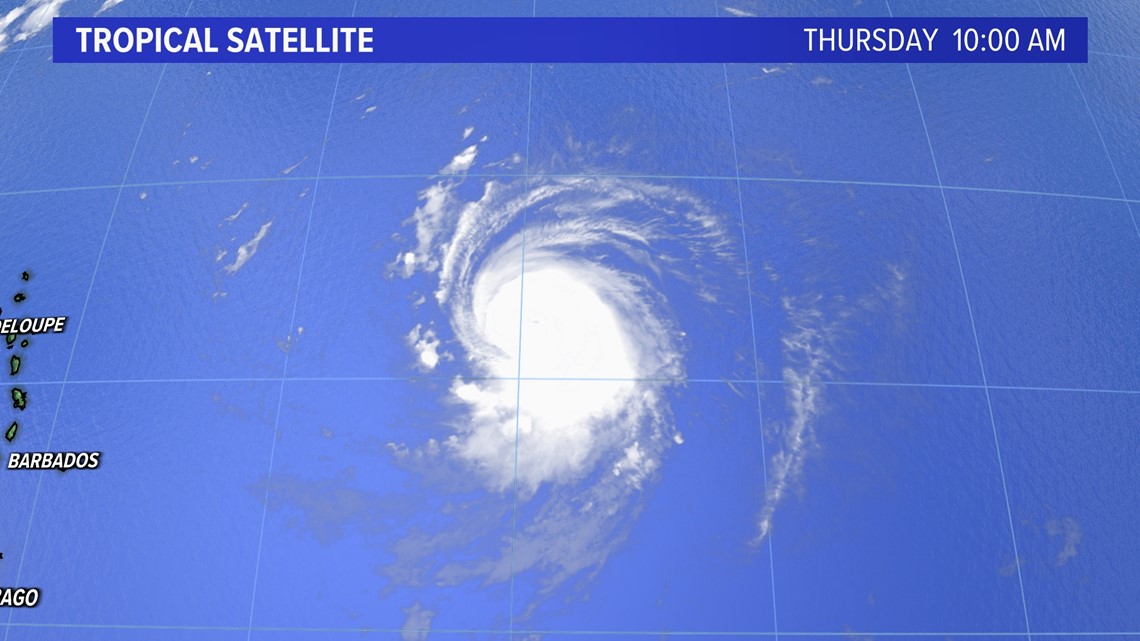
The latest satellite for Lee shows an eye trying to form, which is indicative of a strong hurricane.

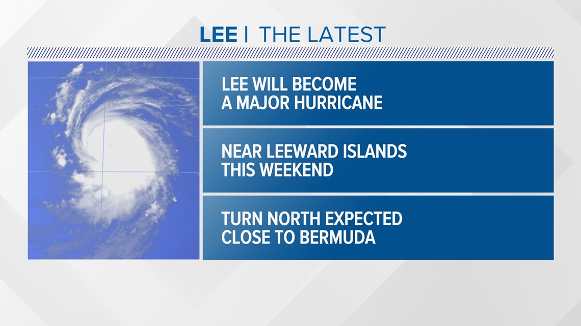
The storm will stay north of the Leeward Islands with some impacts on the southern side of the hurricane.

The tropics tracker shows the major hurricane headed northwest, keeping it south of Bermuda at the beginning of next week. This will be an extremely powerful storm getting close to or at maximum strength of category 5.

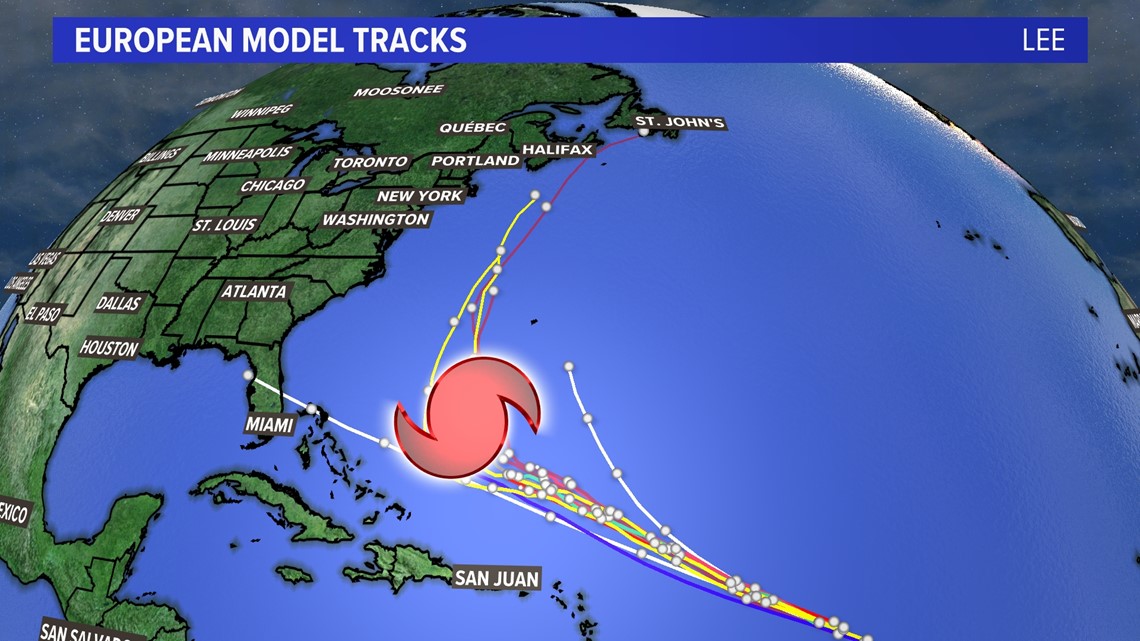
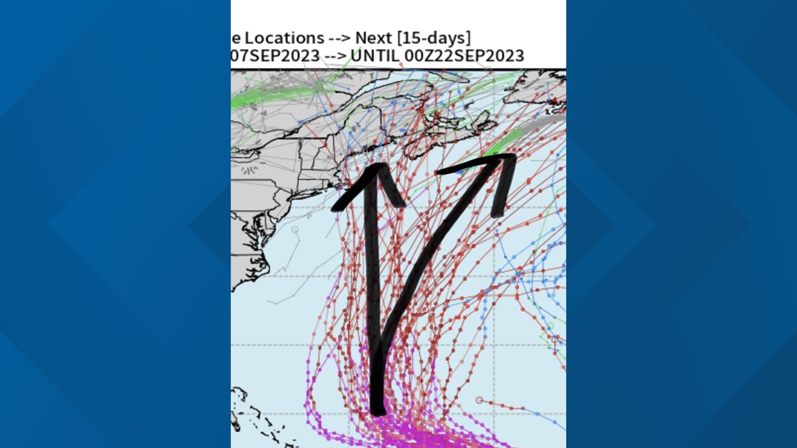
All eyes will be where the storm turns north and how far west it gets before that turn occurs. The spaghetti models are in good agreement that Lee gets farther west than Fiona did last September. That is one factor that will keep it much closer to the East Coast than last year’s category 4 storm that devastated eastern Canada.
RELATED: How are tropical cyclones named?

It is too soon to know whether Maine will be in the cone of uncertainty or whether we will see direct or indirect impacts. I’ll be tracking the storm closely this weekend and next week.


Be sure to check back frequently and follow my social media for the latest.