PORTLAND, Maine — Us math/science types don't really like writing all the words. So when they drag me up from the Nerd Cave (4/5 stars on Tripadvisor. Could use more windows and fewer roommates with shirtless promotional towels) to write a weather blog, you know something is going on.
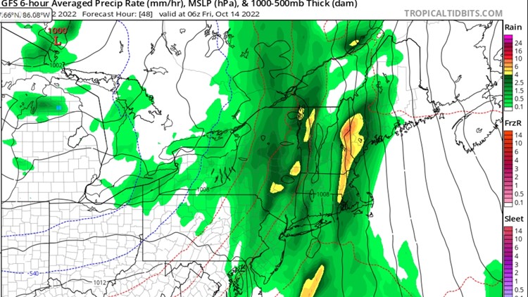
In this case that "something" is a pretty gnarly cold front coming through Thursday night and into Friday.
At first glance, it just looks like a normal front as it approaches Thursday afternoon.

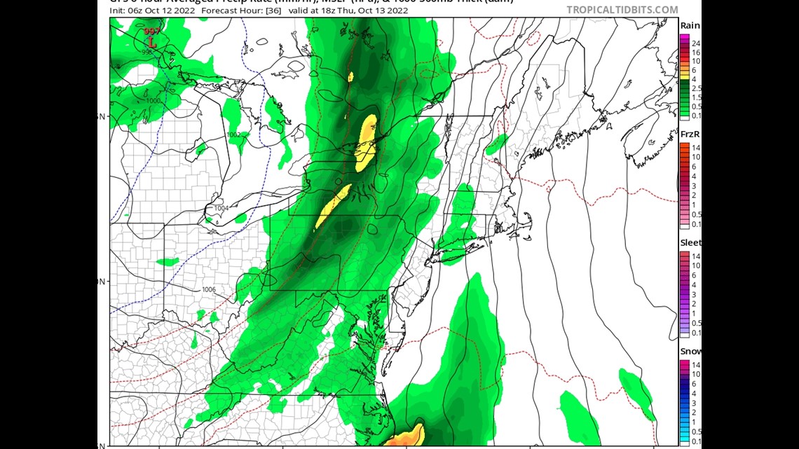
But as it moves into Maine on Thursday night, it starts to tilt a bit more vertically or even a little "negatively" as we call it. A front that tilts that way usually has strong dynamics as far as winds and rain. The look of this front got my attention as early as last weekend, and it hasn't really changed since.
So, let's look under the hood.
It'll definitely be windy late Thursday through the day Friday, but are we talking power outages?

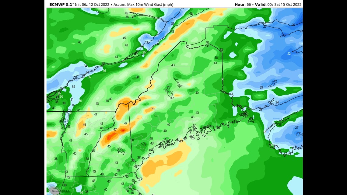
Above is the EURO model output for peak wind gusts during the storm. Although winds get as high as 45 mph, that wouldn't be enough for widespread power outages.
This seems fair considering the dynamics of the storm, and it's also worth noting the EURO is notoriously "hot" on low level wind gusts versus reality. If the EURO is under the power outage threshold, that's a good sign.
That being said, it's pretty close. Winds of 45 mph are very possible, but when we get to 55 mph, our grid seems to have a pretty bad time. I'll keep an eye on it, but at this point I anticipate very windy conditions, but not widespread outages.
Winds will likely be strongest in the early morning hours Friday and wrap up by Friday afternoon.
I also don't think this storm will end foliage season. So many times in the past we've had windstorms in the fall, and everyone thinks, "Well, that's it for fall color season!" But that's not really how it usually works out.
The only time winds like this end the season is when the leaves are JUST hanging on at the very end and ready to fall. Otherwise, it takes the same amount of force to defoliate trees when the leaves are red as it does when they are green — and that's a LOT of force.
Now let's move onto the rain. It could be BIG.

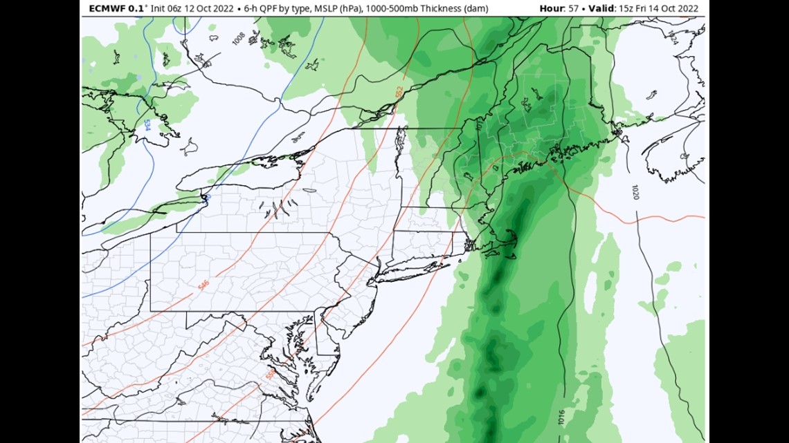
That's because this front looks to stall over us most of the day Friday. As it does so, it drags a lot of moisture in from the south. If the heavier rain bands sit over one area, we could end up with what we call "training," which would lead to some higher rainfall totals.
The EURO model goes absolutely bananas with rain amounts.

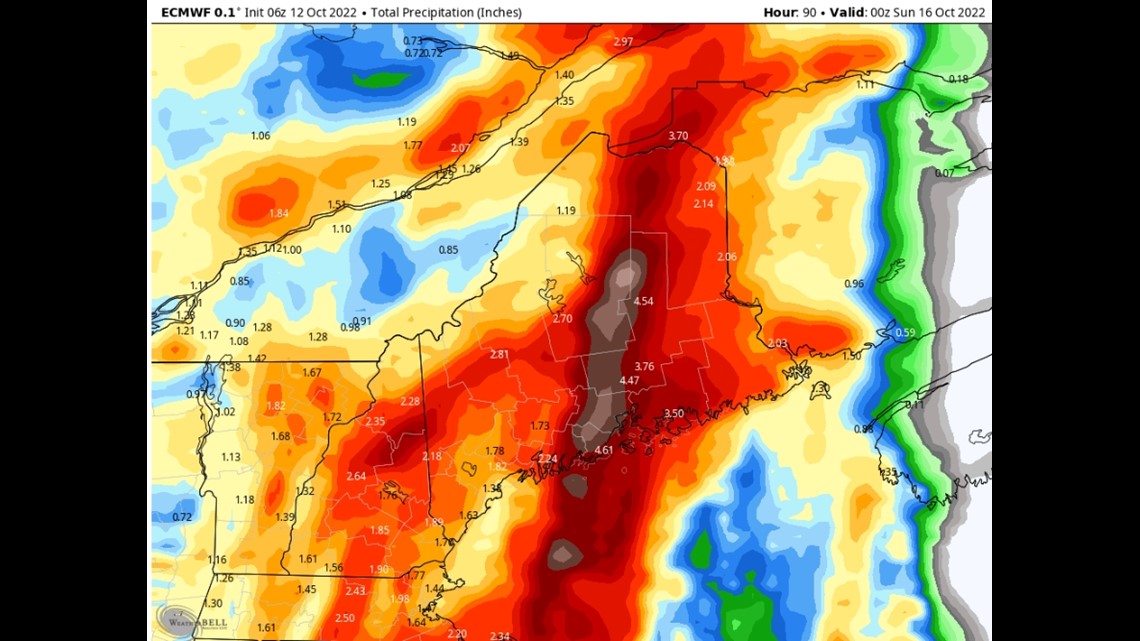
I don't believe we will see many of those 5-inch totals being predicting but I DO think we need to watch the foothills as there is some pretty strong moisture flowing into the terrain. Clearly these amounts would be enough for some flooding.
The rain, in my opinion, is a much bigger threat with this storm than the winds. When strong rain bands are feeding off the Gulf of Maine a lot of bad things can happen....
The storm finally wraps out of here Saturday morning and things are looking much better for the rest of the weekend.
Carson out.
https://www.instagram.com/keithcarsonweather/


