MAINE, USA — 'Tis the season! After a warm rainstorm impacts Maine's weather to kick off the week, a colder snowstorm is on the way to end it.
The upcoming snow will make driving and traveling tough. With heavy, wet snow and strong wind gusts, some power outages are possible by Sunday morning.
The timeline of this storm is important, as the timing makes the switch to snow a bit easier. Charge up those devices, finish any outdoor chores, and get ready for some snow!
Stay here for all the latest updates from NEWS CENTER Maine
Saturday morning starts off dry, but cloudy. Sunrise will be met with overcast skies.
Through the morning, the coastal low to our south keeps strengthening.
LATEST FROM JESS CONLEY
Storm Timeline

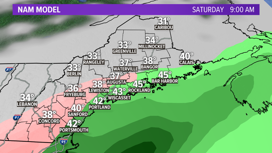
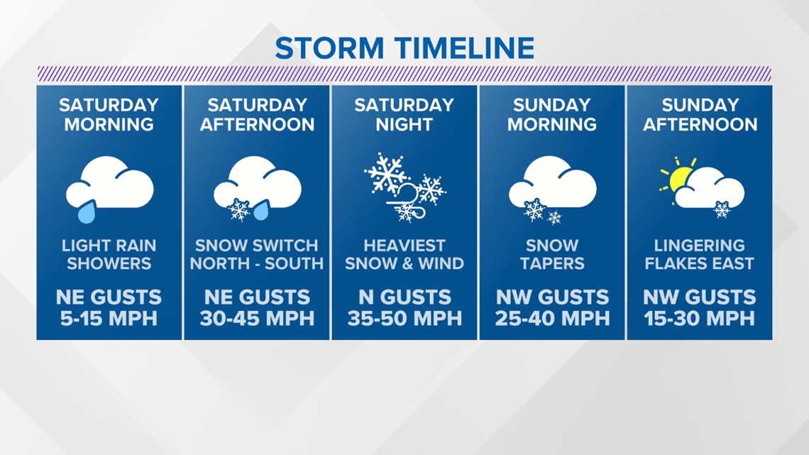
Rain starts up in southwestern Maine around 7 a.m. The entire coastline will see rain before 10 a.m.
The rain might even push far enough inland to allow for some showers in the foothills before the change to snow.

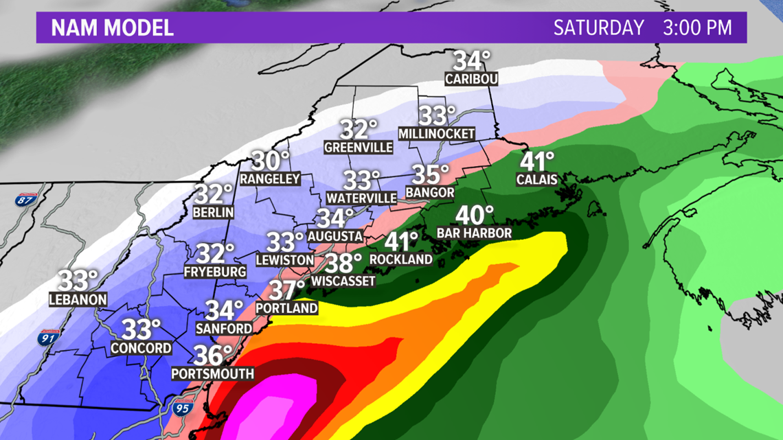
By the early afternoon, colder air starts to get pulled into the storm and there will be a switch to snow from northwest to southeast.
The first flakes will fall near Route 2 in western Maine in the late morning. By 1 p.m., snow will be falling from interior York county all the way to Rangeley.
Lewiston, Augusta, and Bangor will see snow showers around this time, too. Rain continues Downeast and along the I-95 corridor into the later afternoon.

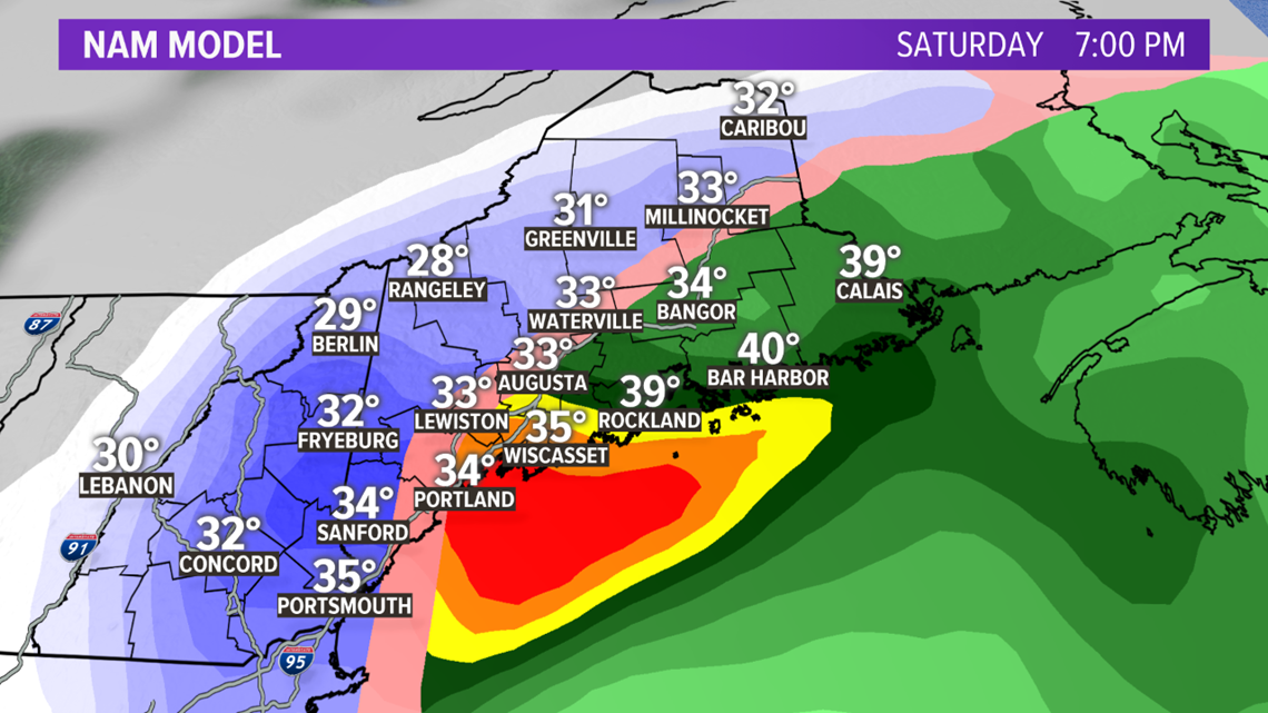
After nightfall, colder air becomes even more plentiful. The transition from rain to snow will be quick at the coastline. Wiscasset to Portland and south will likely see snow starting up around 7 p.m.
Rain will continue Downeast, as this is the warm side of the storm.

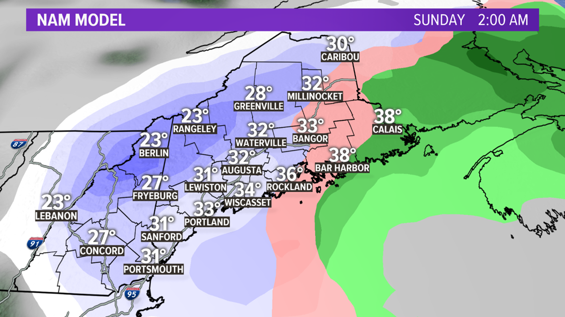
Some of the heaviest snow with this storm could fall overnight Saturday into Sunday. Snowfall rates could easily be over an inch an hour, especially inland.
If you're into winter weather, thundersnow is a big possibility Saturday night as well.

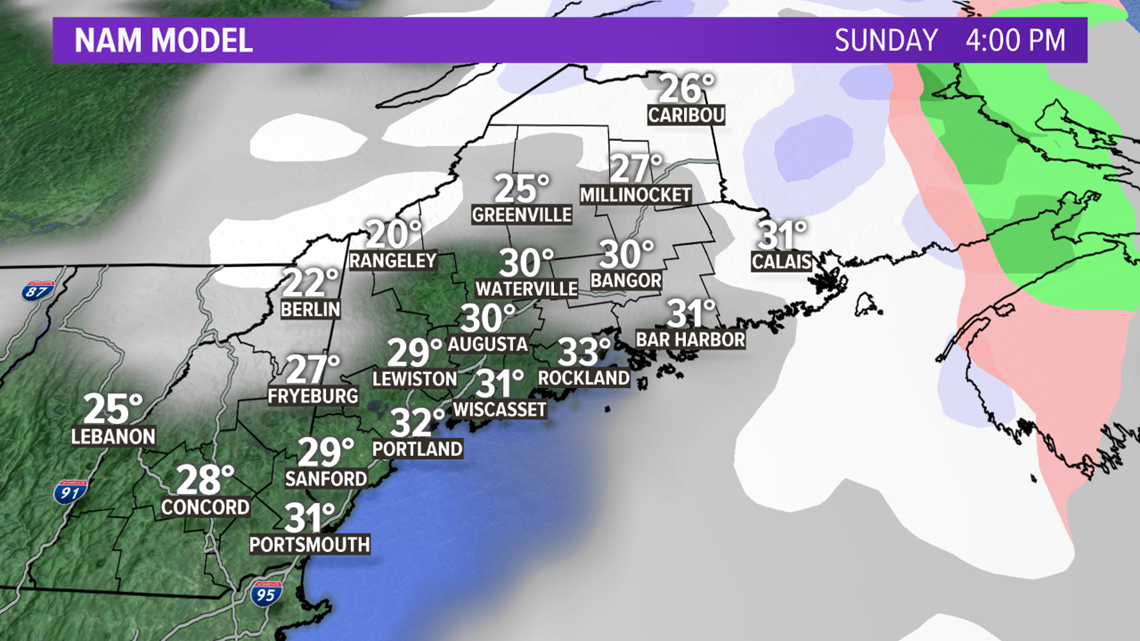
The snow wraps up from west to east Sunday morning. Expect clearing conditions in eastern Maine in the evening.

Storm Impacts & Snow Totals
It looks like this will be the first big snow event for Maine this season.

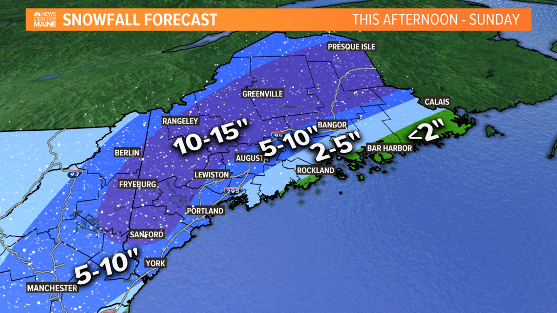
Totals inland will easily be in the double-digit range. There's a significant portion of Maine in the 10-15" range, with the possibility for a couple of higher totals to get mixed in under heavy banding. Western areas of New Hampshire will also get in on these higher snow totals.
The only spots that end up with just a slushy coating will be coastal areas Downeast. Snow totals are not as impressive, since the rain takes so long to switch to snow.

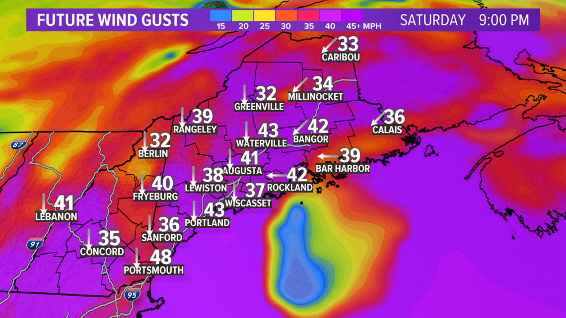
Not only is heavy, wet snow going to be an issue, but some isolated to scattered outages will be possible.
Current gusts are forecast to be between 40 and 50 mph. With the wind coming out of the north, those wind speeds generally do not cause many issues.
The strongest gusts will occur overnight Saturday into Sunday. They do ramp up through the evening Saturday, though, which will add to the threat of whiteout conditions.

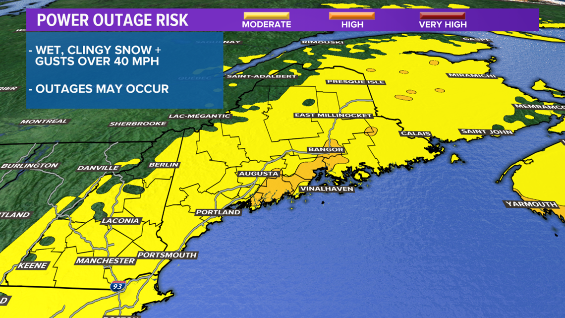
The addition of snow is the wild card here, but it still does not look like a huge outage event.
Travel is going to be difficult, particularly Saturday evening and Saturday night. Watch for rapidly changing conditions. Whiteout conditions will also be possible.
With all the rain that fell Downeast on Monday and Tuesday, a couple of rivers or streams may get close to flood stage. Widespread issues are unlikely. Coastal flooding is not anticipated.
Staying Informed
One of the best ways to stay informed is through the NEWS CENTER Maine app.
You can download it here:
If you have snow pictures to send us, the "Near Me" section is a great way to do that! We love to see any snow-related activities you might join in on. One big help to us; please shoot your photos or video horizontal, not vertical. hamburger, not hotdog. Your great pictures or videos will look better on TV and the web that way.
You can also text us your snow totals or any other fun thing happening to (207) 828-6622. Just remember, please only send us stuff when you can do it safely. Your safety is very important to us all at NEWS CENTER Maine.
We will also have you covered on-air, online, and on social media through the weekend. Stay safe and get ready to bust out the skis.

