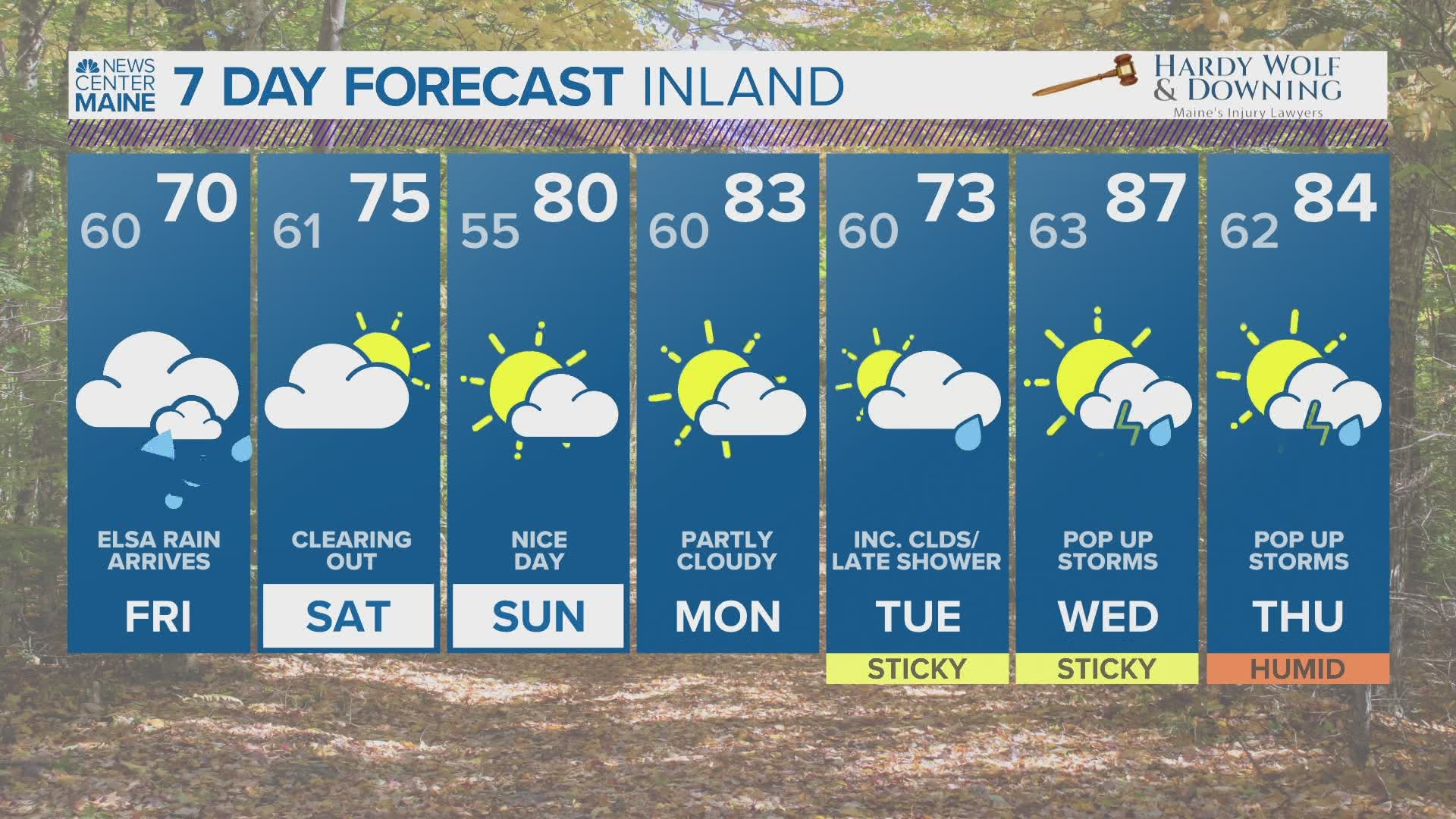
MAINE, USA — Rain, rain, go away...
Another stretch of rainy weather is on the way as Tropical Storm Elsa moves up the eastern seaboard.
Right off the bat, there are a couple of good things with this storm.
We still need some rain, and this will certainly be a drought buster just about everywhere.
The forecast storm track also keeps the strongest wind off of the coastline, so wind damage is unlikely to be an issue for most of Maine and New Hampshire.
After the wet Independence Day, some flooding issues are possible under the heaviest rain bands. Showers begin today with heavier rain expected tonight.
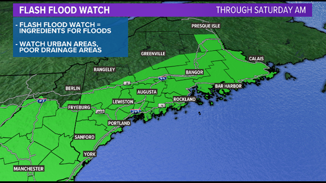
Flash flood watches have been posted for the areas shaded in green. This means the ingredients are in place for flash flooding, which will be possible as heavier rain builds into Maine.
LATEST ELSA MAINE IMPACT UPDATE FROM JESS CONLEY

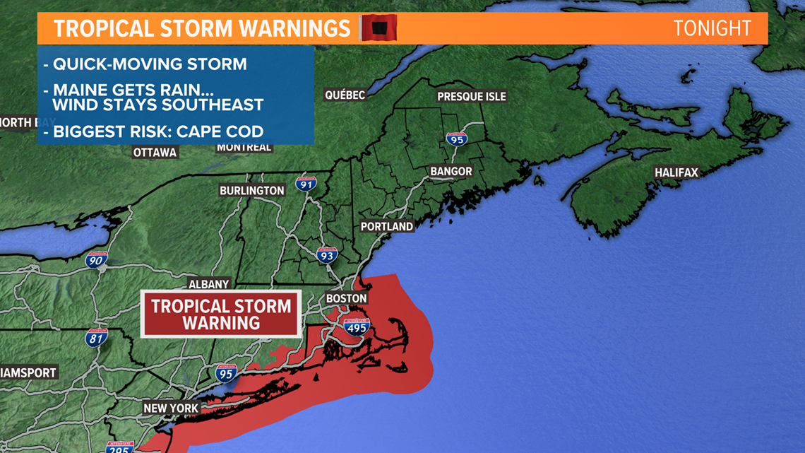
Tropical storm warnings are also in effect for parts of southern New England, but these are not issued for Maine. Since the strongest wind gusts stay south of us, we do not expect these warnings to be expanded to include Maine.

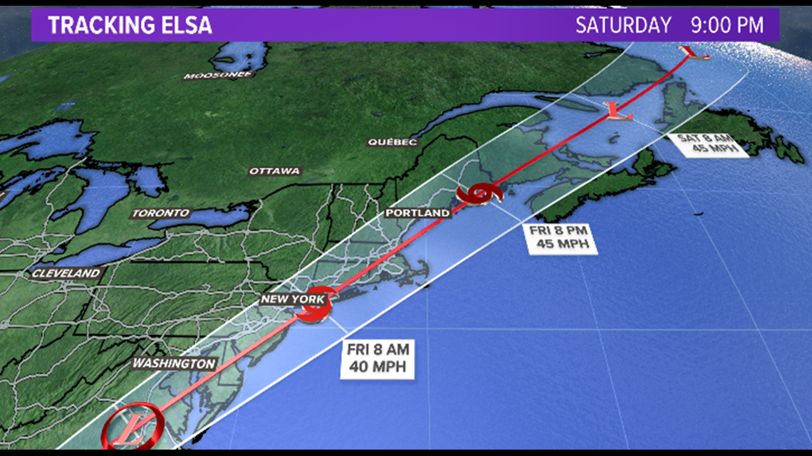
The forecast track comes up the east coast, clips New England, and ultimately puts the storm in the Gulf of Maine. The storm is forecast to move into our area tomorrow afternoon.

Overnight, most areas picked up a little bit of rain. Think of this as an appetizer to the main event today.
During the day on Friday, tropical downpours will keep adding to the saturated ground.
Expect rain all day, with the heaviest across coastal Maine through the afternoon.
Western Maine will see the heaviest rain from noon to 4 p.m., eastern Maine will see the heaviest rain from 4 p.m. to 8 p.m.

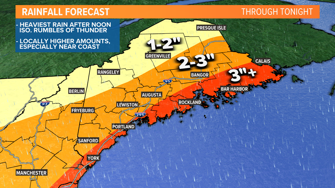
Rain should wrap up pretty quickly as the storm exits since that cuts off the moisture feed. No moisture, no rain!
By the time all is said and done, I expect most people to have picked up 1-3" of rain. The lower totals are expected north, with higher totals south.
A few spots could get to or even exceed 4" of rain if heavy showers train and move through the same location multiple times. This is especially true at the coastline.
The backside of this storm could be a bit gusty for the foothills and mountains, but there is still not a huge risk for outages or wind damage.
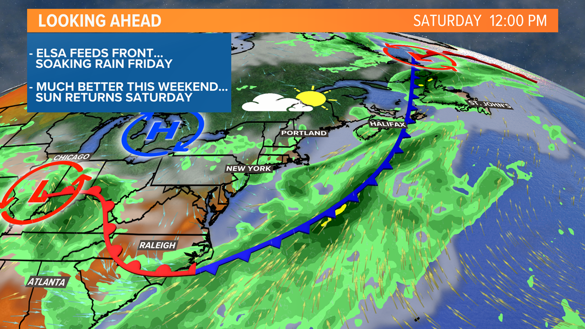
After all is said and done, much nicer weather returns for the weekend. So we've got that going for us, which is nice.

You can download the NEWS CENTER Maine app to get push alerts based on your location should any flash flood warnings be issued.
If you can safely send pictures of the storm, we'd love to see them. The best way to get them to us is through the "Near Me" section of our app.
Follow me on Twitter for updates today and tomorrow, @MikeSliferWX.

