MAINE, USA — There are two ways to measure spring...by meteorological seasons, and by astronomical seasons.
The meteorological definition of spring results in the season starting March 1, 2020. The vernal equinox, or the astronomical measure, results in spring starting March 19, 2020.
No matter how you measure it, we are one and a half to two months away from ending winter and starting the new season.
We're not even two full weeks into January yet and we had a full on taste of spring across Maine.
As the title of this article suggests, it should not be much of a surprise that spring is going to retreat. Quickly, at that.
Saturday Records:
Impressive warmth swept over Maine on Saturday, January 11 and lingered through the evening hours. (I'm putting the date just to give a point of reference as to how quickly we cool down.)
Take a look at the recorded high temperatures in Maine!

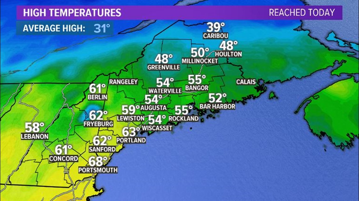
The records in Bangor and Portland were easily broken. In Augusta, the old record of 54° was matched. In Caribou, it was not a record, but still 20 degrees above average!

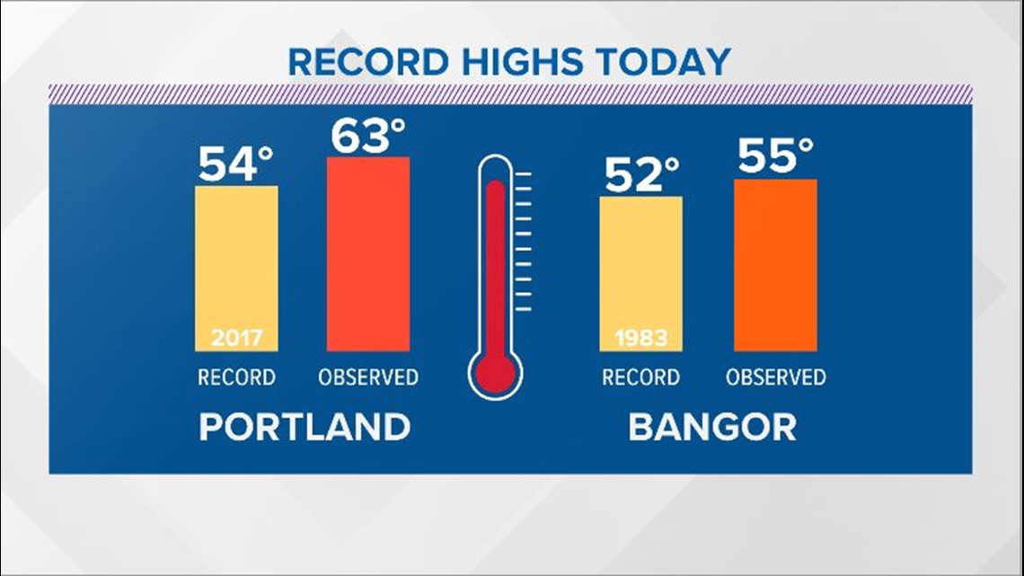
It's almost hard to believe just how quickly we cool down, but that cold air is marching steadily toward us as you read this.
Sunday Ice Potential:
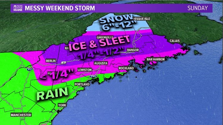
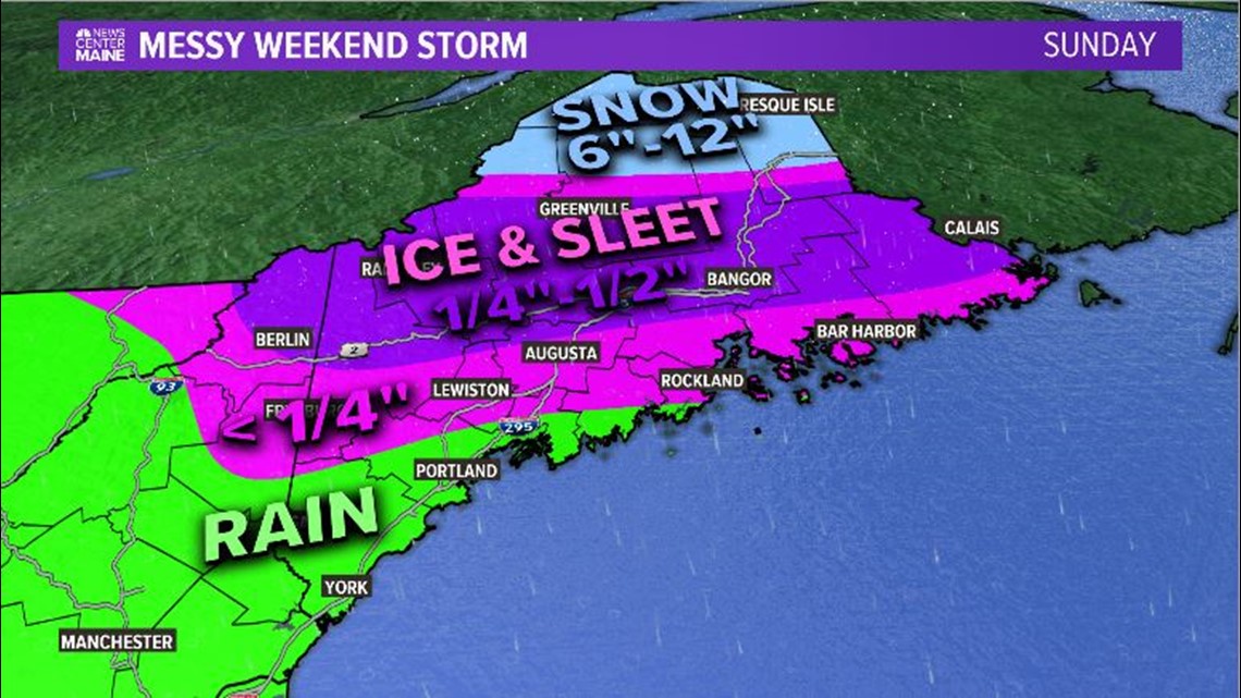
The forecast for Sunday (January 12, 2020...one day after that record warmth) has actually been pretty consistent for almost a week. Cold air undercuts the warm air, resulting in widespread freezing rain and sleet for most of Maine.

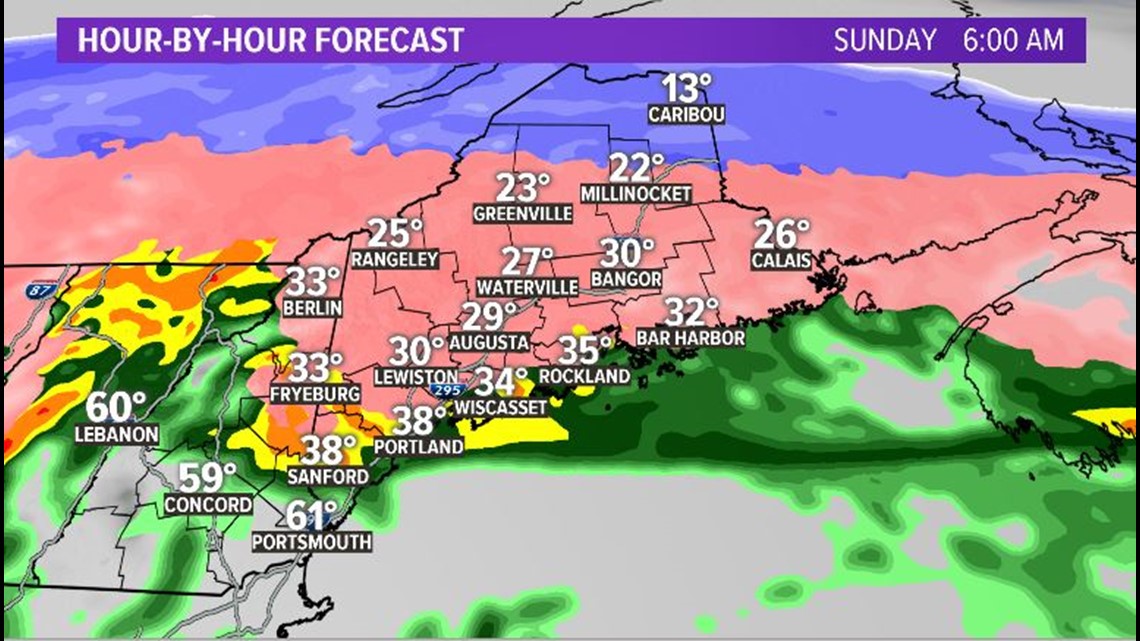
The transition from warm to cold occurs overnight Saturday into Sunday. Northern Maine gets cold enough for snow, while the southwestern coastline stays warm enough for rain.
Lewiston, Augusta, and Bangor are all in the region where the most icing is possible.

RELATED: NEWS CENTER Maine Closings Page
The map above outlines the biggest areas of concern. Notice that northern Maine and much of The County sees just snow; most of southwestern Maine sees just rain.
A big question we get is, "what does this mean" when it comes to ice totals. The graphic below puts that all into perspective.

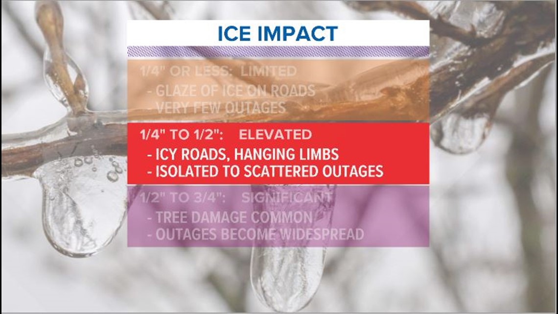
Power outages in central Maine are a good bet. I want to reiterate: this is NOT expected to be a catastrophic event like 1998 was. This will, however, still be impactful for Mainers.
Make sure you've got a way to stay updated in case you lose power. Phones are great, and guess what...we've got an app! Check it out.
Travel also is not going to be great for a good portion of the state.
The Maine Department of Transportation has been working hard to stay ahead of the storm. Part of a complex system like this, though, is to keep on top of the changing conditions.
Paul Merrill, the DOT Public Information Officer, spoke to NEWS CENTER Maine about their plans to deal with the ice.
"We're going to have to react to whatever mother nature throws our way. It's what we do, we're used to it we're going to be keeping an extra close eye on it, the way conditions are the way they are changing and then we are going to react appropriately," Merrill says.
That's about the best thing to do with this storm. Expect icy, slick conditions and some power issues. Have a plan in place if you need to stay warm and make sure you can stay updated.
Ryan will have the latest for you in the morning.

