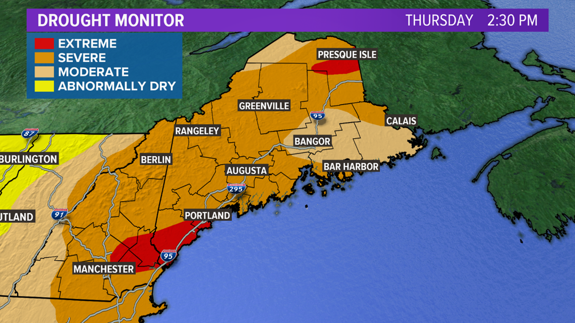
MAINE, USA — I feel like a broken record at this point, but the newest drought monitor shows yet another increase in severity of the ongoing drought.
Over 75% of Maine is in a severe drought now, with roughly 6% of the state in an extreme drought. This is about a 20% increase in severe drought area and a 3% increase in the extreme drought area compared to last week.
For New Hampshire, over 88% of the state is under a severe drought, an increase of 16% versus last week. Roughly 8% of the state has been added to the extreme drought category. There was no extreme drought declared in New Hampshire last week

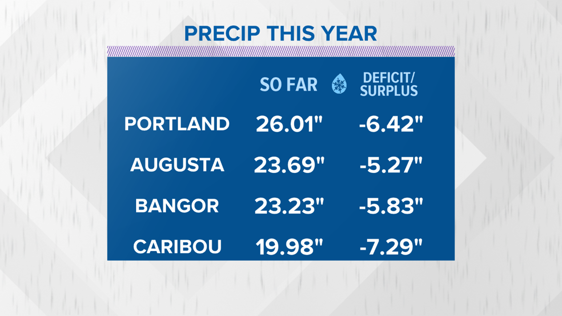
Precipitation deficits continue to stack up. Caribou, Bangor, Augusta, and Portland are all reporting deficits of at least 5" since the start of 2020. Caribou, which is in one of Maine's extreme drought regions, has a deficit of over 7" since the start of 2020.

The drought's effects so far
The effects of the drought have been felt by many. Wells have been running dry for a while in parts of Maine. Farmers have been fighting the effects of the drought for the last few months.
While people are still getting their pumpkin and apple fix, the drought has had an impact on those crops too. Next up on the list for many people is Christmas trees, which have also been struggling due to the dry weather.
In fact, the dry weather has prompted intervention from the U.S. Department of Agriculture (USDA).
The USDA recently declared Aroostook County a drought disaster area, making farmers in Aroostook and its four contiguous counties, Penobscot, Piscataquis, Somerset, and Washington, eligible for emergency assistance from the Farm Service Agency (FSA).
On top of the agricultural issues, fire danger will increase moving forward. Leaves are starting to fall and dry out. With increased dry leaves and brush, and a general trend of less humid days, outdoor fires will have to be watched carefully. Obey burning laws and any fire weather information from the National Weather Service.
What's the forecast look like?
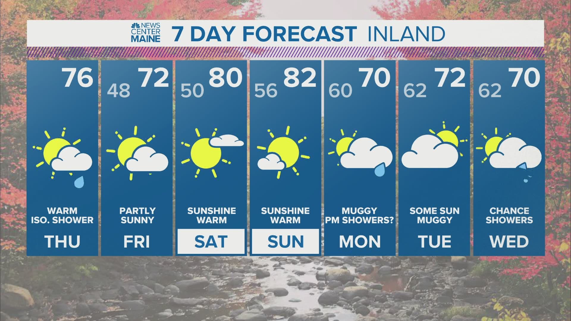
This is where I have a bit of good news. I'm not sure a long duration soaking rain is in our future, but the pattern definitely turns to favor some showers.

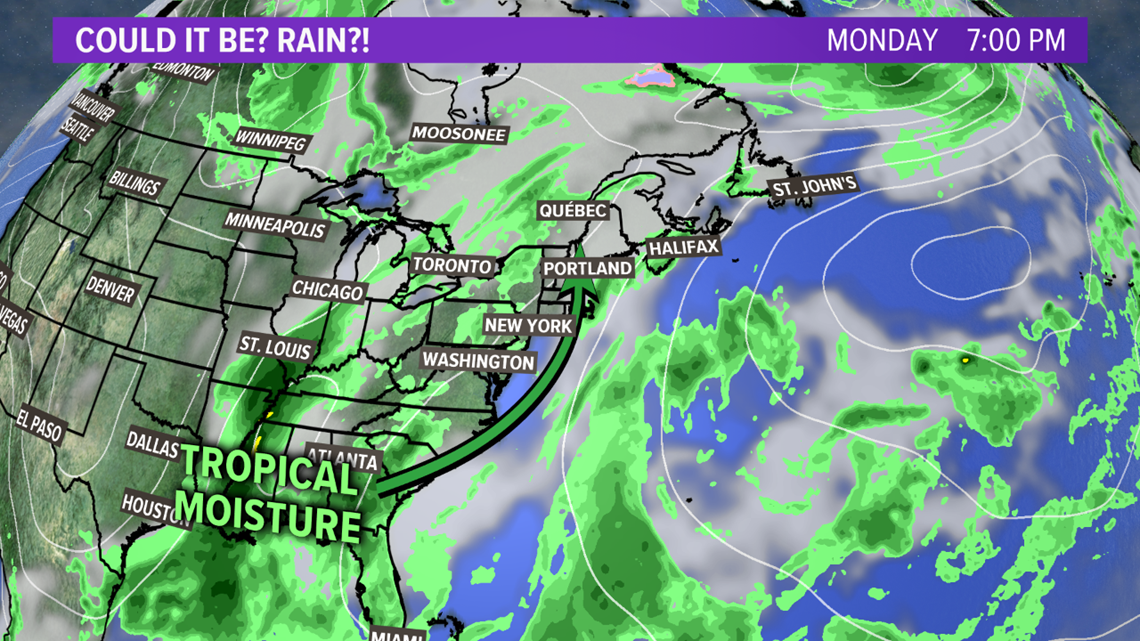
Tropical moisture starts its trek up the east coast on Monday. This is ahead of a good bit of energy, which is what we need to get the showers to form.

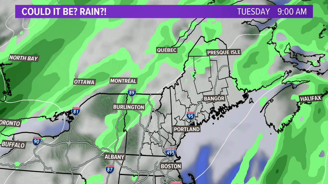
By Tuesday, clouds will move in. A handful of showers are expected on Tuesday.

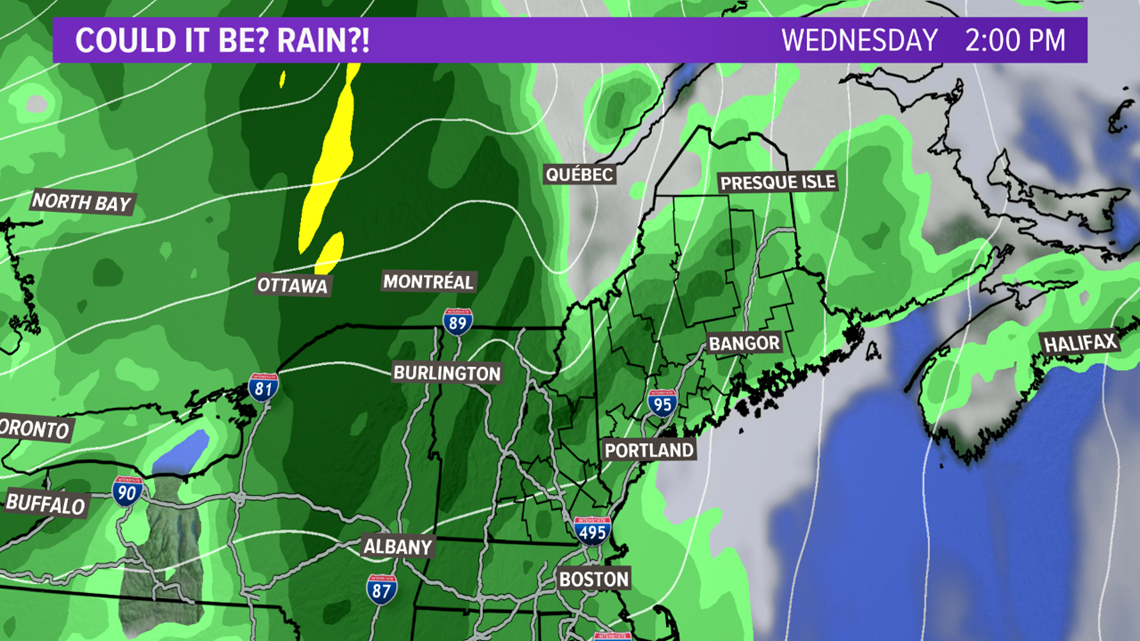
This is where the forecast gets a bit more muddied. The models show different solutions. Some models try to show more rain Tuesday night into Wednesday, while others show more rain on Wednesday.
The worst case scenario is the heaviest rain stays west of us. The best case scenario is we can soak up a good bit of rain early next week.
Right now, I think showers are likely. They will not be the answer to our drought, but any rain will be helpful.

