
PORTLAND, Maine — We're at the halfway point of Tuesday's showers and storms that are continuing to move across the state.
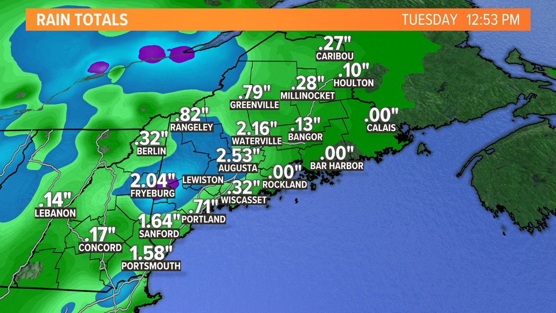
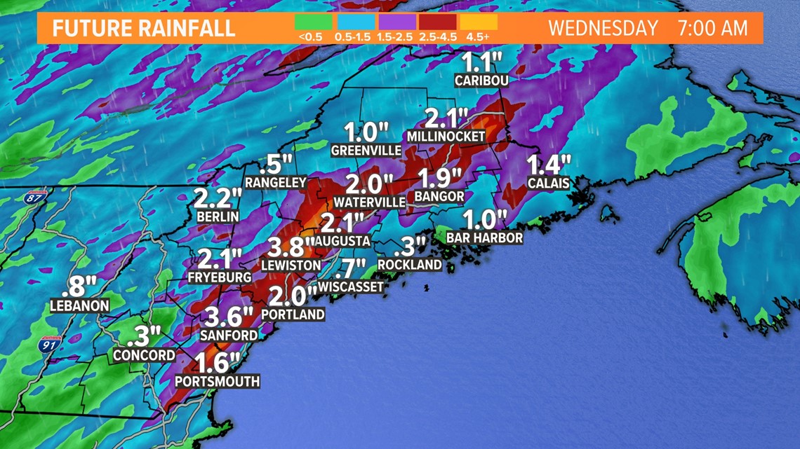
Maine has already seen a lot of rainfall Tuesday. Many areas have seen radar-indicated amounts of at least 2" fall by lunchtime with more on the way.

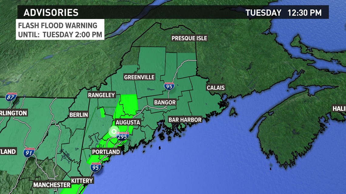
This has caused flooding issues around the state which is why the National Weather Service issued a Flash Flood Warning and a Flood Watch. Almost all of Maine is under a flood watch with some areas in the bright green under a Flash Flood Warning. This includes cities like Portland, Auburn, Lewiston, and Augusta.

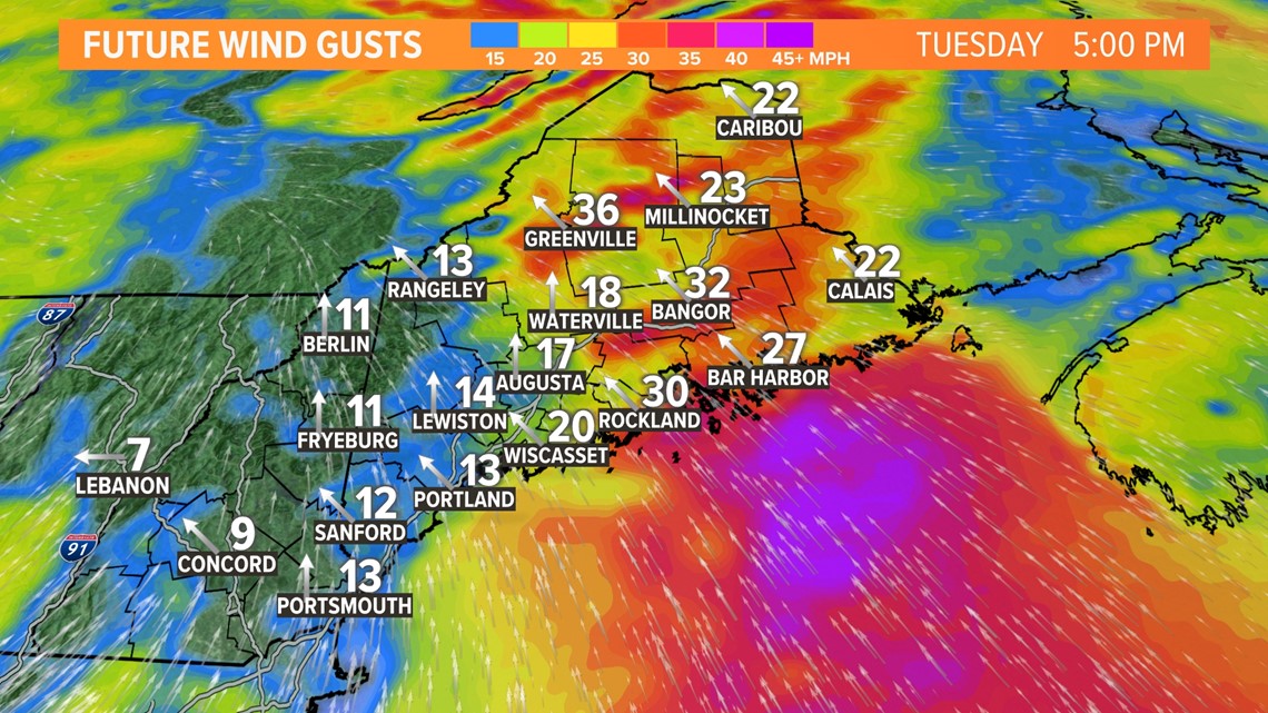
The other main concern for the day is the wind speed. Gusty winds are present throughout the day, up to 35 mph with even higher wind speeds in any storms. This could cause some localized power outages as we continue through the day.

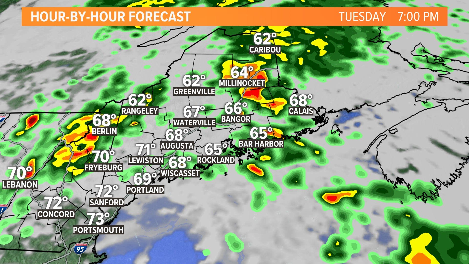
The low moves through the state through the rest of the day, giving eastern Maine heavier rain as we head into Tuesday evening. Here's a timeline of how it will move through:
By the time this system has moved out to sea and is done soaking our state, many will have received around 2-4" of rain with higher amounts locally.

Do not drive through any standing water on the road. We will also see the rivers and creeks begin to rise as we head through Tuesday evening, but most are not set to reach the flood stage.