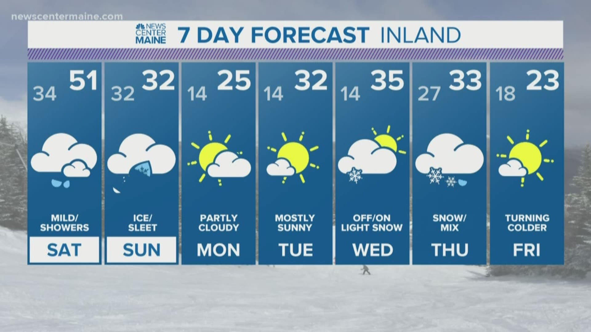
MAINE, USA — Unless you live under a rock, you know by now significant ice will threaten Maine this weekend. We picked up on the signal almost a week ago and have been talking about it ever since. We're pretty much locked in now for dangerous ice to fall over parts of Maine late Saturday night into Sunday.
In a way, it's hard to believe we will see any kind of Wintry precipitation after the big warm up we get on Saturday. This time of year, it's really tough to climb over 50 with snow on the ground and the cold ocean. But, an anomalously warm airmass will surge into the State over the next 24 hours shooting temps up to around 50. The record in Portland is 54 and in Bangor it's 52. If we get an ounce of sun, records will fall.

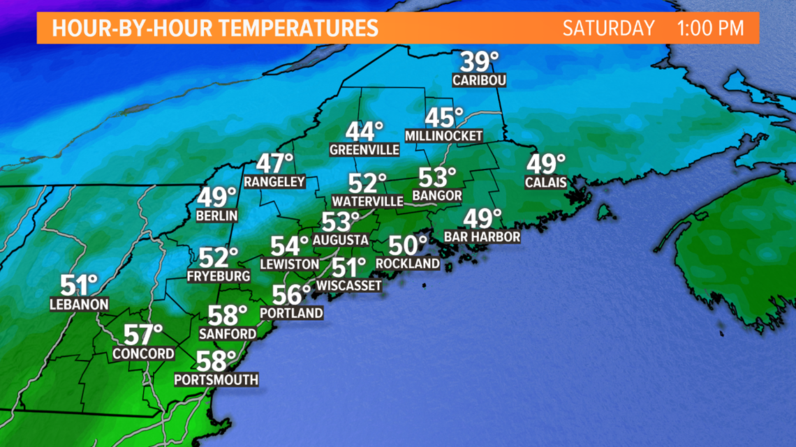
Speaking of falling, that's exactly what the temps will do Saturday night. A strong Arctic high in Canada will drive subfreezing air south through Maine and by Sunday morning, most towns away from the coast will be near or below 32 degrees. Cold air is heavier than warm air so this process will create a cold wedge at the surface, a recipe for ice.

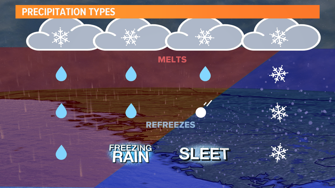
The depth of it is critical, a thin layer means rain freezes when it comes in contact with any surface like limbs, power lines and roadways. A thicker layer means rain freezes into a more manageable sleet pellet.

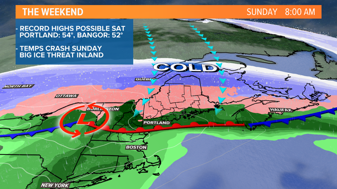
While rain showers begin Saturday evening the real action arrives Sunday morning. The time of greatest concern is 6AM to Noon. This is when the heaviest precipitation will fall as temps slide below freezing. After noon, the storm will be moving out and precip will taper off.

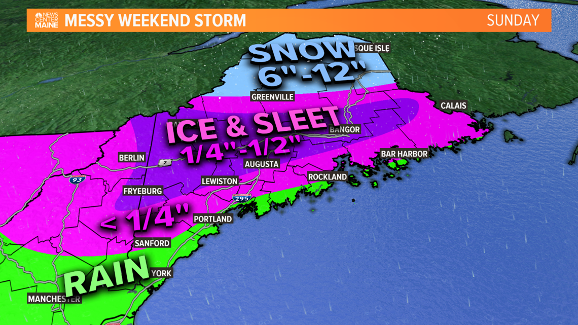
I'm most concerned for Bangor and interior Downeast, over to Augusta and Lewiston then into the Oxford Hills north to just above Route 2. A half inch of ice is possible and scattered power outages are likely. Elsewhere, thinner glazes will present travel problems. I want to stress that this will not be anything like the Ice Storm of 1998. For one, this is a very fast mover. The Ice Storm of '98 lasted days. Secondly, the airmass preceding the storm will be incredibly warm. While I've seen ice occur following warm ups like this, getting epic ice events are more rare.

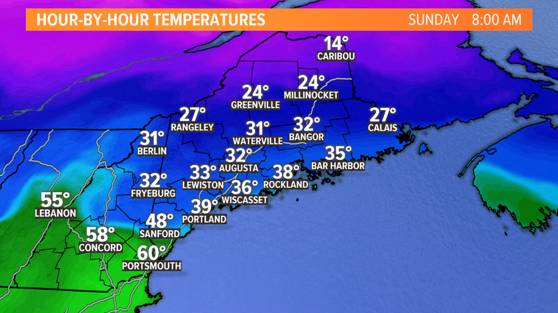
I'm not ready to sound the all clear for the southwestern coastline, including the Greater Portland area yet. The temp spread Sunday morning is going to be insane, teens in Northern Maine to near 60 along the New Hampshire Seacoast. This tells me that margin of error is razor thin. I can easily see a scenario where the coast dips to or below 32 generating light glazes.
Stay with the NEWS CENTER Maine weather team for updates through the weekend. You can follow me on Twitter and Instagram too.
-Todd

