
Before we get into the details of what looks like a very wintry pattern, let me just slow the hype train down a bit.
Yes, there looks to be a significant Nor'easter on Sunday night/Monday.
Yes, I posted about it early like many meteorologists.
No, it's not a guaranteed 40 inches of snow.
Like many weather events these days (kids these days! #GetOffMyLawn), the buildup takes on a life of it's own and before you know it Monday becomes Mayan Calendar status. (AKA the end of the world).
With that being said, let's move on.
Saturday:
Before we even get to Monday's storm with it's 157" of snow and unicorn plow truck drivers, we have a clipper to deal with for Saturday.
This is the current state of that clipper.
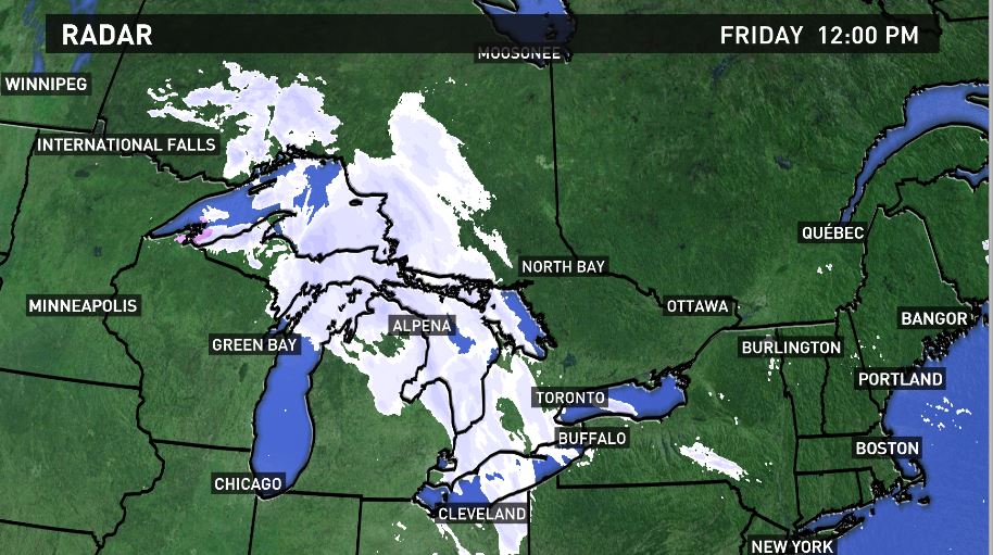
If you pay attention in class you might notice it's a relative robust looking signature for a Clipper as it moves through the Alpena, MI area. (By the way, if you ever get a chance, Alpena is lovely during the summer. They have hundreds of shipwrecks in Lake Huron that you can tour in a glass bottomed boat).
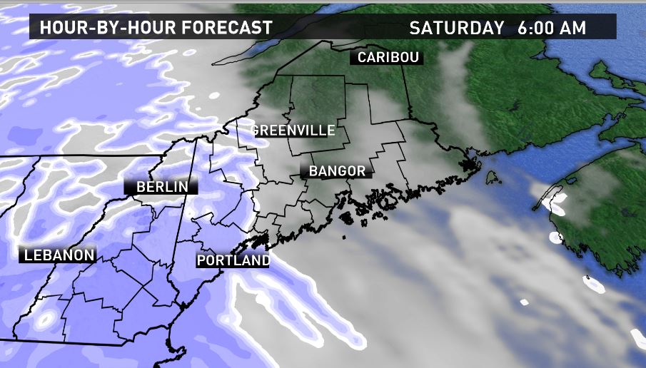
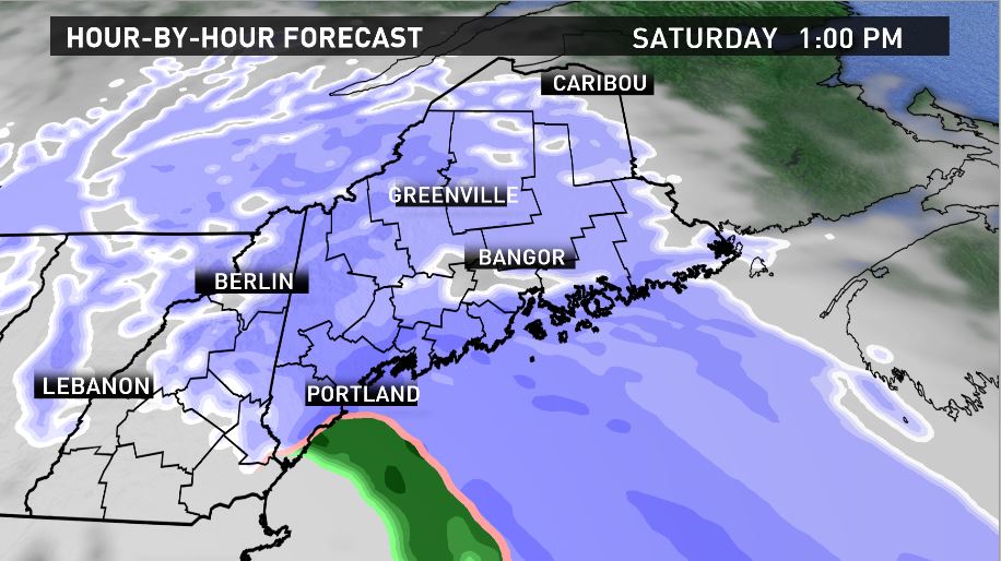
The system will maintain it's "above average" characteristics as it moves into Maine, the result will be some healthy shots of snow starting late tonight:
6 AM
1 PM
8 PM
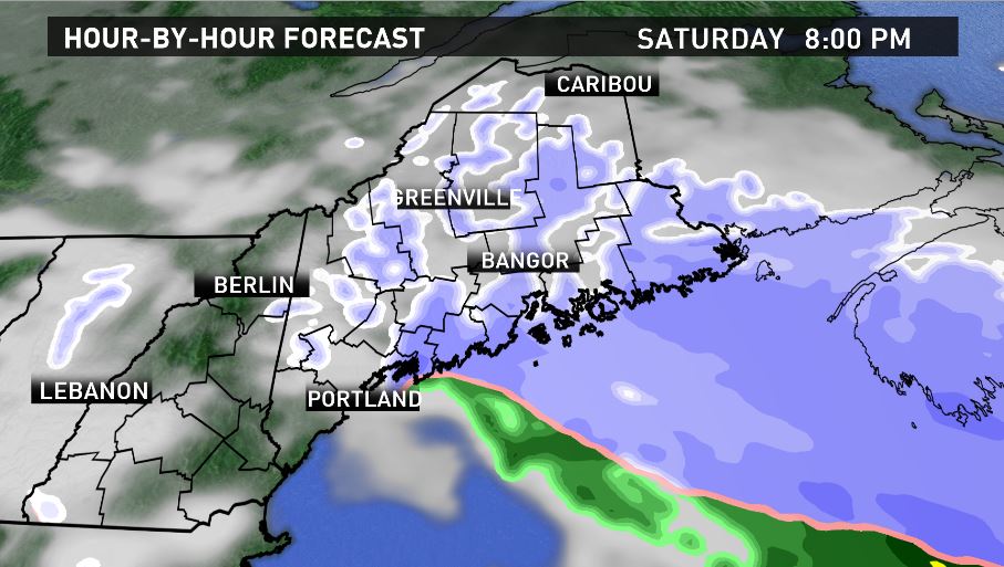
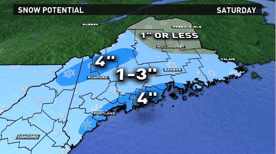
Net, net it won't be a huge deal, but it will be plowable in most spots.
The Main Event:
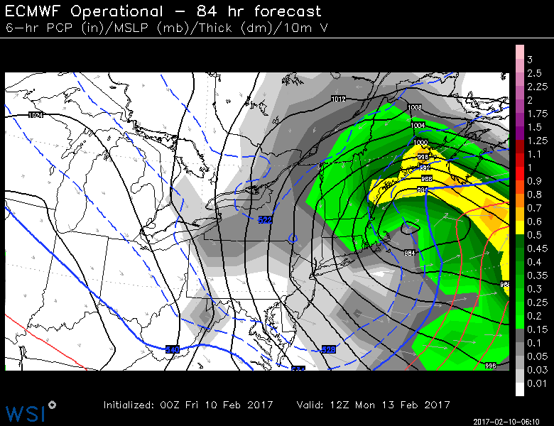
A large and rapidly intensifying low pressure system will approach Maine on Sunday afternoon...and based on pure computer model plots, this thing looks McNasty.
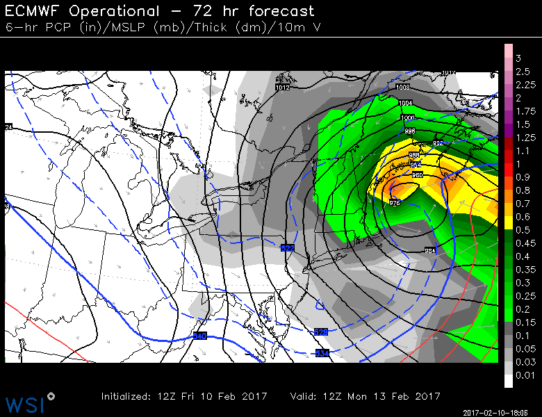
First thing I notice is how deep and wrapped up the low is. The second thing that strikes me is how it LOOKS like it should be too far away from us to be a big deal, but the precipitation extends very far northwest. This is a hallmark of some of our best storms. I still remember looking at a satellite image of Nemo (the all time record holder in Portland) and thinking "How the heck is it snowing HERE from THAT position in the Gulf?!"
So, yes, this thing has plenty of moisture and at the moment a very nice track for a big hit on Maine.
BUT I would be remiss not to express some uncertainty here. Because the storm is perfectly placed, a wobble to the East would take much of the moisture with it. I'm FAR from a "hedger" when it comes to forecasting (something that has earned me praise AND ire over the years), but when a system is this dynamic and still 3 days away...there's a chance things measurably change in the atmosphere.
Going forward, however, with how I feel about the storm now. Here are the details:
Timing: Snow begins Sunday afternoon across southern Maine. Relatively light at first but it's important to think of this as a Sunday storm too, not just Monday. The snow shield will wait until evening over Downeast and northern Maine. It snows all day Monday and then ends by Monday evening for the vast majority of the state.
Wind: This storm will likely be much windier than yesterday's Nor'easter, that could bring more power outages into play. Off the cuff I'd say 50 MPH plus gusts are definitely in play with the potential for more in vulnerable areas.
Amounts: This is what you all showed up for right? This is the NASCAR crash to my previous 100 safe laps...
The number one reason I even took a shot at snowfall at this point in the game is because of, as I mentioned prior, the overwhelming hype that I felt was getting out of control. I figured better to put some numbers to it and go from there:
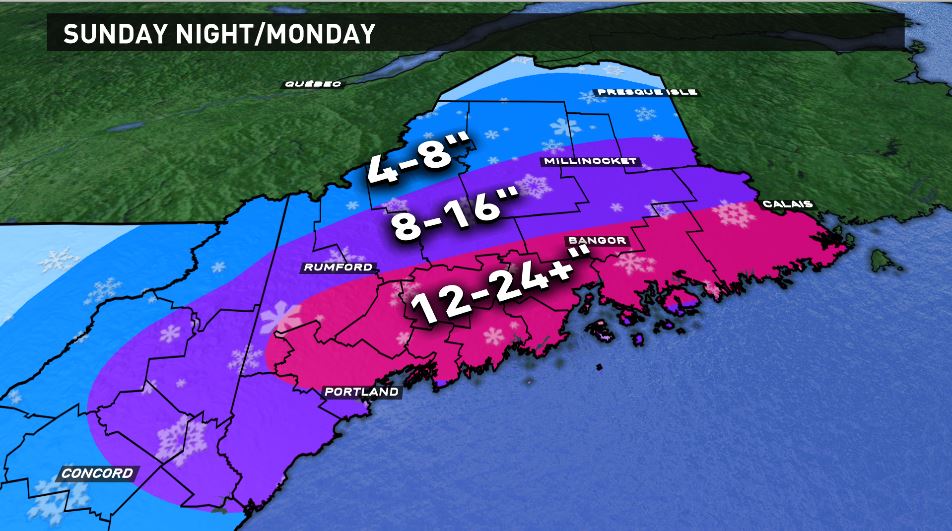
There will be adjustments to this map over time I'd assume, so stay with us.
PS. There might be another storm Thursday. :-)
Carson Out.
