MAINE, USA — You can cross "white Christmas" off your holiday wish list. A strong storm will move through the Northeast today, dropping sizable snow amounts for some and producing gusty winds and cold temps for all.
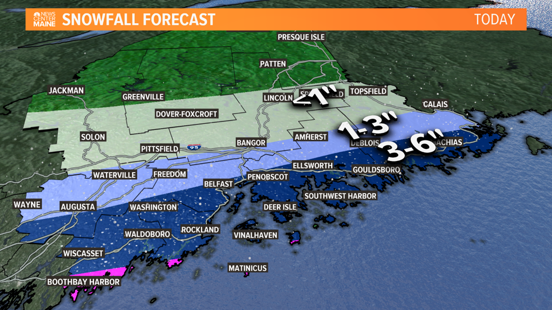
This will not be a statewide snowstorm. While there's plenty of cold and moisture to work with, we'll be on the northern edge of the storm and the snow shield will be battling exceptionally dry air. You won't see many flakes north of Route 2.
LATEST DIGITAL UPDATE

The steady snow overspreads southern Maine this morning. Roads will instantly grease up and get slippery, making for a tough morning commute.

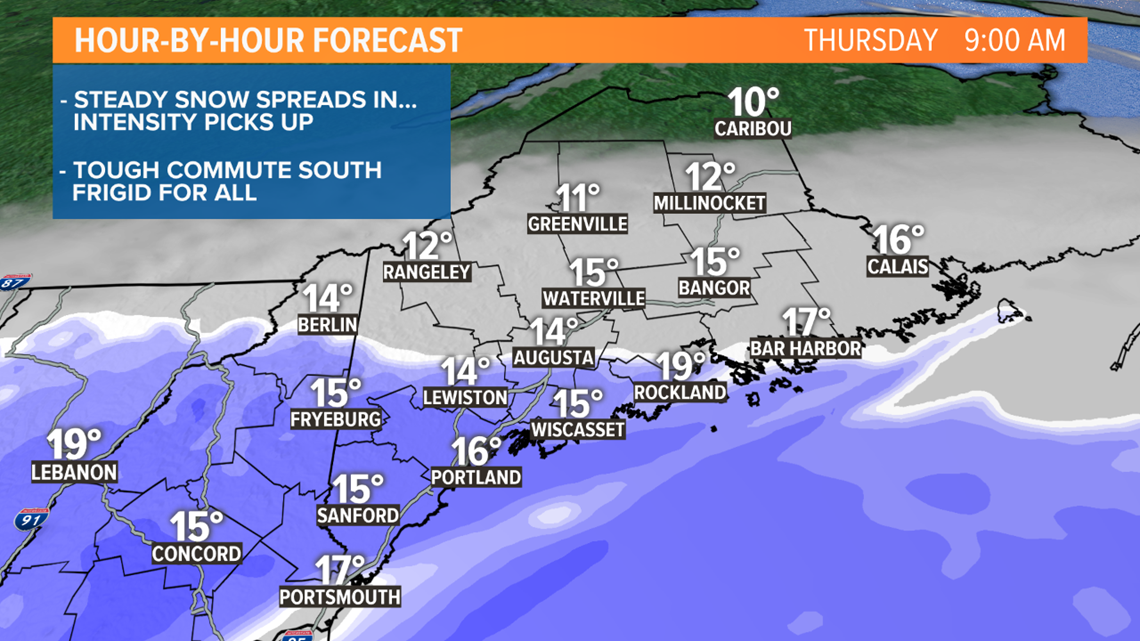
The storm peaks during the morning and early afternoon as it swirls to our east. The snow remains steady and intense at times. There will be some banding (snow rates that top 1" per hour), and possibly thundersnow too. Coastal York County is the most likely location for all this.

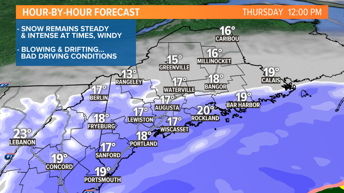
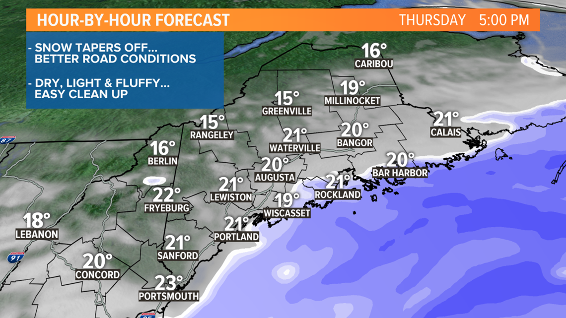
The storm will drift away during the afternoon. Snow will taper off and slide east. The snow will be light and fluffy, so clean up should be quick and easy.

My gut tells me that after the storm passes and we look back at the amounts, there will be some eye-popping numbers for some towns and some paltry ones for others. Here's a look at the southern Maine snow forecast.

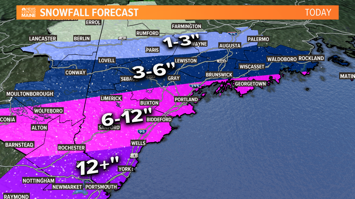
Here's a look at the eastern Maine snow forecast.

