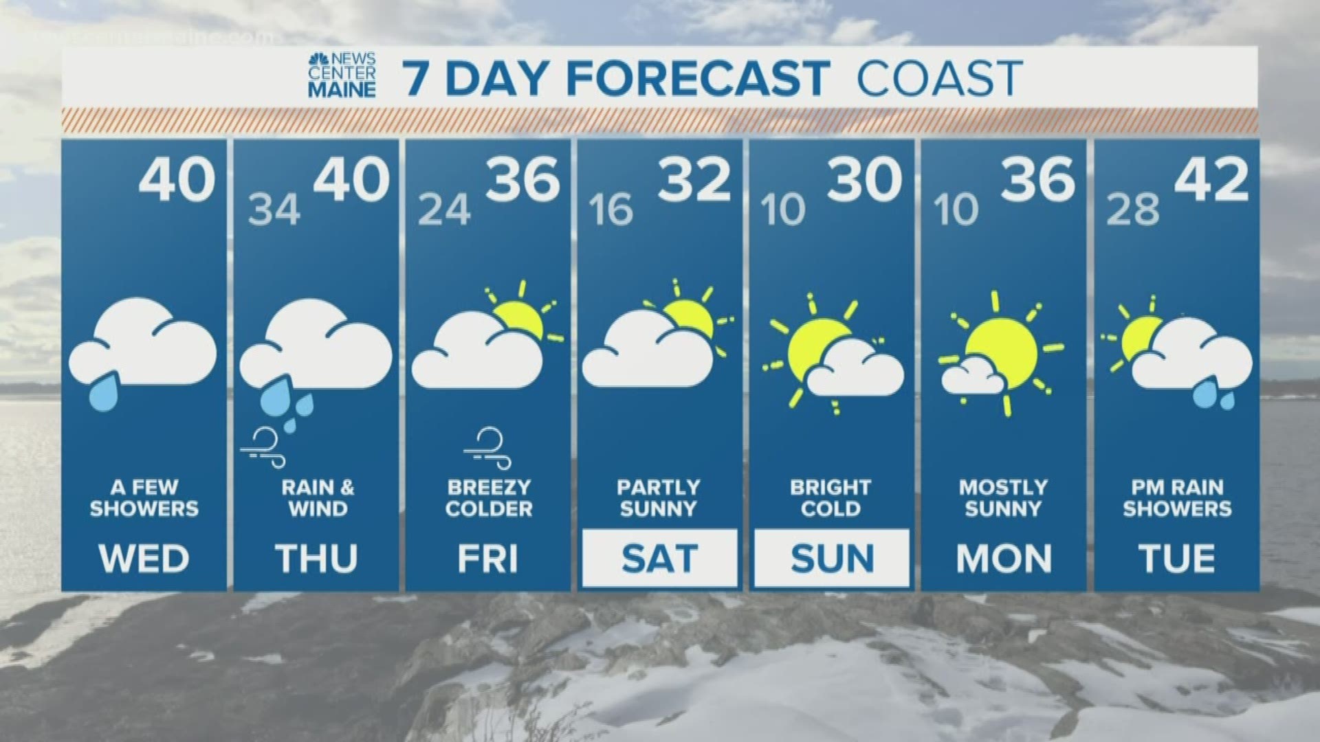
MAINE, USA — Sit back, relax and strap on your seatbelts, tomorrow is going to be one of those wild weather days.
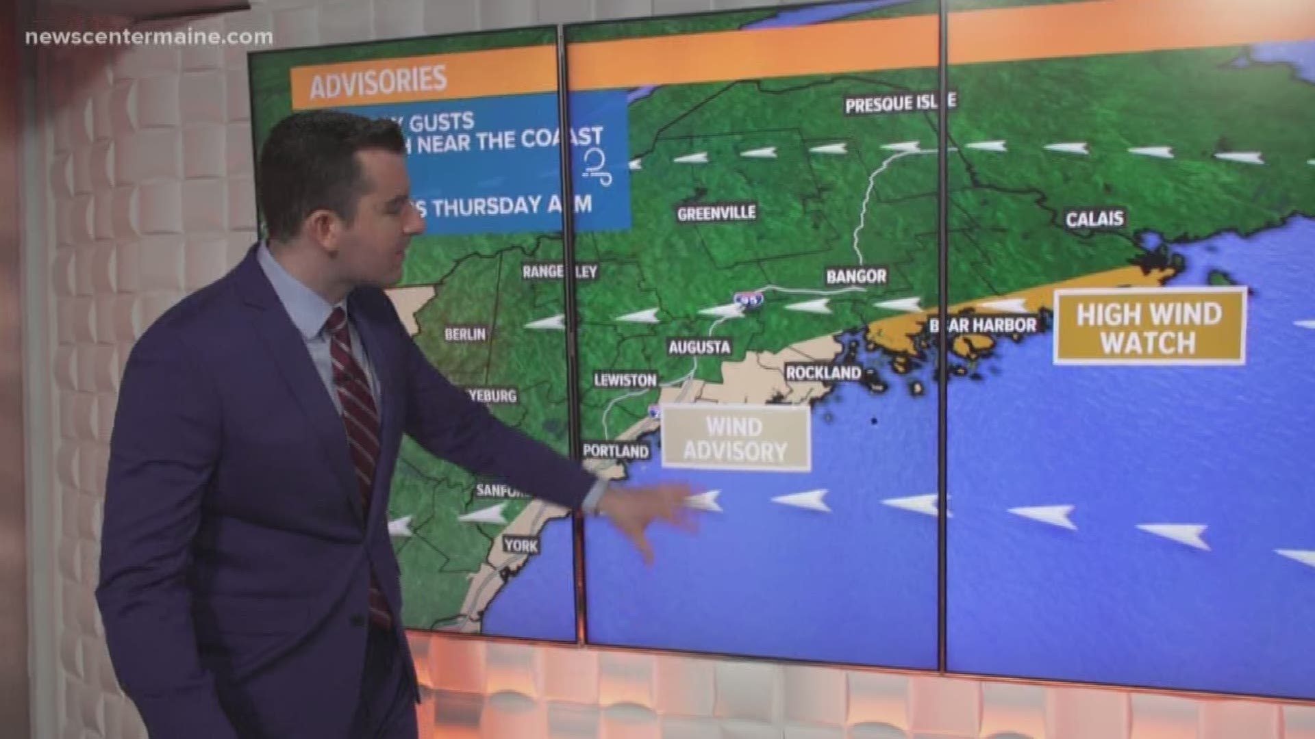
It gets going around dawn tomorrow morning. Low pressure will be traveling through Western New York, redeveloping along the New England coastline. A screaming low-level jet will form with the energy transfer and along the connection, driving heavy precipitation into Maine. In general, heavy rain will dominate the coast and heavy snow will dominate the interior.
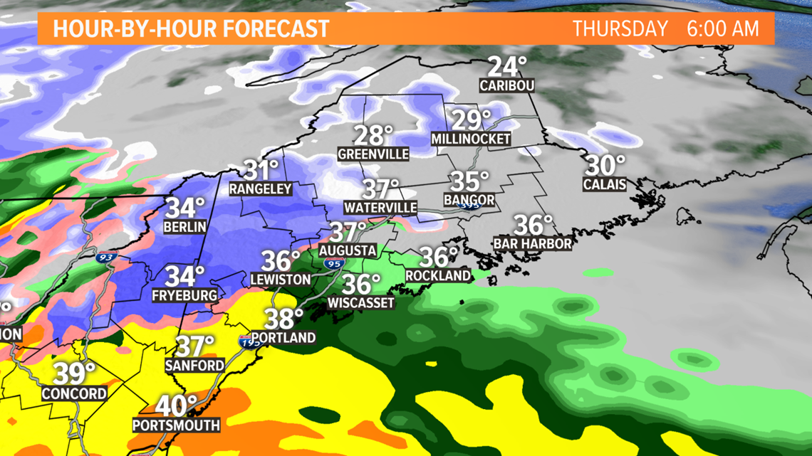
Morning:
Intense rain along the coast, maybe even some thunder. Howling east winds off the ocean. Inland snow rates topping an inch per hour. Big, fat blinding flakes.

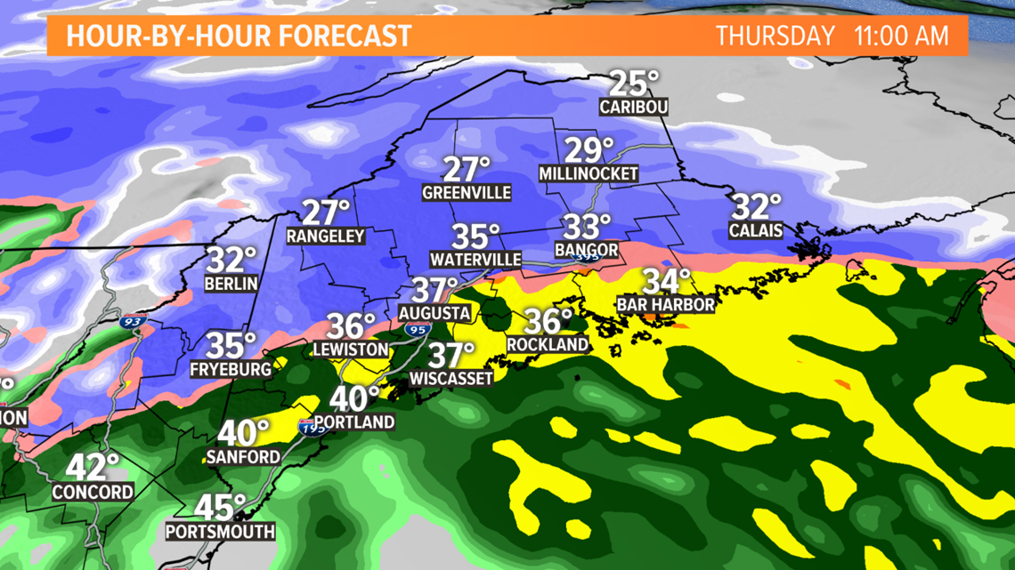
Midday:
The core of strong wind and heavy precip move east and up the coast. The worst is over in Southern Maine. Huge wet flakes fall in the Bangor region. Sideways rain for Ellsworth and Downeast Maine, where winds could reach 60 mph. I'm hoping that daylight will help roads stay more wet than white. While snow piles up on existing snow, decks, etc. Roads will be a mess, though, for the foothills, mountains and through the Central Highlands.

Afternoon/Evening:
Storm's long gone for most. Sun should pop out late in the day too. Winds settle down, but remain active with gusts to 30 mph from the opposite direction....west. Northern Maine still getting hit pretty hard with snow but the tapering isn't far off.

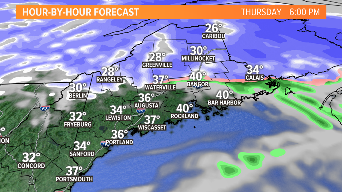
History tells us that when heavy snow starts to push 5 or 6 inches, limbs can crack and power outages can become a problem. The zone to watch will be the north side of Sebago Lake, Oxford Hills, Belgrade Lakes to the north of Bangor through the Central Highlands...perhaps down through Lewiston, Augusta and Bangor too.

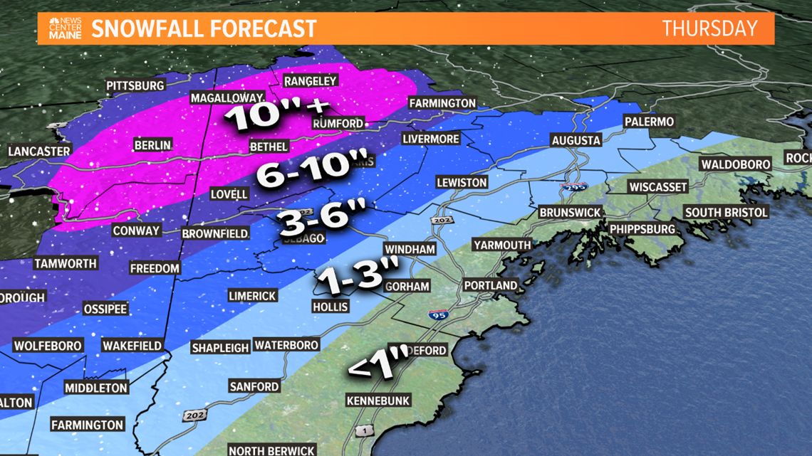

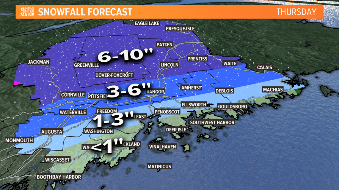
Along the coast the biggest threat is the wind. There will be about a three hour window for gusts over 50 and maybe even 60 mph from the low-level jet to sneak down to the surface in heavy downpours.

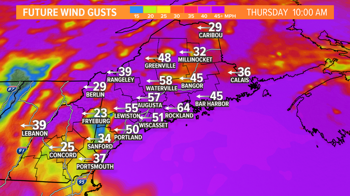
This could easily turn into a big power outage event. Be ready, I expect them and there may be a lot. Keep checking back for updates throughout the day.

