MAINE, USA — Another shot of cold air is on the way, bringing snow, sleet, and rain to Maine.
A low pressure system approaches from the west on Monday. A handful of isolated showers will be possible in the morning Monday, but most stay quiet until the afternoon.
Snow showers start from the west and spread east through the day. The first spot to see snow will be in the mountains. It may start as early as noon on Monday.
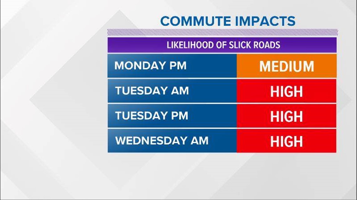
The snow showers will spread through the western half of Maine through Monday afternoon, bringing about some slick conditions for the evening commute.
Some areas of the state will not see accumulation with this first batch of snow, but it looks persistent enough that the western mountains and northern Maine will see commute impacts by Monday evening.

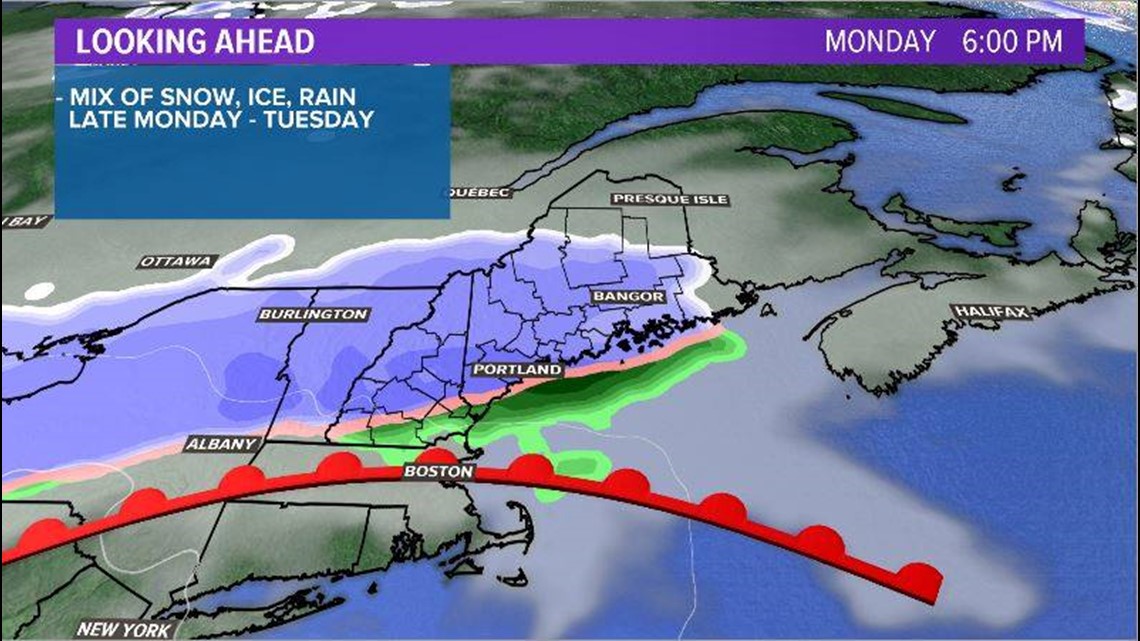
The low pushes into Maine overnight. Snow continues in the mountains and northern Maine, with wintry mix found through interior Maine and rain along the coastline.
As sleet mixes in, slick spots will again be an issue for the morning commute on Tuesday. These will likely be more widespread than the travel issues we see Monday evening.

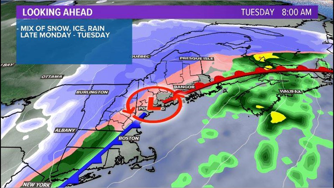
The messy conditions persist through the day. As warm air tries to nose in, there may be more mixing inland and plain rain along the coastline. This will cut into snow totals. Mixing is possible as far north as Millinocket and Houlton.
The low keeps tracking east, eventually moving out during the evening commute. More snow is likely on the backside of the system. It is important to note, though, that this will likely be rather light snow.

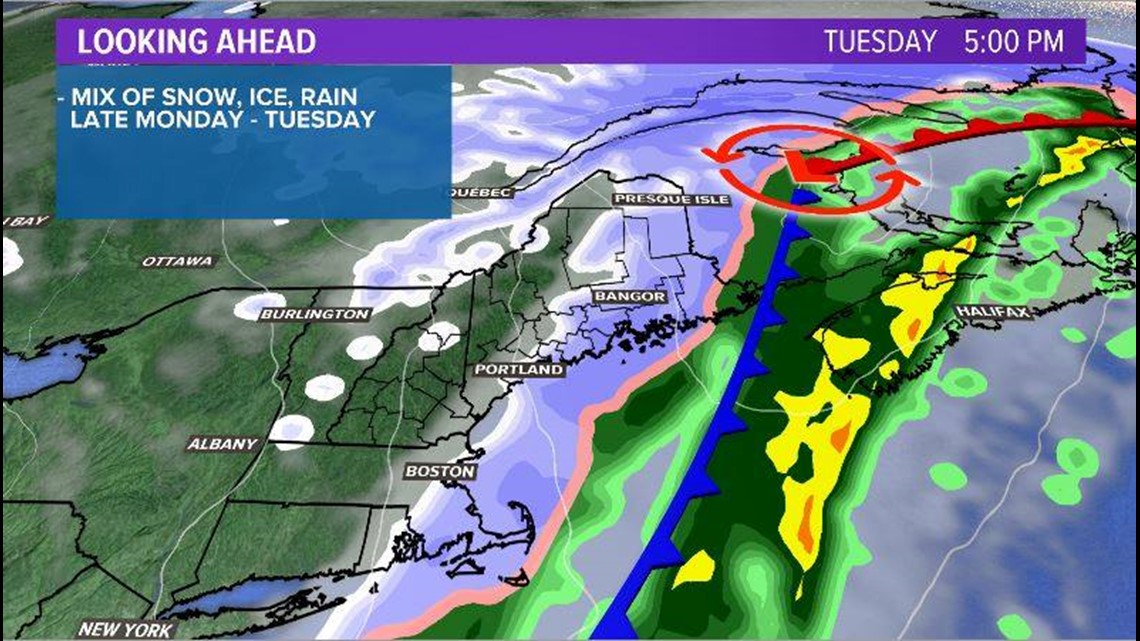
Still, slick conditions will be possible yet again. This is where the coastline has a chance to pick up some minor accumulation.
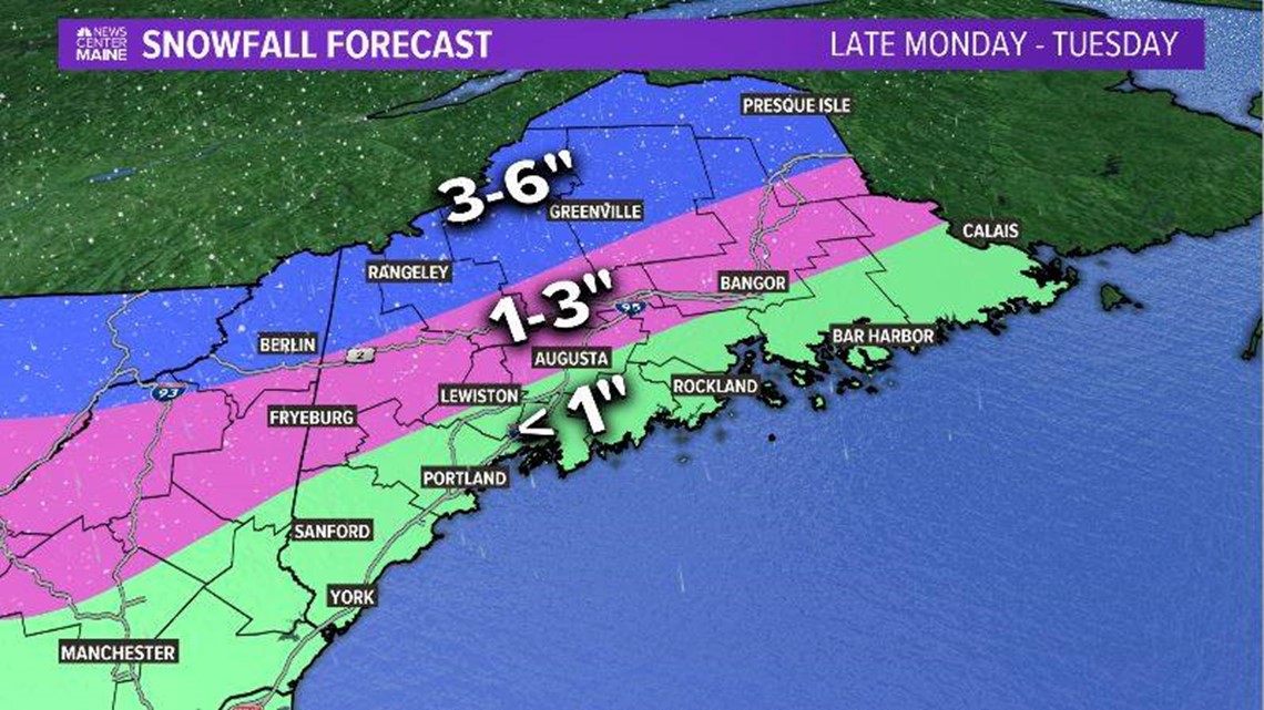
Overall, the highest snow totals will likely be in the western mountains and northern Maine. Mixing will cut into totals through interior Maine, while rain at the coastline keeps snow totals below an inch.

This creates another problem related to the morning commute on Wednesday.
Cold air moves in quickly Tuesday night into Wednesday. Temperatures will drop into the teens and 20s widespread. Anything that is wet will freeze over for the Wednesday morning commute.

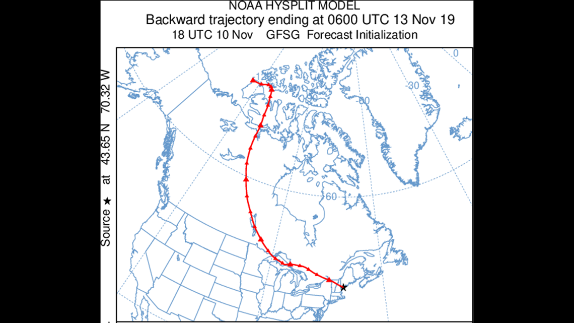
Since the cold air moves in so quickly, there will not be time to dry out. This will be the coldest air so far this season. The NOAA HYSPLIT model, which lets us see where air comes from, shows that our air on Wednesday morning will be coming right down from the Arctic.

Blustery conditions persist on Wednesday. Wind chill values will be in the single digits and high temperatures struggle to top 30 degrees. Temperatures fall into the teens and single digits across Maine early Thursday morning.
A little bit of relief is in the forecast as temperatures return to the 40s on Friday, which is still below average for this time of year.


