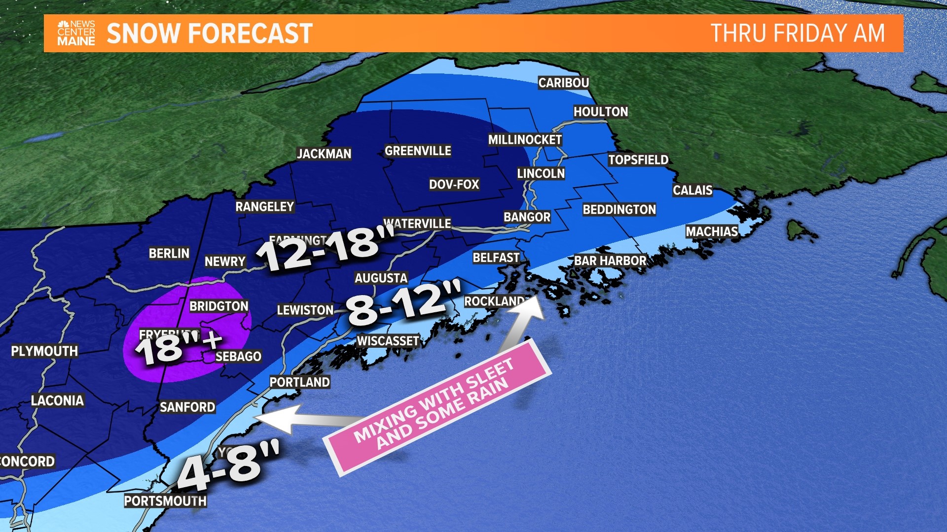
MAINE, USA — Crocuses are blooming, tulips are poking up, and the birds are back from their winter vacation. Spring is here! But it wouldn't be complete without a snow threat, and this one is real and big. Low pressure is developing over the Mid-Atlantic and blowing up into a legit, slow-moving Nor'easter that will impact Maine for a few days.

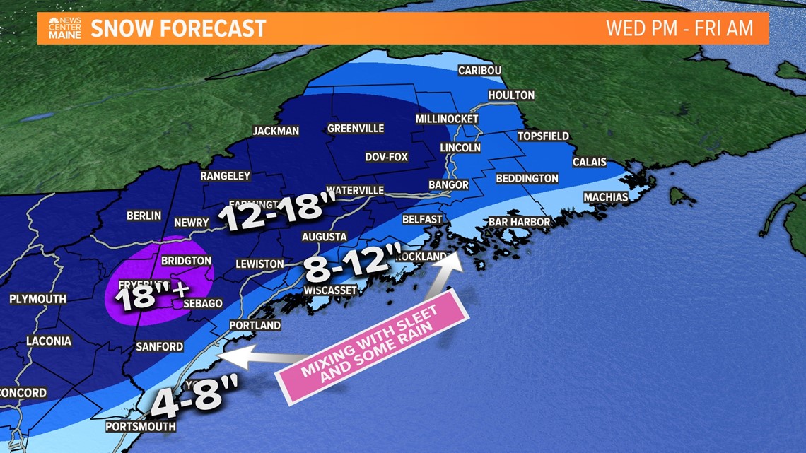
Timing
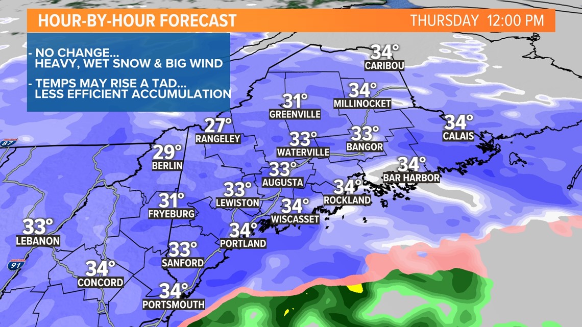
The boundary layer is cooling and conditions have deteriorated quickly. Snowfall rates could exceed 1 to 2 inches per hour at times throughout the morning.
Now that the sun is back up, the accumulation rate is struggling, especially near the coast. Inland, it's slightly colder so the snow is still piling up.

As we head into the evening and night, the low will begin to weaken and loosen it's grip. Heavy snow bands will breakdown and winds will diminish. The worst will be over.

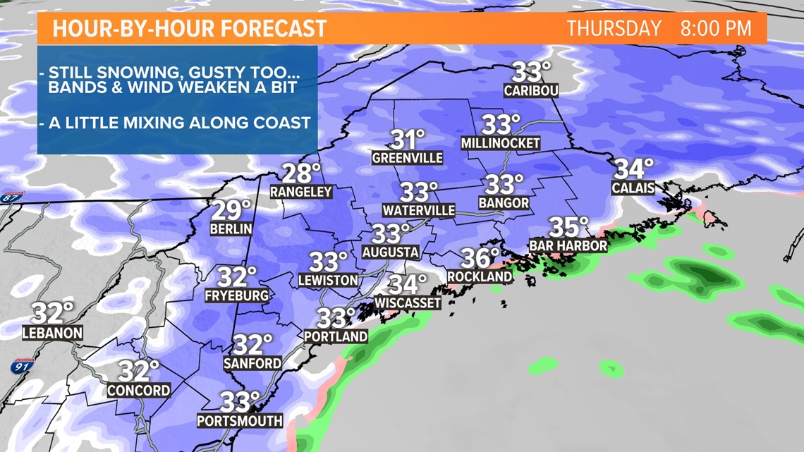
The storm is expected to linger into Friday, but the storm weakens and precipitation rates drop and become more scattered. We won't see much additional accumulation here with temps in the mid- to upper 30s.
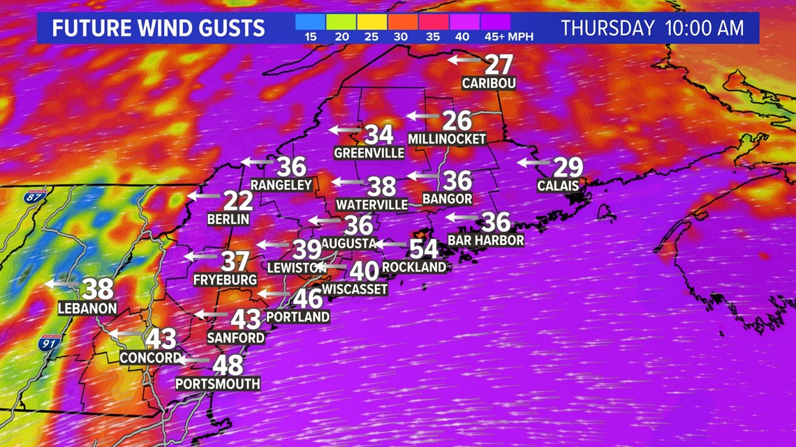
Winds
Because the snow will be of the especially sticky, heavy variety, I have concerns about power outages. This one has all the signs and the risk for widespread outages is extremely high again.

Stay with us for any updates throughout the storm.
Todd - Here's my Instagram...most of the time it's PC.
For the latest breaking news, weather, and traffic alerts, download the NEWS CENTER Maine mobile app.

