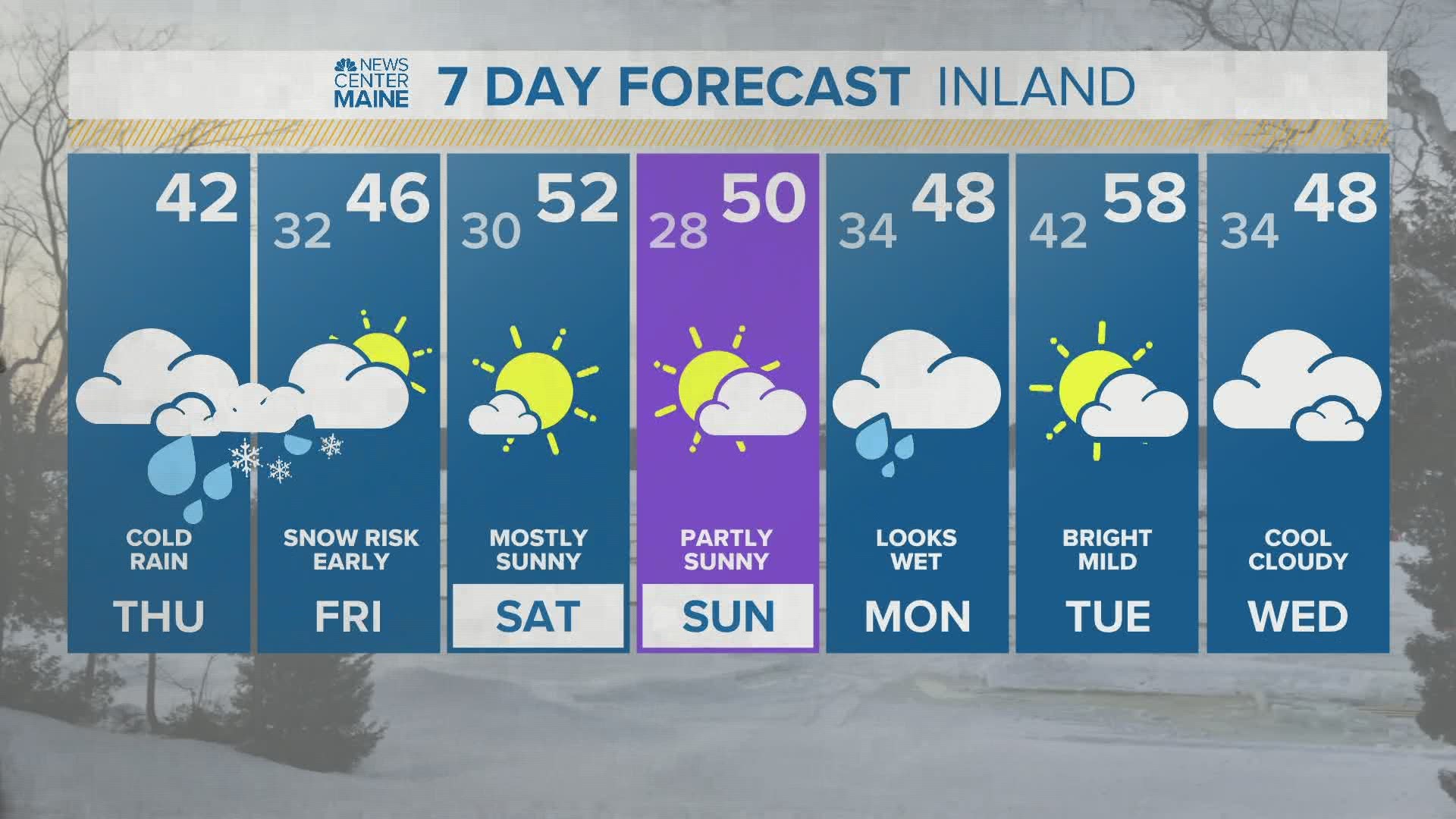
MAINE, USA — April can be both wonderful and cruel and later this week it will be the later. Low pressure, entering the Northeast Thursday, will get a shot of energy Thursday night and rapidly deepen over the Maine coastline. What will start off as harmless rain will transition into a white-out for some this evening. Intense snow, perhaps even thundersnow, will thump away for several hours tonight.

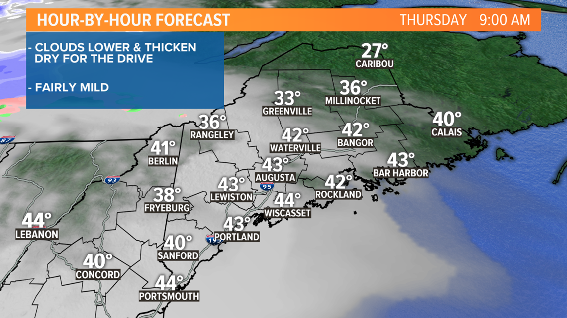
The dynamics aloft cool the entire atmospheric column, supporting several hours of heavy wet snow. At the same time the boundary layer will be battling mild air and inefficient snow accumulation at the surface.

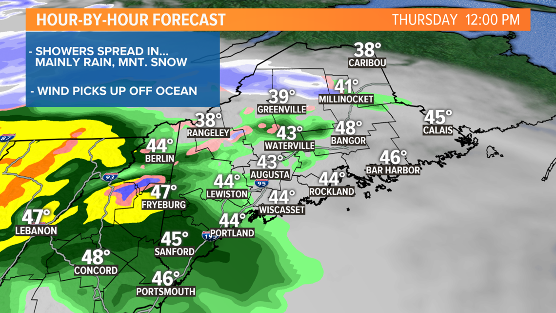
This will be elevation dependent, snow rates and ratios in the lower elevations need to be chopped down even though it could rival some of the heaviest snow of the Winter season.

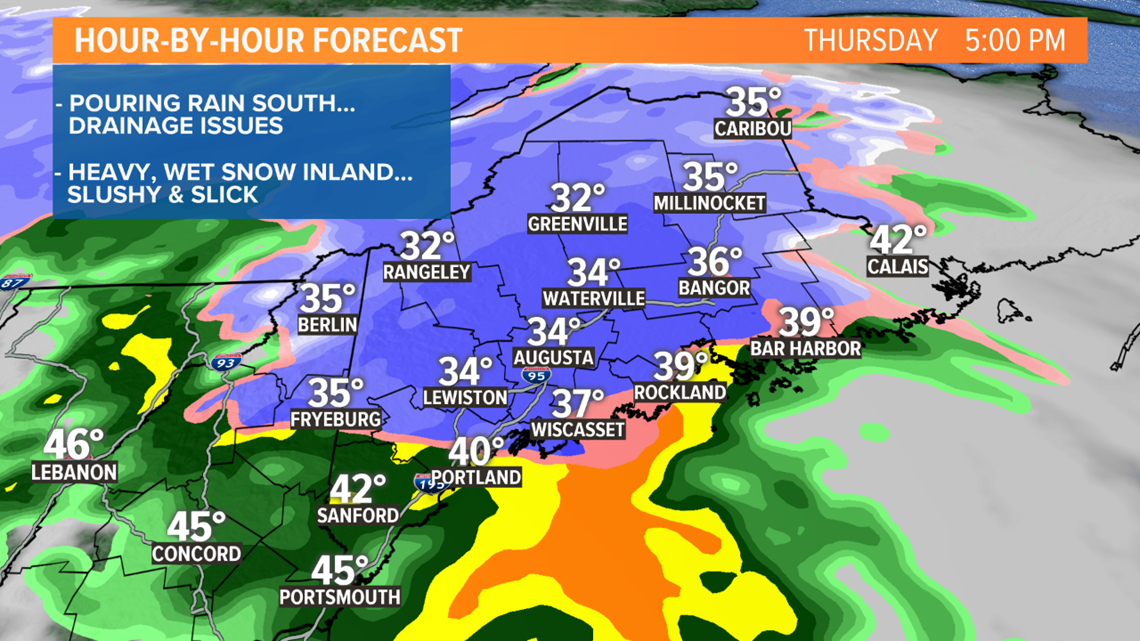
The center of the low will track right over Portland then up the coast and through Washington County before crossing the border into New Brunswick.

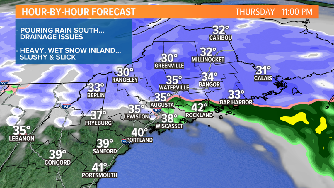
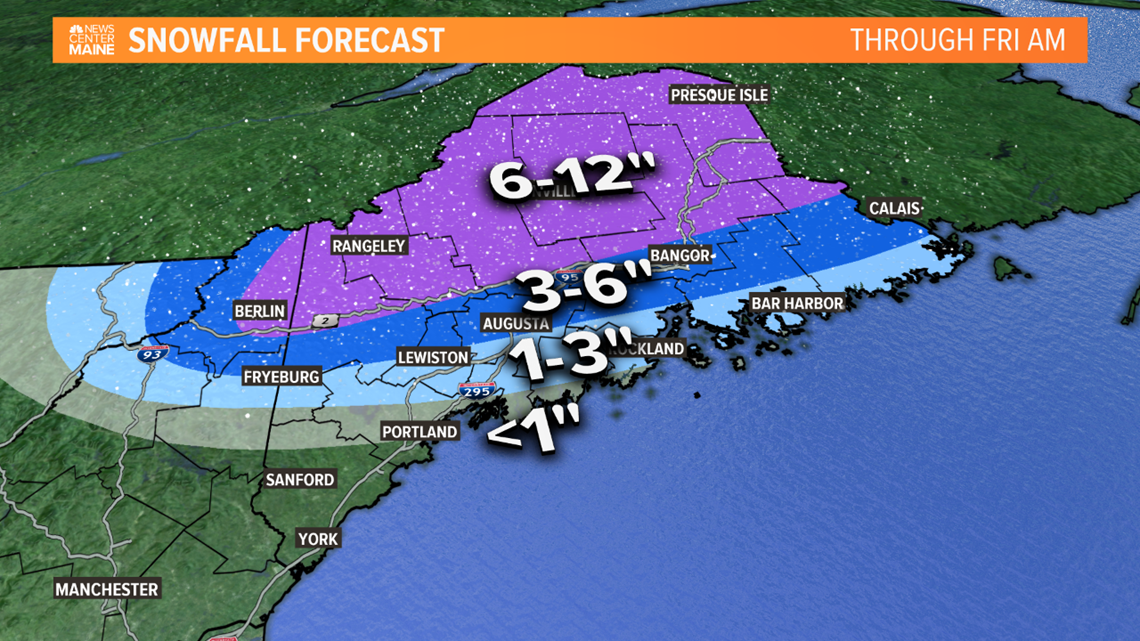
This path favors the Western Maine Mountains, the Central Highlands and far Northern Maine for a stripe of 6"+ snow. Amounts will decrease closer to the coast and become more elevation dependent too. But I'm still expecting several slushy inches to accumulate in Bangor, Augusta and Lewiston.

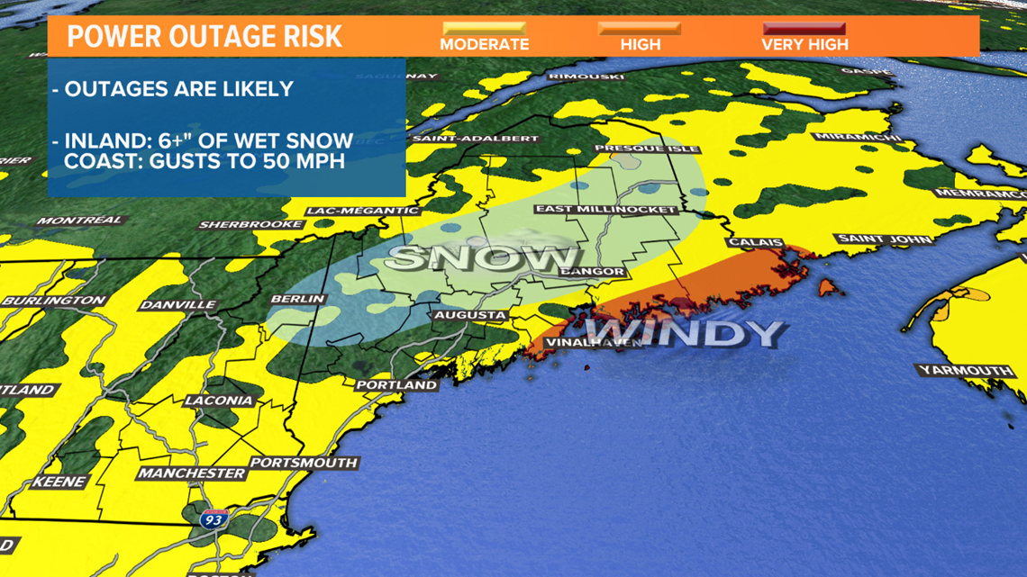
I'm very concerned about power outages. When it comes to heavy, wet snow, 6" is usually the threshold for limbs to break and bring down powerlines. There's going to be a pretty large area that gets near or over 6" so outages are likely. The Downeast coastline is also going to be susceptible to outages. Winds will get very gusty as the storm gets closer and gusts out of the SE may reach 50 mph late this evening and tonight.

Stay with us throughout the day as the storm movies in.

