I'm back. It's gonna snow. I'm out.
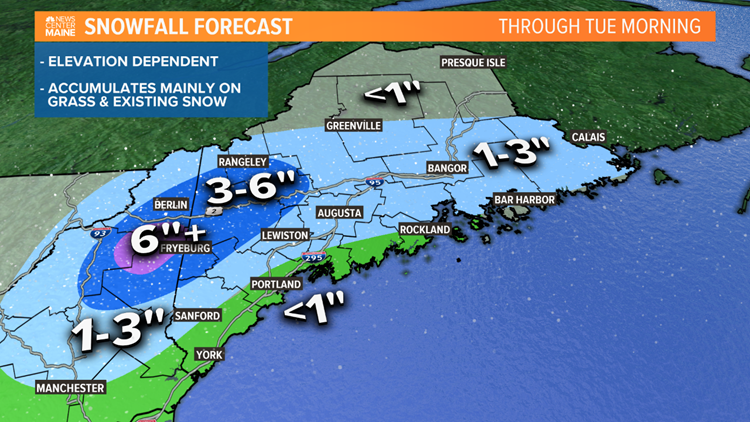
It's late in the season, really late. But, this Spring is absolutely bonkers. Here we are again, starring at another snow threat. Low pressure will rapidly develop this morning south of New England, taking the perfect track through the Gulf of Maine and into Maritime Canada over the next 24 hours. Several communities in Maine will see snowflakes at some point today, tonight or tomorrow. The million dollar question is how much accumulation will we see?
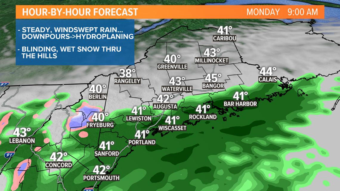
MORNING TIMELINE:


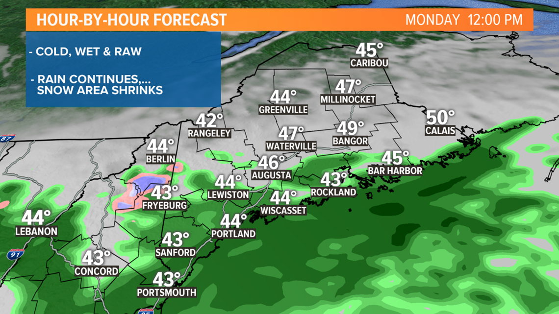
MIDDAY TIMELINE:


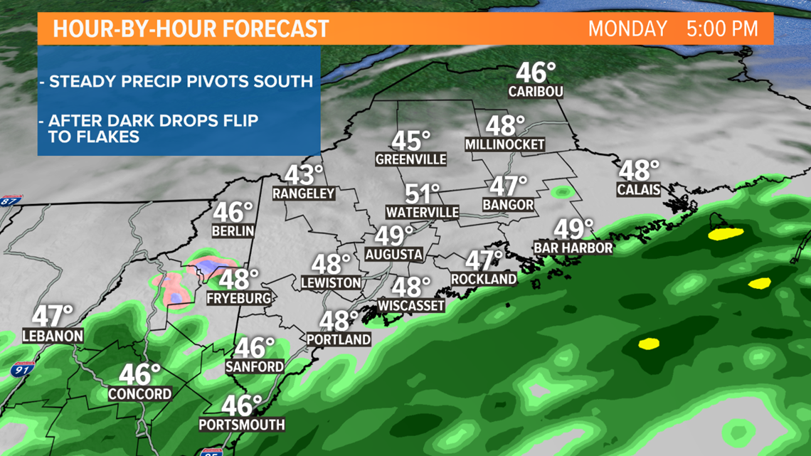
EVENING TIMELINE:


The largest obstacle for manufacturing snow this time of year is finding enough cold air. The air masses to our north in Canada don't have the same bite as they did a couple of months ago so there's not much help there. The Gulf of Maine water temperature has bottomed out and begun the slow crescendo to its peak in late August...not much help there either. So, the only option is from within. The lower atmosphere gets colder with height. With good dynamics and heavy precipitation, momentum can pull down that cold.


Near sea-level, that battle goes back and forth between wet snow and cold rain and doesn't accumulate well, if at all.
In the foothills, the landscape may look white with slushy accumulations on the grass and trees but roads usually remain wet. The higher you go the more efficient the snow accumulates, with the entire landscape draped in white, including some roads too, making travel more difficult through the highest terrain.
We'll be here watching this masterpiece from Mother Nature unfold along with you.


