
MAINE, USA — What would December in Maine be without an active weather pattern?
Actually, that's not a rhetorical question. A tranquil December can happen, but the month tends to be active. For once, 2020 is acting "normal" compared to our climatology.
To add to that case, this year is a La Niña year. During La Niña, December tends to be a colder and more active weather month than January and February.
Given the significant storms so far, I think this December fits that bill.
The upcoming week is no exception. It all starts with a storm offshore on Monday followed up by a blast of Arctic air.

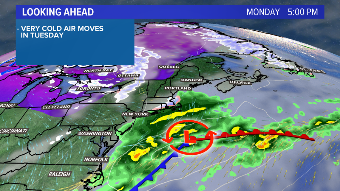
Cloudy and chilly weather prevails on Monday. Given the storm's track, most will remain dry through the day.

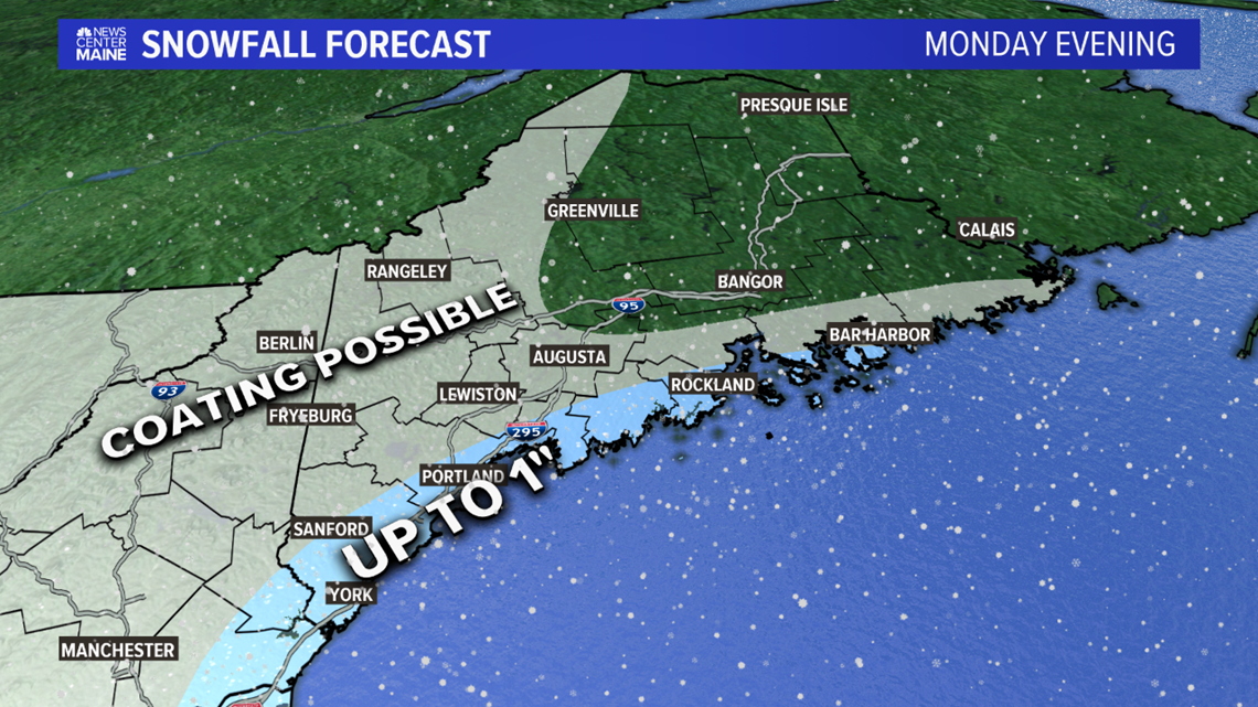
Some snow showers are possible in the evening. Given the timing, it could get a little slick for the evening commute on Monday.
Totals will be paltry at best, though. Most spots will only see a coating. Kittery to Portland and along the Midcoast to Rockland might be able to squeeze out an inch.

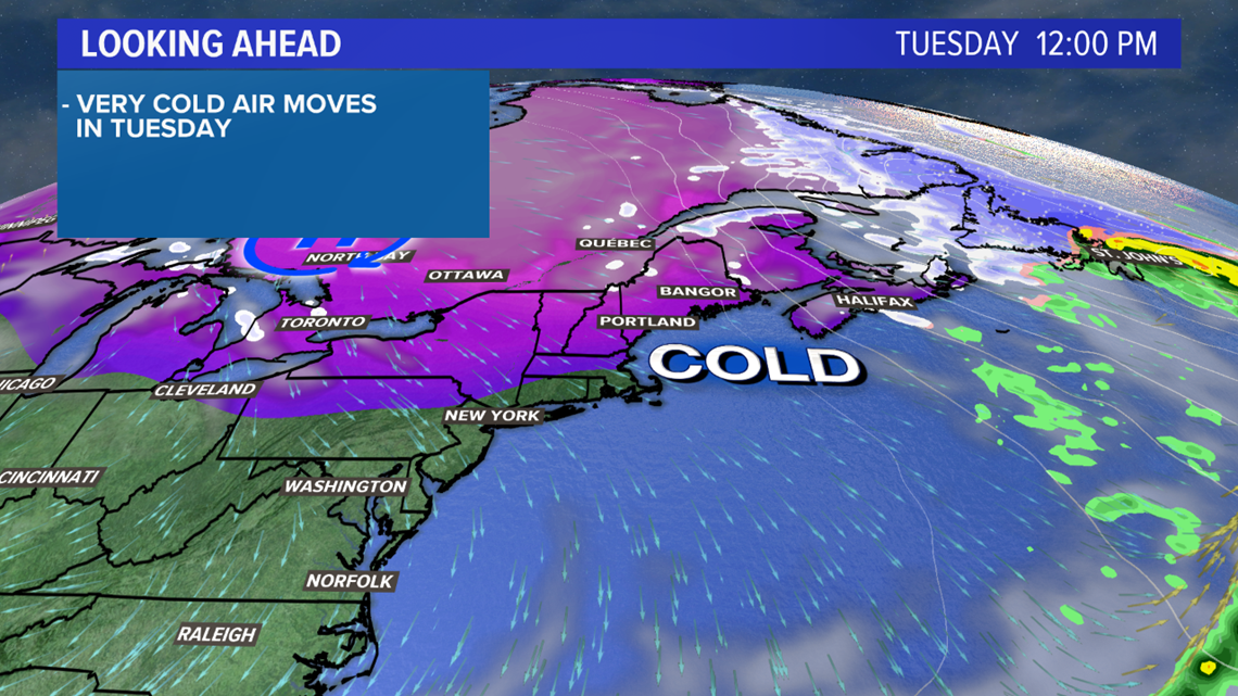
The Arctic cold front rolls on through and it gets wicked cold for Tuesday.

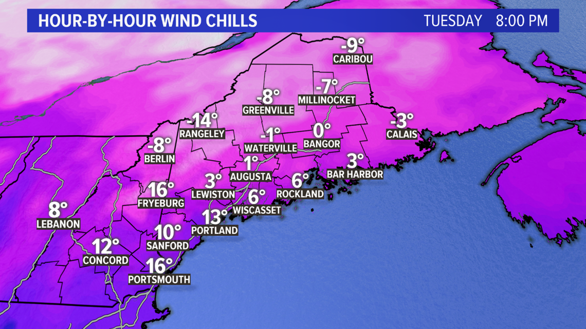
Gusty northwest wind and temperatures falling into the 20s will make it feel frigid by the evening hours.
Most spots will feel like single digits, and far northern Maine might even feel like it's below 0 outside. Like I said...first real cold of the season.

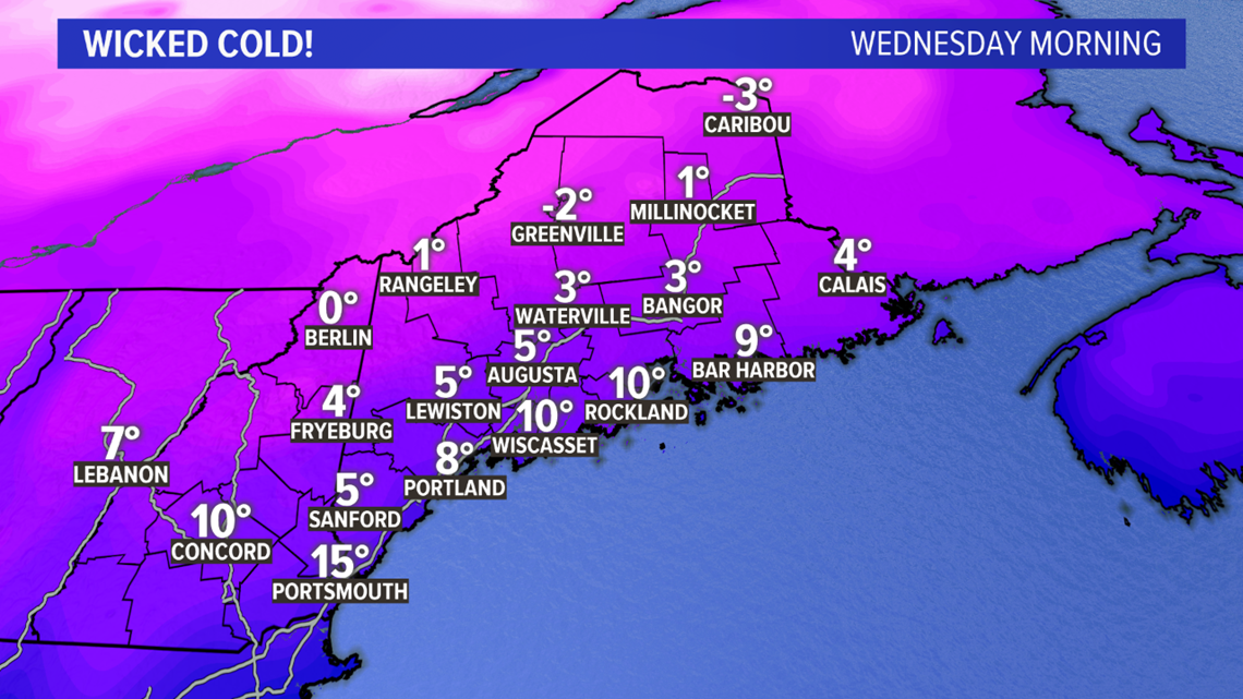
By Wednesday morning, temperatures will fall into the single digits at the coastline. Inland will be near 0, while northern areas and western valleys end up below 0.

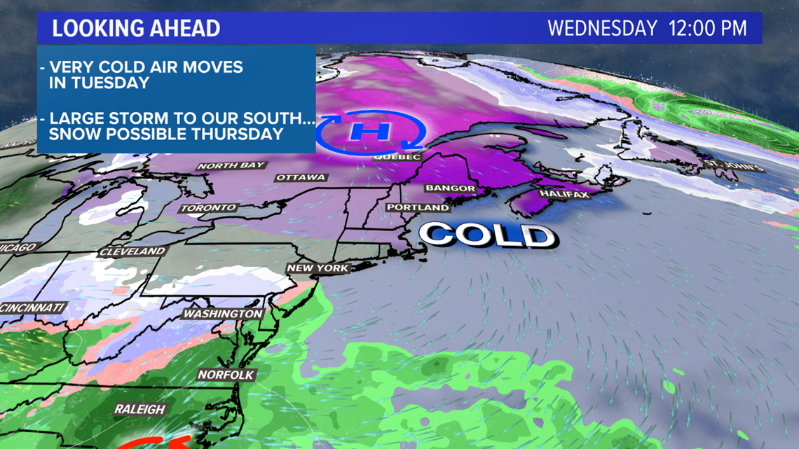
The day stays cold, with high temperatures only making it into the 20s. All eyes will focus on the area of low pressure that begins developing along the eastern seaboard.

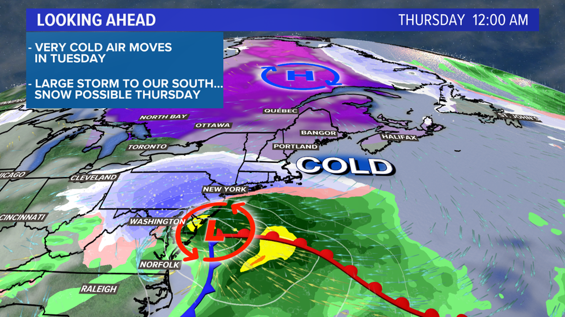
By midnight Thursday, the storm will be moving north. This is where the forecast runs in to some uncertainty.
Disclaimer: I wish this was clear cut and I could give you the forecast now, but that's not the case.

High pressure to the north will be the supply for cold air. This looks to be a lock at this point. The uncertainty comes into play with how the storm will actually move.
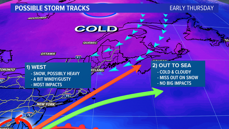
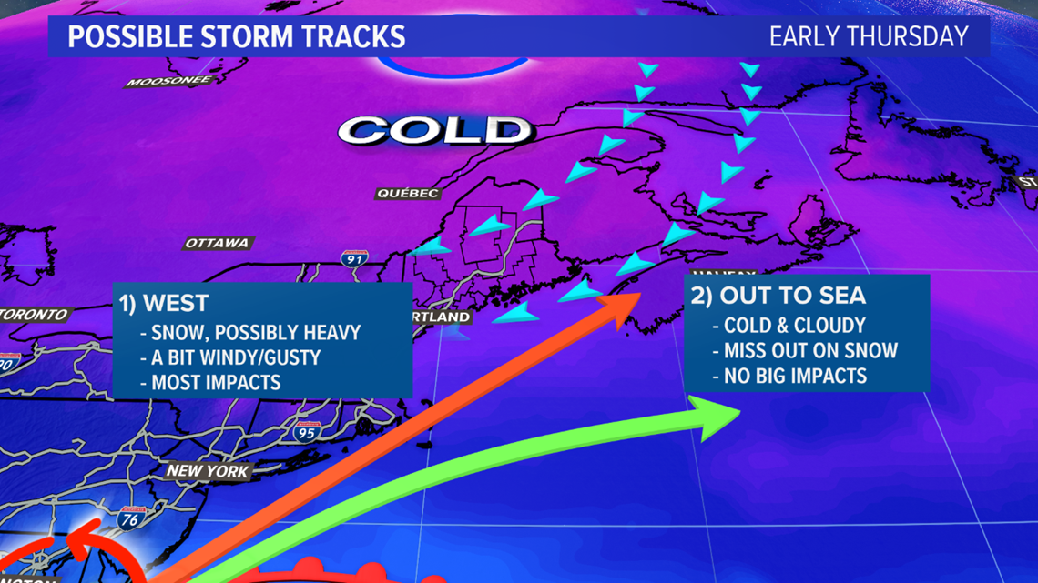
There are two possible storm tracks with this low.
Track 1: The northern and western track would bring the storm south of Maine and put southern Maine well under the precipitation shield.
With the cold air locked in place, heavy snow would fall. There could also be some wind concern, if this track is the one that happens.
This is the storm track that leads to the most impacts locally.
Track 2: The southern track, which would push this storm out to sea, is looking slightly more likely at this point.
Mainers would miss out on the snow and wind. Instead, it would be a cold and gray day. Even a southern track could bring some snow to southern Maine, but it would not amount to much.

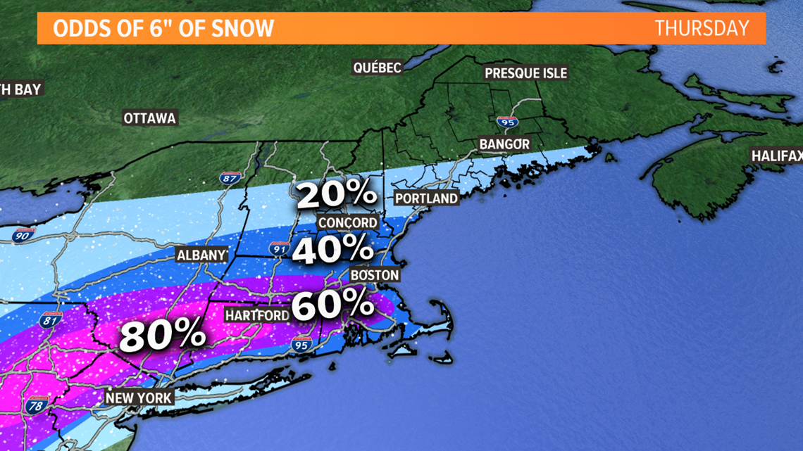
As I stated above, the forecast guidance and overall pattern favor the southern track slightly. Should this be the storm track, southern New England would fall in the bullseye and get the snow.
Even with a more northern and western track, southern New England would still be looking at some higher snow totals.
This track, of course, is where our probability comes in.
There's still a lot to figure out with this one, but time is on our side - for now. Check back the next couple of days with the entire team for updates on the storm.
Follow me on Twitter for more updates, @MikeSliferWX.
