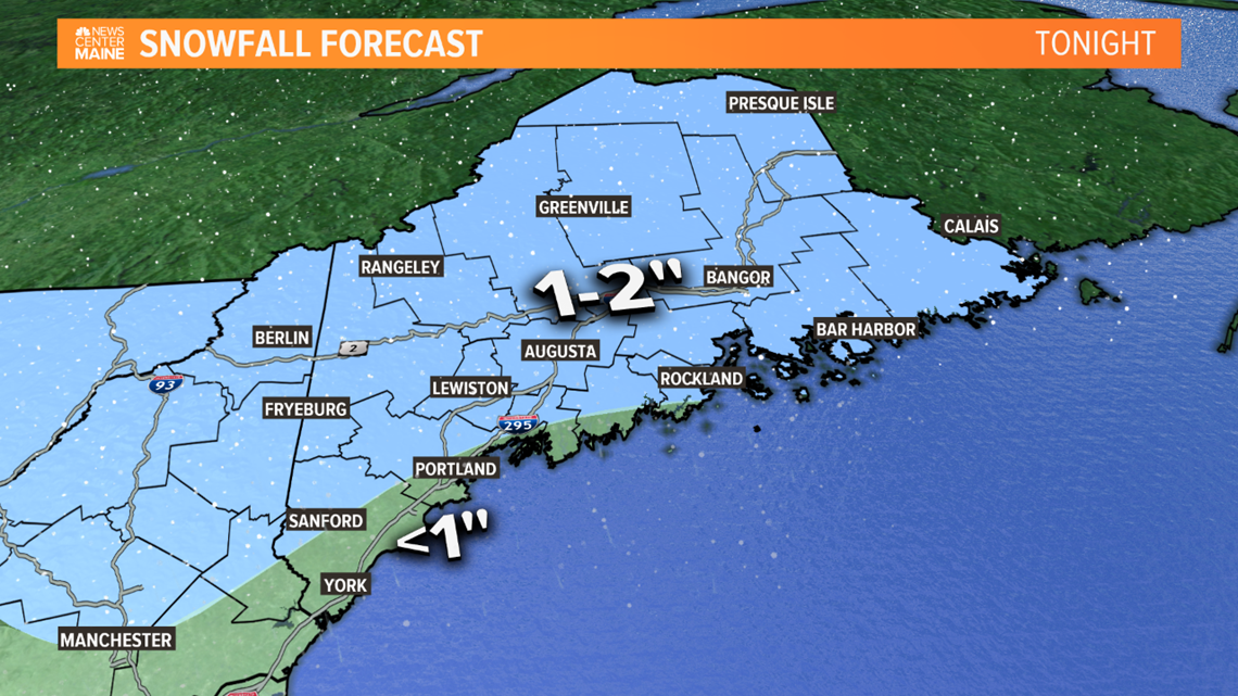
MAINE, Maine — "Stay on your toes", "buckle up", the cliches will be flying this week with several storms threatening New England. We already had one pass through last evening and thin icy glazes made a mess of the evening commute. I'm concerned the same thing could happen again this evening as another round of light snow and freezing drizzle pass through. Accumulations will be minor and glazes will be thin, but it doesn't take much of either to cause big problems this time of year.


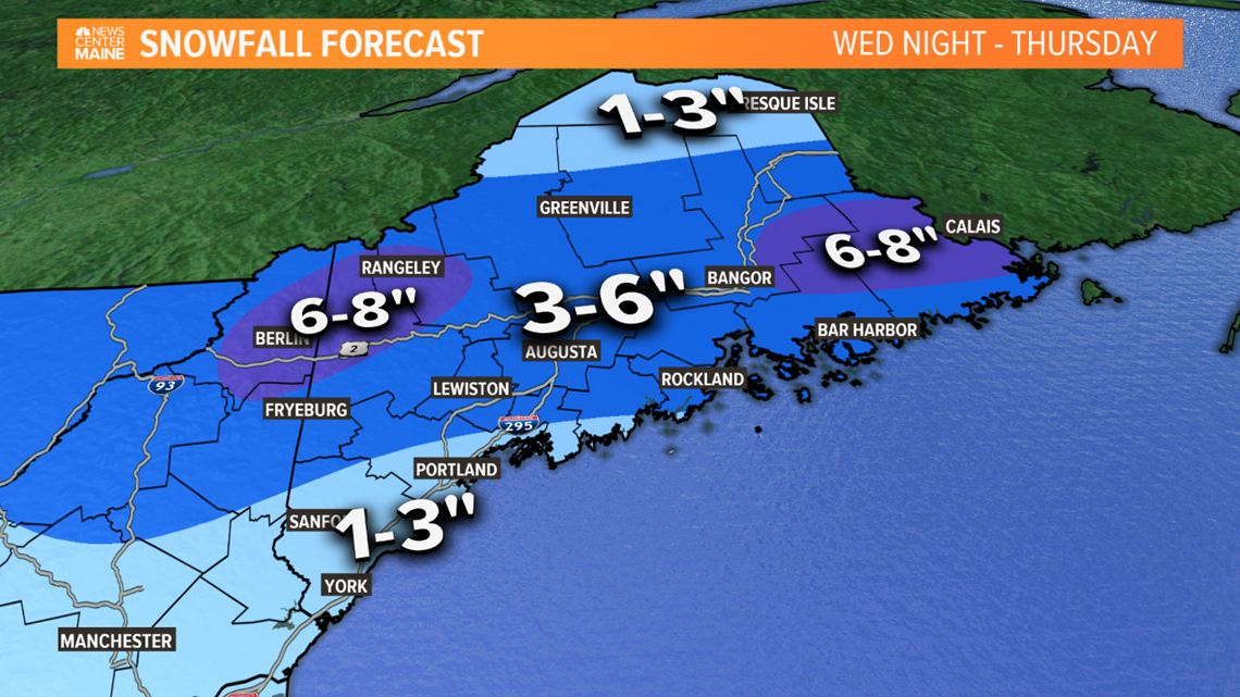
The parade of storms continues through the week. Each one offers greater potential, like a snow crescendo. Wednesday night through Thursday morning the next storm will roll from the Great Lakes through New England. If you want snow, you'll love hearing there's solid moisture to work with and plenty of cold in the mid and upper levels. However, I'm not in love with the track of the surface low. Barreling in from the west will allow for a southerly fetch to introduce warmer air into the boundary layer, near the surface. This would mix in rain or even flip it completely for a while holding down snow amounts for the coastline.


Once the storm gets into the Gulf of Maine, later Thursday morning, it will cut-off the warm air supply. Temps will fall again and any rain would change back to snow as the storm pulls away and the precip winds down. With that said, much of Maine should get enough snow for delays and maybe even cancellations as some areas get over 6".


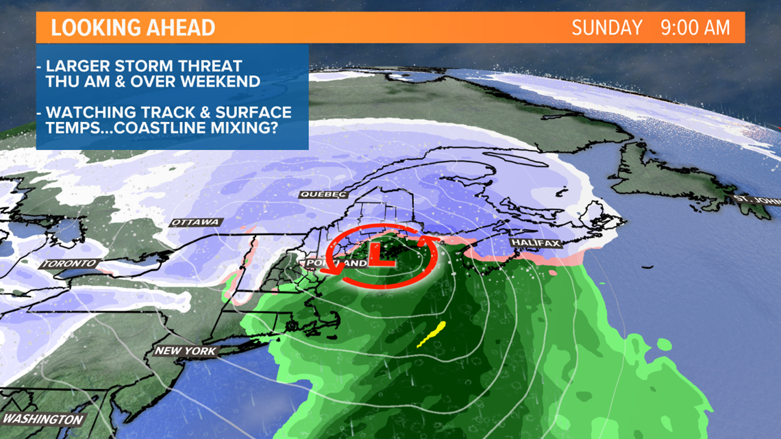
The weekend storm shows the most potential, colder airmass, deeper moisture, stronger surface low, negatively tilted mid-levels. The only thing holding me back from saying "crush job" for snow Saturday night and Sunday morning is that the surface low tracks right through New England and over the coast again. This would present boundary layer temperature issues, allowing for rain to potentially mix in along the coast. It's a subtle detail with big ramifications.
We get info into the weather office every few hours so keep checking back for updates and adjustments.
-Todd

