PORTLAND, Maine — This winter has certainly had its moments so far, from extreme cold to record-breaking warm temperatures.
The best way to describe the past season is inconsistent, that is, until the past couple of weeks.
Now, winter's back with a reminder that it isn't quite done with us yet, and the past week especially has been a solid reminder with a storm on our doorstep.
Low pressure south of the Great Lakes will weaken overnight and transfer its energy to a surface low off the Delaware coast. This storm will become the parent storm and intensify as it tracks just south of southern New England late tonight and tomorrow morning, finally exiting as it heads out to sea Saturday evening.
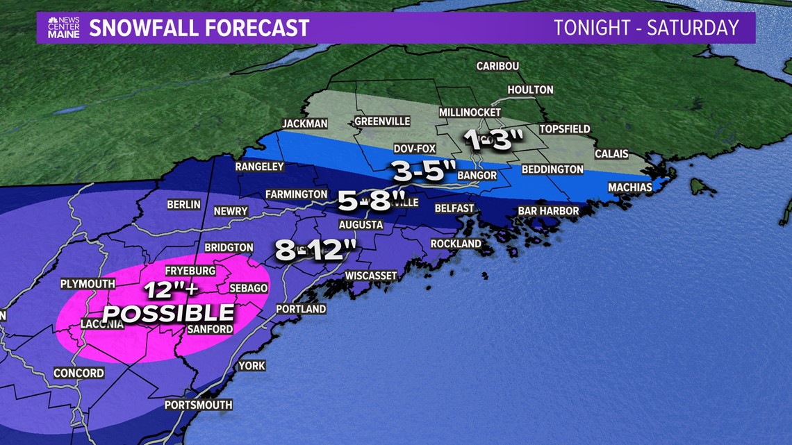
Much of southern Maine and New Hampshire will see over a foot of snow along with gusty East/Northeast winds which may cause some power outages, especially along the coast where we are expecting a wetter, pastier snow.
Snow will develop across New Hampshire and southern portions of Maine around midnight and rapidly push northeastward overnight. Winds will also be on the increase out of the East.

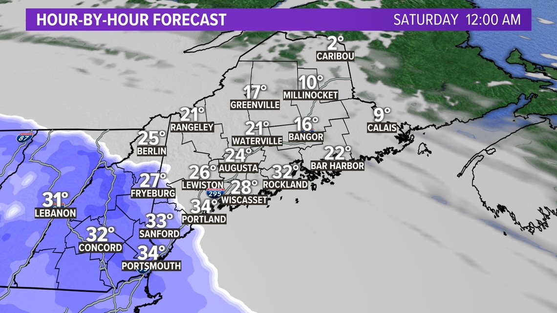
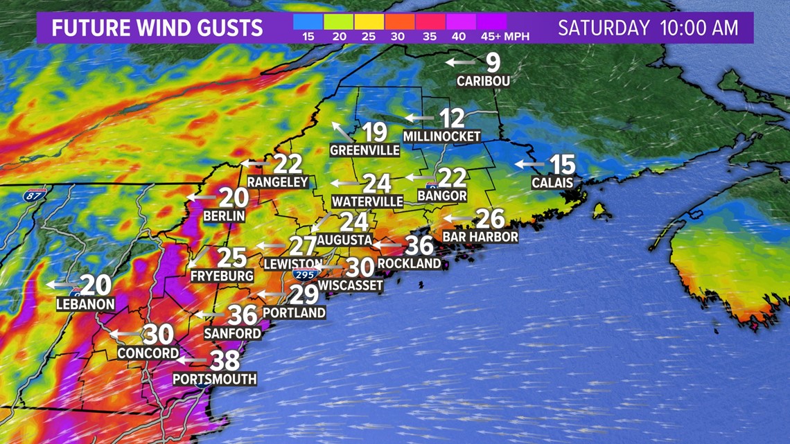
By 6 a.m., snow will envelope much of the state with snowfall rates reaching 1-2 inches per hour rates. Winds will also be gusting over 30 mph out of the East/Northeast which may cause some power outages due to the wet, pasty nature of the snow, especially along the coast where temps will be close to freezing. We're not expecting any coastal flooding, but we could see some minor issues during the mid-morning high tide cycle.

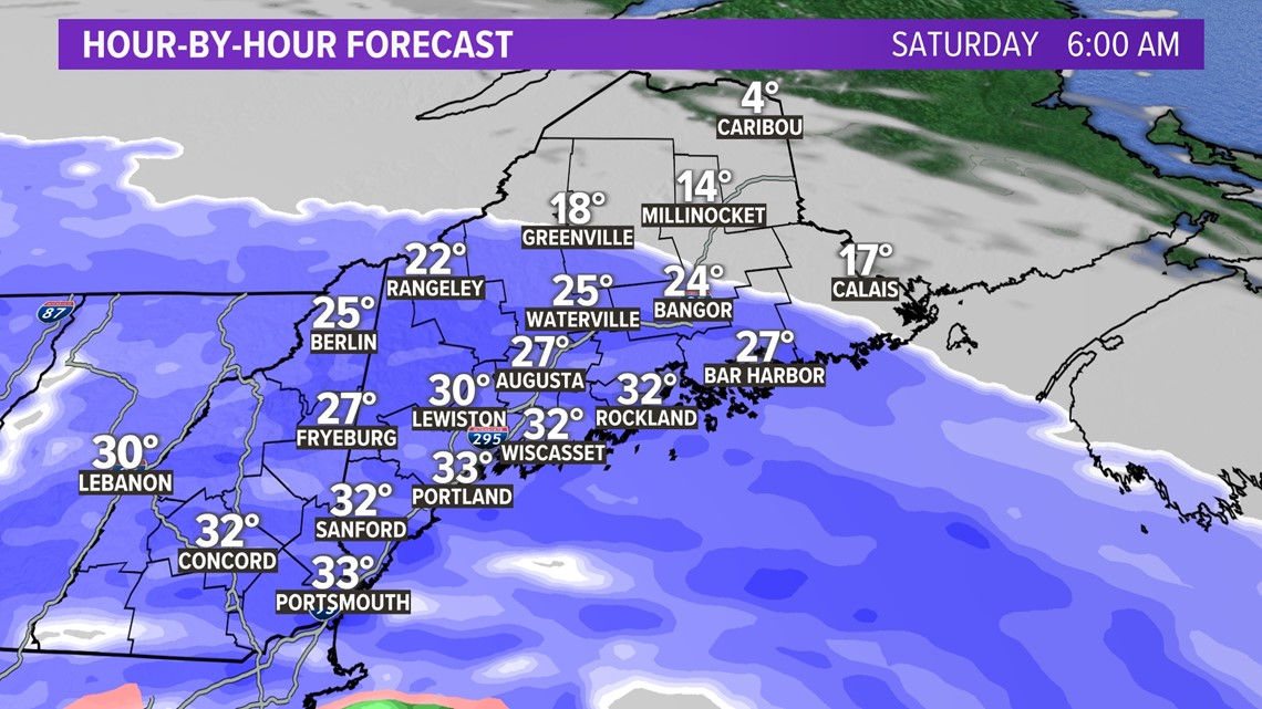
By late in the morning into the early afternoon, we'll be in the thick of the storm with snow rates continuing to reach 1-2 inches per/hour across the western and the southern half of the state into New Hampshire. Far northern Maine will remain dry as the northern extent of the snow barely reaches Millinocket. Winds will continue to be a factor along the coast gusting out of the East/Northeast up to 40 mph.

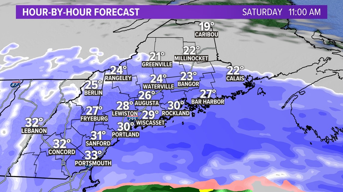
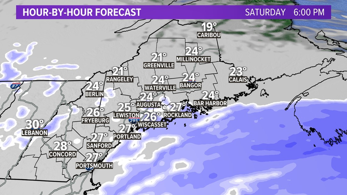
By late in the afternoon, we'll see the snow shield collapse offshore as low pressure pulls away from New England. Expect snow to come to an end by Saturday evening with a few leftover flurries/snow showers through early Saturday night.

We're expecting the strongest winds to occur from the mid-morning hours Saturday through the mid-afternoon. Gusts could blow up to 30 mph inland and over 40 mph along the coastline.
Again, we're not expecting any major flooding issues along the coast during the Saturday mid-morning high tide cycle, but a few areas may see some minor issues with splash over. The bigger issue looks to be potential power outages, due to the wet consistency of the snow, especially along the coast.

Here's a look at the final numbers. When all is said and done, the jackpot looks to be from the Lakes Region of New Hampshire into western, and interior southern Maine where we could see well over a foot of snow. A broad area of 8-12 inches of snowfall will fall across the southern half of Maine and most of New Hampshire. Snow totals drop off rapidly from Bangor points north with far northern portions of the state being spared this time around.

- David

