PORTLAND, Maine — A quiet day is on tap for Saturday. But, true to form for this week, another storm arrives on Saturday night.
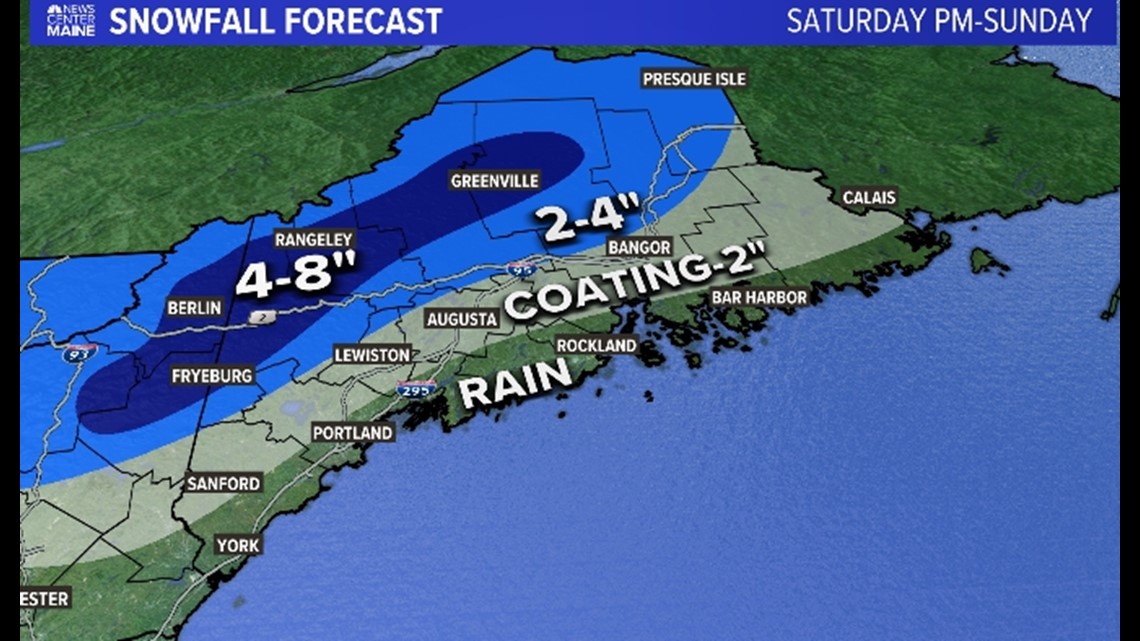
There's slightly more cold air to work with so many towns away from the coast may begin with some wet flakes. Outside of the terrain, the flip to rain will happen fast and all will see another round of drenching downpours. Rain amounts of 1 to 2 inches will lead to drainage issues and additional minor river flooding.
Snow amounts will depend on elevation and some of the higher peaks in Western Maine and New Hampshire will see double-digit snow amounts. The valleys in the hills and mountains could see as much as 8 inches. There may be some minor slushy accumulations on the grass and decks from Sebago Lake through Lewiston-Auburn and Augusta to Bangor, but it will be washed away after the transition to rain early Sunday morning.


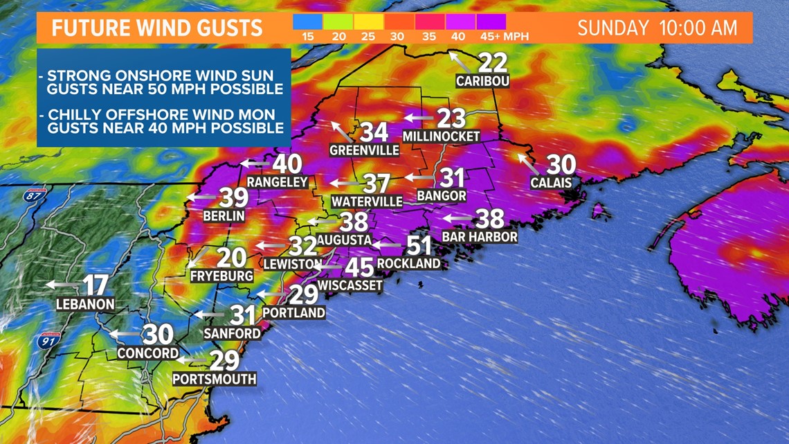
Winds will peak Sunday morning and midday with gusts as high as 50 miles per hour out of the southeast. I'm not too concerned about power outages, but obviously there will be some.


More importantly, that onshore wind will blow water up against our coastline. Tides are running very high due to the new moon and that surge of water will produce minor to moderate coastal flooding with the midday high tide. The flooding won't be anything like what we saw back in January, but I still expect some shore and marsh roads to close down for a few hours and our beaches will take a beating from large breakers.
Follow our team through the weekend for the latest.
RELATED: NEWS CENTER Maine Weather Forecast

