Unfortunately, I could see this Christmas Day storm coming from a mile away.
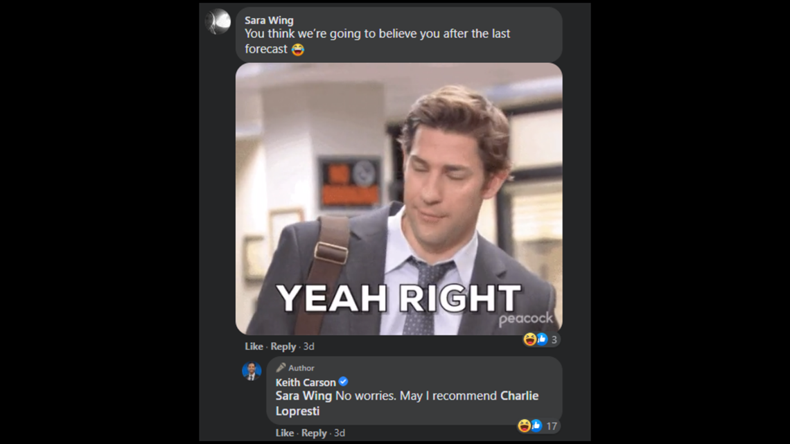
In fact I started posting about it last Friday. Of course, I had just recently gotten absolutely SMOKED on a snowfall forecast, so the comments section didn't go great:

Yet here we are; this storm is still a thing 5 days later.
The system moves in on X-mas eve and is out of here by Friday late afternoon.
Here's what we know:
1. It's gonna be rain.

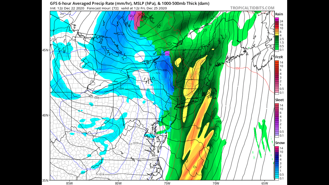
Typically, in late December it would be more of a challenge to determine a precipitation type. But with a screaming southerly wind many of us will pop into the upper 40s before this thing even gets going. And during the middle of the event many of us will touch the mid 50s. So this is a rainer. Apologies to the ski areas.
2. Oh, oh there it goes...it's a snow eater!
(Look, if I'm not allowed to do these kinda dad jokes what is the point of having a child?)
The combination of the rain, temperatures, and the wind will absolutely gobble up our snowpack.
Why does the wind matter? When a basement floods and you want to dry it up faster you bring in giant fans right?
Why? Because the more air you can move over a wet surface the more evaporation ability you have. If the air is stagnant the layer right about the snow becomes saturated and can no long eat into the snow pack. If the air keeps moving that layer never gets saturated and the evaporation or sublimation is almost unlimited. (This is the same concept for why a fan keeps us cool in the summer. Our sweat is the snow and the fan is the wind.)
This is a really long way to say some of us will go from 15" of snow on Thursday to bear ground on Saturday morning.
3. The wind is the key

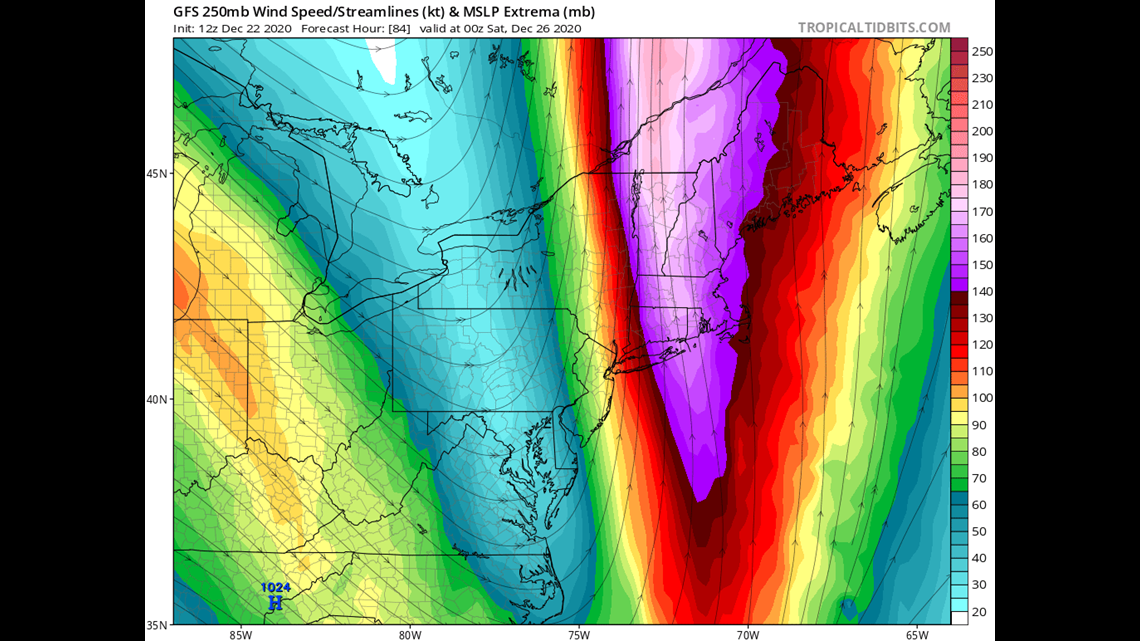
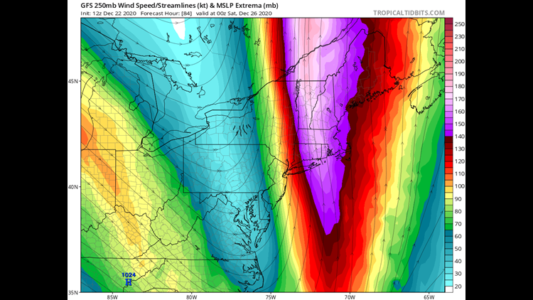
Because this is a negatively tilted storm, you can tell from a long distance it's going to be a significant wind maker. The baseline for gusts along the coast is at least 45 MPH in my opinion. But when you dig deeper and look at the screaming upper level jet and sufficiently warm temperatures at the surface to mix winds down. I think you end up with gusts that are even higher:

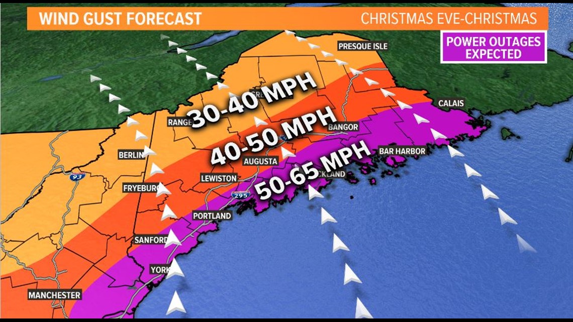
If we cross that 55 MPH threshold, power outages will become big. The wind will also be out of the South/Southeast which is a vulnerable wind direction for the state.
Peak gusts will start overnight on X-mas Eve and wrap up during the afternoon on Christmas Day.
4. Flooding is a concern
This storm will pull in a very unusually moist airmass for this time of year, which will allow for higher rainfall totals than you'd expect to see in late December.

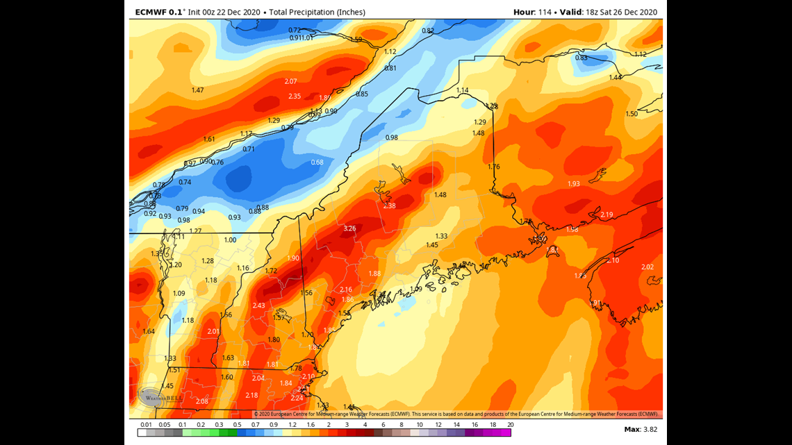
Widespread total of 1-2" will be likely. In addition you have to add the snowmelt to the equation which will produce, in some cases, as much as 3" of net liquid.
Minor flooding is possible due to this, especially since some storm drains may be clogged with snow and debris.
Could be clogged by worse though I suppose:
Updates as needed on this annoying storm.
Carson
Fewer shirtless photos than Lee Nelson, but not by much: https://www.instagram.com/keithcarsonweather/


