
MAINE, USA — This week should be interesting. It is without question the most active week of our winter so far; yet it's coming on the heels of an ice event that basically wasn't a thing and an "under-forecast" in Southern Maine a few weeks ago.
So we will warn you, we will put out forecast maps, and we will get a lot of comment shade.
Such is life in the world of weather forecasting in New England. Ain't no thing.
(Honestly though: What's frustrating about the weekend ice event is that we undercut the model forecasts for ice by 50% and it was STILL too much. Annoying when you outsmart the models but it's not enough. Big picture the problem was that high temperatures on Saturday were about 5 F warmer than forecast, which was lovely, but we couldn't make up the difference the next day to drop into the low 30s in time for ice.)
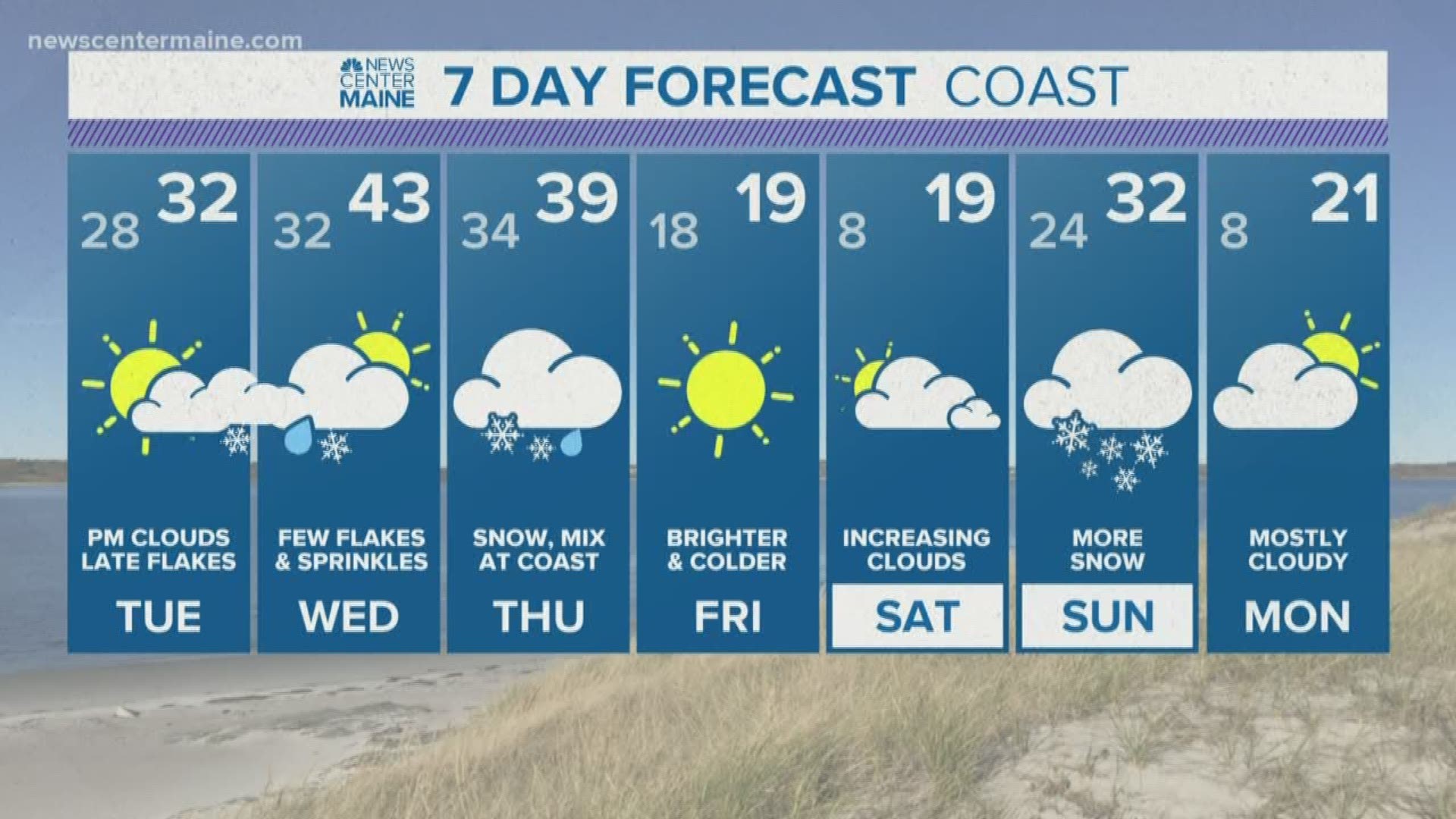
On to Cincinnati... This week looks very busy with 2 and 1/2 storms.
The 1/2 is the first little event on Tuesday night. It's no big deal.

It's just an impulse overnight on Tuesday into Wednesday .1-2" pretty widespread.
Yawn, wake me when it's over.
Let's move on to the good stuff.
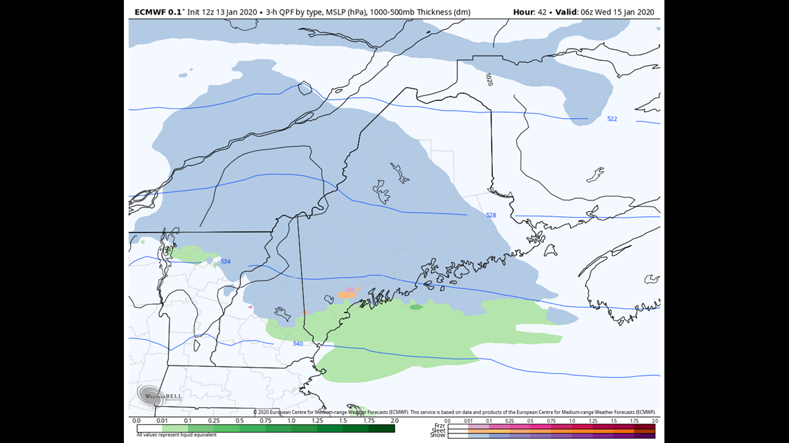
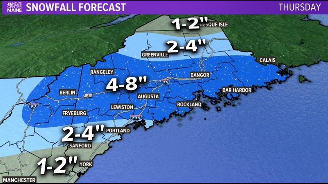
The system after that shows a lot more promise ("promise", "nice", "pretty" are all bad things if you're not a weather weenie) for Thursday. It has it's origins as a Continental almost Clipper system-


Presumably jacked up on lobster rolls, Patrick Dempsey rom-coms and $20 four packs of craft beer, the system becomes notably stronger once it passes over Maine.
The speed of that intensification is critical as the GFS is a bit slower than the EURO and therefore has lower total moisture to work with.
I lean towards the EURO a bit here as it tends to dominate in matters of dynamic development, so my forecast totals are heavier than if you followed the American model more closely.

The American model isn't all bad though. I've noticed it does better with extreme temperatures and...stuff...like..that...


Keep in mind it's only Monday at 3 PM as of writing this, so the team might have to adjust the map as we get closer. The most up in the air zone is between Portland and Brunswick since there will be some rain mixed in, but the exact location of that mix is key for amounts.
Thursday is a decent storm, but all the nerds have their eyes on the weekend.
It's rare to have every model clue in on a Nor'easter over a week ahead of time.
But that's what they are doing:
In fact the Ensemble members (the computer model being run 50 plus times with minor tweaks to account for uncertainty) give about a 60% chance of over a foot of snow inland through the week and that hinges on the Saturday night/Sunday storm.

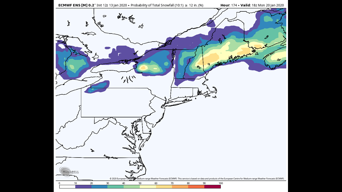
This storm isn't going to just go away. The only way it's not big snow for Maine is if it trends farther East and somewhat out to sea.
So for now, stay tuned and pencil in Sunday as "Crush Job Potential."
Yes it's 6 days away, but you can't keep the kid down.
See ya
Carson
STORIES NEWS CENTER MAINE VIEWERS ARE READING