
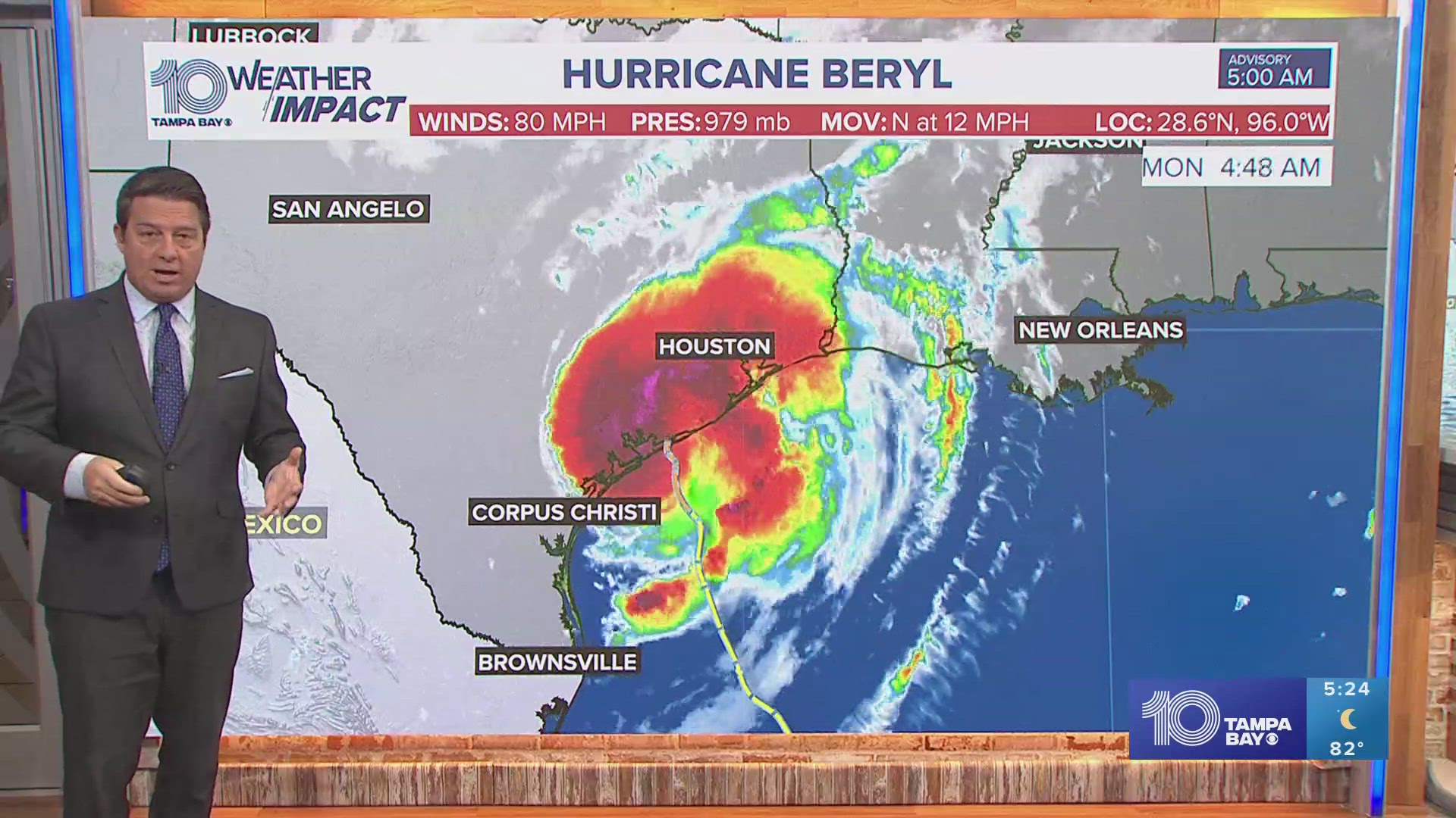
ST. PETERSBURG, Fla. — Tropical Storm Beryl strengthened into a hurricane and made landfall as a Category 1 storm in Texas.
The center of Beryl made landfall near Matagorda and forecasters said dangerous storm surge and strong winds with flash flooding are expected.
As of the latest advisory, Tropical Storm Beryl is about 85 miles south-southwest of Houston. Forecasters say the storm is moving at 12 mph with maximum sustained winds of 80 mph.
A storm surge warning is in effect for Mesquite Bay to Sabine Pass, including Matagorda Bay and Galveston Bay.
A hurricane warning is in effect for the Texas coast from Mesquite Bay northward to Port Bolivar.
A tropical storm warning is in effect for the Texas coast north of Port Bolivar to Sabine Pass.
The center of Beryl is expected to move over eastern Texas today, then move through the Lower Mississippi Valley into the Ohio Valley on Tuesday and Wednesday.

Forecasters said storm conditions could include heavy rainfall of 5-10 inches with localized amounts of 15 inches across portions of the Texas Gulf Coast and eastern Texas beginning late Sunday through midweek. That rain is likely to produce areas of flash flooding and urban flooding, according to NHC.
Beryl is the first named hurricane of the season and the earliest a Category 4 and Category 5 storm ever formed in the Atlantic. The previous record for the earliest Category 4 hurricane was Hurricane Dennis on July 8, 2005.
Elsewhere in the tropics, forecasters had been keeping an eye on Invest 96-L in the Atlantic. It has since dissipated and the NHC is no longer tracking it.
The first named storm of the season, Tropical Storm Alberto was named on June 19 when it was close to making landfall over Mexico in the Gulf. It was a relatively short-lived system that quickly weakened to a depression once it made landfall and then dissipated over land.