PORTLAND, Maine — As this storm rolls through the area, flooding will occur inland and along the coast -- but for different reasons.
First, let's focus on the inland flooding.
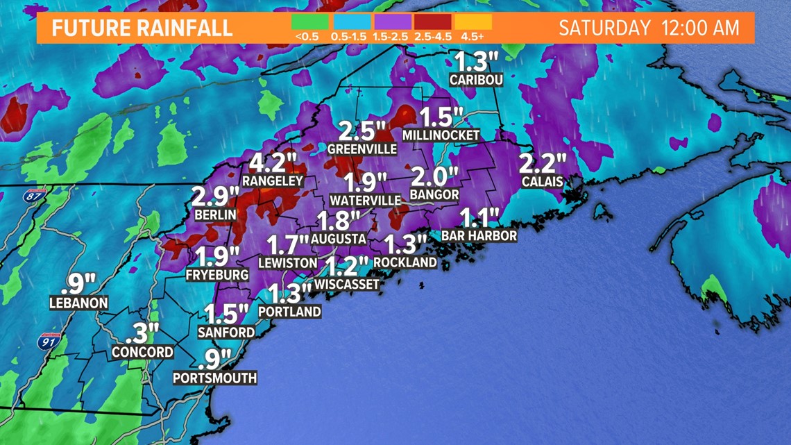
The inland flooding will be the result of the sheer volume of water that will fall throughout the day.
Most of the state is expected to receive 1 to 3 inches of rainfall, and a lot of that will be falling as snow in the western mountains.


All that rain will collect and then run off, flooding rivers, creeks, and streams.
One example of the inland flooding can be seen when we look at the Kennebec River forecast at Hallowell.


Moderate flood stages will be reached Saturday on Christmas Eve as water continues to run off. It is not immediate because the water has to collect before it can start to cause issues.
This means water will enter the back side of buildings along Water Street in Hallowell. Front Street will become submerged as well as the parking lot by the town docks.
Coastal flooding is a bit different and is influenced by the astronomical tides and wind direction.
We are under a new moon, which is stronger and influences the tides even more. This was going to increase the crest anyways but not problematically.
When you combine the very high tide with the wind speed and direction, that's where the problems begin.
The high wind speeds are blowing directly onto the shore from the southeast, bringing even more water onto the coast.


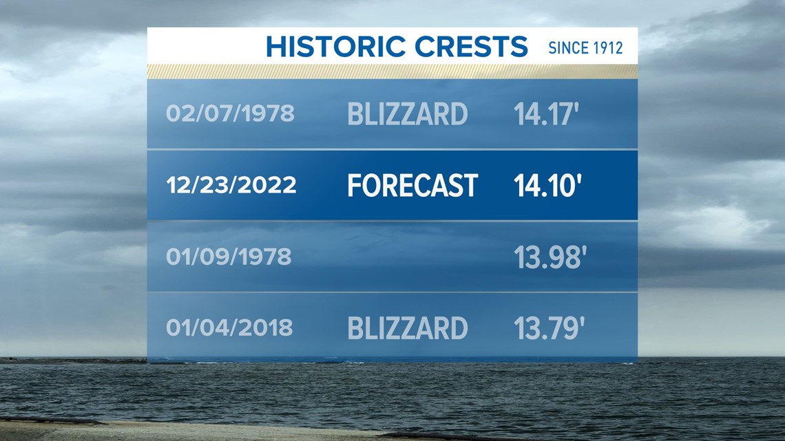
The coast at Portland is set to reach 14.10 feet later this morning during high tide.
This will be one for the history books.
The only date to rival today's coastal flooding was the blizzard of 1978, and not by much.
We could tie or break that record as we are only forecasting a difference of 0.07'.
Stay safe and have a Merry Christmas and Happy Holidays!
- Aaron

