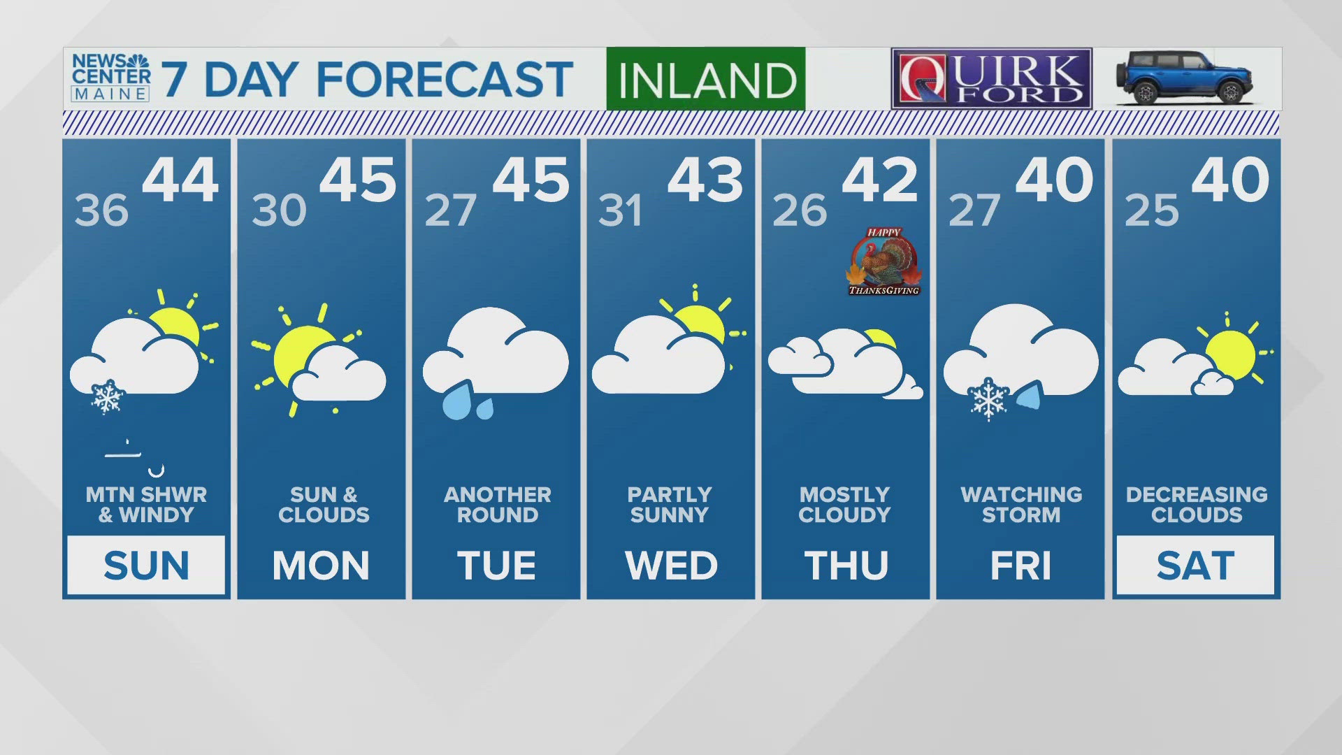
PORTLAND, Maine — We get in different grooves when it comes to weather. Sometimes they are nice grooves, like temperatures in the 70s during early November. Sometimes they are less desirable, like several wind and rainstorms in a row.
Coming off the heels of a windy soaker Sunday night, we have another lined up for Wednesday afternoon/evening. If anything, this storm looks a little stronger.
First things first, it's basically just a warm front/cold front combo. But the warm front is all the way up in Canada. As a result, this means rain for pretty much all of Maine.

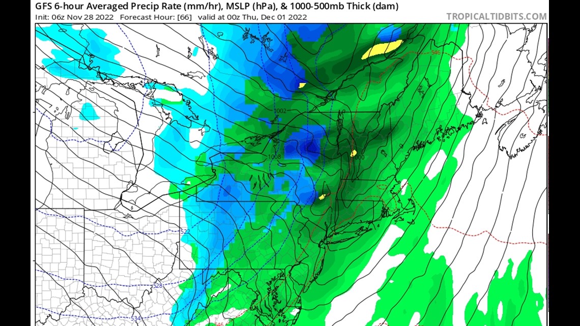
By Wednesday afternoon rain starts breaking out over western Maine, moving into central Maine and the midcoast shortly after sunset.
Just by looking at that front presentation, I can guess (as a weenie with years of weenie experience) that we are likely to have some strong wind gusts in there.
This has mainly to do with how close the isobars (black lines on map) are and the slight tilt in the front.
Sure enough, the models agree: It's gonna be windy.

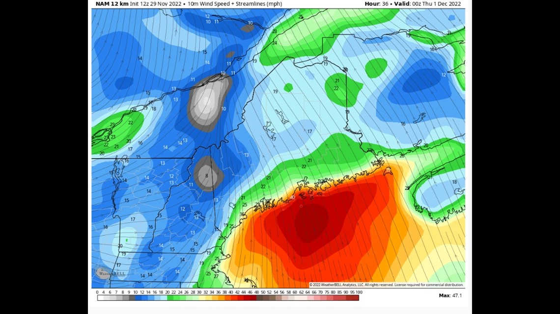
The wind profile makes sense to me, too, as it's projected to be strongest along the coastline (less friction over water) and generally south to southeast.
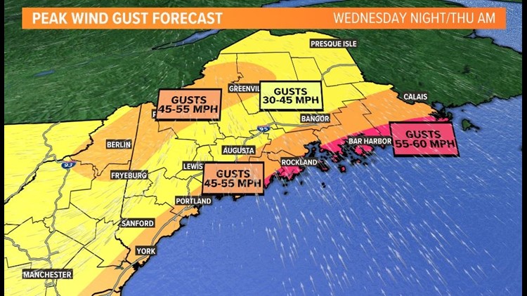
I took into account a few different model forecasts and drew this map: (Hang it on your fridge and tell me how good it is, please!)


This would be good enough for some power outages for sure. The good news is it's November, and the grey, dreary landscape lacks foliage. No leaves on the trees means less drag for wind and fewer power outages.
There will likely be some mountain snow on the way out Wednesday night.

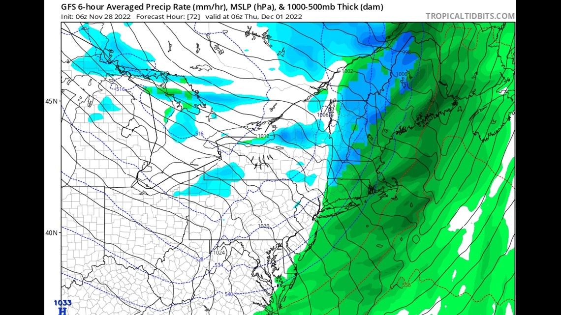
But it's too little, too late. This will be a net loser for the mountains.
Speaking of net losers, I'm outta here.
Carson


