We've been dealing with lots of pollen and not a lot of rain lately in Maine, but that's about to change in a big way.

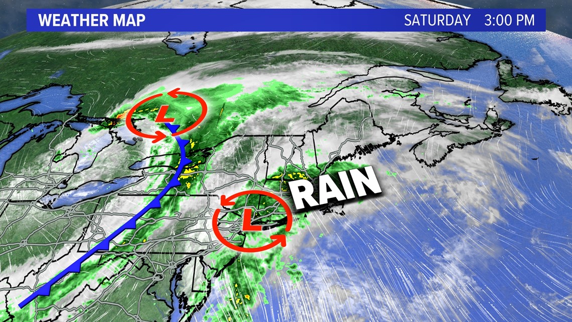
An area of low pressure moving east of the Great Lakes will pull another area of low pressure northeast that is developing along the East Coast Saturday.

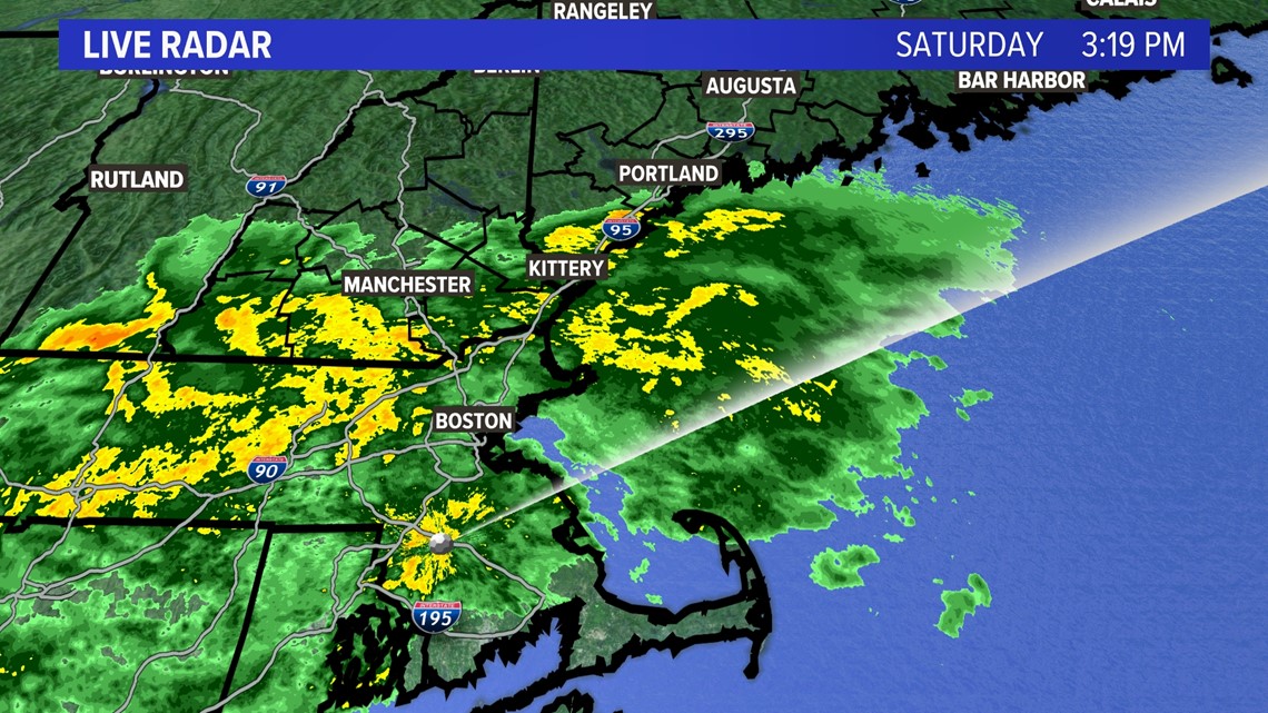
The rain has already begun to fall heavily in the Boston metro area and is heading north up the turnpike into southern Maine.

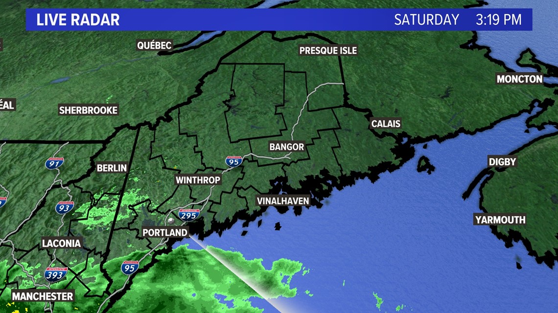
Most of the Pine Tree state is dry for now, but that will change tonight as the rain moves north.

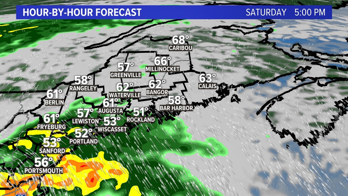

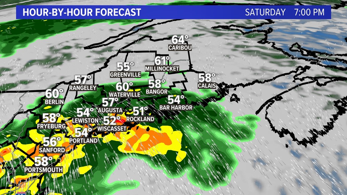
As we get into 9 and 11 p.m. the rain gets heavier statewide with the exception of the western mountains getting a little less.

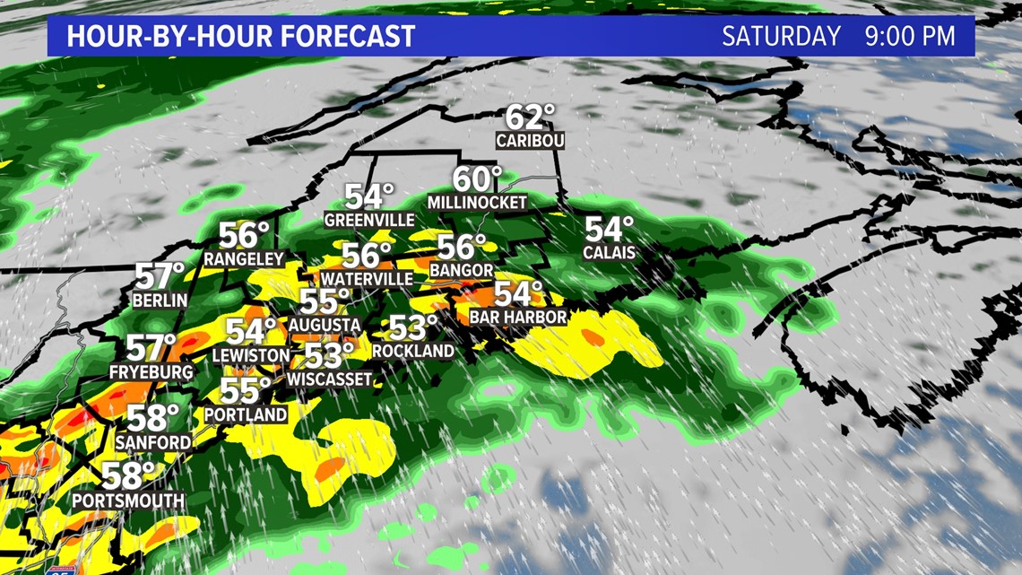

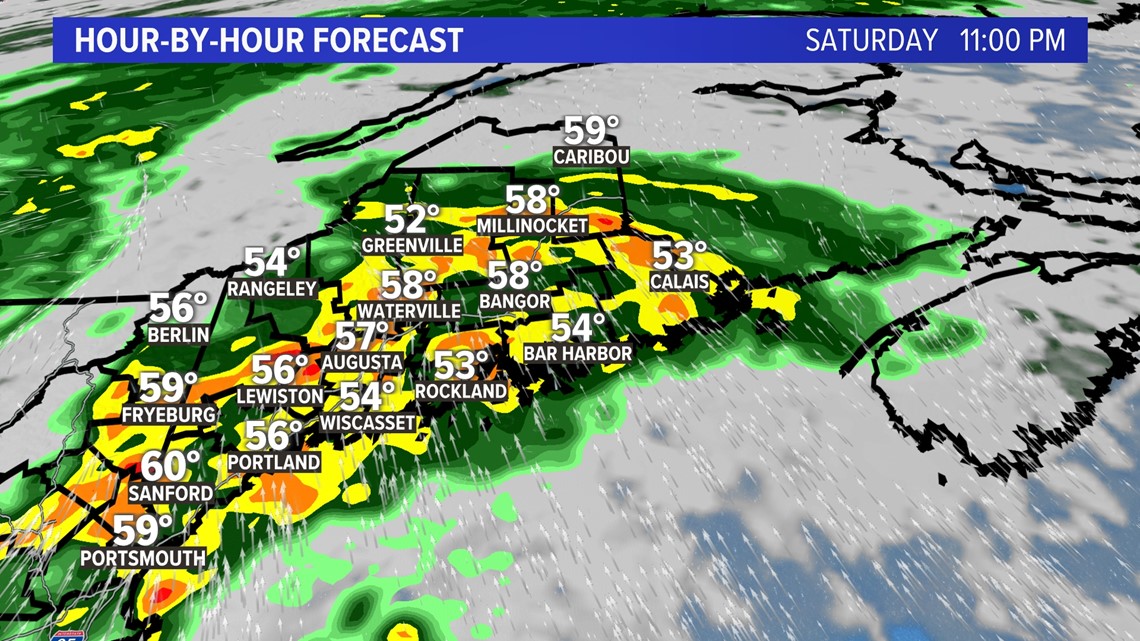
After midnight the rain will peak for much of the state and could even wake you up while you are sleeping.

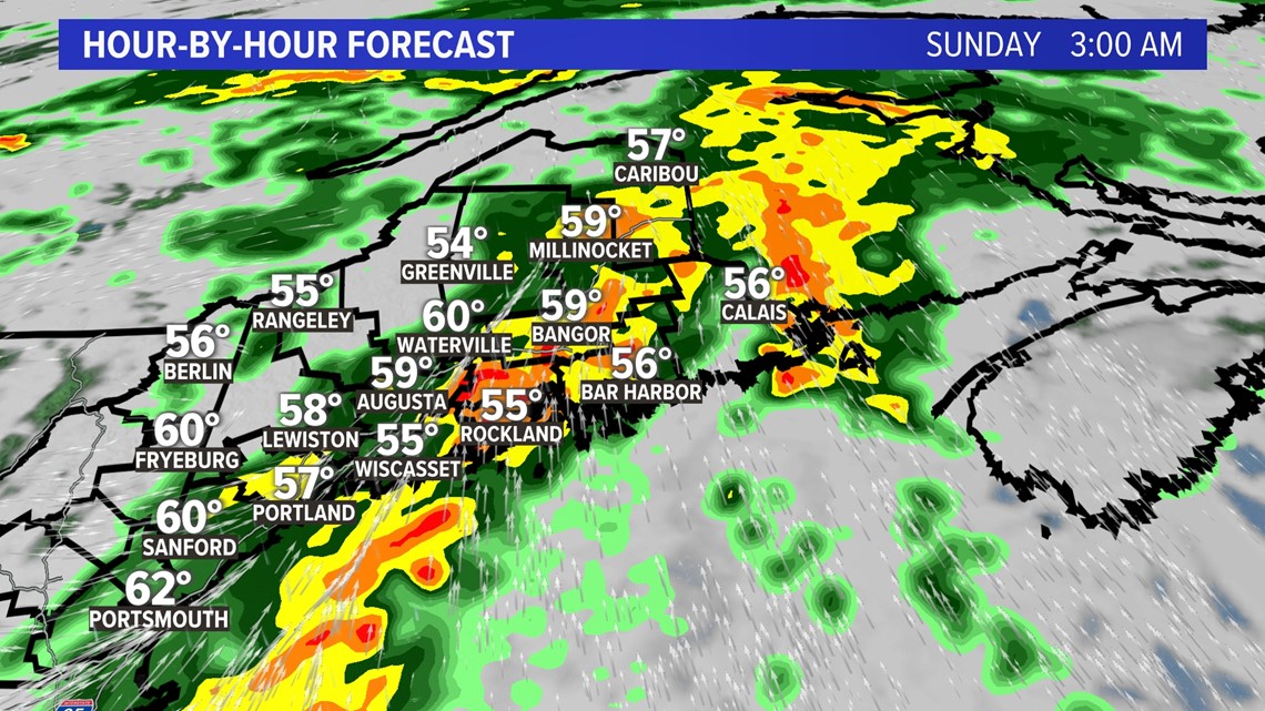

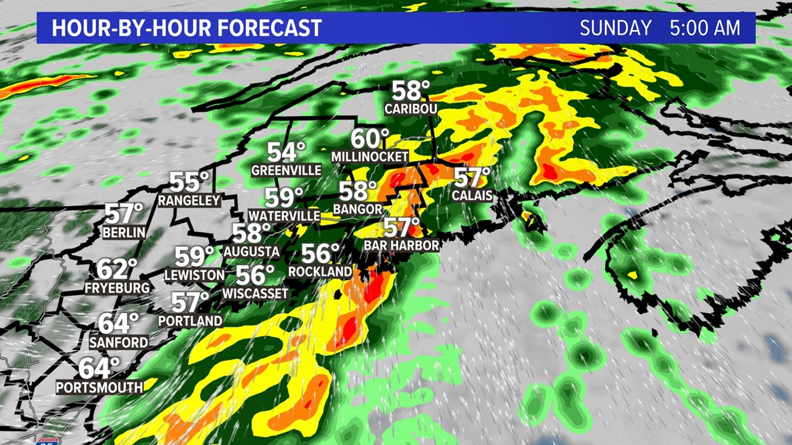
By daybreak the rain is shutting off quickly from west to east and even before the sun comes up for southern Maine.

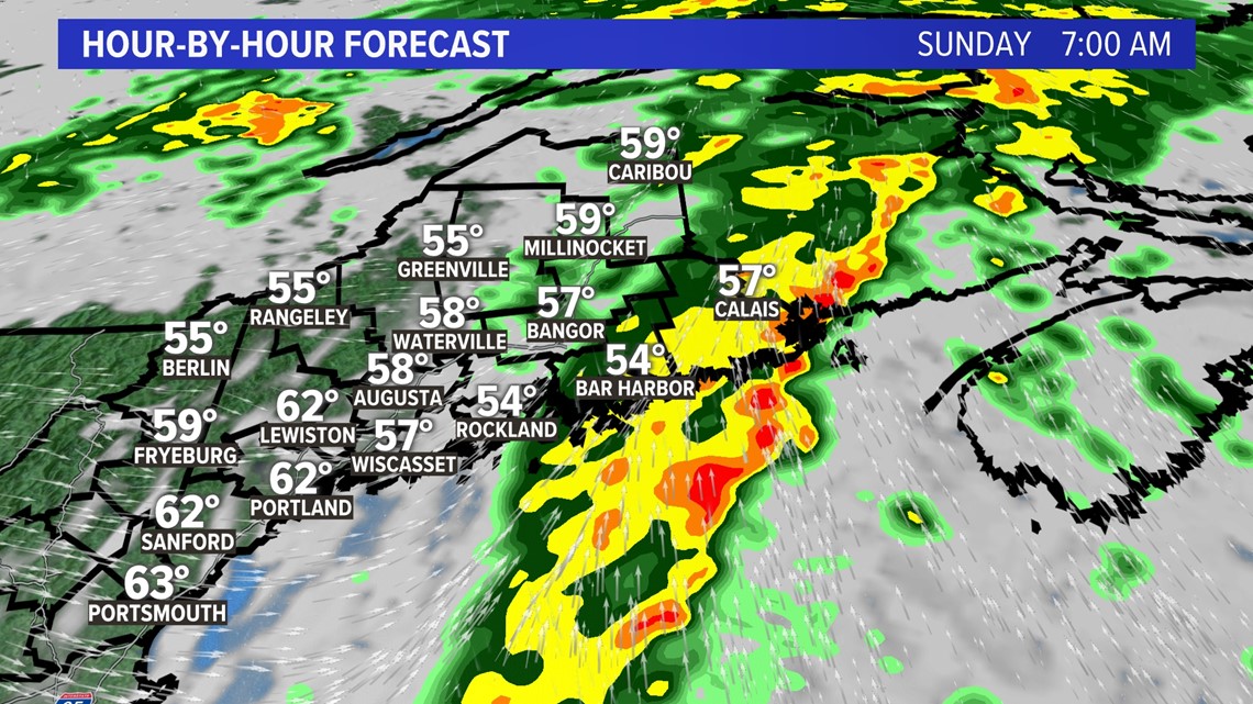

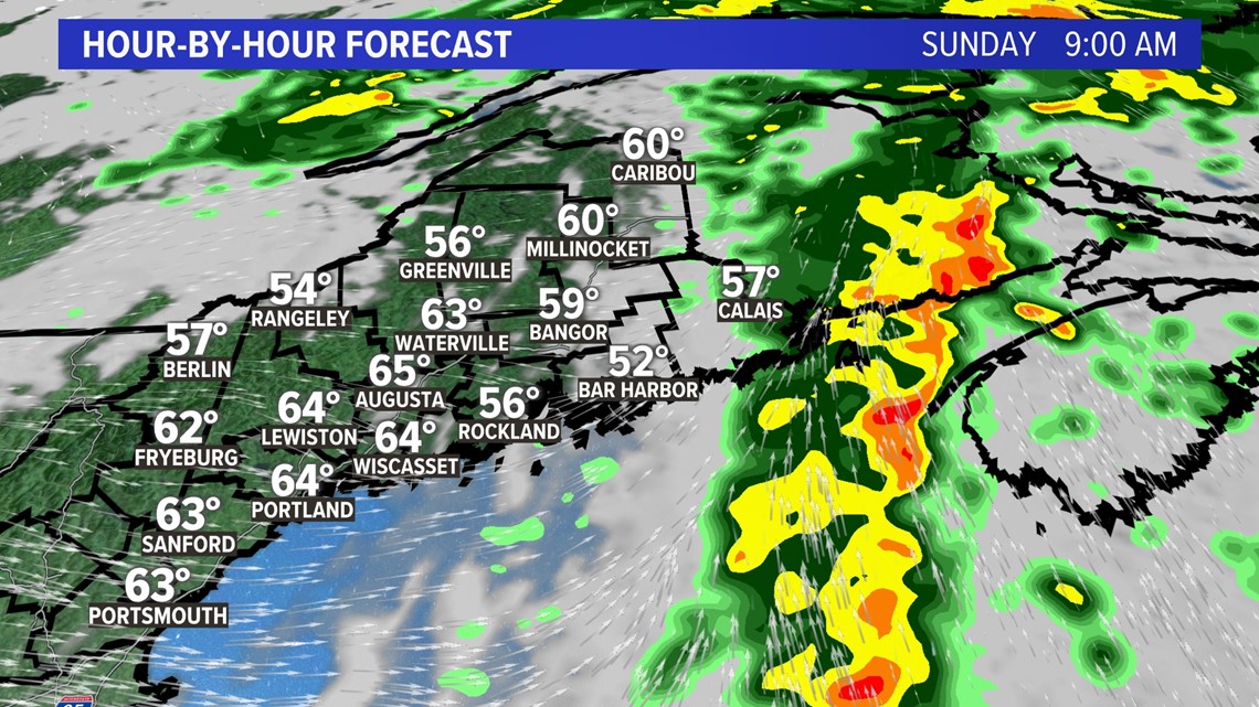
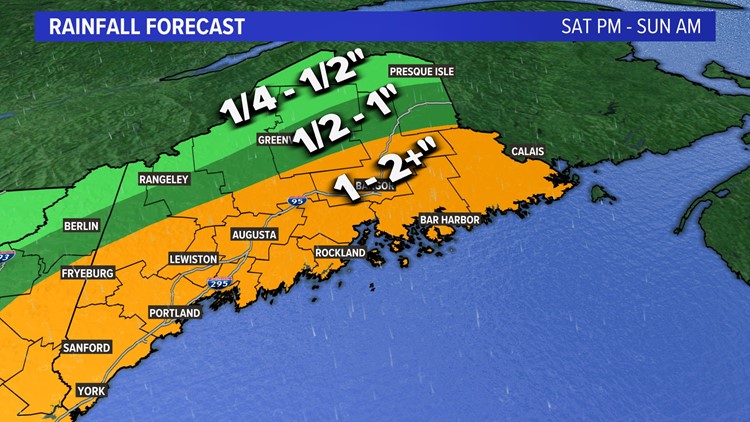
When the rain stops early on Sunday morning the amounts will range from more than 1 to 2 inches south of the mountains to less for areas north and west. Locally, I expect close to 4 inches in the heaviest bands. Urban flash flooding is the greatest threat overnight. Remember to turn around, don't drown.


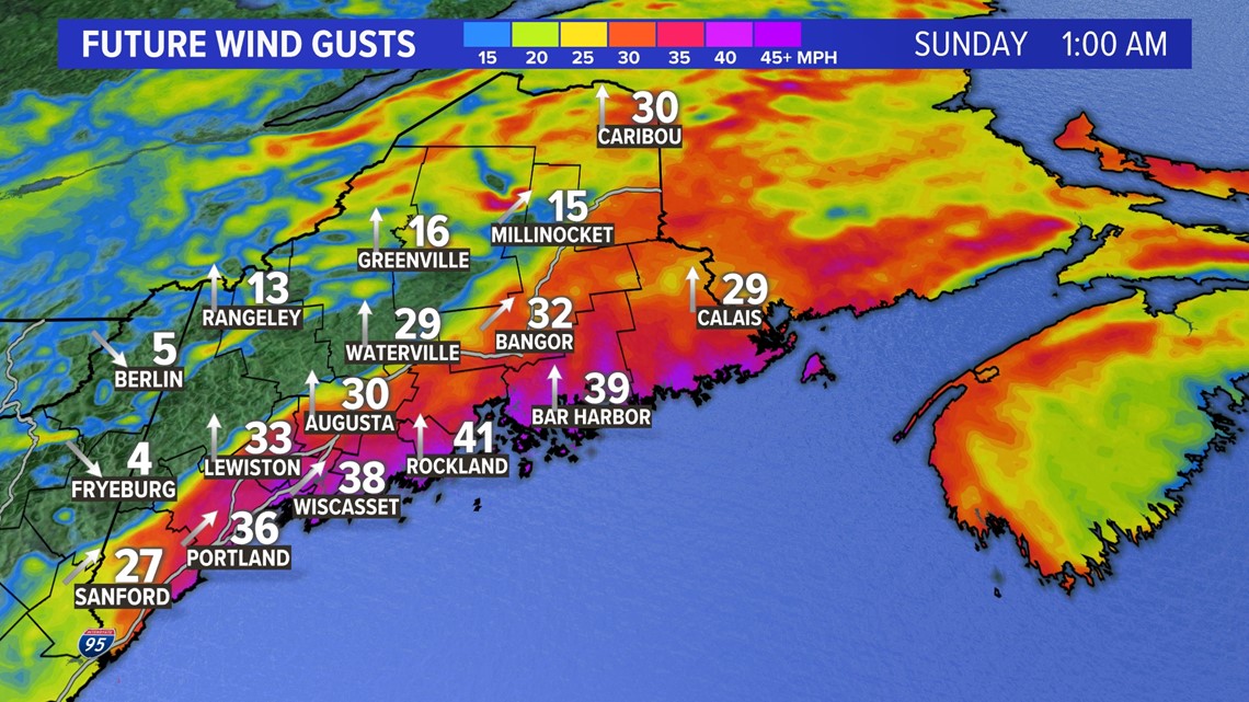
There will also be a brief period of windy conditions along the coastline.

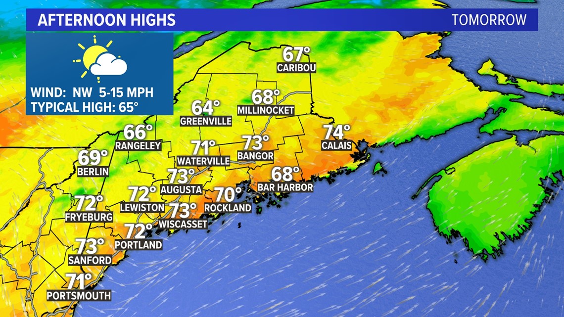
Things will improve dramatically tomorrow with a downsloping wind to dry things out and warm the temps up in the 70s for most of us. Great day to wash the car.

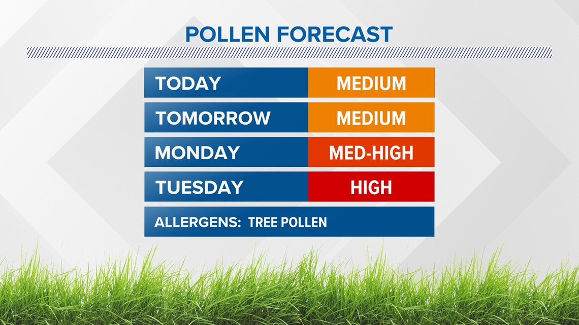
The one positive to all of this rain will be a brief break from the high pollen count as it gets washed away.

For updates on the storm make sure to follow me on social media:
Jason's Facebook
Jason's Twitter


