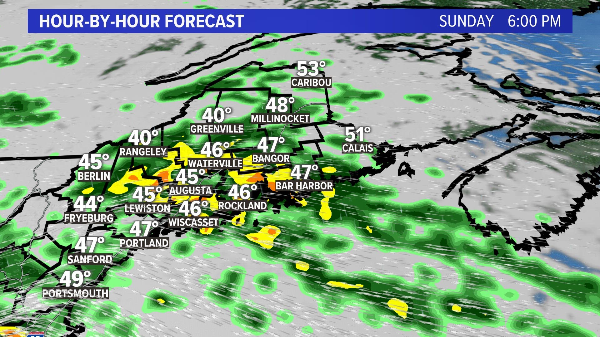
MAINE, Maine — Sunday 9:20 p.m. Update
More than 3 inches of rainfall has fallen over the Mid coast of Maine and a lot more is on the way.

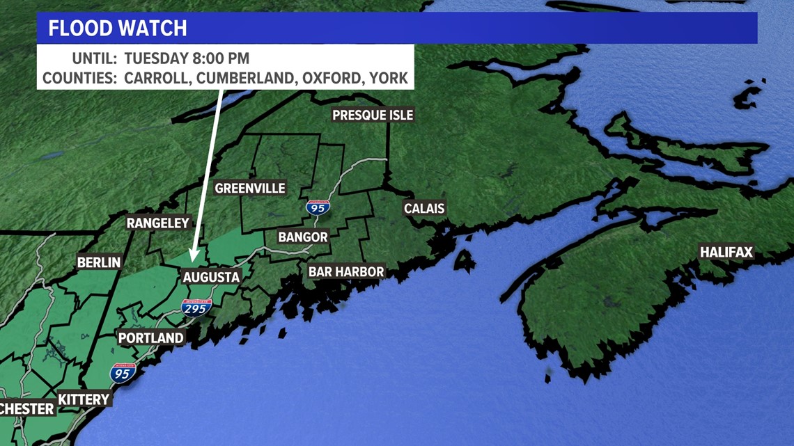
Flood watches were issued Sunday through Tuesday in parts of Maine where several inches of rain are expected.

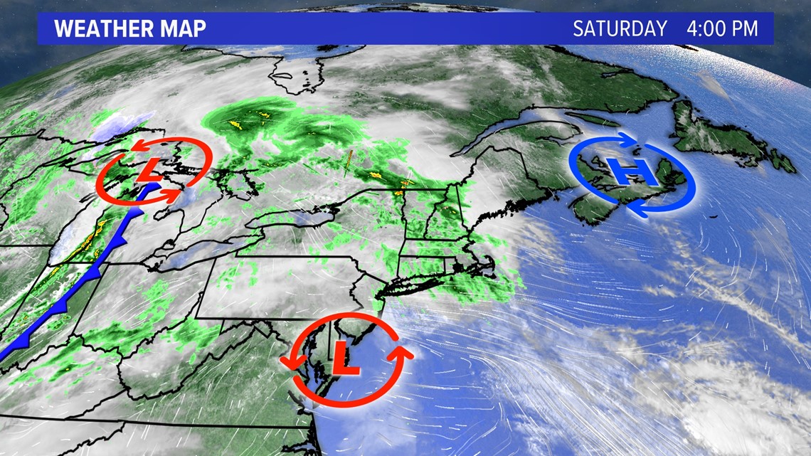
An area of low pressure will transfer its energy from the Great Lakes into the Northeast this week. It will allow primary low pressure over southern New England to take control and get stronger.

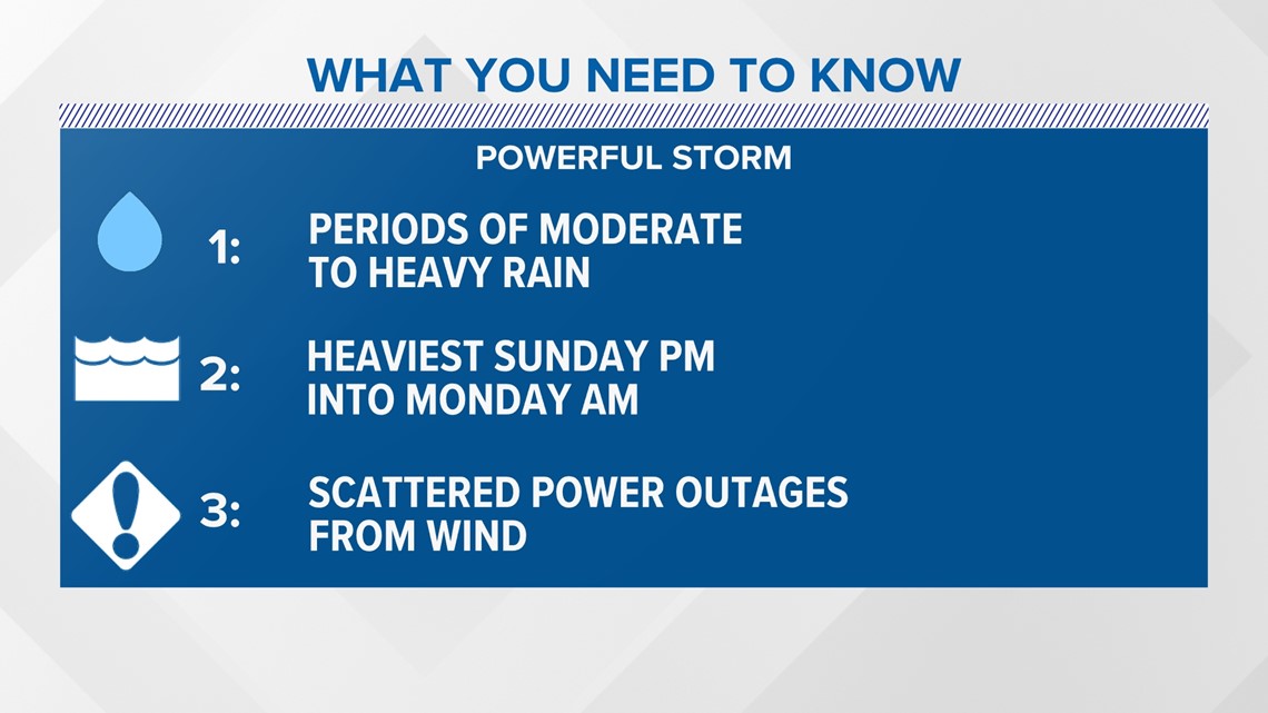
All day Sunday there will be periods of moderate rain, but late on Sunday is when waves of the heaviest rain will move in from south to north. There will be scattered power outages as well.

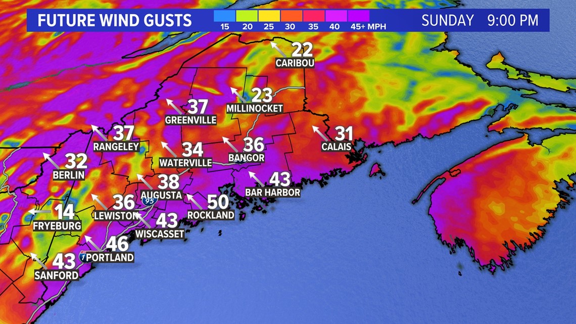
Wind gusts are expected to exceed 40 mph, especially along the coastline Sunday night into Monday morning.

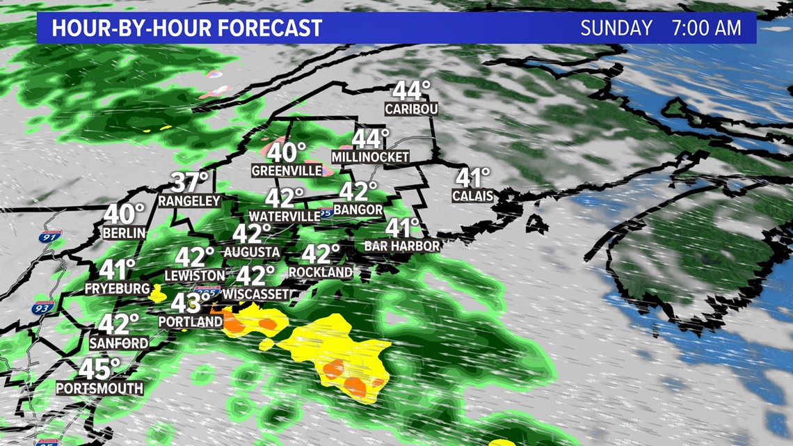
The first batch of moderate to heavy showers arrives in the morning Sunday.

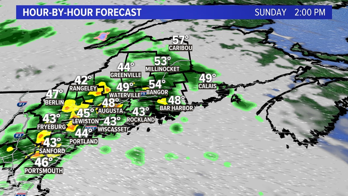
More rain moves in Sunday afternoon, at times it will be heavy precipitation.

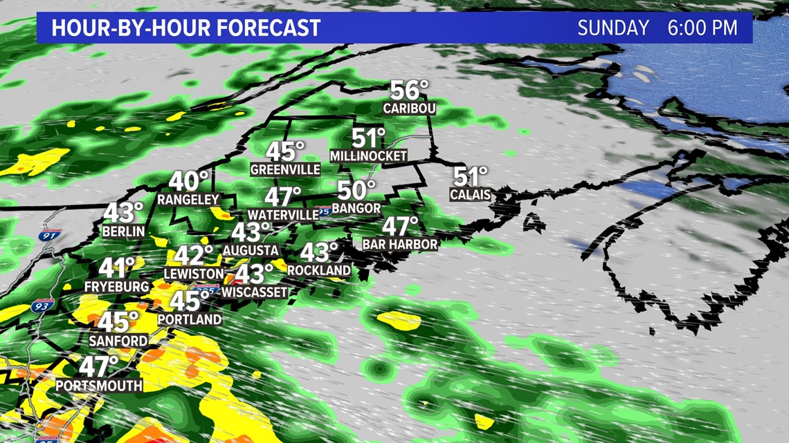
However, the heaviest batch arrives Sunday evening in southern Maine.

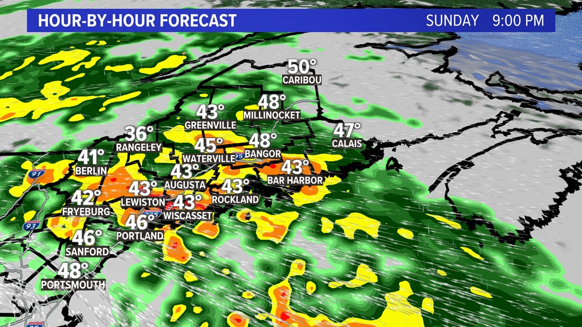
By late Sunday, the Pine Tree state will see the heaviest rain of the storm.

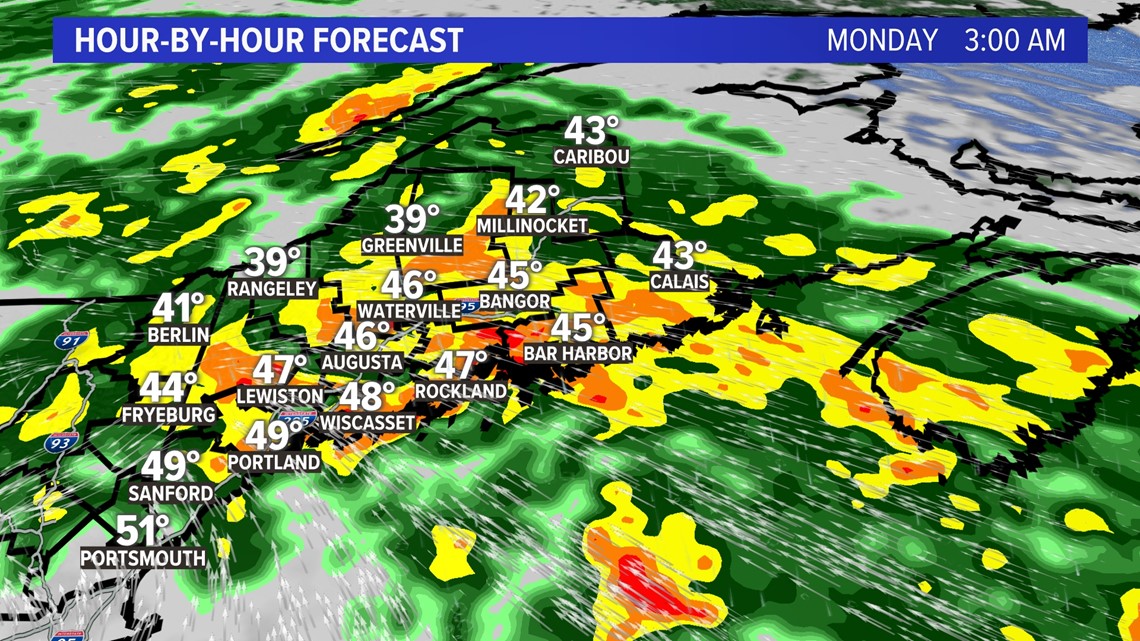
During the pre-dawn hours on Monday, it will be pouring rain for nearly the entire state with rivers running high.

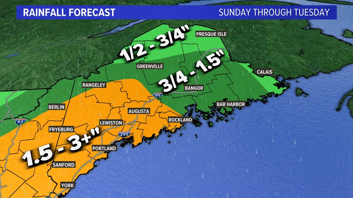
Southern Maine gets the most rain from this storm with more than 2 to 3 inches and most of the rain will fall Sunday into early Monday.

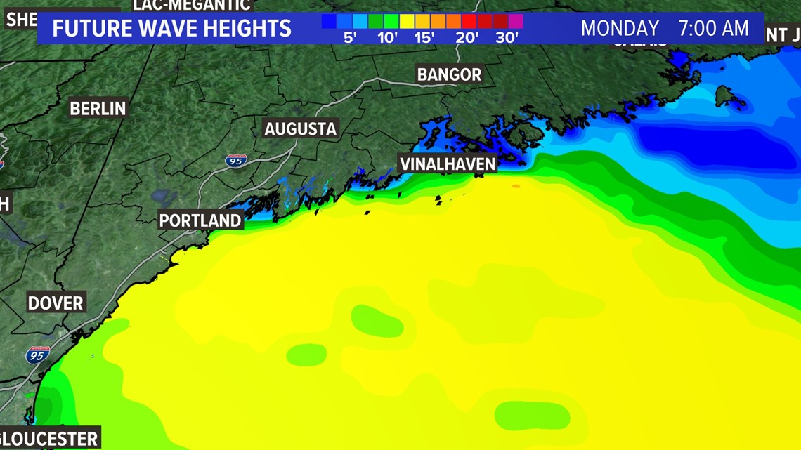
The seas will also build Sunday night into Monday with more than 15-foot breakers near-shore.
You can get the latest updates on the storm by following me on social media:

