
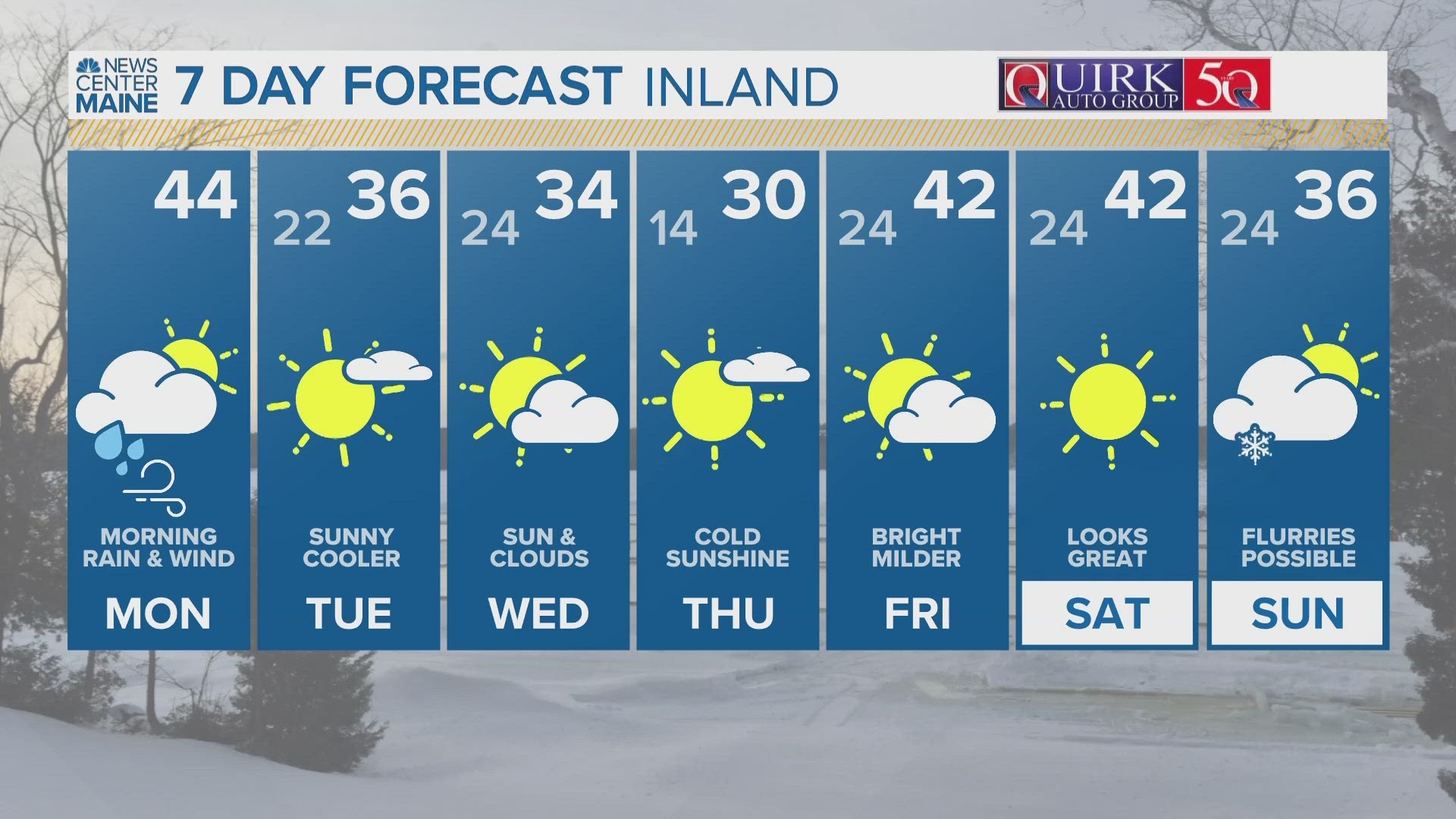
PORTLAND, Maine — Another powerful Monday morning storm, I think that's three Mondays in a row. However, this one is way different than the last one.
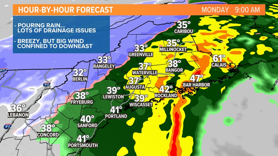
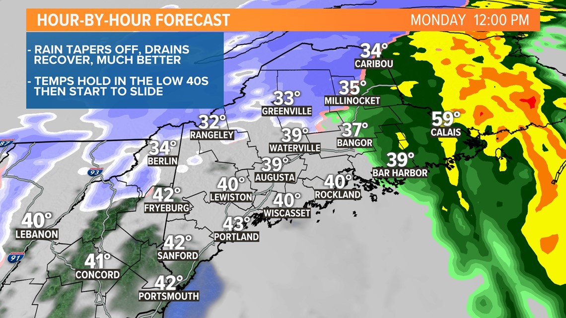
The only snow we get out of this one will be along the Canadian border, where several inches of heavy, wet snow will accumulate. Rain is the big player for most of us. With rain amounts exceeding 2 inches in many communities, there will be numerous drainage flooding issues.
Storm drains will have a tough time keeping up with the pace of the rain, especially over the interior, where many drains are clogged and covered by snow. You may even run into a few detours.
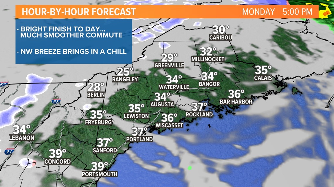
The rain will shut down by the middle of the day, and sun will return this afternoon.
MORNING:

MIDDAY:

AFTERNOON/EVENING:

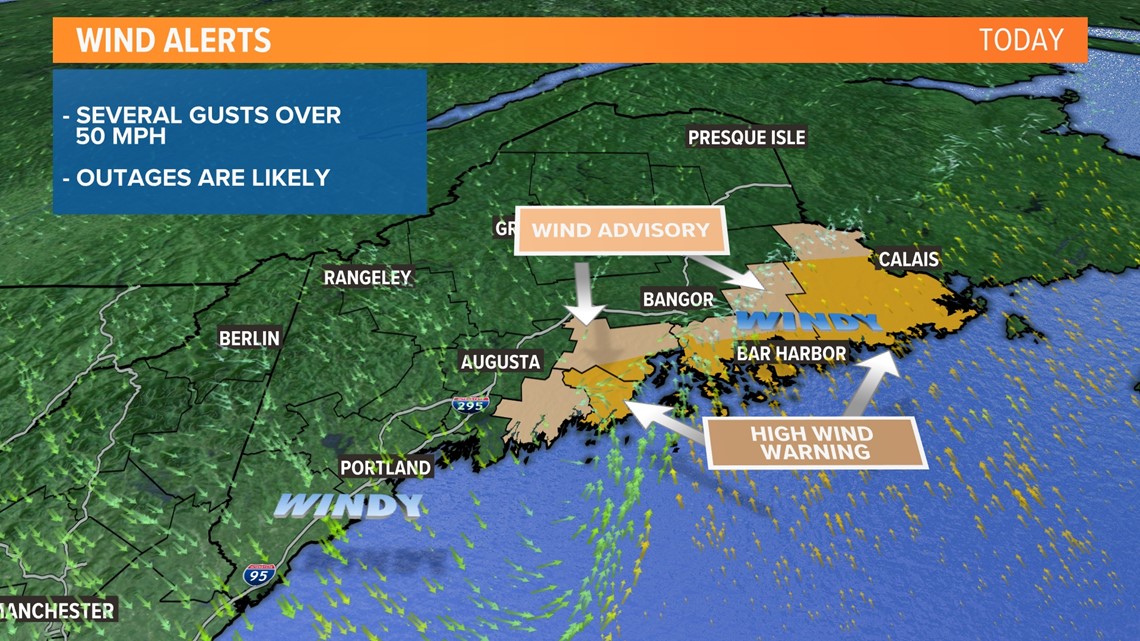
All along, our largest concern was the high winds and power outage risk.
It was looking like outages would be a real big problem. But, over the weekend, the storm shifted east and so did the core of the strongest winds sparing a lot of the state from damaging wind gusts and therefore the outage threat has been reduced.
We'll still have problems, but they will be confined to Down East, where there are High Wind Warnings. Gusts could exceed 50 mph through early afternoon.

The National Weather Service will pass along rain amounts and wind gusts throughout the day. You can track the growing lists here:
Once this storm passes, we are in real good shape for the rest of the week.
Todd - I made some mean chicken cutlets yesterday. Check them out here: Todd's Instagram