
PORTLAND, Maine — Editor's note: The video attached to this story was published Sept. 28, 2022.
It's very challenging to forecast a wind/rain storm a week after a wind/rain storm was mostly a bust. It's a bit like being a quarterback who just threw a pick-6. But, I've learned to have a short memory in this game. That mentality, combined with my completely unwarranted sense of self-confidence, puts me in the position to give you the forecast for Sunday night/Monday.
Right now, the storm that is going to impact us on Monday is merely a few showers in the Gulf of Mexico. (My dad used to describe periods of time before I was born as "when you were merely a twinkle in your mother's eye." Which, in retrospect, is a bit of a weird thing to say to a 6-year-old. But I digress.)

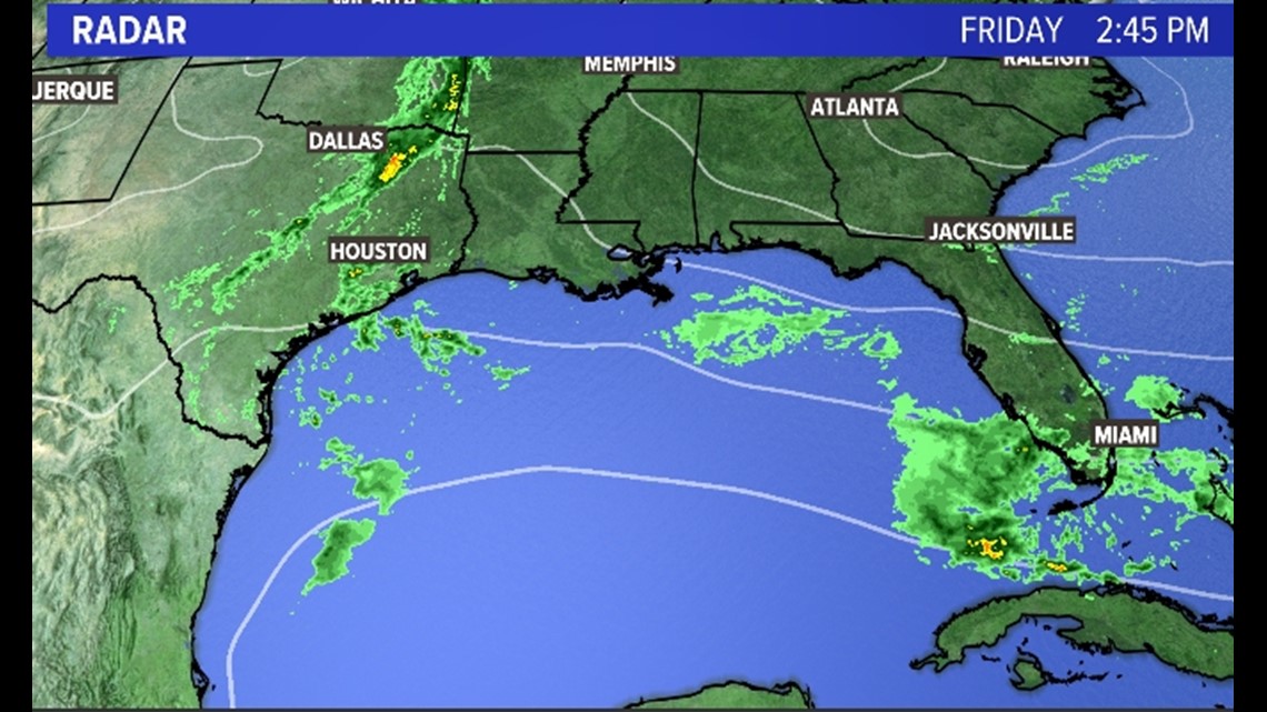
Those showers will organize into a pretty well-developed low-pressure system on Saturday and start heading up the East Coast.
That gives us all of Saturday and most of Sunday with calm, dry weather. It's not until late afternoon Sunday that the first bands of rain move in from southwest to northeast.

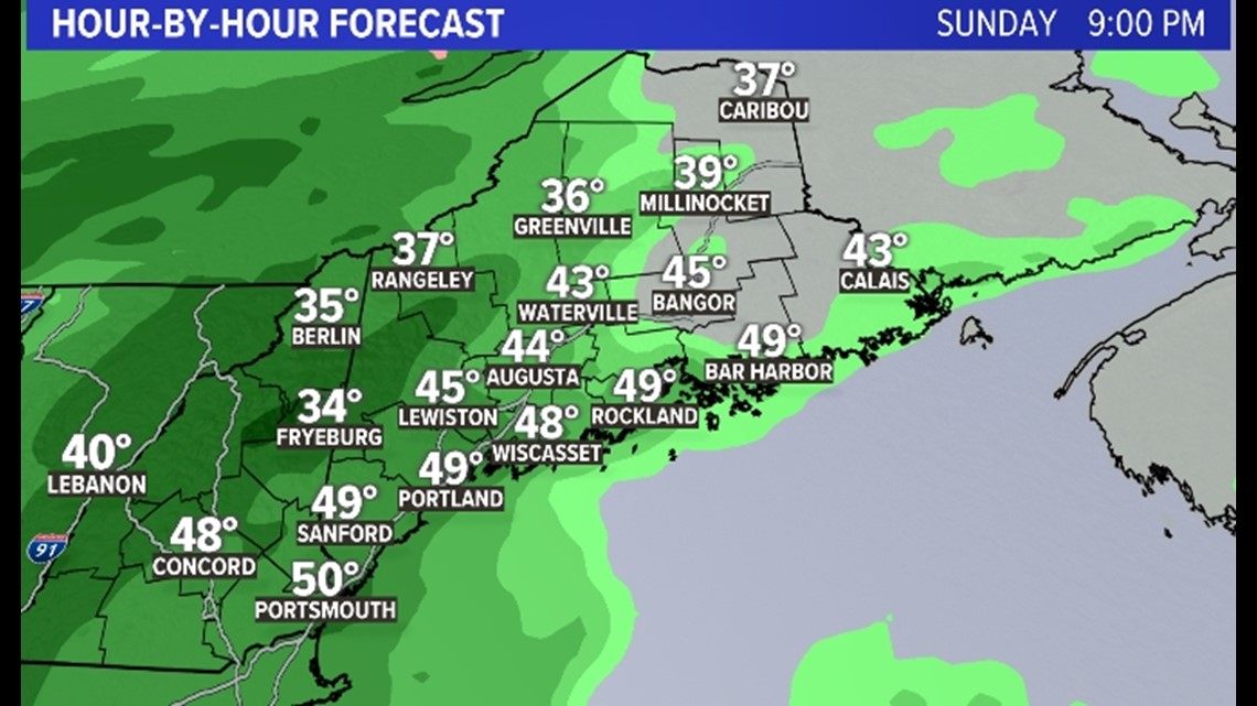
The rain gets heavier overnight Sunday and into Monday morning with the peak of the rain and wind coming during the daylight hours on Monday.

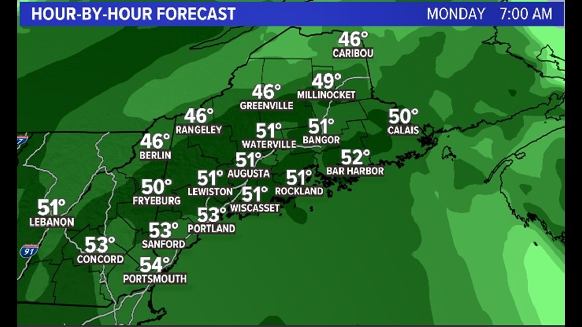
By midday on Monday we are right in the teeth of this low with strong Southeast winds and periods of downpours.

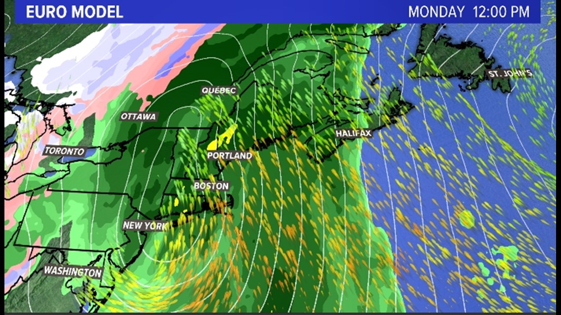
Now, I want you to look at the image above (please don't be a customized ad for painless catheters. No whammy. No whammy). Although there are some similarities between last Monday's storm and this one, there are some key differences, too.
Most notably the position of the low and the size of the wind field. Last Monday the wind field was pretty narrow and an eastward shift in the path of the storm put most of us out of the strongest winds. This time around we would need a MUCH bigger jog to the East. Nothing is impossible (just Google a picture of my wife), but I think it is highly unlikely.
With that in mind, let's talk winds. I think the coastline is in for wind gusts between 45-55 MPH. On the plus side, we don't have any leaves on the trees. On the negative side, we will have quite a bit of rain to go along with the wind which sometimes weakens the root systems AND the wind will be out of the Southeast, which is not a favorite for us here in Maine.

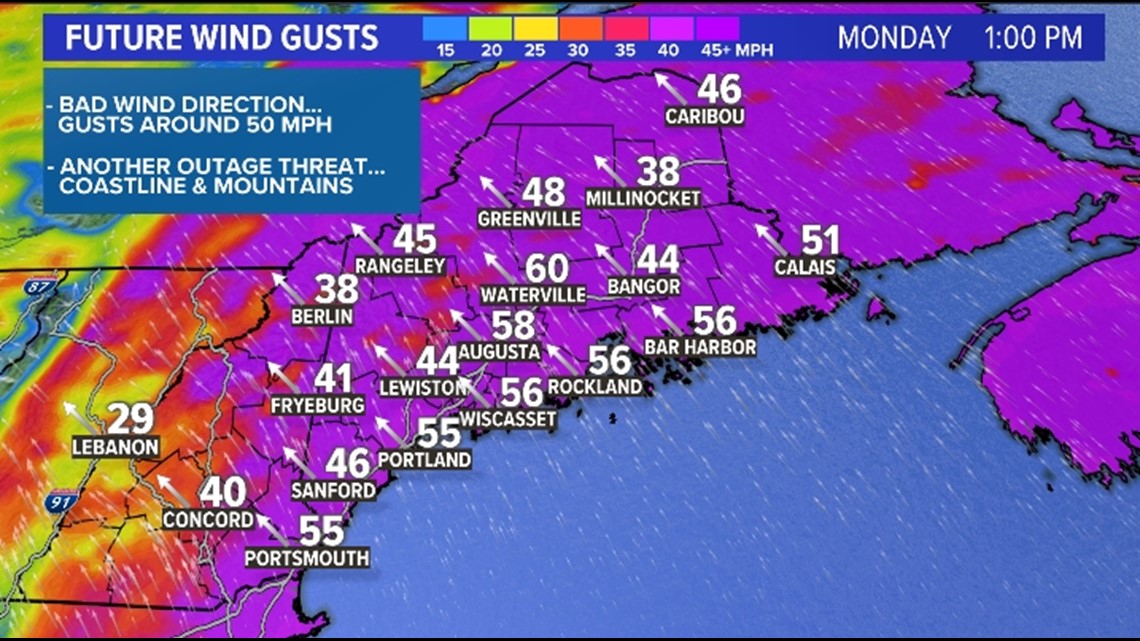
Peak wind gusts will likely be during the daylight hours on Monday and if these numbers hold we will have at least low-end moderate outages along the coastline and perhaps the mountains.
A more widespread threat, however, will be heavy rain.

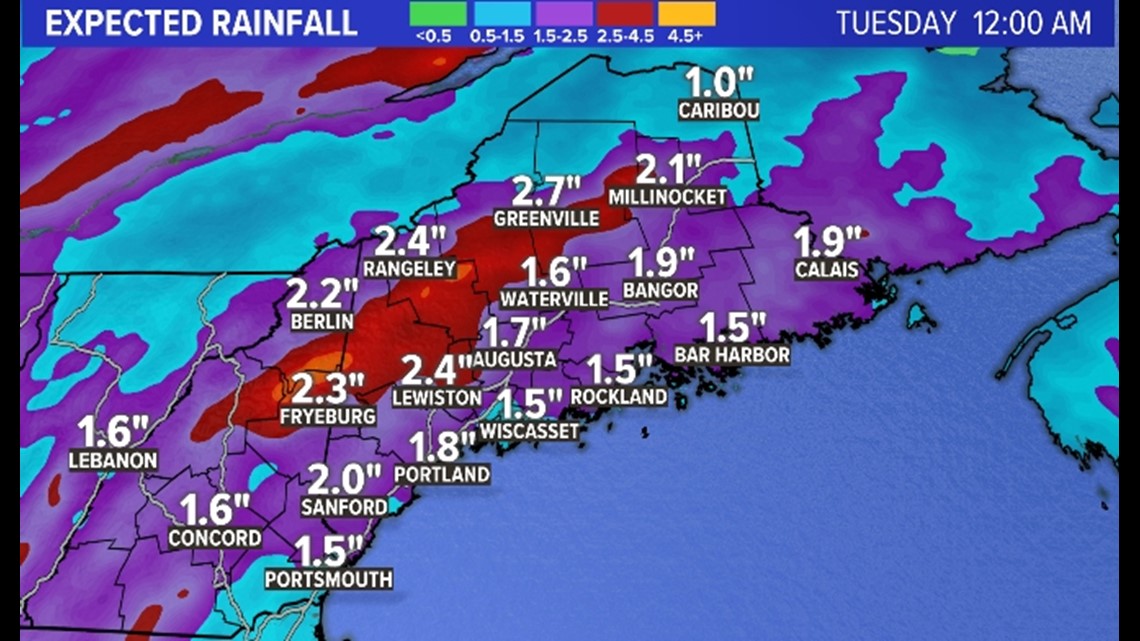
Rain totals of 2-3" will be widespread and I'm especially concerned with the enhanced rainfall being depicted in the red along the east side of the mountains. This rain pattern makes sense with a strong Southeast wind as moisture will hit the mountains and get "wrung out" before it can crest the ridgeline.
The problem is that these areas also have snowpack so if they get 3-4" of rain PLUS the liquid from the snow melt, we will likely have some flooding issues.
Things will wind down on Monday night but I think before it's all said and done we will have areas of flooding and some power outages to deal with.
Stay with us this weekend if you can.
I'm out.
- Keith Carson
Follow me on Instagram