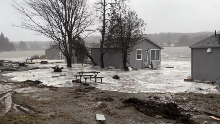
MAINE, USA — On Jan. 10, as salt water swirled around the Machias town office, which sits nearly level with the Middle River just northwest of Machias Bay, town manager Bill Kitchen was in his nearby truck with the police chief and another officer standing by in their cruisers.
They were waiting to see when they should close the nearby causeway, which had begun to flood with seawater and debris in what would turn out to be one of most destructive storms to hit the Maine coast in decades.
Although Kitchen was in and out of the office that day, staff had been told to stay home. The night before, in preparation, they raised boxes off the floor and secured other essentials. It was a good move: More than a foot of seawater eventually surrounded the building, with an inch covering the floor.
The next day, staff reported to a “pop-up” office in another town building further inland. “We never went back,” said Kitchen.
Nearly two months later, they still haven’t returned. The ballpark cost to repair the town office is about $30,000 to $50,000. Even before the storm, Kitchen had proposed a new building in his five-year plan, but it likely will cost between $10 million and $15 million.
“We are dealing with the public’s money. We have to ask ourselves, ‘What is the most responsible thing we can do?’ None of us think this is an isolated, one in 50-year event,” said Kitchen. “We have to answer to the taxpayers if we move back in and it happens again.”
Machias isn’t alone. After back-to-back January storms caused millions in damages, ripping shacks from their pilings and tossing piers into the sea, coastal communities are suddenly having to decide how and where to rebuild, if they do at all.
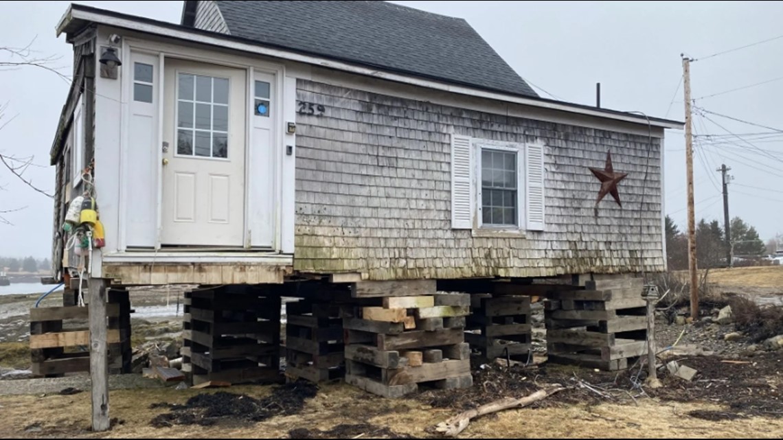
West of Machias, in the village of Prospect Harbor in Gouldsboro, a fisherman and TikTok celebrity, Jacob Knowles, and his wife, Ashley, were devastated as they watched the sea surge pick up three of the five seaside cabins they had just finished renovating, drop them, pick them up again and drop them, eventually leaving three off their pilings and at least one facing an entirely different direction.
“It all happened in less than half an hour,” Ashley said of the destruction at Rest Ashoar Waterfront Cottages. Doors on two cottages were pushed open, letting seawater rush in. All but one had their front decks ripped off.
In neighboring Winter Harbor, the Donut Hole, a weather-beaten longtime eatery transformed into a cottage and perched over Henry Cove, tumbled into the water that same day. Seaweed and water traveled across the property, across the road, up to the doorstep of Winter Harbor Provisions.


Both the Knowles and the owners of the Donut Hole say they’ll rebuild, albeit with changes.
“We are moving (the cottages) back to the 75-foot line because of the number of storms that have been coming,” Ashley Knowles said. “We don’t want to be stressed out every time there is a storm.”
Larry Lawfer, who owns the Donut Hole with his business partner, Gene Kelley, said they will have to keep the building where it is but plan to raise the pilings several feet.
“The pilings are going to be put in while we build the platform on which the house will sit. Then we’re going to drop the crooked, twisted horse onto that frame,” Lawfer said. Because the house will be higher, they will also build steps leading to the door.
“The decision to save it was not just a business decision,” Lawfer said. “It had to do with the historical sense of the property in this town.”
Historic structures and attractions up and down the coast were devastated by the storms. A nearly 150-year-old walking path in Bar Harbor that runs along the shore and sees thousands of summer visitors sustained an estimated $900,000 in damages, and has been closed since it was hit.
“We probably lost over 800 feet of seawall,” said Dickie Cough, president of the Bar Harbor Village Improvement Association, which stewards the path. “It was a perfect storm with the tide, full moon and wind.”
Areas of nearby Acadia National Park also sustained heavy damage, including popular hiking paths and large sections of the Schoodic Loop Road, which was undermined in spots.
Amanda Pollock, the Acadia National Park public affairs officer, estimated there were roughly 700 downed trees at Seawall Campground and Seawall picnic area, both popular destinations.
Peter Slovinsky, a marine geologist with the Maine Geological Survey who has studied sea level rise and climate change for decades, told The Monitor last year that the state is likely to see more downed trees as storms intensify and wind patterns change.
“I can’t scientifically say there’s an increase in southeasters,” said Slovinsky, but anecdotally, “We’re seeing more southeasters in the late fall and early winter.”
Southeast winds “expose bluff areas to erosive wave forces that don’t typically see them,” Slovinsky said, and “knock down a lot of trees, because all our trees are basically conditioned for nor’easters.”
Thunder Hole, a carved-out inlet in the park along the rocky eastern shoreline, also incurred damage. The location is a dramatic spot, particularly when a storm or the turning tide forces waves into the narrow channel. The air escapes with a thunderous reverberation.
“We are aware of the undermining road issues over there,” Pollock said, “but we do not have any intention of closing it."
This story was originally published by The Maine Monitor, a nonprofit and nonpartisan news organization. To get regular coverage from the Monitor, sign up for a free Monitor newsletter here.


