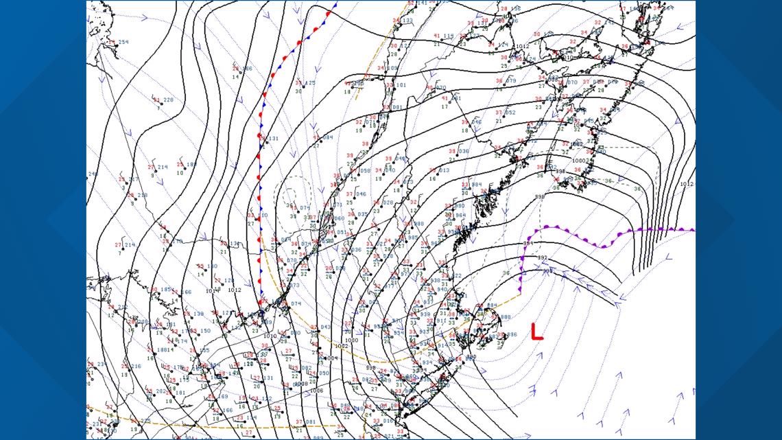
MAINE, USA — Tuesday's nor'easter is about to peak as low-pressure "bombs out" in the Gulf of Maine. Surface observations show pressure dropping in the southern gulf, which will increase tonight.

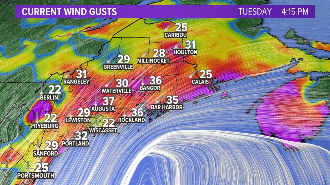
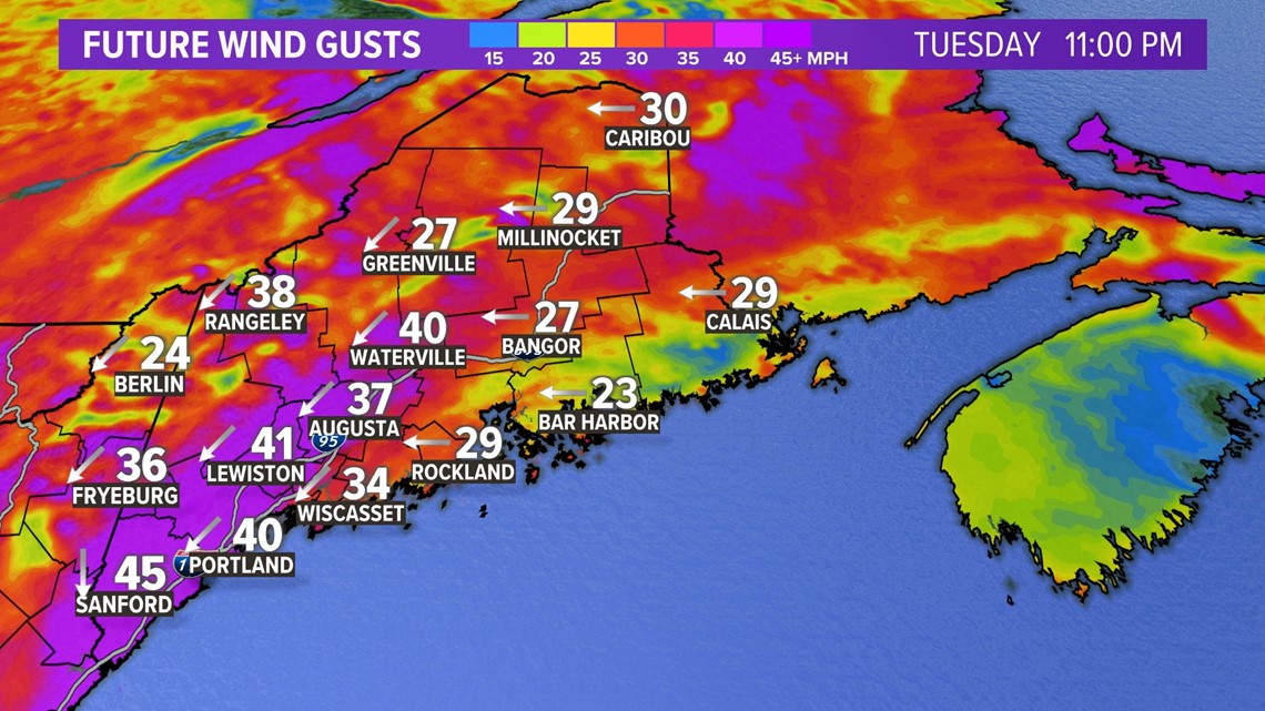
Current wind gusts across Maine show 30 to nearly 50 mph, making driving difficult.

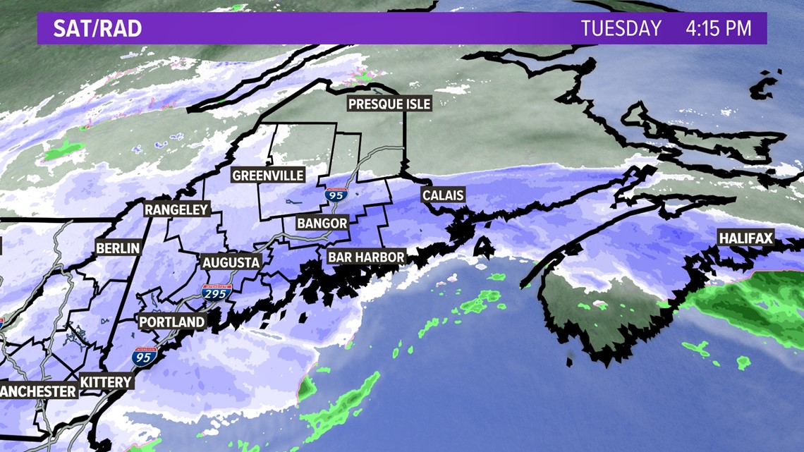
The latest look at radar shows the darker blue snow bands pushing into central and Downeast Maine.

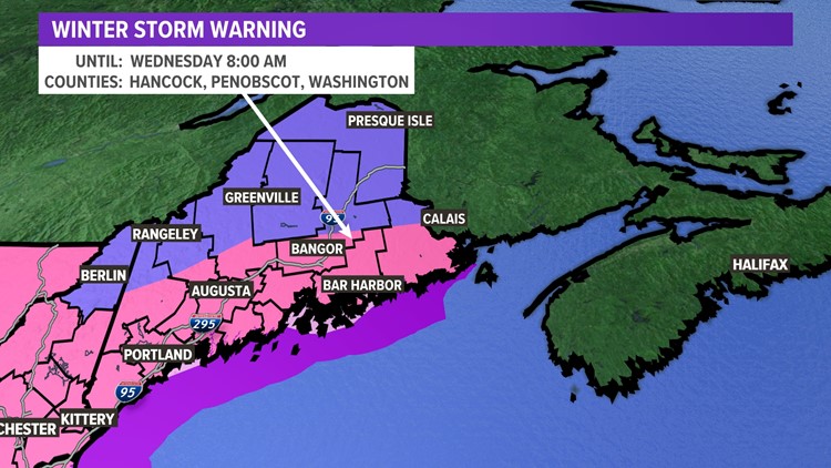
Winter storm warnings and winter weather advisories are up for the entire state.


Here's a look at the timeline for the storm.

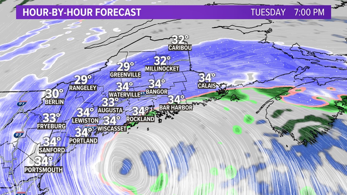
The storm will peak at 7 p.m. and continue through 9 p.m.

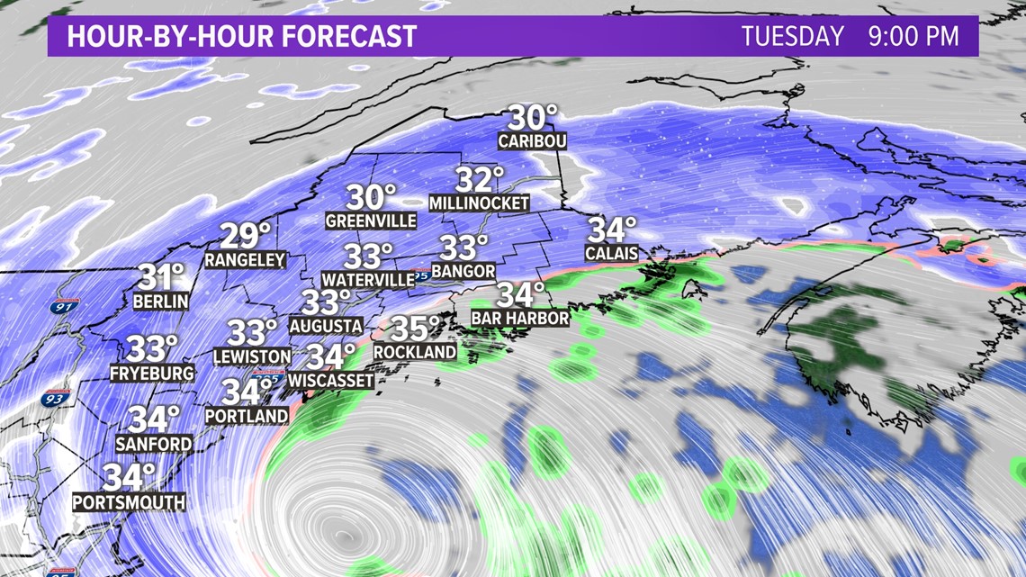
The snow gets lighter for southern Maine after midnight.

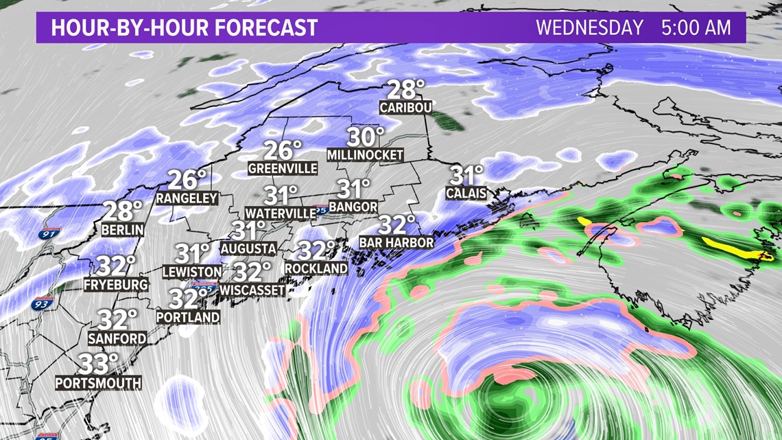
Downeast Maine will be the focus of the storm on Wednesday.

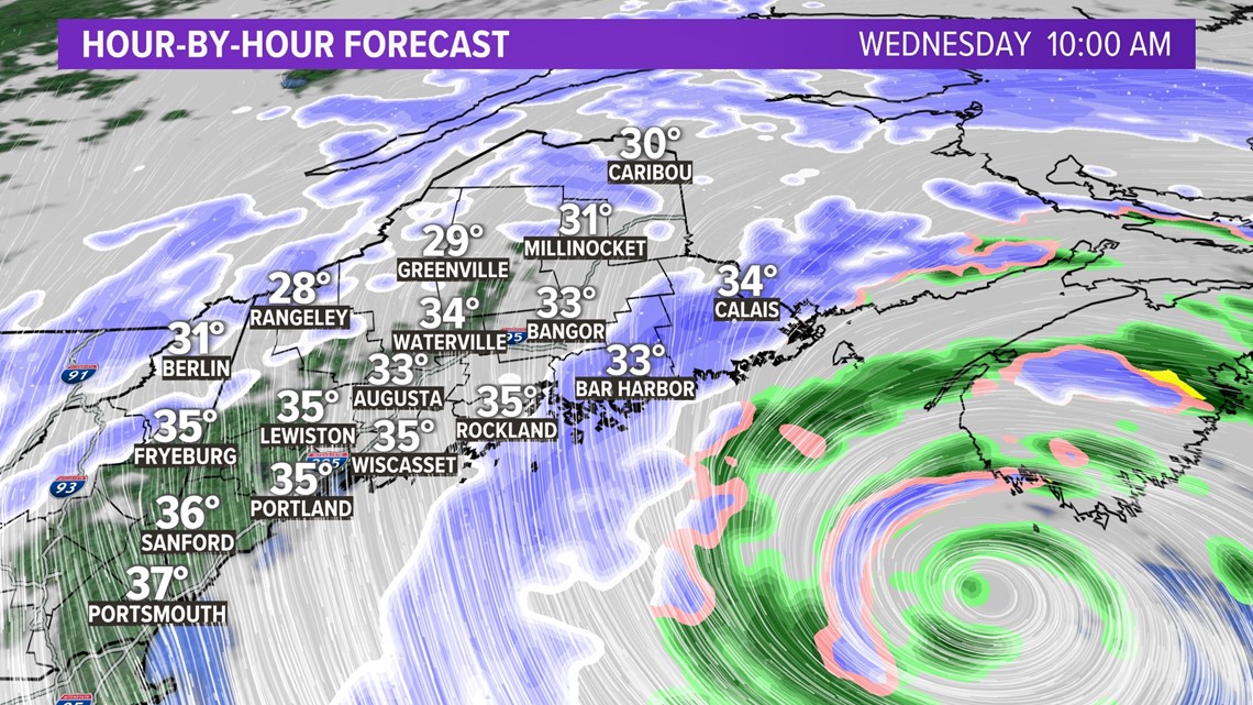
The wind tomorrow will be breezy once again as it shifts out of the north.

When the storm is over, here's how much snow you can expect:

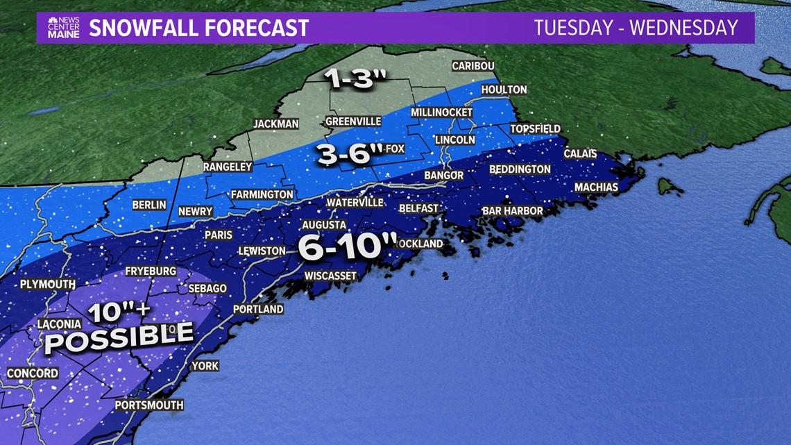
I'll have snow amounts on my social media. Check tonight and tomorrow for the latest:
-Meteorologist Jason Nappi


