
PORTLAND, Maine — More downpours are about to make their way to New England.
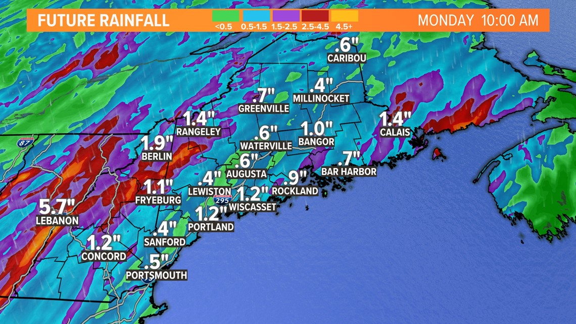
Showers and embedded storms are expected to begin Sunday morning. The storm will hit most of New England before it reaches Maine. Areas in Vermont and New Hampshire are set to get another 1 to 3 inches of rain they do not need.
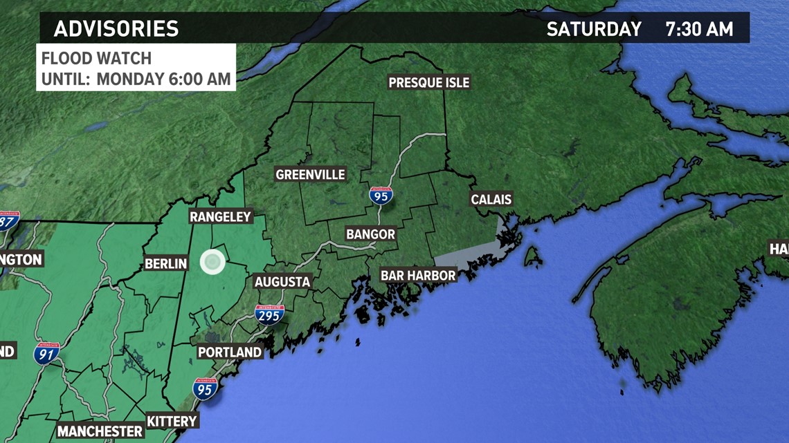
Most of New England is under a flood watch and that extends to the western border of Maine. That's where the heaviest rain will come here in the state. This is also where the flood risk is the highest.

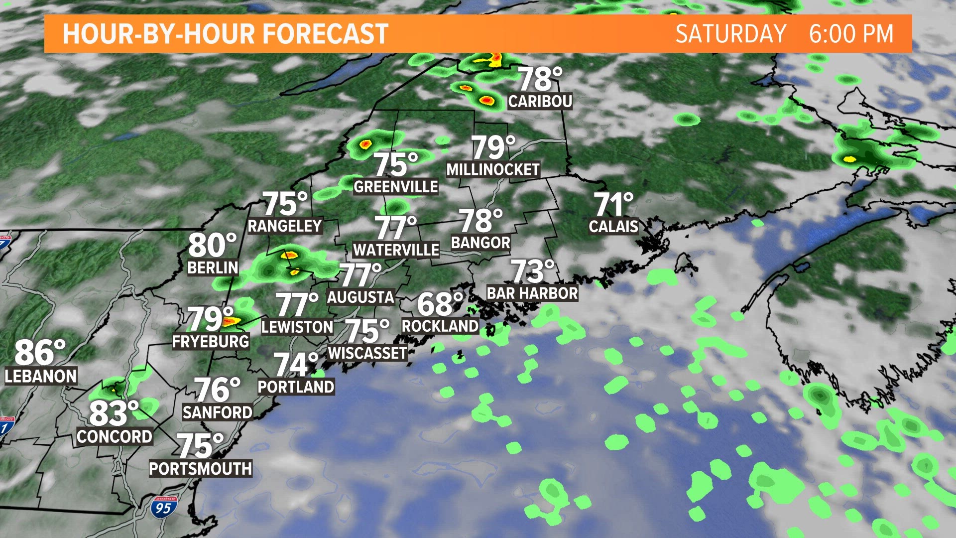
The rain is expected to start late tomorrow morning for western Maine and extend to the east in the afternoon. Heavier showers and storms will be embedded within this system as it moves through. Here's a breakdown for the rain's timeline.
Many in western Maine can expect 1 to 3 inches of rain with localized rainfall amounts up to 4 to 5 inches. The ground is already quite saturated here. Even just 1 to 2 inches of rain could cause flash flooding in this region, and we are forecast to get more than that. Western Maine and the mountains will have the highest flood risk.

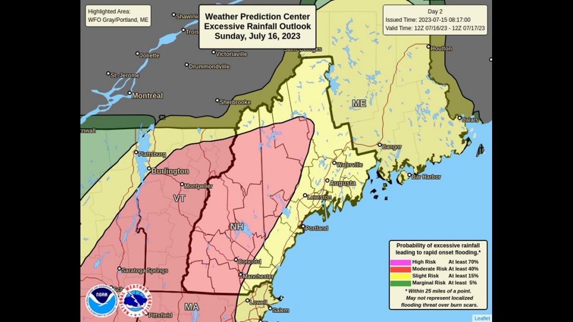
Western Maine has the highest risk of flooding. Here's a graphic from the National Weather Service.

Rain should end before many head out the door Monday morning with skies clearing west to east.
Stay safe, and don't drive through any flood waters. It's always better to turn around and find a different route.