MAINE, USA — This month started off with a bang when three winter storms hammered the state in one week. Now that we're done with that trifecta, what can we expect for the rest of the month?
Spring *technically* begins this month on March 20, but the weather pattern seems to look more like winter.
This month started off right on par as far as temperatures are concerned. March 1 would normally have a high temperature of 38 degrees, and it hit 40 degrees instead. The month should end with a high of 47 degrees but will probably be a little colder.

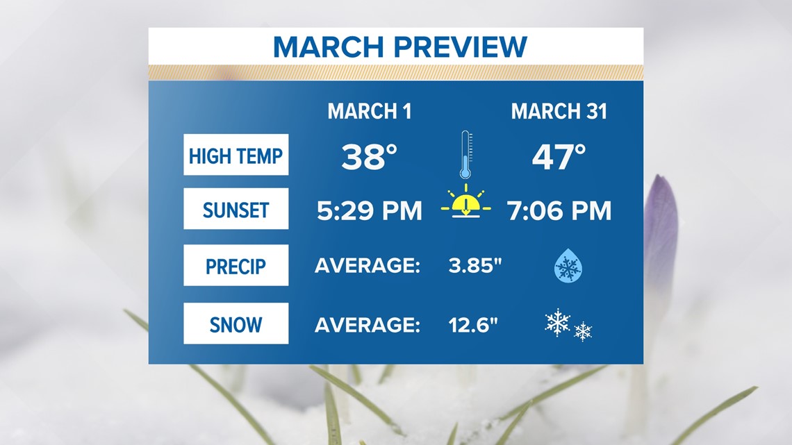
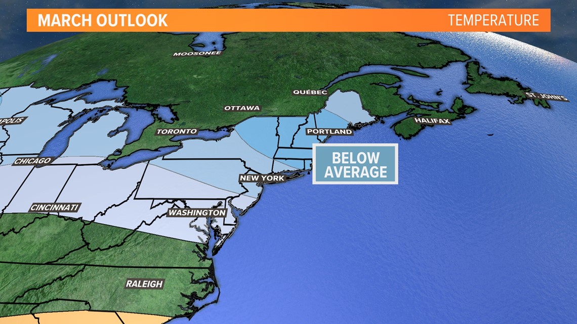
That's because the Climate Prediction Center (CPC) released its monthly temperature outlook which keeps New England below average. Don't worry, this doesn't mean temperatures are plummeting back to -20, but it does mean we should stay slightly below the average highs ranging from 38-47 degrees.

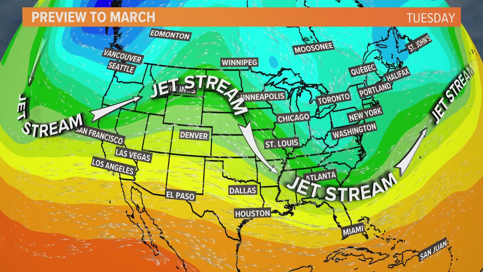
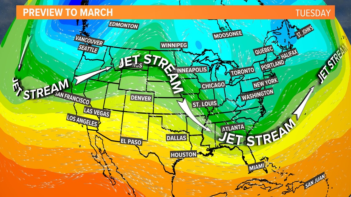
Who's to blame for this? The jet stream.
The jet stream looks to be staying to our south this winter which allows colder air from the north to move into New England. This pattern can also carry moisture from the Gulf of Mexico and the Atlantic to our region. When we combine those, snow is possible. Cold air + water = snow.

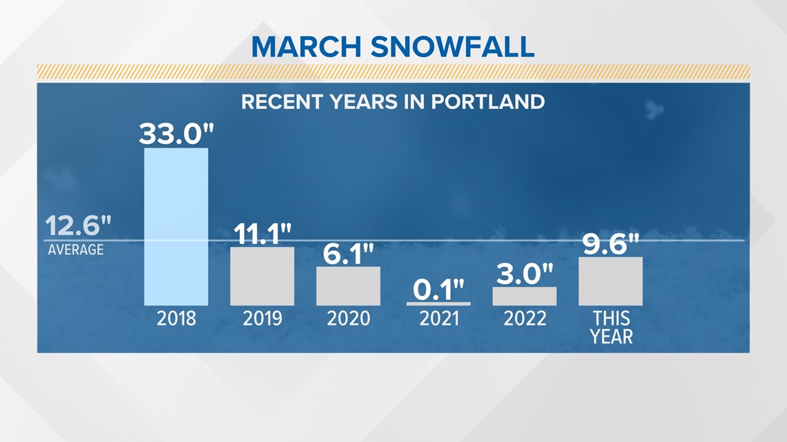
As far as snow is concerned, many Mainers haven't seen a snowy March in several years. Portland hasn't hit their average of 12.6" since 2018. In 2021, the city got almost no snow.

Similar story for the rest of us in Bangor—2018 was the year that overshot the snow totals while 2021 was basically snowless.

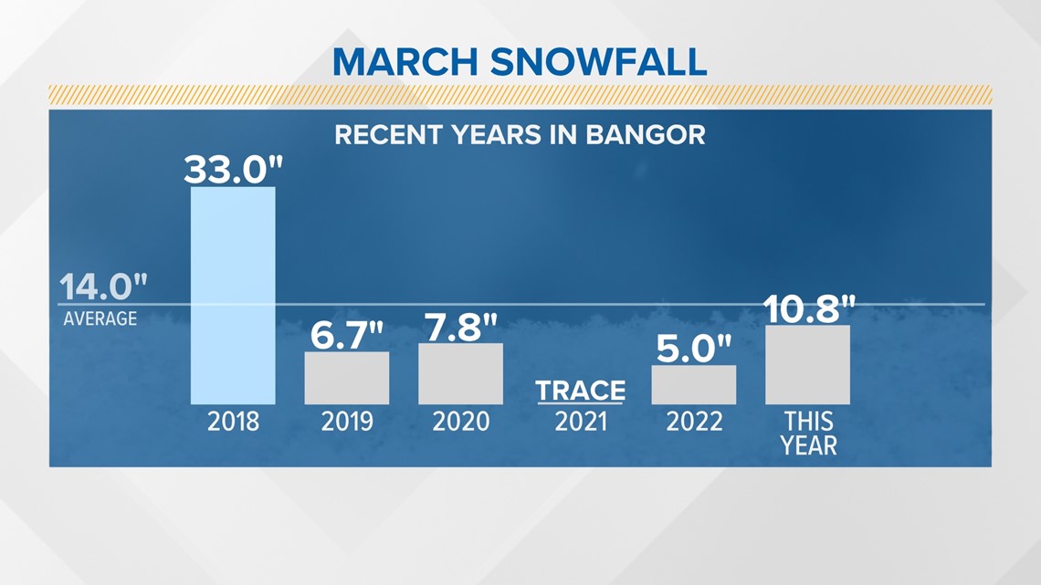
The good news (for snow lovers) is that we're already close to our averages for this year, and will likely surpass them sometime this month.
Good excuse to build a snowman? I think so.
- Aaron

